
Texas spans over 268,000 square miles of contrasting terrain, ranging from alpine desert peaks in Far West Texas to moss-draped bayous in the Piney Woods. Travelers researching the most beautiful places to visit in Texas encounter ancient limestone gorges, spring-fed swimming holes, living caves, and preserved Spanish colonial missions.
When mapping family road trips or planning quiet weekend escapes, prioritizing the best places to visit in Texas requires understanding driving distances between regions. Iconic landmarks sit hundreds of miles apart, making route selection essential for an efficient itinerary.
This travel guide highlights fifty top Texas places to visit, detailing entrance regulations, seasonal considerations, and verified logistical facts. Recognized among the most beautiful places in Texas, these destinations represent the state’s most memorable natural and cultural landscapes.
Texas Bucket List at a Glance: Top Natural and Cultural Highlights
Reviewing the most beautiful natural wonders in Texas alongside historic municipal landmarks helps travelers prioritize key stops across different ecological zones. The comparison table below summarizes ten marquee destinations across the state, outlining regional geography, landscape features, admission costs, and primary field recommendations.
Use this quick planning reference to select cool places to visit in Texas and map out classic texas road trip destinations for your next highway journey.
| Destination | Region | Terrain / Highlight | Entry Fee / Access | Key Practical Advice |
|---|---|---|---|---|
| Big Bend National Park | Far West Texas | Desert basins & alpine peaks | $30 / vehicle (7 days) | Book Chisos Basin lodging or campsites months in advance. |
| Palo Duro Canyon State Park | Texas Panhandle | Multi-colored canyon gorge | $8 / adult (13+) | Carry one gallon of water per person on the Lighthouse hike. |
| Guadalupe Mountains National Park | Far West Texas | Permian fossil reef & high peaks | $10 / person (16+) | Park operates on Mountain Time; prepare for intense summit winds. |
| Enchanted Rock State Natural Area | Texas Hill Country | Pink granite batholith dome | $8 / adult (13+) | Reserve day passes online 30 days ahead to ensure entry. |
| Caddo Lake State Park | East Texas | Cypress bayou & maze sloughs | $4 / adult (13+) | Download offline GPS maps before paddling labyrinth boat lanes. |
| Balmorhea State Park | West Texas | Spring-fed artesian pool | $7 / adult (13+) | Pool maintains 72 to 76 degrees Fahrenheit year-round. |
| Hamilton Pool Preserve | Central Texas | Collapsed grotto & waterfall | $12 reservation + $8 / adult | Mandatory advance reservations; swimming status changes with rainfall. |
| Barton Springs Pool | Central Texas (Austin) | 3-acre natural spring pool | $5 to $11 / adult | Closed Thursdays 9:00 AM to 7:00 PM for weekly ecological cleaning. |
| San Antonio River Walk | South Central Texas | 15-mile urban river corridor | Free public access | Rent a BCycle e-bike to explore the southern Mission Reach path. |
| Padre Island National Seashore | Texas Gulf Coast | 66 miles of wild barrier dunes | $10 / vehicle (1 day) | Driving past Mile 5 on South Beach requires high-clearance 4WD. |
These scenic places in Texas display the immense geographic diversity across the state. Travelers building a statewide itinerary should cluster nearby stops to make the most of their drive time across these distinct places to see in Texas.
Texas Hill Country
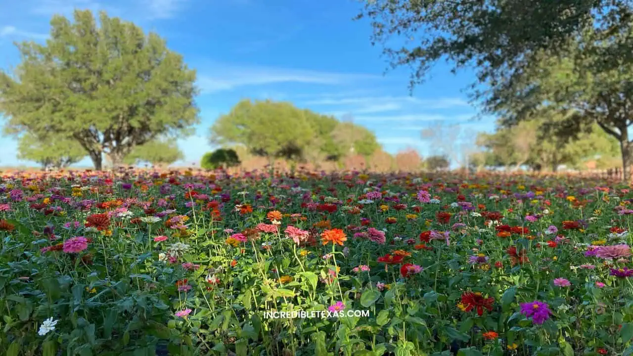
The Texas Hill Country encompasses rolling limestone hills, clear spring-fed rivers, and historic agricultural communities across Central Texas. Travelers researching places to visit fredericksburg tx explore scenic communities including Boerne, Kerrville, and Wimberley for boutique shopping and heritage architecture.
Wine production defines the regional corridor along Highway 290, featuring over fifty commercial tasting rooms. Visitors can pair rural roadway excursions with outdoor swimming along the Guadalupe and Blanco rivers. Review our guide to Texas Hill Country scenic towns and wineries to structure your regional itinerary.
- Primary Region: Central Texas (Gillespie, Blanco, and Kerr counties)
- Best Season to Visit: March through May for peak wildflower blooms and October through November
- Key Highlights: Highway 290 wine corridor, German heritage architecture, and spring river recreation
- Visitor Access: Free public highways; individual winery tastings range from $20 to $45 per flight
Tip
Book Highway 290 winery reservations two to three weeks ahead for Saturday visits, and visit Wildseed Farms on weekday mornings to view wildflower fields without large tour bus crowds.
Big Bend National Park
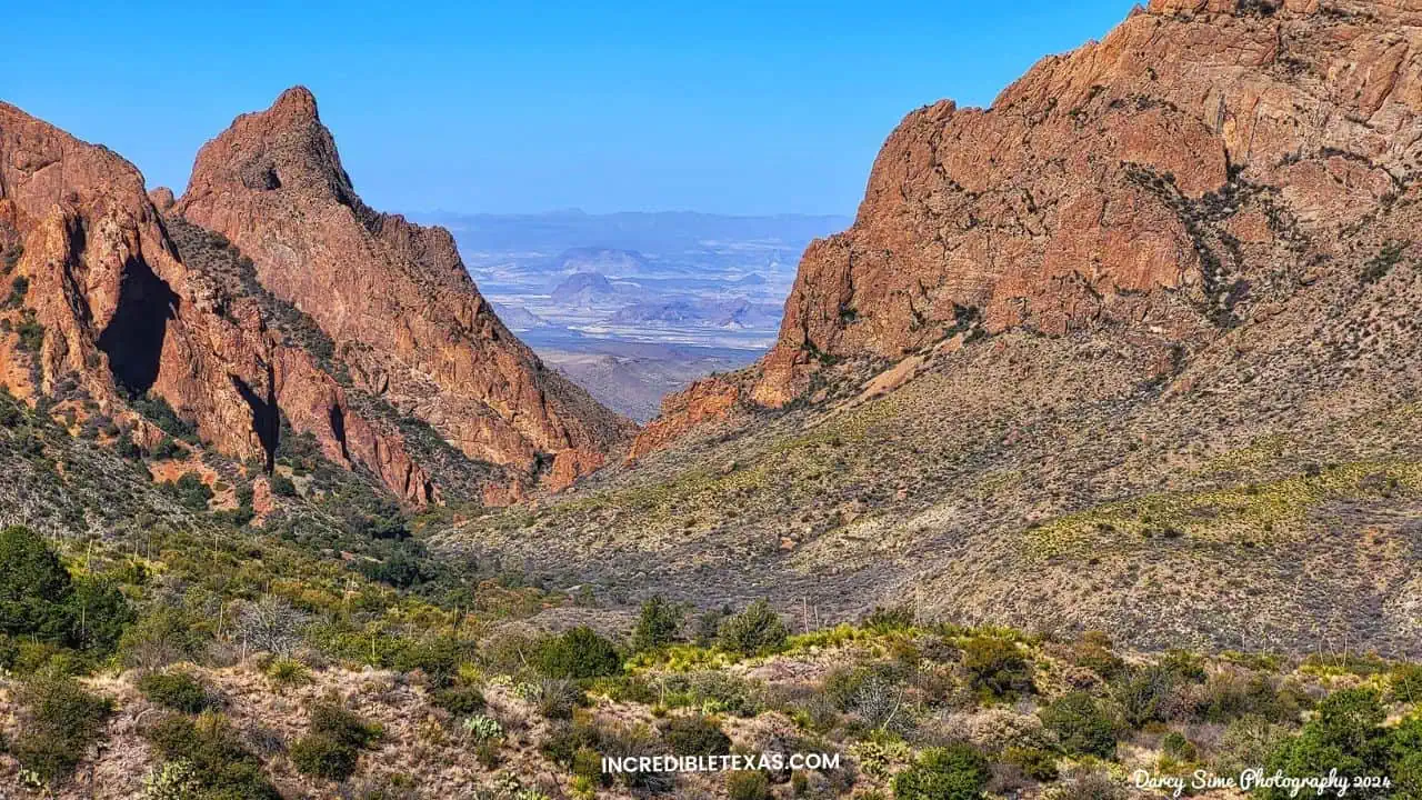
Big Bend National Park protects over 800,000 acres of remote desert basins, sheer river canyons, and the isolated Chisos mountain range in Far West Texas. The park borders Mexico along 118 miles of the Rio Grande, creating one of the most ecologically diverse desert parks in North America.
Hikers tackle alpine trails like the South Rim and Emory Peak before descending into the warm desert flats. Consult the National Park Service Big Bend portal for backcountry trail conditions, or read our complete Big Bend National Park visitor guide before driving south.
- Primary Region: Far West Texas (Brewster County)
- Best Season to Visit: November through April; summer temperatures regularly exceed 110 degrees Fahrenheit
- Key Highlights: Santa Elena Canyon, Chisos Basin trails, Ross Maxwell Scenic Drive, and Boquillas Crossing
- Admission Fee: $30 per non-commercial vehicle (valid 7 days) or America the Beautiful Interagency Pass
Tip
Vehicles longer than 24 feet are prohibited on Chisos Basin Road past the Lost Mine Trailhead due to steep switchbacks, and fuel is only available at Panther Junction and Castolon.
The Big Bend Scenic Loop
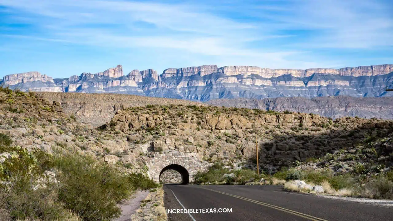
The Big Bend Scenic Loop follows the thirty-mile Ross Maxwell Scenic Drive and adjacent highway spurs through volcanic desert terrain. Drivers pass ancient volcanic dikes, desolate cottonwood oases, and colorful badland formations that slope downward toward the Mexican border.
Key scenic overlooks include Sotol Vista, which provides panoramic vistas across the entire western half of the park. The route terminates at the towering mouth of Santa Elena Canyon, offering access to riverfront walking paths and shaded picnic areas.
- Primary Region: Far West Texas (Big Bend National Park)
- Best Season to Visit: Late October through March for clear skies and comfortable afternoon driving
- Key Highlights: Sotol Vista Overlook, Mule Ears Viewpoint, Castolon Historic District, and Santa Elena Canyon
- Admission Fee: Included with standard $30 Big Bend National Park vehicle entry pass
Tip
Stop at the Castolon Visitor Center for cold drinks and historical exhibits, and ensure your gas tank is full before leaving Study Butte or Panther Junction.
Palo Duro Canyon State Park
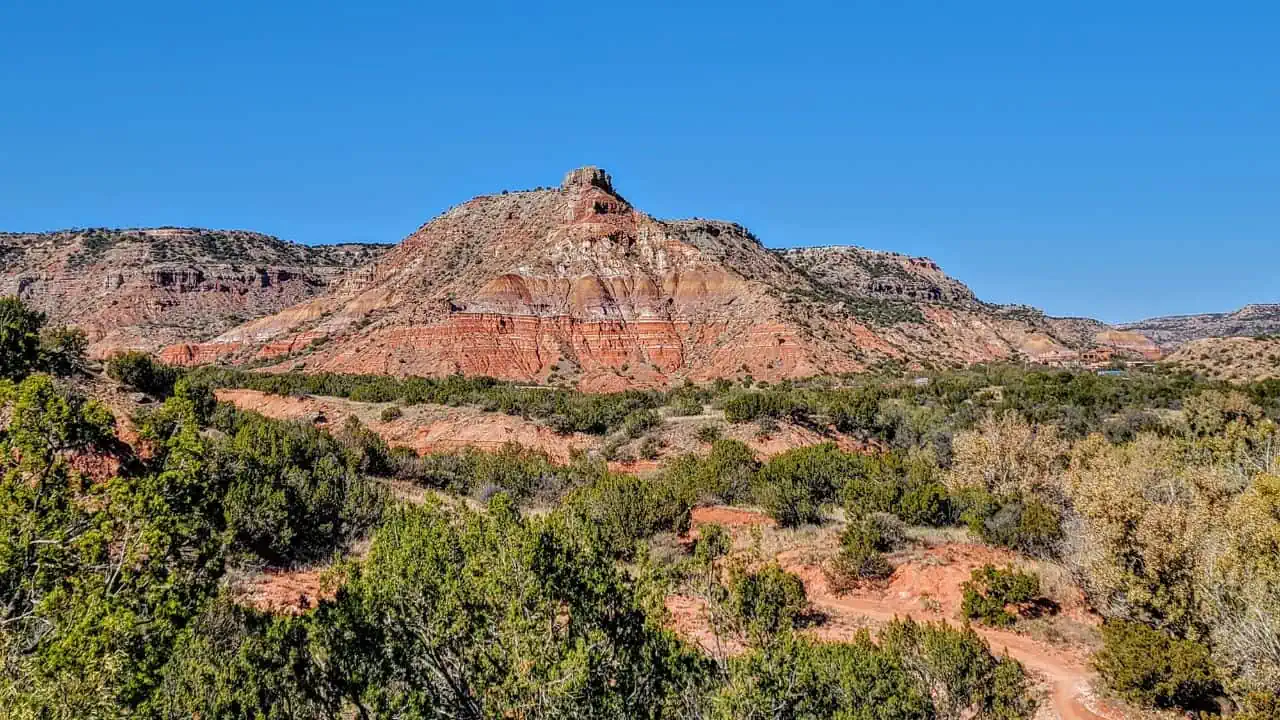
Palo Duro Canyon is the second-largest canyon in the United States, spanning roughly 120 miles in length and up to 800 feet deep in the Texas Panhandle. Exposed geological layers display brilliant red, orange, and yellow clay formations dating back over 250 million years.
Outdoor enthusiasts hike and mountain bike the 5.8-mile round-trip trail to the iconic Lighthouse rock formation. Check the Texas Parks and Wildlife Palo Duro Canyon page or our detailed guide to Palo Duro Canyon State Park hiking trails for campsite bookings.
- Primary Region: Texas Panhandle (Randall and Armstrong counties, near Canyon)
- Best Season to Visit: March through May and September through November; canyon floor hits extreme heat in July
- Key Highlights: Lighthouse Rock Trail, Capitol Peak, outdoor TEXAS musical (summer), and rim overlooks
- Admission Fee: $8 per adult (13 and older); children 12 and under free; Texas State Parks Pass accepted
Tip
Carry at least one gallon of water per person on the Lighthouse Trail, as canyon floor temperatures are consistently ten to fifteen degrees hotter than the rim parking areas.
Guadalupe Mountains National Park
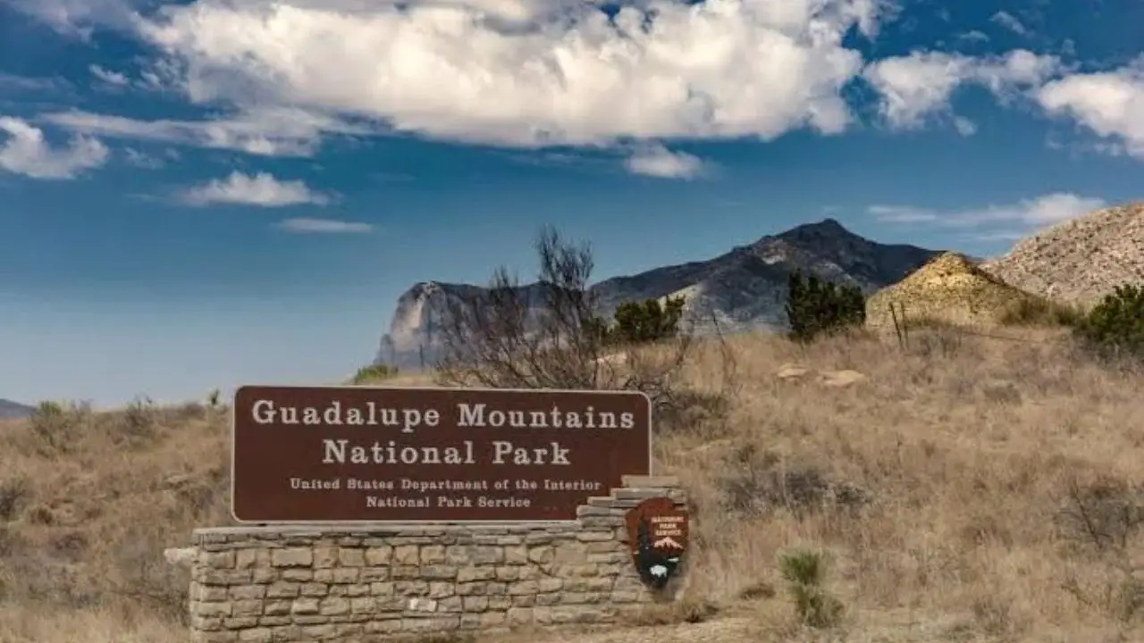
Guadalupe Mountains National Park protects the world’s most extensive Permian fossil reef, rising dramatically above the salt basins of West Texas. The park contains Guadalupe Peak, the highest geographic point in the state at 8,751 feet above sea level.
McKittrick Canyon features deciduous bigtooth maples that transform into vivid red and gold canopies each autumn. Review our Guadalupe Mountains National Park trail guide and official National Park Service Guadalupe Mountains portal for seasonal conditions.
- Primary Region: Far West Texas (Culberson and Hudspeth counties)
- Best Season to Visit: October and November for McKittrick Canyon foliage; March through April for spring hiking
- Key Highlights: Guadalupe Peak Trail (8.4 miles round-trip), McKittrick Canyon, and Devil’s Hall
- Admission Fee: $10 per person for visitors 16 and older (valid 7 days); federal recreation passes accepted
Tip
The park operates on Mountain Time, one hour behind the rest of Texas, and winter wind gusts frequently exceed 60 miles per hour across exposed ridge trails.
Enchanted Rock State Natural Area
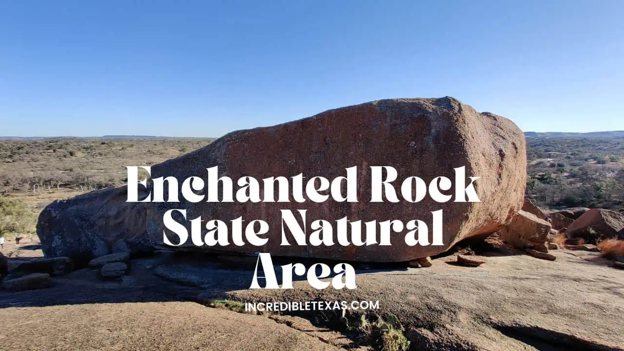
Enchanted Rock State Natural Area centers around a gigantic pink granite dome that rises 425 feet above the surrounding Hill Country terrain. Native American tribes held spiritual reverence for the formation due to creaking noises emitted by the cooling granite at night.
The Summit Trail challenges climbers with a steep, unshaded 0.8-mile ascent over bare granite sheets to reach sweeping panoramic views. Explore our comprehensive guide to Enchanted Rock summit trail and camping before reserving your day pass.
- Primary Region: Texas Hill Country (Llano and Gillespie counties)
- Best Season to Visit: October through April; summer granite surface temperatures can exceed 130 degrees Fahrenheit
- Key Highlights: Summit Trail, Loop Trail, Turkey Pass Trail, rock climbing, and vernal pool ecosystems
- Admission Fee: $8 per adult (13 and older); free for children 12 and under; Texas State Parks Pass accepted
Tip
Park gates close when vehicle capacity is reached, so book online day passes up to thirty days in advance, especially during spring wildflower and autumn weekends.
Franklin Mountains State Park
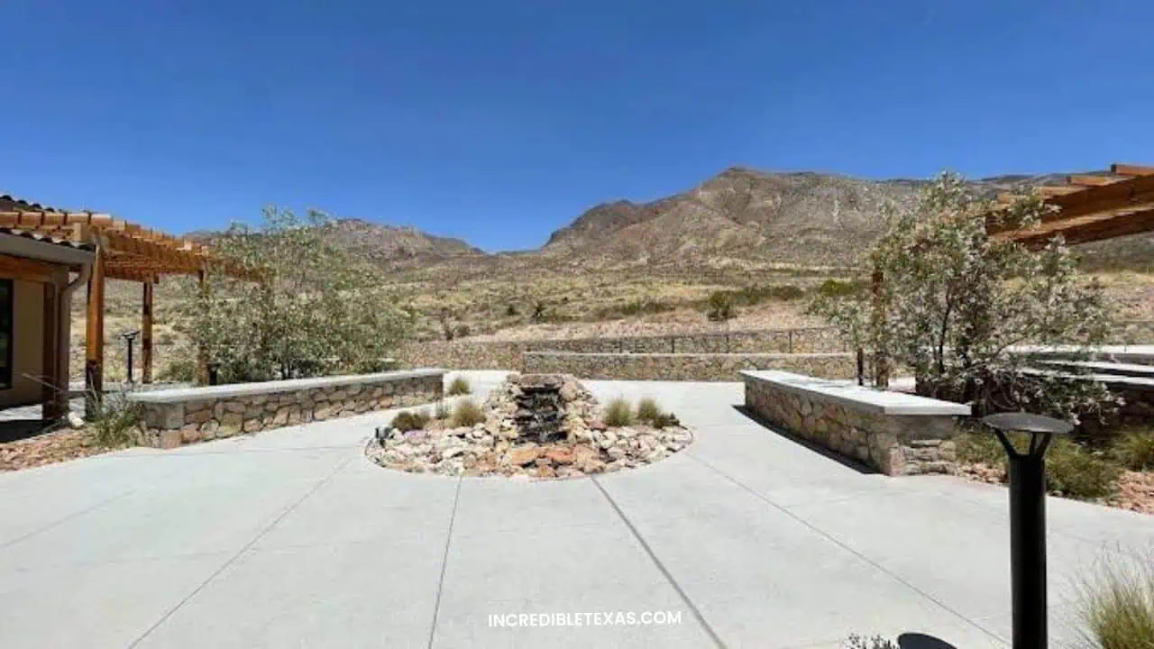
Franklin Mountains State Park encompasses nearly 27,000 acres of rugged Chihuahuan Desert mountains situated entirely within the city boundaries of El Paso. It represents one of the largest urban wilderness parks in the United States, dividing the city into eastern and western sectors.
Over one hundred miles of multi-use trails accommodate aggressive mountain bikers, trail runners, and summit hikers aiming for North Franklin Peak. Desert wildlife includes mule deer, golden eagles, and ringtails inhabiting rocky arroyos and limestone bluffs.
- Primary Region: Far West Texas (El Paso County)
- Best Season to Visit: October through April for mild high-desert temperatures and crisp mountain visibility
- Key Highlights: North Franklin Mountain Peak, Tom Mays Unit trails, Ron Coleman Trail, and rock climbing
- Admission Fee: $5 per adult (13 and older); children 12 and under free
Tip
Enter through the Tom Mays Unit off Transmountain Road for the best developed trailheads, shaded picnic pavilions, and primitive walk-in campsites.
Lost Maples State Natural Area
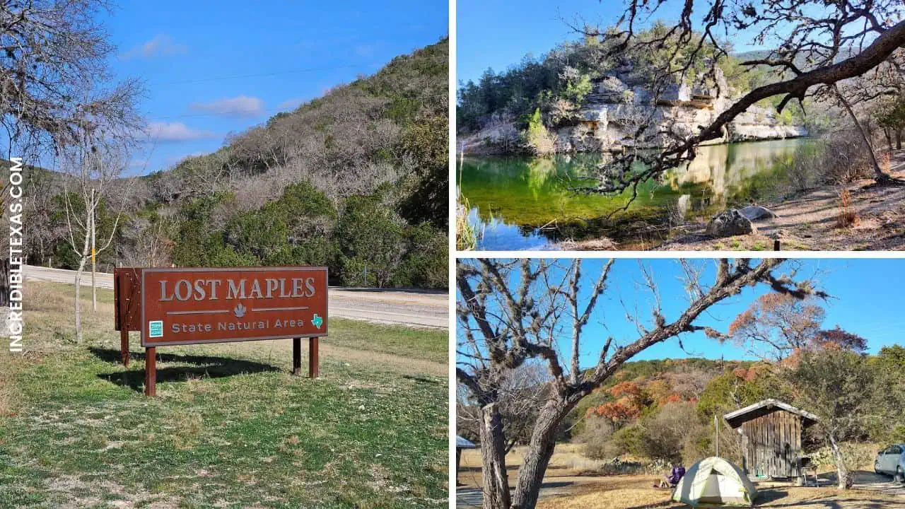
Lost Maples State Natural Area protects an isolated relict stand of Uvalde bigtooth maples along the upper reaches of the Sabinal River canyon. The deep limestone walls create a cool microclimate that allowed these northern deciduous trees to survive since the last ice age.
Hikers follow the East Trail to witness limestone cliff walls framed by intense red and orange autumn foliage between late October and mid-November. Plan your trip with our detailed Lost Maples State Natural Area fall foliage guide.
- Primary Region: Texas Hill Country (Bandera and Real counties, near Vanderpool)
- Best Season to Visit: Late October through mid-November for fall foliage; April and May for spring wildflowers
- Key Highlights: East Trail canyon loop, Monkey Rock formation, Sabinal River crossings, and primitive camping
- Admission Fee: $6 per adult (13 and older); children 12 and under free; Texas State Parks Pass accepted
Tip
Check the Texas Parks and Wildlife online foliage report before visiting, and make reservations thirty days in advance because parking lots fill by 9:00 AM during peak color weeks.
Monahans Sandhills State Park
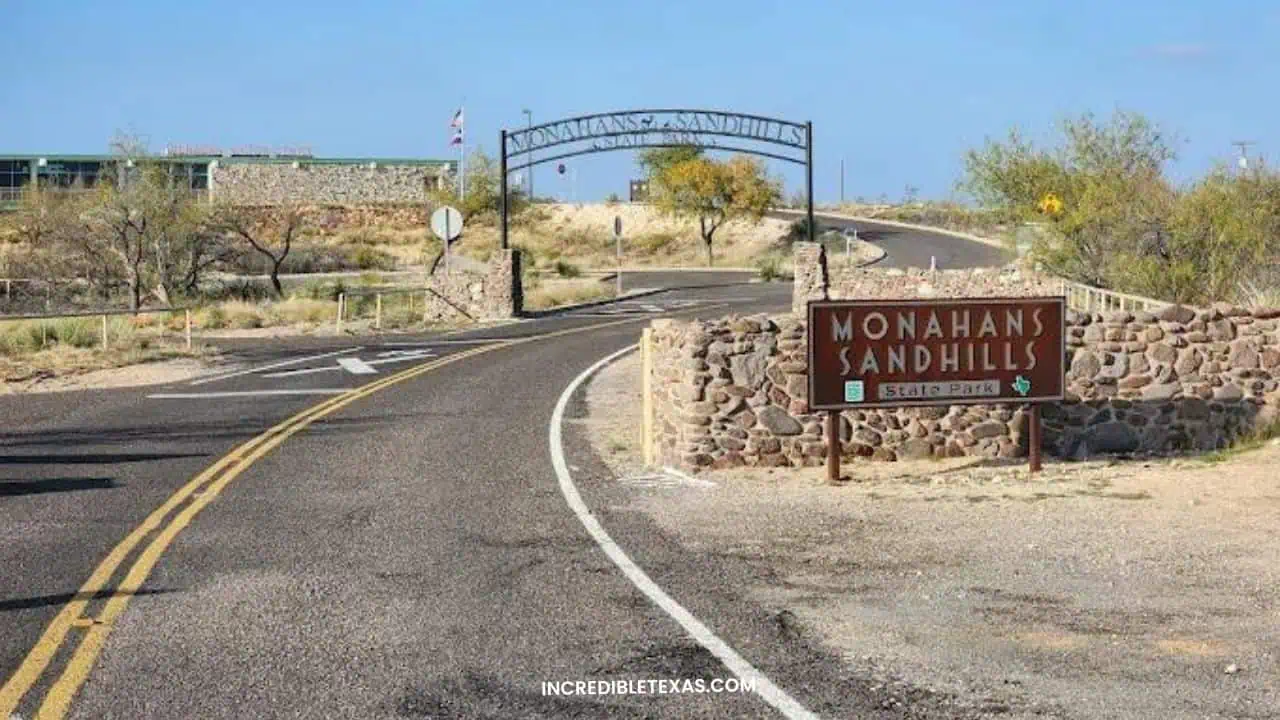
Monahans Sandhills State Park features nearly 4,000 acres of clean, wind-sculpted quartz sand dunes that resemble an inland desert playground. These active dunes constantly shift with prevailing prairie winds, creating fresh contours and rolling ridges up to seventy feet high.
Visitors rent plastic sand disks from the park headquarters to slide down steep dune faces before exploring the surrounding havard shin oak forest. Beneath the dunes lies a dense subterranean dwarf forest where mature oak trees grow less than four feet tall above ground.
- Primary Region: West Texas (Ward and Winkler counties, off Interstate 20)
- Best Season to Visit: October through April to avoid extreme summer sand temperatures
- Key Highlights: Sand surfing and dune sledding, Dunagan Visitor Center interpretive exhibits, and walking trails
- Admission Fee: $4 per adult (13 and older); children 12 and under free; sand disc rentals available on site
Tip
Purchase wax at the headquarters desk to buff the bottom of your rental sand disk for significantly faster rides down the steepest dune slopes.
Caddo Lake
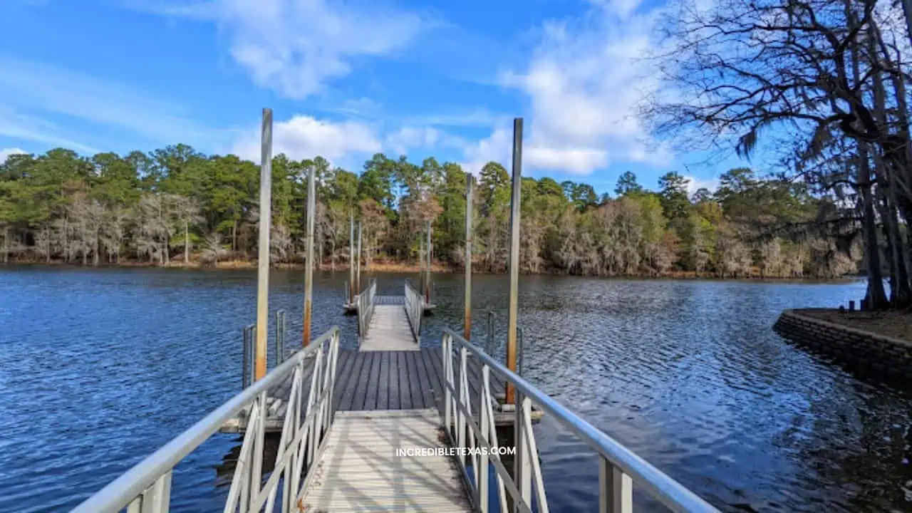
Caddo Lake covers over 25,000 acres of sprawling bayous, shallow sloughs, and ancient bald cypress groves along the Texas-Louisiana border. As the only naturally formed large freshwater lake in Texas, it sustains a wetland ecosystem rich with alligators, turtles, and wading birds.
Paddlers navigate more than fifty miles of marked water trails through towering cypress trunks draped with heavy Spanish moss. Refer to our complete guide to Caddo Lake paddling trails and bayous to organize canoe rentals and primitive cabin stays.
- Primary Region: East Texas Piney Woods (Harrison and Marion counties, near Karnack)
- Best Season to Visit: March through May for blooming water plants, or late October for copper cypress needles
- Key Highlights: Saw Mill Pond, Hell’s Half Acre paddling trail, historic boat tours, and CCC stone cabins
- Admission Fee: $4 per adult (13 and older) at Caddo Lake State Park; private boat launches vary from $5 to $10
Tip
Download offline navigation maps on your phone before paddling into the maze-like boat lanes, as cellular coverage is erratic and identical cypress trees make landmark orientation tricky.
Devils River
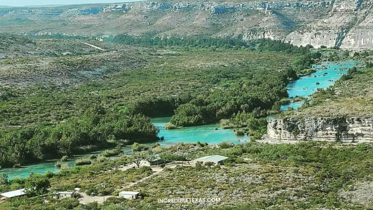
The Devils River flows through rugged desert canyons in southwest Texas before entering Amistad Reservoir. Fed by clear subterranean springs, its crystalline waters represent one of the cleanest and least ecologically disturbed river corridors in the American Southwest.
Paddling the river requires advanced whitewater skills, self-sufficiency, and mandatory permits through Texas Parks and Wildlife. Multi-day expeditions challenge paddlers with Class II and III rapids, mandatory portages around Dolan Falls, and strict Leave No Trace waste rules.
- Primary Region: Southwest Texas (Val Verde County)
- Best Season to Visit: March through May and October through November for moderate temperatures and manageable flows
- Key Highlights: Dolan Falls, Devils River State Natural Area (Del Norte and Big Satan units), and smallmouth bass fishing
- Admission Fee: Devils River State Natural Area requires advance reservations and backcountry river permits
Tip
All paddlers must carry human waste disposal containers and pack out every ounce of trash, as private landowners strictly enforce trespass boundaries along riverbanks.
Medina River
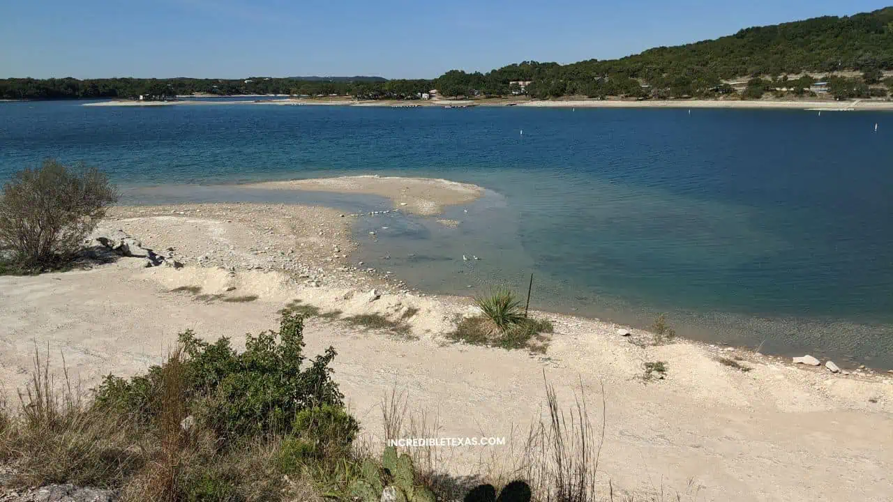
The Medina River cuts a cool, shaded path through the limestone ridges of Bandera and Medina counties in the Texas Hill Country. Dense canopies of century-old bald cypress trees line both banks, creating a refreshing canopy for kayakers and recreational tubers.
Unlike more commercialized Central Texas waterways, the Medina offers a quieter, unhurried float past limestone bluffs and natural swimming holes. Popular entry points include Bandera City Park and the English Crossing bridge access near the Cowboy Capital of the World.
- Primary Region: Texas Hill Country (Bandera County)
- Best Season to Visit: May through August for warm swimming; river levels depend directly on recent Hill Country rain
- Key Highlights: Kayak paddling runs, tubing from Bandera City Park, fly fishing for bass, and riverbank picnics
- Admission Fee: Free public access points; Bandera City Park charges nominal vehicle fees on summer holiday weekends
Tip
Check the USGS river flow gauge at Bandera before heading out; ideal paddling flows range between 100 and 300 cubic feet per second, while lower rates require dragging boats over gravel shallows.
Balmorhea State Park
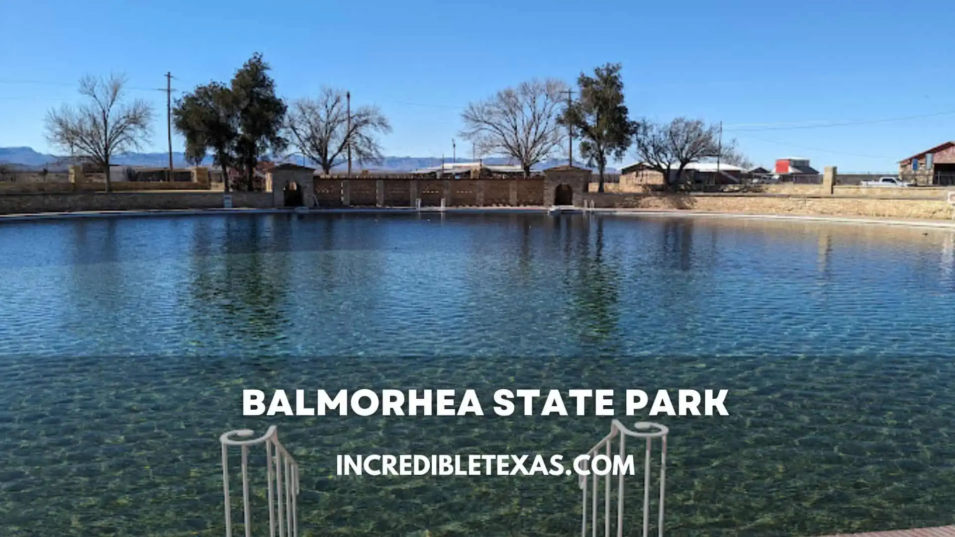
Balmorhea State Park centers around the world’s largest spring-fed swimming pool, constructed by the Civilian Conservation Corps in the 1930s. Fed by San Solomon Springs, over fifteen million gallons of clear artesian water circulate through the pool daily before flowing into agricultural irrigation canals.
Swimmers and scuba divers share the deep pool with species like the Comanche Springs pupfish and Pecos gambusia. Explore our visitor overview of the Balmorhea State Park spring-fed pool for lodging reservations and daily gate caps.
- Primary Region: West Texas (Reeves County, near Toyahvale and Fort Davis)
- Best Season to Visit: May through September for refreshing desert swims; pleasant year-round due to 72-76 degree water
- Key Highlights: CCC historic pool (up to 25 feet deep), high diving boards, scuba diving, and restored desert cienega
- Admission Fee: $7 per adult (13 and older); children 12 and under free; scuba divers pay an additional $5 activity fee
Tip
Book daily pool passes online through Texas Parks and Wildlife up to thirty days ahead, as day-use admissions are strictly limited to prevent pool overcrowding.
Blue Lagoon
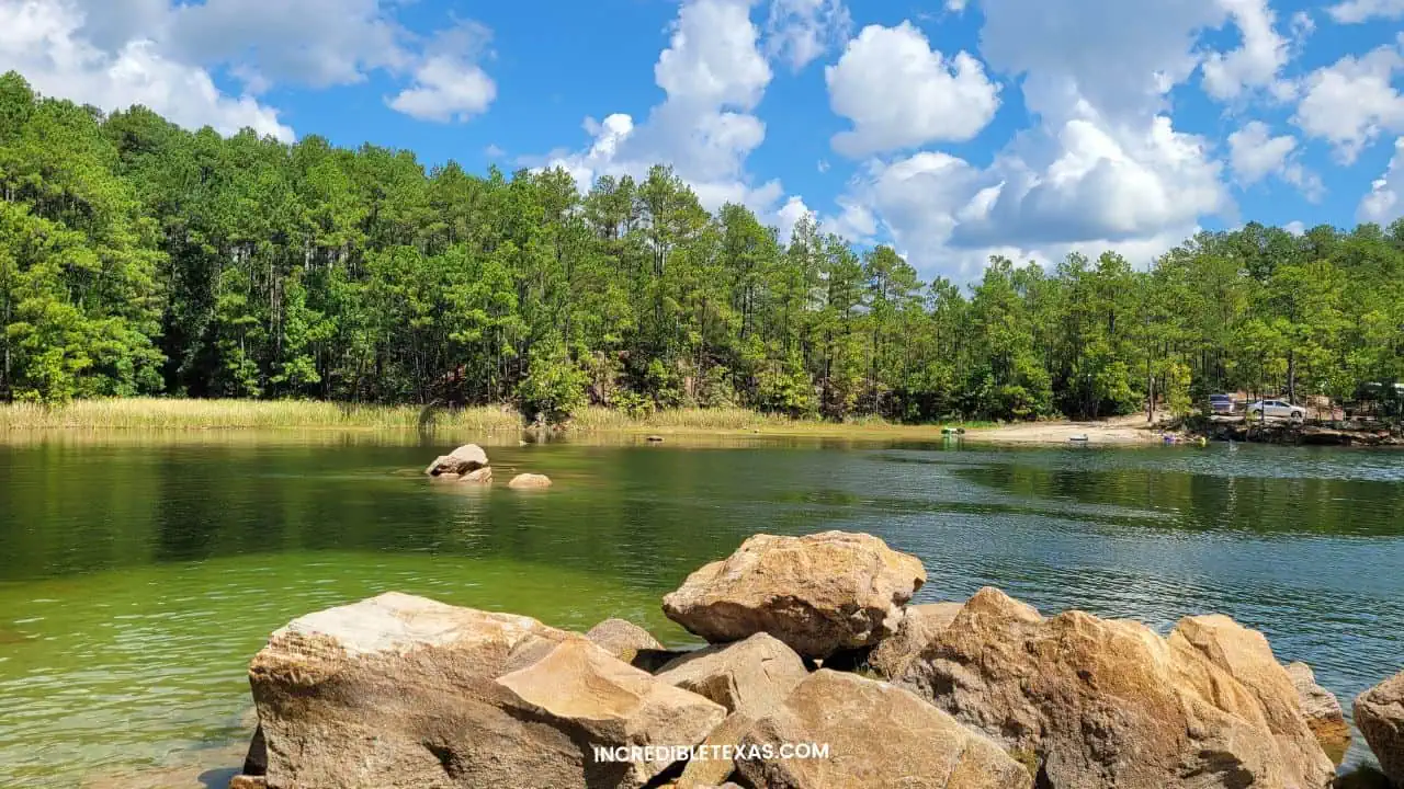
The Blue Lagoon consists of two flooded limestone quarries situated just north of Huntsville in the pine forests of Walker County. The spring-fed water displays a remarkable turquoise color caused by suspended calcium carbonate particles reflecting sunlight against the light limestone bottom.
The facility primarily serves as a primary training site for open-water scuba certifications in Texas. Non-divers can also access the private site for sunbathing and swimming on designated weekdays when diver training volume is low.
- Primary Region: East Texas Piney Woods (Walker County, near Huntsville)
- Best Season to Visit: May through September for warm surface swimming and clear underwater diving conditions
- Key Highlights: Open-water scuba training platforms, underwater sunken boats and planes, and turquoise shoreline waters
- Admission Fee: Approximately $25 to $30 for certified divers; non-diver entry fees vary and daily non-diver quotas apply
Tip
Non-divers must arrive at opening time because the facility restricts non-diver admissions strictly to maintain water clarity and safety for training scuba classes.
Devil’s Waterhole in Inks Lake State Park
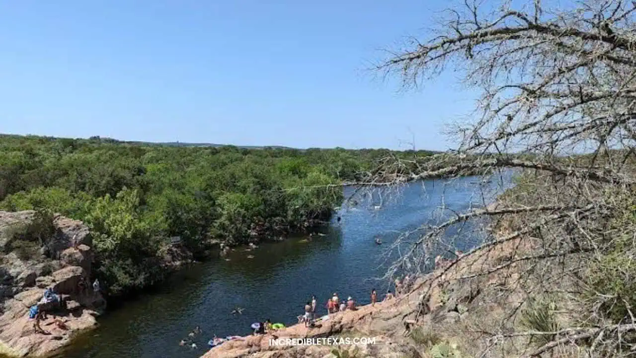
Devil’s Waterhole is a famous natural swimming cove carved into pink gneiss rock where Spring Creek enters Inks Lake in the Highland Lakes chain. Surrounded by steep granite ledges up to forty feet high, it provides deep, cool water for summer swimmers and kayakers.
A scenic trail follows the creek upstream to scenic rock pools and shallow waterfalls that flow after seasonal rains. Read our comprehensive guide on Inks Lake State Park camping and swimming to plan a multi-day weekend escape.
- Primary Region: Texas Hill Country (Burnet County, near Burnet and Marble Falls)
- Best Season to Visit: April through September for swimming and kayaking; October through November for hiking
- Key Highlights: Deep swimming cove, granite rock jumping ledges, Spring Creek Valley trail, and canoe rentals
- Admission Fee: $7 per adult (13 and older); children 12 and under free; Texas State Parks Pass accepted
Tip
Rent a kayak or paddleboard from the park store and paddle north across Inks Lake directly into the cove to avoid the hot quarter-mile hike from the trailhead parking lot.
Hamilton Pool Preserve
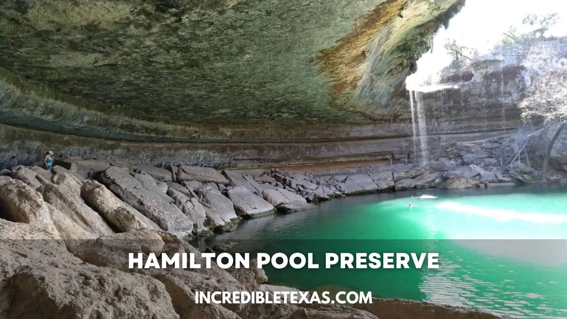
Hamilton Pool Preserve protects a collapsed limestone grotto where Hamilton Creek spills over a fifty-foot ledge into a jade-green pool. Maidenhair ferns, mosses, and rare orchids cling to the massive overhanging box canyon created by thousands of years of water erosion.
The preserve is managed by Travis County Parks with strict environmental protections to preserve the fragile canyon habitat. While trail access remains open, swimming access is periodically restricted due to safety assessments of falling rock hazards beneath the overhanging grotto.
- Primary Region: Central Texas / Texas Hill Country (Travis County, near Dripping Springs)
- Best Season to Visit: March through May for vigorous waterfall flows; October and November for pleasant hiking
- Key Highlights: 50-foot waterfall, collapsed limestone grotto, Pedernales River trail, and ancient bald cypress trees
- Admission Fee: Mandatory online reservation fee ($12) plus per-person entrance fees ($8 per adult) paid on site
Tip
Check the Travis County Parks website the morning of your reservation to confirm current trail and pool swimming status, and wear sturdy trail shoes for the rocky canyon trail descent.
Jacob’s Well Natural Area
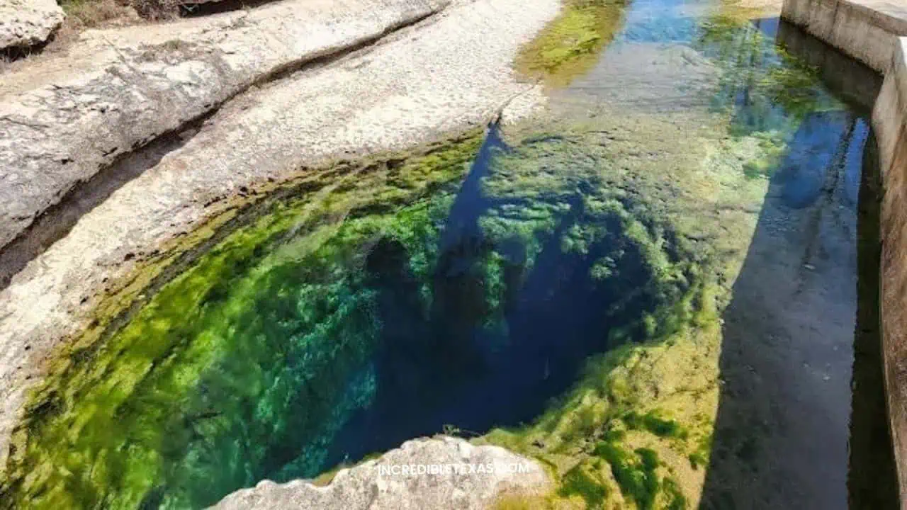
Jacob’s Well is an artesian spring that surges from the Trinity Aquifer to form the headwaters of Cypress Creek near Wimberley. The submerged cave opening measures twelve feet across and drops vertically for thirty feet before angling into thousands of feet of subterranean limestone chambers.
The surrounding nature preserve features restored native prairies, shaded creek walking trails, and educational signage detailing aquifer conservation. Pair this natural attraction with our guide to family attractions in Wimberley for an afternoon of local exploration.
- Primary Region: Texas Hill Country (Hays County, near Wimberley)
- Best Season to Visit: Year-round for hiking trails and interpretive center; spring flow determines water access
- Key Highlights: Artesian spring cave opening, Cypress Creek riparian trail, nature center, and birding blinds
- Admission Fee: Free entry to nature trails and preserve; swimming requires seasonal permits when aquifer flow permits
Tip
Prolonged droughts can temporarily halt the spring flow and close the well to swimming, so verify current creek conditions on the Hays County website before planning a swimming outing.
Barton Springs Pool
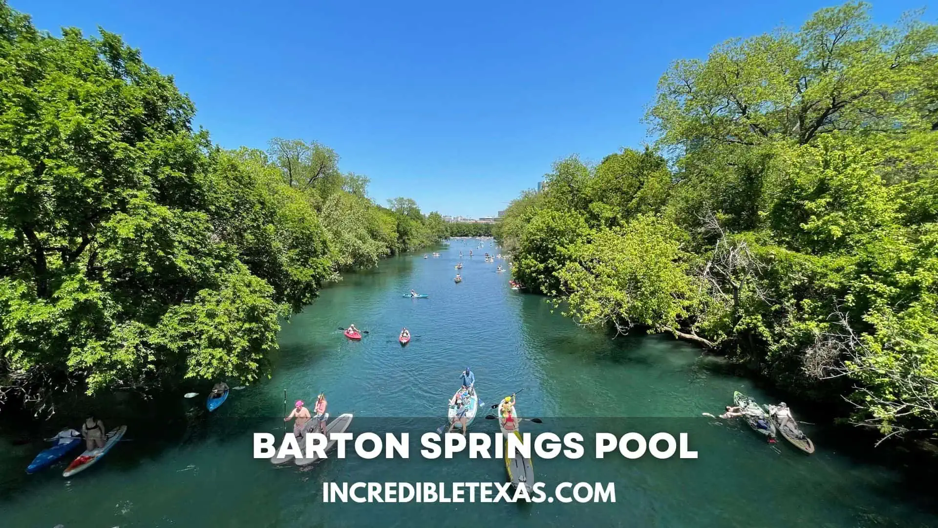
Barton Springs Pool is an iconic three-acre municipal pool fed by natural underground springs located inside Zilker Park in downtown Austin. The pool maintains an invigorating temperature of approximately 68 to 70 degrees Fahrenheit throughout all four seasons.
Sunbathers relax on sloping grassy lawns beneath heritage pecan trees while swimmers lap the quarter-mile pool channel. The pool also serves as federally protected habitat for the endangered Barton Springs salamander, which thrives in the clean artesian outflow.
- Primary Region: Central Texas (Travis County, Austin)
- Best Season to Visit: May through September for classic summer swims; year-round for early-morning cold plunge laps
- Key Highlights: Natural artesian spring pool, diving board, sprawling grassy lawns, and historical bathhouse
- Admission Fee: $5 to $9 for Austin residents; $9 to $11 for non-residents; free admission during early-morning swim hours
Tip
Barton Springs closes every Thursday from 9:00 AM to 7:00 PM for weekly ecological pool cleaning, so schedule your visit between Friday and Wednesday.
Cattail Falls
Cattail Falls is a secluded, hidden oasis tucked into a protected canyon on the western slope of the Chisos Mountains in Big Bend National Park. Fed by mountain runoff, an eighty-foot waterfall drops down a polished volcanic rock face into a deep, shaded fern-fringed pool.
The three-mile round-trip hike departs from an unmarked gravel pullout near the Oak Springs maintenance road. Because the canyon shelters fragile mountain ecology and black bear watering spots, visitors must remain on the trail and respect strict day-use rules.
- Primary Region: Far West Texas (Big Bend National Park, Brewster County)
- Best Season to Visit: Winter and early spring; waterfall flow peaks immediately following seasonal mountain rainfall
- Key Highlights: 80-foot desert waterfall, maidenhair fern grotto, and remote Chisos wilderness scenery
- Admission Fee: Included with standard $30 Big Bend National Park vehicle entry pass
Tip
Swimming and wading are strictly prohibited in Cattail Falls pool to protect delicate endemic aquatic invertebrates and preserve the drinking source for local wildlife.
Gorman Falls
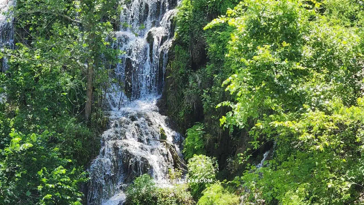
Gorman Falls is a 65-foot living waterfall fed by subterranean springs inside Colorado Bend State Park in San Saba County. As mineral-rich spring water flows over the cliff face, it continuously deposits calcium carbonate, forming delicate tufa rock terraces coated with mosses and maidenhair ferns.
The three-mile round-trip hike traverses rugged limestone terrain before descending a steep rock staircase equipped with metal handrails. Compare this site with other scenic waterfalls across Texas to map out a central Texas road trip.
- Primary Region: Texas Hill Country (San Saba County, Colorado Bend State Park)
- Best Season to Visit: March through May for optimal spring volume; autumn for cooler hiking trail conditions
- Key Highlights: 65-foot tufa waterfall, Colorado River canyon bluffs, cave tours, and Colorado Bend hiking trails
- Admission Fee: $5 per adult (13 and older); children 12 and under free; Texas State Parks Pass accepted
Tip
Do not step off the viewing deck onto the waterfall formations, as the delicate mineral tufa rock takes centuries to form and crumbles easily under human footwear.
Krause Springs
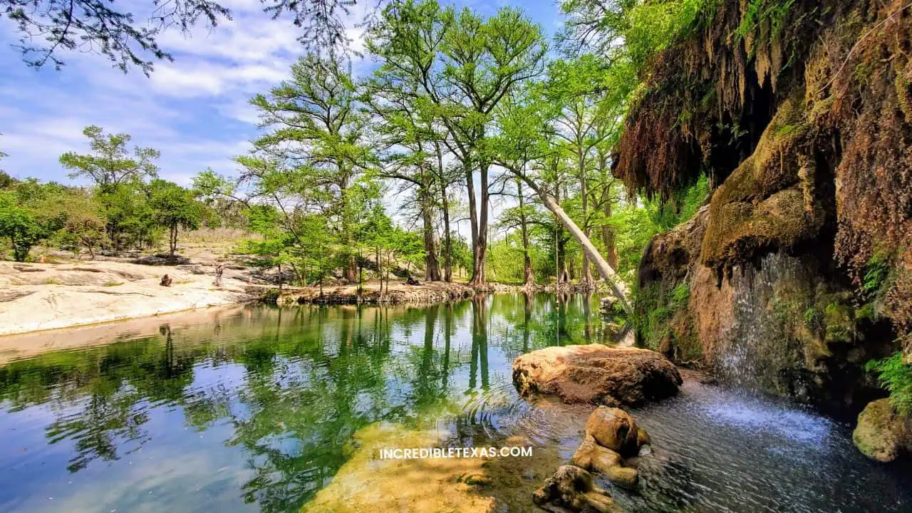
Krause Springs is a privately owned thirty-acre swimming retreat located in Spicewood, approximately thirty miles west of Austin. Thirty-two natural springs bubble up on the property, continuously supplying both an upper concrete swimming pool and a natural swimming hole in Little Cypress Creek.
Towering bald cypress trees provide deep shade over cascading waterfalls, stone sunbathing terraces, and gardens. Primitive tent camping beneath the trees makes this historic property a classic summer destination for Texas families.
- Primary Region: Texas Hill Country (Burnet County, Spicewood)
- Best Season to Visit: May through September for summer swimming; open year-round with water at 68 degrees
- Key Highlights: 32 natural springs, two distinct swimming pools, rope swing, waterfall grotto, and overnight tent camping
- Admission Fee: Day pass $10 for adults (12+), $6 for children (4-11); overnight camping $15 for adults, $10 for children
Tip
Krause Springs accepts cash only at the entrance gate; credit and debit cards are not processed, so remember to stop at an ATM before arriving in Spicewood.
Galveston Island
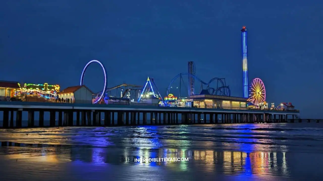
Galveston Island pairs thirty-two miles of sandy Gulf of Mexico beaches with one of the largest concentrations of Victorian architecture in the country. Situated fifty miles south of Houston, the barrier island served as a booming maritime port throughout the late nineteenth century.
Travelers walk along the historic Strand District for antique shops, seafood restaurants, and historic museums before walking the ten-mile Seawall. Consult our guide to the Galveston Island historic district and beaches to organize your weekend coastal tour.
- Primary Region: Texas Gulf Coast (Galveston County)
- Best Season to Visit: March through May and September through October for mild beach temperatures and festivals
- Key Highlights: The Strand Historic District, Seawall Boulevard, Galveston Island Historic Pleasure Pier, and Moody Gardens
- Admission Fee: Free public beach access; parking fees apply along central Seawall Boulevard and designated beach parks
Tip
Ride the free Bolivar Ferry across the Houston Ship Channel to Bolivar Peninsula to view passing dolphins and massive ocean cargo vessels from the observation deck.
Padre Island National Seashore
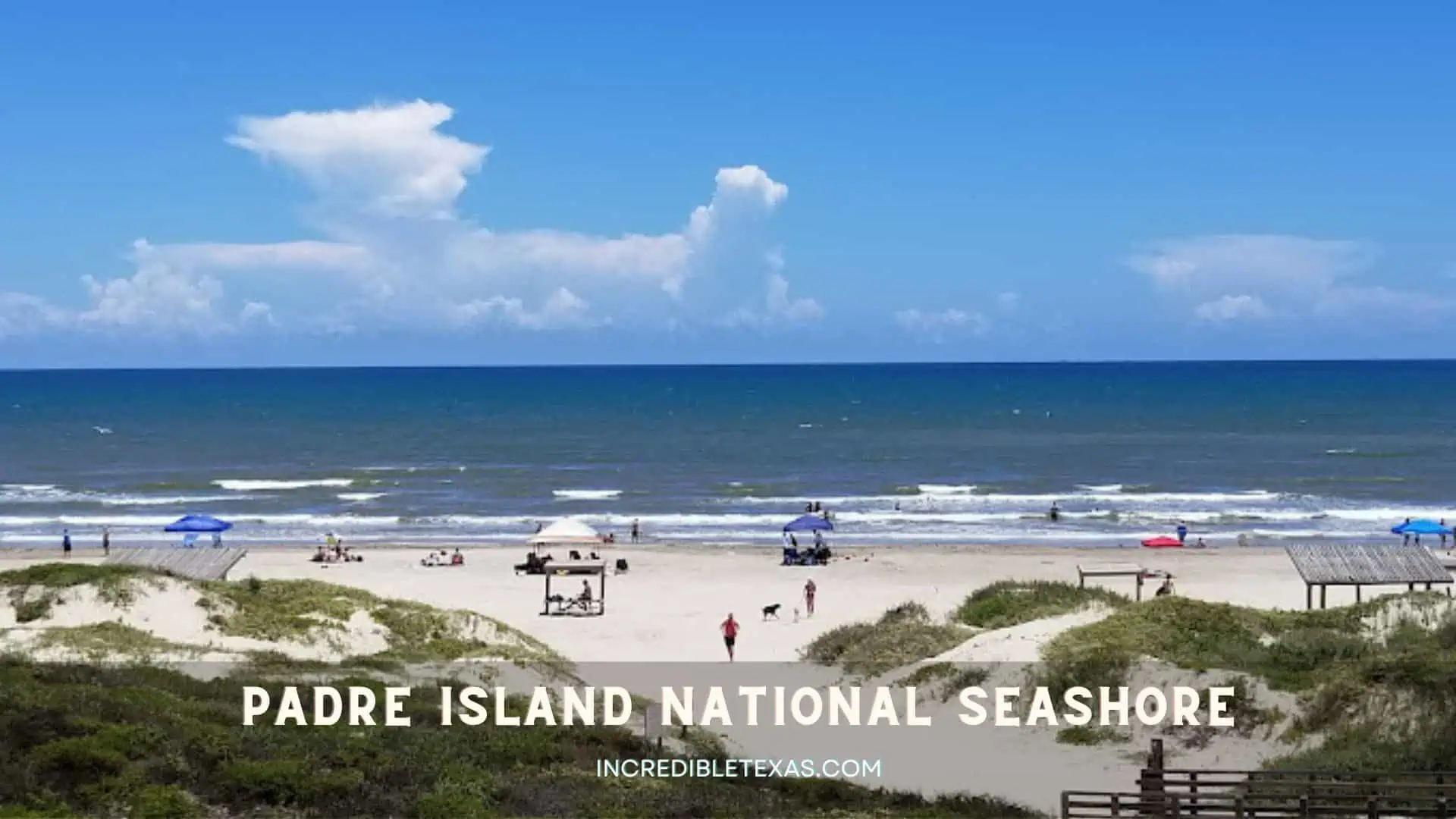
Padre Island National Seashore preserves the longest undeveloped barrier island coastline in the world, spanning sixty-six miles along the southern Gulf Coast. It separates the open Gulf of Mexico from the hyper-saline Laguna Madre, sheltering hundreds of migratory bird species.
The park provides nesting habitat for the endangered Kemp’s ridley sea turtle, with public hatchling releases held on Malaquite Beach throughout summer mornings. Check the official Padre Island National Seashore official site and our guide to Port Aransas coastal activities for trip prep.
- Primary Region: Texas Gulf Coast (Kleberg and Kenedy counties, south of Corpus Christi)
- Best Season to Visit: November through April for birdwatching; June and July for morning sea turtle hatchling releases
- Key Highlights: Malaquite Beach, 4WD down-island driving on South Beach, Bird Island Basin windsurfing, and beach camping
- Admission Fee: $10 per vehicle (1-day pass) or $25 (7-day pass); federal recreation passes accepted
Tip
Driving past Mile Marker 5 on South Beach requires a high-clearance four-wheel-drive vehicle and recovery equipment due to deep beach sand and shifting tide lines.
Rockport Beach
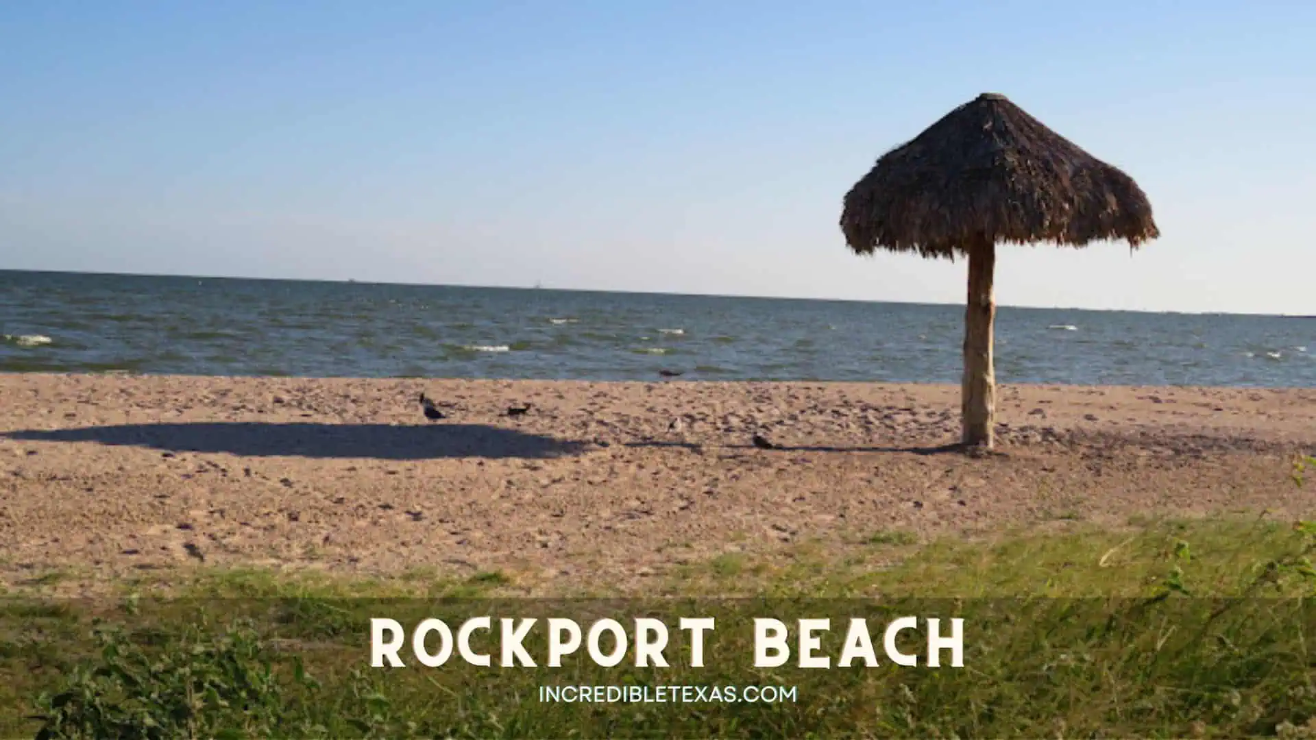
Rockport Beach curves along Aransas Bay, recognized as the cleanest certified municipal waterfront on the Texas coastal bend. As the state’s first certified Blue Wave Beach, it maintains clean water testing standards, spotless facilities, and a calm, wave-free swimming shoreline.
Families appreciate the shallow, gentle water entry and shaded thatched palapas spaced along the mile-long sandy beachfront. Check our curated list of top-ranked Texas beaches to see how Rockport compares to open Gulf surf destinations.
- Primary Region: Texas Gulf Coast (Aransas County, Rockport)
- Best Season to Visit: April through October for pleasant swimming; winter for whooping crane viewing tours
- Key Highlights: Thatched palapas, 800-foot fishing pier, calm bay swimming, playground, and walking trail
- Admission Fee: $10 daily parking pass per vehicle; $40 annual pass available
Tip
Arrive before 10:00 AM on summer weekends to claim one of the popular shade palapas, which are available on a first-come, first-served basis at no extra charge.
Boquillas Canyon
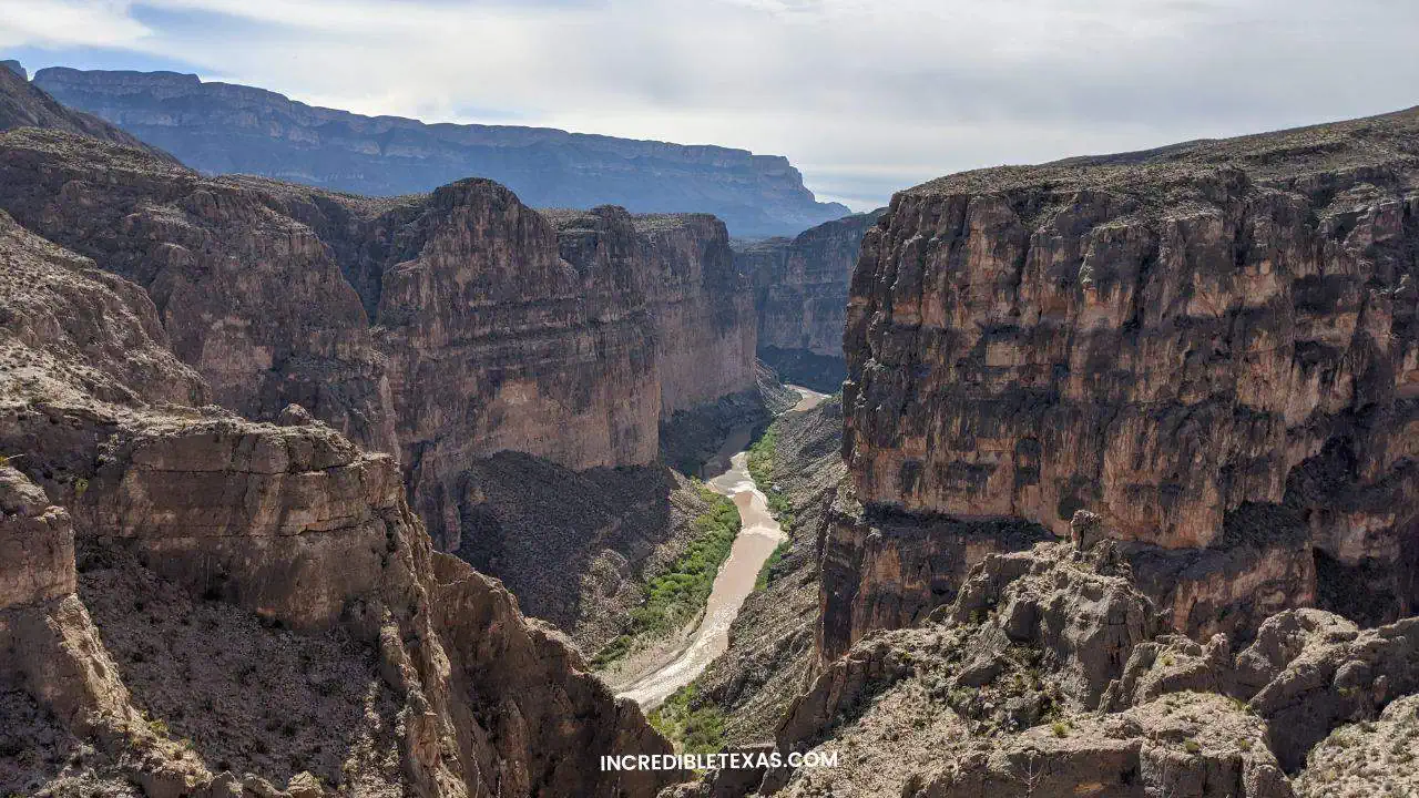
Boquillas Canyon carves through the massive Sierra del Carmen mountain range at the eastern terminus of Big Bend National Park. Sheer limestone walls climb over 1,200 feet above the Rio Grande, creating a dramatic natural gateway along the international boundary.
A 1.4-mile round-trip trail climbs over a low ridge before descending to the riverbank, passing ancient mortar holes ground into limestone by prehistoric native inhabitants. Sand dunes accumulate along the base of the canyon wall, providing resting spots for canyon hikers.
- Primary Region: Far West Texas (Big Bend National Park, eastern sector)
- Best Season to Visit: November through March; afternoon canyon temperatures become sweltering from May to August
- Key Highlights: 1,200-foot canyon gorge walls, Rio Grande sandy banks, Native American bedrock mortar holes, and birdwatching
- Admission Fee: Included with standard $30 Big Bend National Park vehicle entry pass
Tip
Carry your passport if you plan to use the nearby Boquillas Port of Entry to take a small rowboat across the river for lunch in the Mexican village of Boquillas del Carmen.
Caprock Canyons State Park
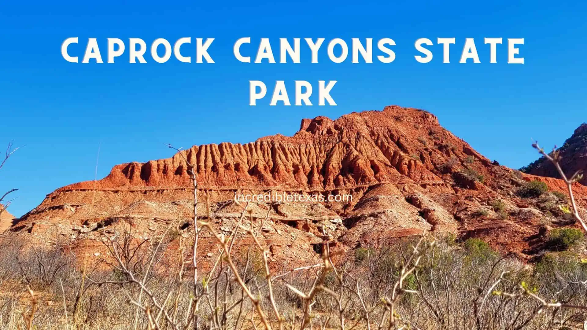
Caprock Canyons State Park presents jagged red sandstone badlands, dramatic escarpments, and gypsum-streaked bluffs in the southern Panhandle. The park preserves over ninety miles of multi-use trails that cut through rugged canyon country carved by Little Red River tributaries.
Most notably, the park serves as the permanent home to the historic Texas State Bison Herd, descendants of Charles Goodnight’s legendary 1878 conservation herd. Browse our guide to the Caprock Canyons bison herd and trails for trail elevations and campsite amenities.
- Primary Region: Texas Panhandle (Briscoe County, near Quitaque)
- Best Season to Visit: March through May and September through November; crisp prairie air and active wildlife viewing
- Key Highlights: Free-roaming bison herd, Haynes Ridge Overlook Trail, Clarity Tunnel Mexican free-tailed bat colony, and Trailway
- Admission Fee: $5 per adult (13 and older); children 12 and under free; Texas State Parks Pass accepted
Tip
Always maintain a distance of at least fifty yards from grazing bison; these wild animals roam freely across roads and campsites and can sprint up to thirty-five miles per hour.
Santa Elena Canyon
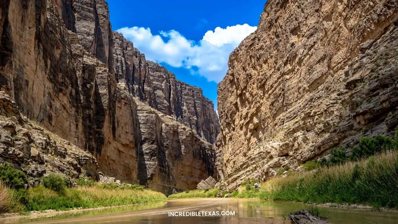
Santa Elena Canyon stands as the most dramatic geological landmark in Big Bend National Park, where the Rio Grande bisects the Sierra Ponce. Vertical limestone cliffs rise 1,500 feet straight up from the water’s edge, casting deep shadows across the narrow canyon floor.
The Santa Elena Canyon Trail spans 1.7 miles round-trip, crossing Terlingua Creek before climbing concrete stairs along the canyon face and descending to water level. River outfitters run popular day trips by canoe or raft through the canyon when water flow permits.
- Primary Region: Far West Texas (Big Bend National Park, western sector)
- Best Season to Visit: Late October through April; early mornings provide optimal lighting for photography
- Key Highlights: 1,500-foot sheer limestone walls, Terlingua Creek crossing, scenic canyon trail, and river rafting
- Admission Fee: Included with standard $30 Big Bend National Park vehicle entry pass
Tip
Crossing Terlingua Creek at the trailhead often requires wading through ankle-to-knee-deep water and mud, so pack water shoes or sturdy sandals for the initial crossing.
Seminole Canyon State Park
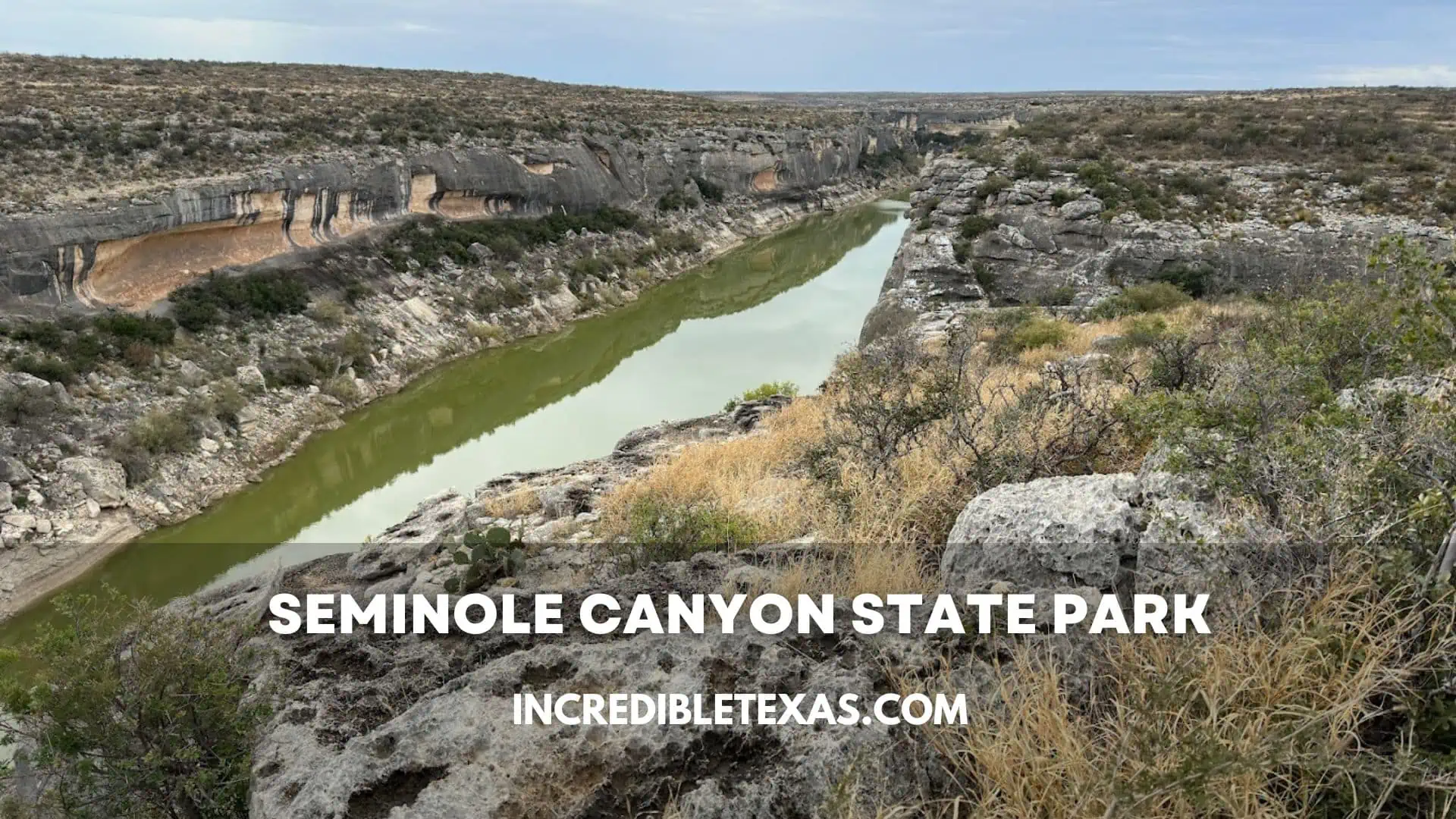
Seminole Canyon State Park preserves some of the oldest and most significant pre-Columbian pictographs in North America, located near the confluence of the Pecos and Rio Grande rivers. Deep rock shelters hollowed out of limestone cliffs provided refuge for nomadic hunter-gatherer cultures for thousands of years.
Park rangers lead guided interpretive tours into Fate Bell Shelter to explain the monumental red, black, and yellow pictographs painted with organic pigments. Read our visitor report on Seminole Canyon rock art tours to check seasonal tour schedules.
- Primary Region: Southwest Texas (Val Verde County, near Comstock)
- Best Season to Visit: October through April; summer temperatures in the rocky canyon frequently reach 105 degrees
- Key Highlights: Fate Bell Shelter guided rock art tour, Presa Canyon, Canyon Rim Trail, and Pecos River overlook
- Admission Fee: $5 per adult (13 and older); children 12 and under free; Fate Bell Shelter tour requires an additional $8 fee
Tip
The pictograph rock shelters are strictly accessible by ranger-led guided tour only; reserve your tour spots in advance through the Texas Parks and Wildlife website.
Cascade Caverns
Cascade Caverns offers an underground excursion beneath the limestone hills of Kendall County near Boerne. Operating as a show cave since 1932, the cave maintains a consistent temperature of 68 degrees Fahrenheit year-round, regardless of surface weather conditions.
Guided walking tours lead visitors along paved, illuminated corridors through cathedral-sized chambers featuring active stalactites, stalagmites, and a subterranean waterfall. The cave is also home to the rare Cascade Caverns salamander and small colonies of tricolored bats.
- Primary Region: Texas Hill Country (Kendall County, Boerne)
- Best Season to Visit: Open year-round; excellent summer retreat due to steady 68-degree subterranean temperature
- Key Highlights: 45-minute guided walking tour, subterranean waterfall room, geological exhibits, and shaded on-site RV park
- Admission Fee: Approximately $19.95 for adults (12+); $14.95 for children (4-11); under 4 free
Tip
Wear closed-toe shoes with slip-resistant soles, as the subterranean limestone pathways remain naturally wet from continuous underground mineral drips.
Cave Without a Name
Cave Without a Name is a designated National Natural Landmark located eleven miles northeast of Boerne in the Texas Hill Country. Named after a 1939 student contest entry declaring the cavern too beautiful to name, it features six massive rooms decorated with speleothems.
Visitors walk down 126 steps into subterranean rooms filled with delicate soda straws, rimstone dams, flowstones, and towering stalagmites. The acoustic properties of the Queen’s Throne Room make it a celebrated venue for underground musical concerts throughout the year.
- Primary Region: Texas Hill Country (Kendall County, Boerne)
- Best Season to Visit: Year-round; constant subterranean temperature of 66 degrees Fahrenheit
- Key Highlights: 60-minute guided walking tour, Queen’s Throne Room concerts, gemstone sluicing, and picnic grounds
- Admission Fee: $22 for adults (13+); $11 for children (6-12); under 6 free; concert tickets sold separately
Tip
Check the cavern event calendar ahead of your trip; attending an evening acoustic cello or vocal concert inside the subterranean throne room provides an unforgettable experience.
Caverns of Sonora
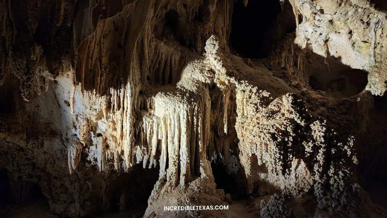
The Caverns of Sonora represent one of the most intricately decorated show caves on earth, located halfway between San Antonio and Big Bend. World-renowned speleologists celebrate the cave for its density of rare helictites, crystal formations that twist and grow in gravity-defying directions.
Guided walking tours cover nearly two miles of underground paths through warm, humid chambers 155 feet beneath the Edwards Plateau. The cave maintains an ambient temperature of 72 degrees Fahrenheit with 98 percent relative humidity, creating a tropical subterranean climate.
- Primary Region: West Texas / Western Hill Country (Sutton County, Sonora)
- Best Season to Visit: Year-round roadside stop along Interstate 10; ideal during road trips between Central Texas and Big Bend
- Key Highlights: Crystal Palace, butterfly helictite formation, Horseshoe Lake, and guided photography tours
- Admission Fee: Guided walking tour approximately $28 for adults; $22 for children (4-11); specialty photography tours extra
Tip
The cave interior is humid and warm rather than chilly, so dress in light, breathable clothing and leave heavy jackets in your vehicle.
Longhorn Caverns State Park
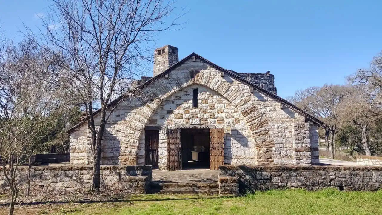
Longhorn Cavern State Park preserves a unique subterranean cave sculpted by the rushing waters of an ancient underground river in Burnet County. Unlike most Texas limestone caves formed by slow water dripping, Longhorn Cavern features smooth, polished bedrock walls carved by high-volume river currents.
The cavern has a colorful history, serving as a Comanche tribal council chamber, a Confederate gunpowder factory, and a 1920s speakeasy dance hall. Review our visitor guide on Longhorn Cavern walking tours to organize above-ground hiking and CCC stone architecture tours.
- Primary Region: Texas Hill Country (Burnet County, near Marble Falls and Burnet)
- Best Season to Visit: Year-round; constant 68-degree cave temperature provides shelter from winter cold and summer heat
- Key Highlights: 90-minute walking tour, historic subterranean dance floor room, CCC stone observation tower, and nature trail
- Admission Fee: Park grounds and surface trails are free; walking cavern tours are approximately $22 for adults and $18 for children
Tip
Climb the historic CCC stone observation tower near the park headquarters for panoramic views across the Hill Country toward Lake Buchanan.
Natural Bridge Caverns
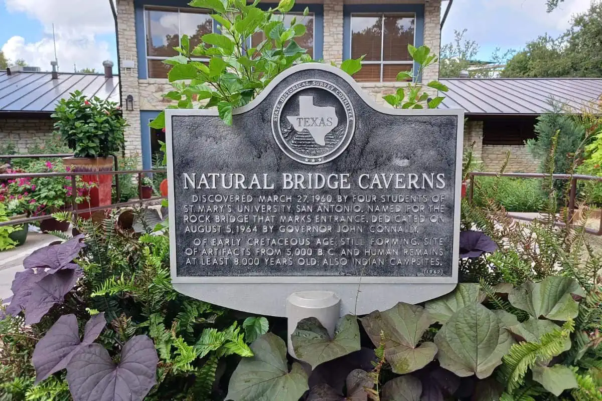
Natural Bridge Caverns is the largest commercial cavern system in Texas, located north of San Antonio near New Braunfels. Named for a natural sixty-foot limestone bridge spanning its entrance, the cave was discovered in 1960 by four college students exploring deep subterranean sinkholes.
The Discovery Tour guides visitors 180 feet underground through massive chambers filled with colossal stalactite columns, delicate soda straws, and flowstone draperies. Above ground, the complex features high ropes adventure courses, canopy zip lines, and gemstone mining sluices.
- Primary Region: Central Texas / Hill Country (Comal County, near San Antonio and New Braunfels)
- Best Season to Visit: Year-round; subterranean temperature stays constant at 70 degrees with 99 percent humidity
- Key Highlights: Discovery Tour, Hidden Passages Tour, 60-foot natural limestone entrance span, and Twisted Trails ropes course
- Admission Fee: Dynamic tour pricing ranges from $25 to $36 for adults depending on date and booking window; discounts for advance online purchases
Tip
Purchase tour tickets online several days in advance to secure preferred morning time slots and save up to twenty percent compared to on-site walk-up ticket prices.
Lonesome Highway
The Lonesome Highway refers to the striking stretch of US Route 285 and Highway 54 crossing the wide desert plains toward Guadalupe Peak. Long, dead-straight stretches of asphalt cut through expansive Chihuahuan Desert grasslands against the dramatic silhouette of the Guadalupe Mountains.
Road trippers and photographers celebrate this roadway as the visual embodiment of West Texas solitude and immense scale. The route connects the oil towns of the Permian Basin to the highest mountain summits in the state, offering unobstructed sunset views.
- Primary Region: West Texas (Culberson and Reeves counties)
- Best Season to Visit: October through April for clear road visibility and comfortable driving temperatures
- Key Highlights: Panoramic vistas of El Capitan and Guadalupe Peak, classic open-highway road trip photography
- Admission Fee: Free public state and federal highway corridor
Tip
Fill your fuel tank completely in Pecos or Van Horn before driving toward the mountains, as highway services are practically non-existent for over eighty miles.
Fort Worth Stockyards
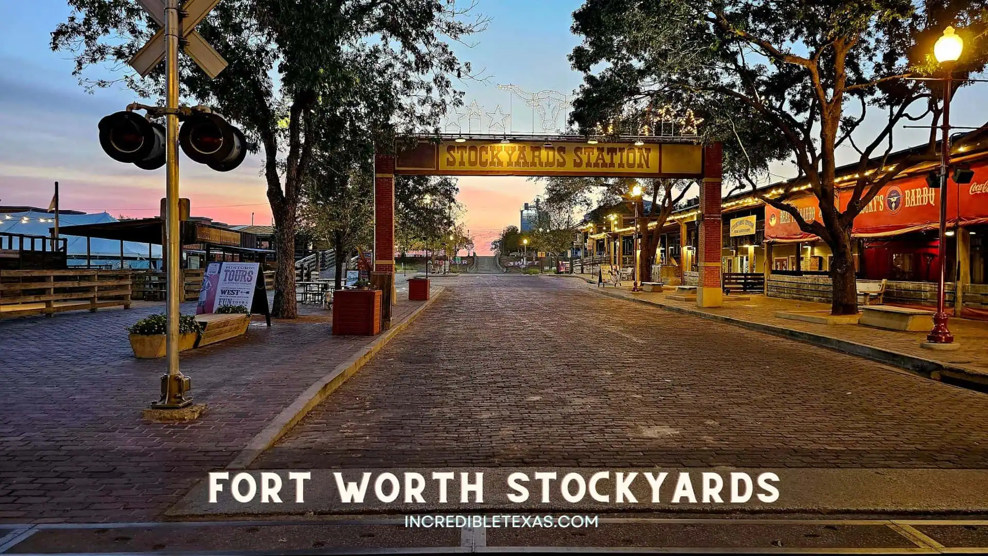
The Fort Worth Stockyards National Historic District celebrates the transformative livestock heritage that made Fort Worth the epicenter of the Texas cattle industry. Paved with original 1902 yellow brick, Exchange Avenue is flanked by preserved wooden livestock corrals, historic saloons, and western heritage shops.
A herd of Texas Longhorns marches down the street twice daily at 11:30 AM and 4:00 PM in the world’s only daily longhorn cattle drive. Read our travel breakdown of the Fort Worth Stockyards historic district when evaluating iconic western attractions alongside the cultural places to visit in Dallas.
- Primary Region: North Texas (Tarrant County, Fort Worth)
- Best Season to Visit: Year-round; October through April offers comfortable temperatures for walking the brick streets
- Key Highlights: Twice-daily Fort Worth Herd cattle drives, Billy Bob’s Texas honky-tonk, Cowtown Coliseum rodeo, and Mule Alley
- Admission Fee: Free public street access; Billy Bob’s, Cowtown Coliseum rodeo, and stockyards museums charge separate admissions
Tip
Arrive thirty minutes prior to the 11:30 AM cattle drive to secure standing spots along the curb outside the Stockyards Station, and park in the public lots off North Main Street.
Dinosaur Valley State Park
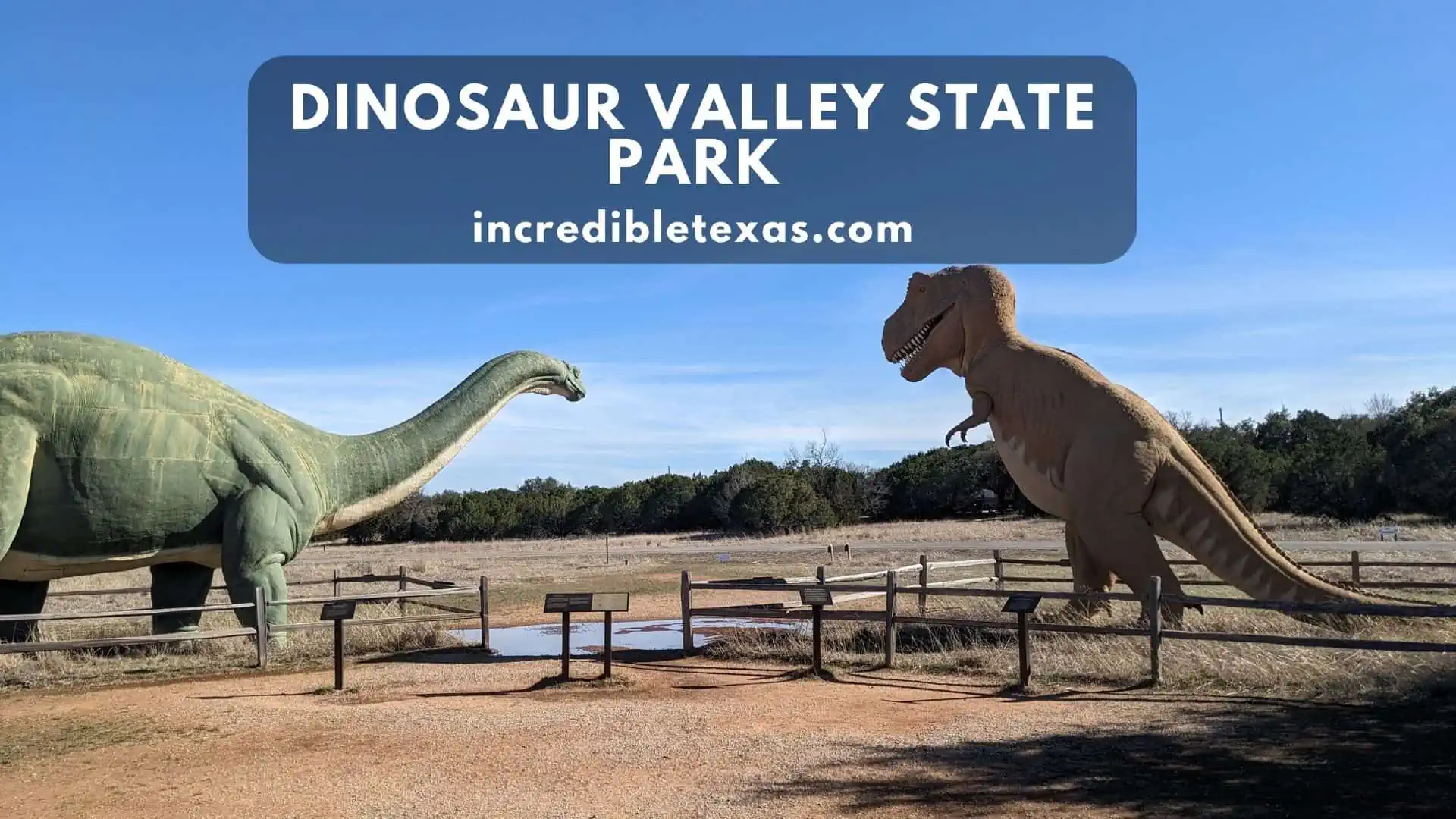
Dinosaur Valley State Park preserves fossilized dinosaur trackways embedded in the limestone riverbed of the Paluxy River near Glen Rose. Over 113 million years ago, sauropods and theropods walked along the muddy shoreline of an ancient ocean bay, leaving deep footprints that later calcified into stone.
Visitors wade into the clear river shallows to stand directly beside massive three-toed Acrocanthosaurus tracks and colossal sauropod footprints. Explore our guide to Dinosaur Valley fossil trackways for family camping and river trail advice on popular places to visit near Dallas.
- Primary Region: North Central Texas (Somervell County, Glen Rose)
- Best Season to Visit: Late summer and early autumn when lower river levels expose the greatest number of track sites
- Key Highlights: Real fossilized track sites in the Paluxy River, Track Site Trail, swimming, equestrian trails, and camping
- Admission Fee: $8 per adult (13 and older); children 12 and under free; Texas State Parks Pass accepted
Tip
Check the park’s online river gauge status before driving out; heavy rainfall causes river water to rise and submerge the fossil tracks beneath murky current.
Big Thicket National Preserve
Big Thicket National Preserve protects an ecological transition zone where southeastern swamps, eastern hardwood forests, and central prairies intersect in East Texas. Naturalists refer to the preserve as the biological crossroads of North America due to its plant and animal biodiversity.
Visitors explore nine distinct ecosystems within a single afternoon, ranging from carnivorous pitcher plant bogs to towering cypress sloughs. Over forty miles of foot trails and paddling corridors wind through the preserve along Village Creek and the Neches River.
- Primary Region: East Texas Piney Woods (Hardin, Tyler, and Polk counties, near Kountze)
- Best Season to Visit: March through May for blooming orchids and pitcher plants; October through November for mild hiking
- Key Highlights: Kirby Nature Trail, Pitcher Plant Trail, Village Creek paddling trail, and biodiversity exhibits
- Admission Fee: Free public access across all preserve units; free backcountry camping permits available at visitor center
Tip
Walk the 1-mile Pitcher Plant Trail boardwalk in late spring to observe thousands of carnivorous pitcher plants actively trapping insects in wet pine savanna wetlands.
McKinney Falls State Park
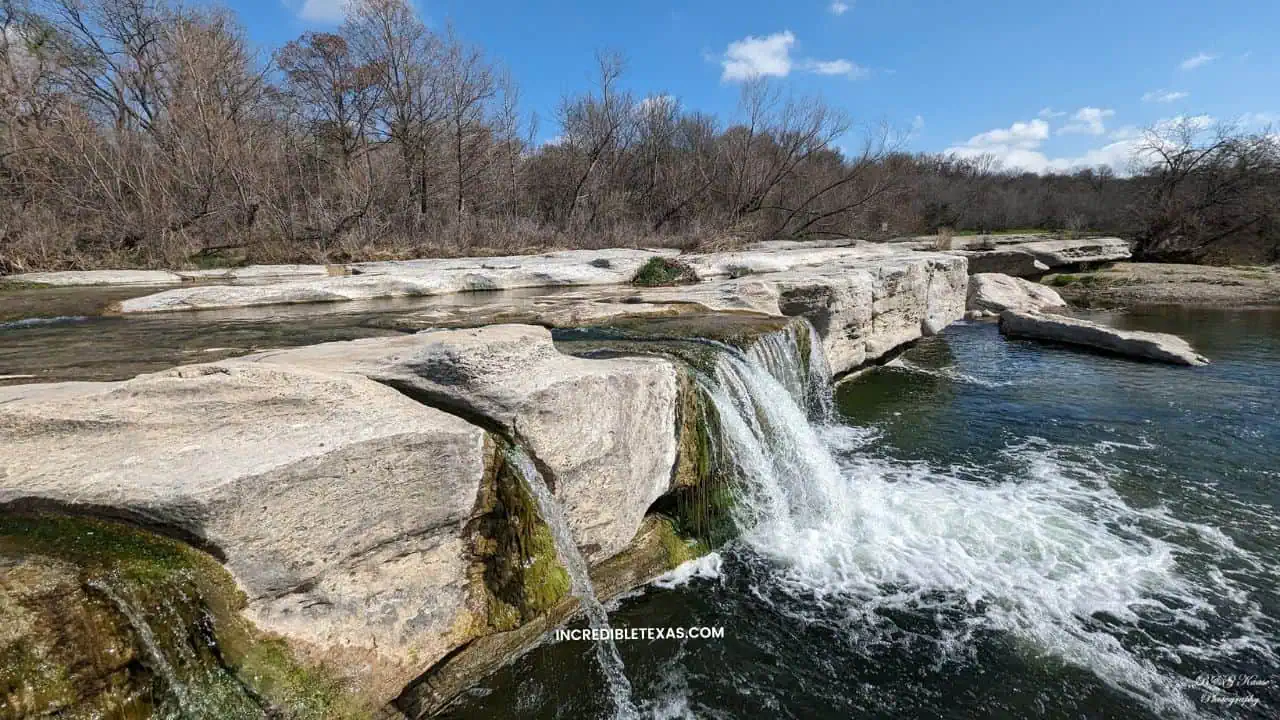
McKinney Falls State Park offers an outdoor retreat just thirteen miles southeast of downtown Austin along the rocky course of Onion Creek. The park centers on two scenic waterfalls where water cascades over broad limestone shelves into natural swimming pools.
Nine miles of paved and crushed-stone trails lead through shaded pecan groves, past historic 1850s stone homestead ruins and Old Baldy, a 500-year-old bald cypress. Read our complete guide to McKinney Falls camping and swimming to plan your state park visit.
- Primary Region: Central Texas (Travis County, Austin)
- Best Season to Visit: March through May for steady waterfall flow; pleasant year-round for urban trail running and camping
- Key Highlights: Upper and Lower Falls limestone ledges, Onion Creek hiking trails, historic Thomas McKinney ruins, and Old Baldy
- Admission Fee: $6 per adult (13 and older); children 12 and under free; Texas State Parks Pass accepted
Tip
Pack water shoes with rubber grip soles, as the submerged limestone shelves around Lower Falls are slippery with natural algae.
Brazos Bend State Park

Brazos Bend State Park protects nearly 5,000 acres of coastal bottomland hardwood forest, oxbow lakes, and wetland marshes along the Brazos River south of Houston. The park is renowned across the state for its wild population of American alligators, which sun along lakefront walking trails.
Over thirty-seven miles of level, crushed-gravel pathways provide birdwatching opportunities for herons, ibises, and roseate spoonbills. Check our review of Brazos Bend alligator trails for trail maps and George Observatory public stargazing schedules.
- Primary Region: Texas Gulf Coast / Houston Metro (Fort Bend County, Needville)
- Best Season to Visit: October through April for active alligator basking and comfortable trail temperatures without heavy humidity
- Key Highlights: 40-Acre Lake trail, Creekfield Lake nature path, George Observatory (Saturday stargazing), and alligator viewing
- Admission Fee: $7 per adult (13 and older); children 12 and under free; Texas State Parks Pass accepted
Tip
Maintain a strict distance of at least thirty feet from any alligators resting beside the trails, keep pets on leashes at all times, and never feed wildlife.
Mustang Island State Park
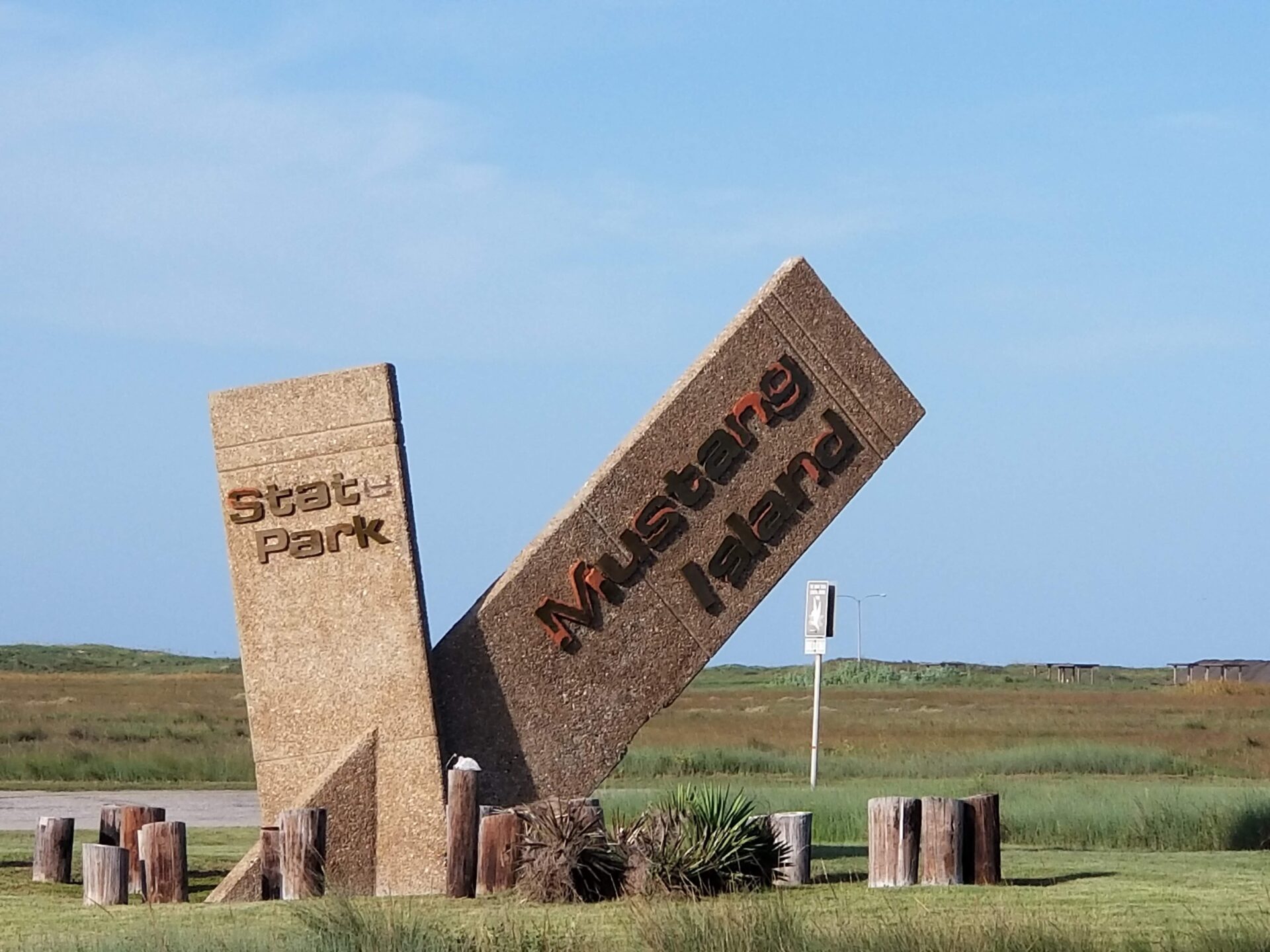
Mustang Island State Park preserves five miles of open barrier island coastline and rolling coastal dunes on the Gulf of Mexico near Port Aransas. Named for the wild horses that roamed the island for hundreds of years, the park offers coastal recreation for surf fishermen, campers, and beachcombers.
The Mustang Island State Park Paddling Trail encompasses twenty miles of shallow saltwater paddling lanes through cordgrass marshes along Corpus Christi Bay. Review our guide to Mustang Island beach camping when planning coastal places to visit in Corpus Christi.
- Primary Region: Texas Gulf Coast (Nueces County, between Port Aransas and Corpus Christi)
- Best Season to Visit: April through May and September through October for pleasant breezes and warm water
- Key Highlights: 5 miles of Gulf beach frontage, drive-on beach camping, coastal dunes, and shallow saltwater kayak paddling trails
- Admission Fee: $5 per adult (13 and older); children 12 and under free; Texas State Parks Pass accepted
Tip
Purchase a drive-on camping pass to pitch your tent directly on the beach sand just steps from the breaking waves, and bring extra fresh water to rinse salt off camp gear.
South Padre Island
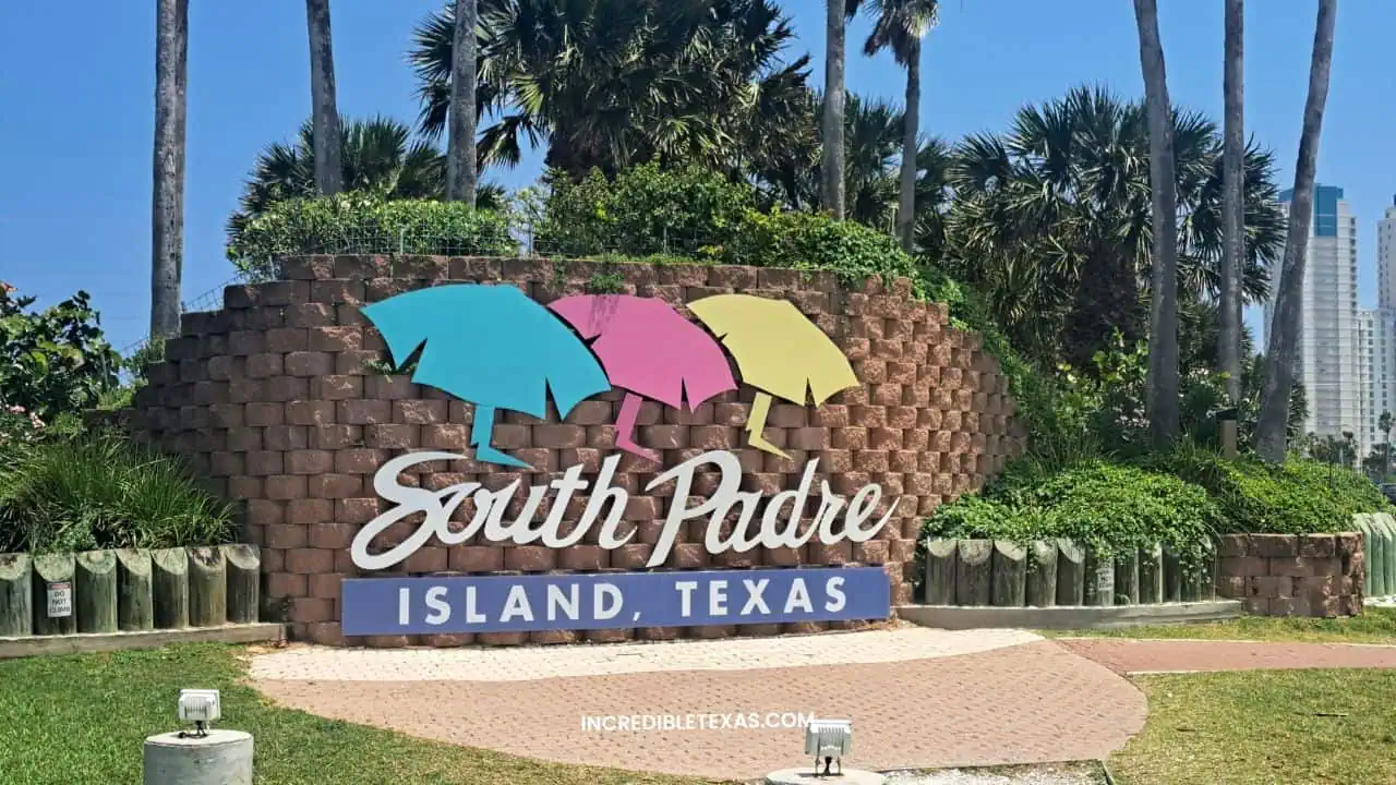
South Padre Island sits at the southernmost tip of Texas, famous for broad white-sand beaches, emerald Gulf waters, and sub-tropical weather. Connected to the mainland by the two-mile Queen Isabella Memorial Causeway, the island provides a classic resort setting.
Water sports enthusiasts flock to the calm, shallow waters of the Laguna Madre for windsurfing, kiteboarding, and dolphin-watching boat charters. Discover our travel guide to South Padre Island coastal adventures for top seaside restaurants and sea turtle conservation tours.
- Primary Region: Deep South Texas (Cameron County)
- Best Season to Visit: October through April for quiet beaches and mild warmth; May through August for prime ocean swimming
- Key Highlights: Isla Blanca Park beach pavilions, Sea Turtle Inc. rescue facility, dolphin watching cruises, and Laguna Madre kiteboarding
- Admission Fee: Free island public beach access; Isla Blanca Park charges $12 daily vehicle admission
Tip
Visit Sea Turtle, Inc. in the morning to observe rescued Kemp’s ridley sea turtles during feeding sessions and support rehabilitation efforts in their educational hospital.
The Texas State Capitol
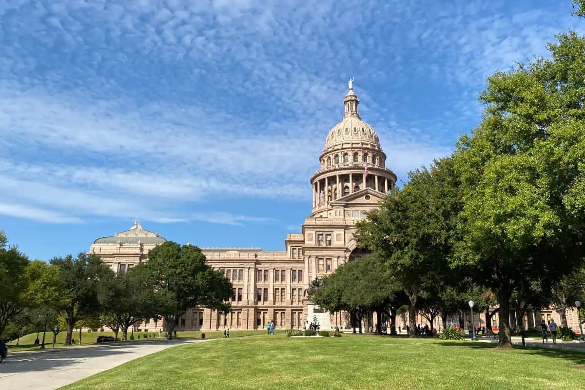
The Texas State Capitol stands as an architectural monument to the Lone Star State, anchoring the northern terminus of Congress Avenue in downtown Austin. Completed in 1888 using locally quarried Sunset Red Texas granite, the Italian Renaissance Revival structure rises 308 feet high.
Visitors take free daily guided walking tours through the central rotunda, legislative chambers, and the multi-story subterranean Capitol Extension. Pair your historic tour with our guide to iconic Austin attractions to explore the downtown cultural corridor.
- Primary Region: Central Texas (Travis County, Austin)
- Best Season to Visit: Year-round; spring legislative sessions (odd-numbered years) offer lively political observation
- Key Highlights: Rotunda dome star, Senate and House Chambers, 22-acre shaded monument grounds, and Capitol Visitors Center
- Admission Fee: Free public building admission and free 30-minute guided historical tours daily
Tip
Park in the Capitol Visitors Parking Garage on San Jacinto Boulevard, where your first two hours of parking are completely free of charge on weekdays and weekends.
The Alamo
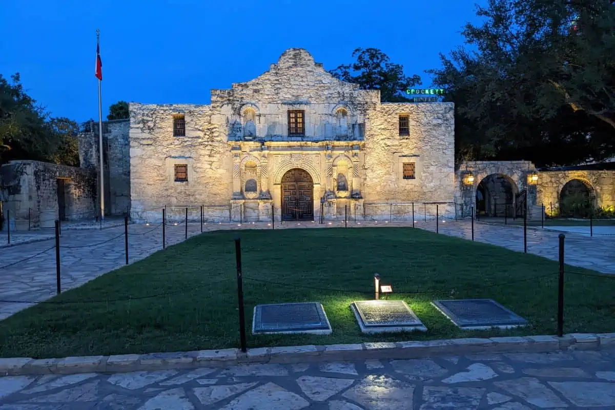
The Alamo stands at the historic heart of downtown San Antonio, representing one of the most famous historical battle sites in the United States. Originally founded in 1718 as Mission San Antonio de Valero, the complex became the epicenter of the historic 1836 Battle of the Alamo during the Texas Revolution.
Visitors explore the preserved stone church, the Long Barrack museum, and courtyard gardens shaded by heritage live oaks. Consult the official Alamo historic site and our guide to San Antonio historic missions and sites to schedule timed entry passes.
- Primary Region: South Central Texas (Bexar County, San Antonio)
- Best Season to Visit: October through April for comfortable outdoor temperatures; early morning visits avoid summer crowds
- Key Highlights: Historic Church sanctuary, Long Barrack museum, Ralston Family Collections Center, and living history encampment
- Admission Fee: Free entry to the historic church (timed ticket recommended); paid admission for the Collections Center museum exhibits
Tip
Reserve your free timed-entry church pass online in advance, especially during holiday weekends, to bypass lengthy standby lines on the plaza.
The San Antonio River Walk
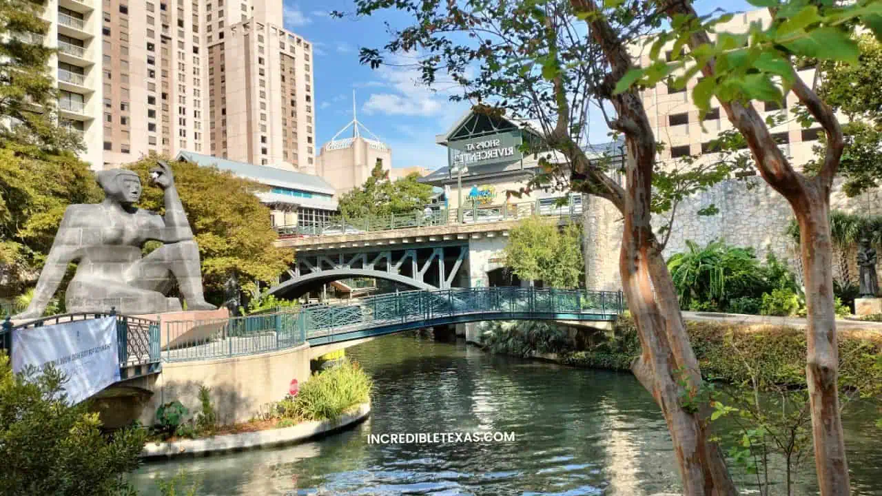
The San Antonio River Walk is a world-renowned network of paved pedestrian walkways sunken one level below the street grid of downtown San Antonio. Lined by bald cypress trees, stone arch bridges, and outdoor dining patios, the river corridor spans fifteen miles.
Narrated electric barge cruises carry passengers along the downtown loop while sharing architectural and cultural history. Plan your dining stops and walking routes with our complete guide to San Antonio River Walk dining and boat tours.
- Primary Region: South Central Texas (Bexar County, San Antonio)
- Best Season to Visit: November through April for outdoor patio dining; late November through early January for holiday light displays
- Key Highlights: Downtown dining loop, narrated river barge cruises, Pearl District extension, and historic Mission Reach
- Admission Fee: Free public pedestrian access 24/7; GO RIO river cruise tickets are approximately $14.50 for adults
Tip
Rent a BCycle e-bike to pedal the scenic, paved Mission Reach extension south of downtown to explore four UNESCO World Heritage Spanish colonial missions without automotive traffic.
Cadillac Ranch

Cadillac Ranch is a world-famous public art installation located in a wheat field along historic Route 66 west of Amarillo. Created in 1974 by the San Francisco art collective Ant Farm and patron Stanley Marsh 3, it features ten vintage Cadillacs buried nose-down in the earth.
The cars represent the evolution of the Cadillac tailfin from 1949 to 1963, buried at an angle matching the Great Pyramid of Giza. Check our guide to Amarillo roadside landmarks for travel tips when connecting to regional places to visit in Wichita Falls TX.
- Primary Region: Texas Panhandle (Potter County, along Interstate 40 west of Amarillo)
- Best Season to Visit: Year-round roadside stop; early morning and sunset provide dramatic Panhandle prairie light
- Key Highlights: 10 buried vintage Cadillacs, interactive spray painting, Route 66 photo opportunities, and open prairie scenery
- Admission Fee: Free public admission year-round; accessible via an unlocked pasture walk-through gate
Tip
Bring your own cans of spray paint and take your empty cans back to the dumpster near the highway gate to help maintain the pasture grounds clean.
Fort Davis National Historic Site
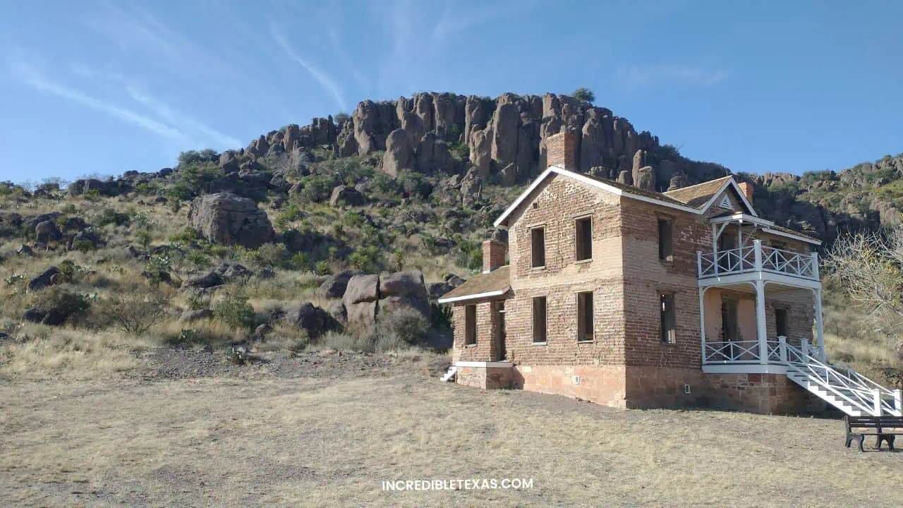
Fort Davis National Historic Site protects one of the best-preserved frontier military posts in the American Southwest, set against the red volcanic cliffs of the Davis Mountains. Active from 1854 to 1891, the fort protected stagecoaches, emigrants, and freight wagons along the San Antonio-El Paso road.
Visitors walk through more than twenty restored historic stone and adobe buildings, including soldier barracks, the post hospital, and officers’ quarters. Foot trails connect the fort grounds to scenic mountain overlooks within adjacent Davis Mountains State Park.
- Primary Region: Far West Texas (Jeff Davis County, Fort Davis)
- Best Season to Visit: October through April for crisp mountain air; summer temperatures remain cooler than low desert basins
- Key Highlights: Restored 19th-century fort buildings, bugle retreat audio recordings, museum exhibits, and Hospital Canyon trail
- Admission Fee: $10 per adult (16 and older); children 15 and under free; federal recreation passes accepted
Tip
Listen for the bugle call recording echoing across the parade grounds throughout the day, and visit the nearby McDonald Observatory for an evening Star Party.
Space Center Houston

Space Center Houston serves as the official public visitor center for NASA Johnson Space Center, the historic training center for American astronauts. Located in the Clear Lake area south of Houston, the museum displays more than four hundred space artifacts, space capsules, and moon rocks.
Open-air tram tours take guests onto the active NASA campus to view the historic Apollo Mission Control Center and the massive Saturn V rocket at Rocket Park. Check the official Space Center Houston visitor portal and our roundup of Houston cultural activities to plan your day.
- Primary Region: Texas Gulf Coast / Houston Metro (Harris County, Clear Lake)
- Best Season to Visit: Year-round indoor science museum; weekday mornings avoid major student field trip groups
- Key Highlights: Independence Plaza shuttle complex, NASA Tram Tour to Apollo Mission Control, Rocket Park Saturn V, and Astronaut Gallery
- Admission Fee: Approximately $30 to $35 for general admission; children under 4 free; parking is $10 per vehicle
Tip
Board the NASA tram to the historic Apollo Mission Control room early in the day by reserving your tram boarding pass on the Space Center Houston app immediately upon entry.
Padre Island Barrier Coast
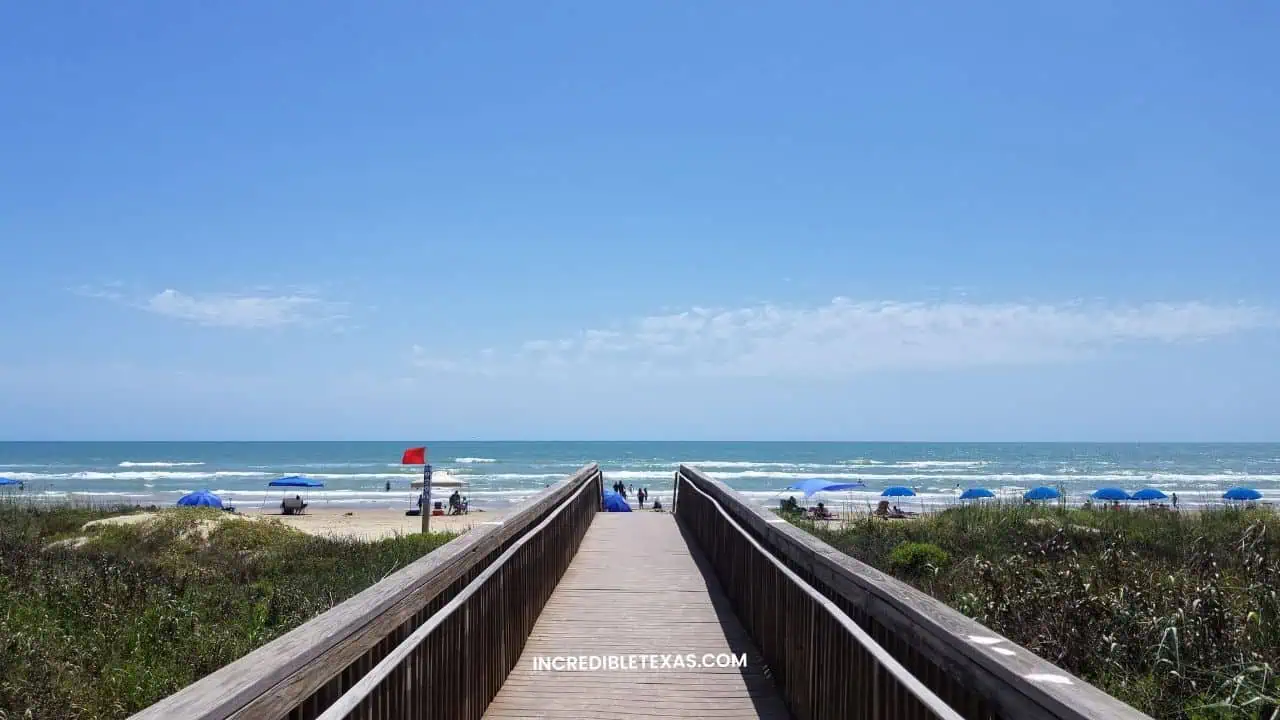
Padre Island stretches over 113 miles along the lower Texas Gulf Coast, representing the world’s longest barrier island. Formed by coastal sandbars accumulated over thousands of years, the island shelters fragile marine wildlife, coastal prairies, and coastal sand dunes.
Divided into North Padre Island near Corpus Christi and South Padre Island near Port Isabel, the island accommodates both remote wilderness and coastal communities. Coastal travelers can camp in seclusion on undeveloped shores or enjoy modern beachfront lodging on the south end.
- Primary Region: Texas Gulf Coast (Kleberg, Kenedy, Willacy, and Cameron counties)
- Best Season to Visit: October through May for mild coastal weather, quiet beaches, and excellent saltwater fishing
- Key Highlights: 113 miles of barrier island shoreline, Laguna Madre windsurfing, remote 4WD beach exploration, and sea turtle nesting
- Admission Fee: Varies by section from free public beach access to federal park vehicle fees
Tip
Bring plenty of fresh water and tire deflators if exploring remote sandy sections of the island, and avoid driving into soft sand above the high tide line without 4WD.
Lake Amistad
Amistad National Recreation Area centers around the expansive waters of Amistad Reservoir along the United States-Mexico border near Del Rio. Created by a joint international dam on the Rio Grande, the lake features crystal-clear waters flanked by steep limestone cliff canyons.
The reservoir is nationally celebrated for tournament bass fishing, open boating, and water skiing across over 60,000 surface acres. Boaters also access remote canyon walls containing ancient Native American pictographs that are visible directly from water level.
- Primary Region: Southwest Texas (Val Verde County, Del Rio)
- Best Season to Visit: March through May for prime bass fishing; June through August for recreational boating and swimming
- Key Highlights: Amistad Dam, Diablo East boat marina, Governor’s Landing camping, and Panther Cave rock art
- Admission Fee: Lake day use requires a $4 daily lake use permit per boat; federal recreation passes accepted
Tip
Rent a pontoon boat at Diablo East Marina to cruise up the Pecos River canyon arm to view Panther Cave’s 4,000-year-old pictograph panel preserved high on the cliff face.
Sam Houston National Forest
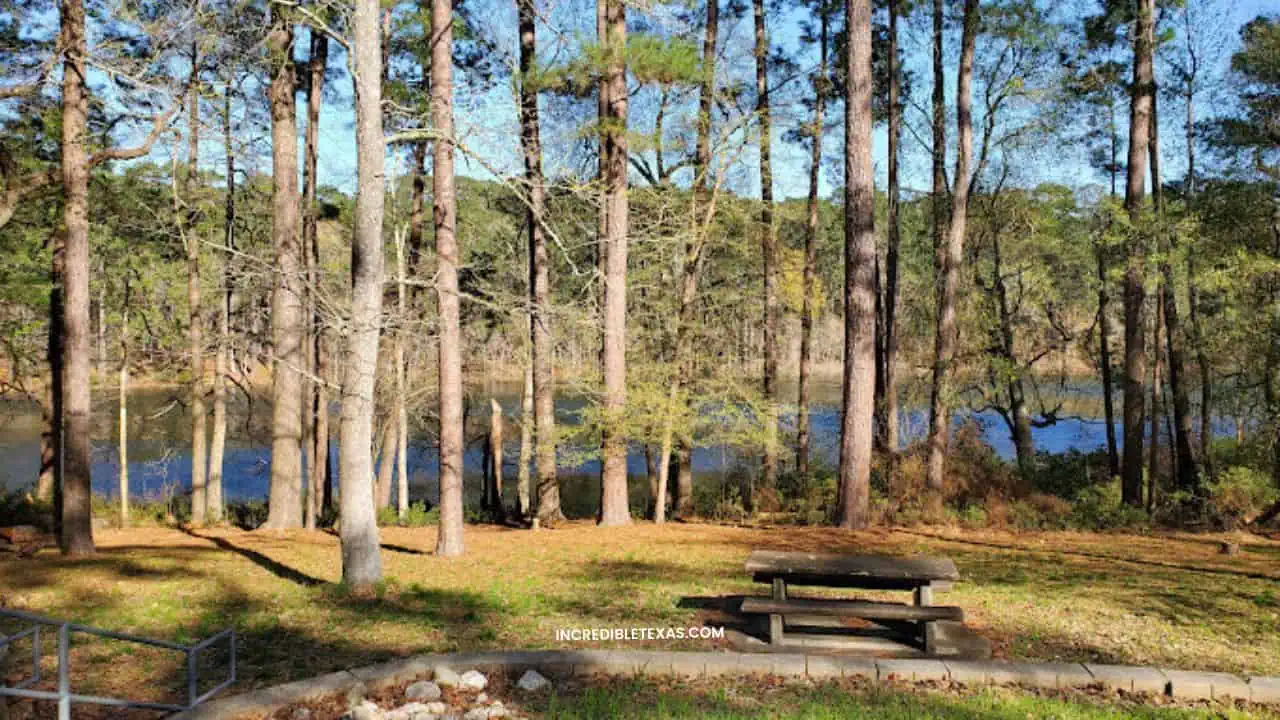
Sam Houston National Forest encompasses over 160,000 acres of towering loblolly pine woodlands and rolling hardwood bottoms fifty miles north of Houston. The forest serves as a vital wildlife sanctuary for white-tailed deer, feral hogs, and the endangered red-cockaded woodpecker.
Hikers access the 128-mile Lone Star Hiking Trail, the longest continuous designated foot trail in Texas, which meanders through the forest. Shaded lakeside campgrounds at Double Lake Recreation Area provide canoe rentals, swim beaches, and quiet family campsites.
- Primary Region: East Texas Piney Woods (Montgomery, Walker, and San Jacinto counties)
- Best Season to Visit: October through April for comfortable hiking without summer heat, humidity, or heavy mosquitoes
- Key Highlights: 128-mile Lone Star Hiking Trail, Double Lake Recreation Area, Lake Conroe shoreline, and multi-use off-road trails
- Admission Fee: Free general forest access; Double Lake Recreation Area charges $7 day-use vehicle fee and camping fees
Tip
Wear bright fluorescent hunter orange apparel when hiking forest trails during the general autumn deer hunting season from early November through mid-January.
Frequently Asked Questions About Visiting Beautiful Places in Texas
What is the number one most visited attraction in Texas?
The San Antonio River Walk ranks as the number one most visited tourist attraction in Texas, welcoming over fourteen million annual visitors to its pedestrian river paths, historic dining patios, and narrative river barge tours.
The river network connects the downtown urban center with the historic Alamo and four southern Spanish colonial missions. When travelers ask what is the best place to visit in Texas, this shaded urban river corridor consistently stands as the top recommendation.
What is the most scenic natural area in Texas?
Big Bend National Park is widely recognized as the most scenic natural area in Texas, offering over 800,000 acres of Chihuahuan Desert, the dramatic Chisos Mountain range, and sheer 1,500-foot limestone gorges carved by the Rio Grande.
Its remote geographic location provides exceptionally dark night skies, recognized as an International Dark Sky Park. Travelers experience striking transitions from low desert cactus flats to high-elevation ponderosa pine forests along mountain trails.
When is the best time of year to explore Texas bucket list destinations?
The best time to visit Texas bucket list destinations is during the spring months of March through May or autumn from October through November, when moderate temperatures avoid dangerous summer heat and wildflowers or fall foliage are active.
Determining the best time to visit texas bucket list sites depends largely on whether travelers prioritize spring bluebonnet fields or autumn canyon foliage. Both shoulder seasons provide comfortable conditions for camping and strenuous day hikes.
Do you need advance reservations for Texas state and national parks?
Yes, advance reservations are required or strongly recommended for Texas state and national parks, especially during weekends and holidays at high-demand sites like Enchanted Rock, Hamilton Pool Preserve, and Balmorhea State Park.
Texas Parks and Wildlife allows visitors to reserve day passes online up to thirty days ahead of arrival. Securing your pass early guarantees vehicle entry and prevents being turned away at full capacity gates.
What are the best outdoor places to visit in Texas for swimming?
The best places in Texas for swimming are natural spring-fed destinations including Barton Springs Pool in Austin, Krause Springs in Spicewood, and the San Solomon Springs pool at Balmorhea State Park, which remain cool year-round.
Unlike surface lakes that heat up during summer, these subterranean springs maintain water temperatures between 68 and 76 degrees Fahrenheit. Swimmers enjoy crisp, crystal-clear water even when afternoon air temperatures climb past one hundred degrees.
How should travelers plan a Texas bucket list road trip?
Travelers should plan a Texas bucket list road trip by clustering destinations into regional travel corridors such as the Hill Country, West Texas Big Bend, or the Gulf Coast, allocating three to five days per geographic region.
Driving across Texas from east to west spans more than eight hundred miles. Focusing on one or two adjacent regions allows adequate time for hiking, swimming, and exploring without spending entire days driving on interstate highways.
Essential Texas Bucket List Travel Planning Advice
Exploring the diverse landscapes of Texas requires intentional pacing and preparation. Because distances between state parks and urban cultural districts can be substantial, group your stops by geographic proximity to maximize your time on trails rather than highways.
Invest in a Texas State Parks Pass if you plan to visit multiple state parks within a twelve-month window. The annual pass waives day-use entry fees for the cardholder and all passengers in a personal vehicle, delivering immediate savings on an extended road trip.
Pack plenty of drinking water, sun protection, and durable walking footwear regardless of your destination. By respecting seasonal weather windows and booking necessary day passes in advance, you will experience the enduring natural beauty and historic character of the Lone Star State.