
The best Texas islands for vacation stretch across 367 miles of Gulf coastline, connecting historic ports, remote barrier shores, and coastal getaways. Travelers can explore shallow paddling trails near Corpus Christi or enjoy the energetic evening scene on South Padre Island.
From shallow back bays to exposed barrier sandbars, the gulf coast islands Texas maintains offer a dynamic blend of wildlife preserves, historic towns, and coastal recreation. Selecting the right islands to visit in Texas comes down to balancing driving convenience with your preferred coastal setting.
Travelers planning Texas island getaways can choose between fully developed beach districts and primitive off-grid shorelines. This comprehensive guide details the top ten Texas barrier islands, comparing practical transit logistics, state park permits, wildlife preserves, and seasonal timing.
Key takeaways
- Texas barrier islands span from Galveston Island near Houston southwest to Brazos Island at the Mexican border.
- South Padre Island and Galveston Island offer the most developed amenities, complete with beachfront resorts, dining, and family attractions.
- Padre Island National Seashore protects 66 miles of undeveloped coastline, representing the longest undeveloped barrier island seashore on Earth.
- San Jose Island and Matagorda Island require boat transit and feature zero commercial development or public utility hookups.
- Follet’s Island offers free drive-on beach access and up to 14 consecutive nights of free primitive camping along Brazoria County Road 257.
What Are the Best Texas Islands for a Vacation?
The best Texas islands for a vacation depend directly on your travel preferences, ranging from full-service resort destinations like South Padre Island to remote wilderness preserves like Matagorda Island. Travelers comparing the best beaches in Texas can choose between vehicle-accessible causeways and wild ferry-only barrier islands. Among the diverse barrier islands in Texas, each destination presents its own regulatory profile and lodging environment.
The table below outlines the core specifications, access methods, and primary attractions for all ten major island destinations along the Texas Gulf Coast.
| Island Destination | Nearest City | Access Type | Entry / Ferry Fee | Primary Appeal | Best Season |
|---|---|---|---|---|---|
| Galveston Island | Galveston / Houston | I-45 Causeway / Ferry | Free bridge access | Victorian architecture, Pleasure Pier, dining | Spring, Summer, Fall |
| Mustang Island | Port Aransas / Corpus Christi | TX-361 / Free Ferry | $7 state park day pass | Paddling trails, drive-on beaches, camping | Spring & Fall |
| Padre Island (North) | Corpus Christi | Park Road 22 Causeway | $25 per vehicle (7 days) | Undeveloped dunes, windsurfing, sea turtles | Spring & Fall |
| South Padre Island | Port Isabel / Brownsville | Queen Isabella Causeway | Free bridge access | Resort hotels, clear waters, nightlife | Spring & Summer |
| Matagorda Island | Port O’Connor | Boat or charter only | Free day use (permit for camp) | Remote wildlife, lighthouse, bird watching | Spring & Fall |
| San Jose Island | Port Aransas | Jetty Boat passenger ferry | $25 adult round-trip ferry | Vehicle-free shelling, quiet surf fishing | Fall & Winter |
| Follet’s Island | Surfside Beach / Freeport | Bluewater Highway (CR 257) | Free public access | Free drive-on beach camping, coastal quiet | Spring, Summer, Fall |
| Brazos Island | Brownsville | TX-4 / Boca Chica Blvd | Free public access | SpaceX rocket views, historic battlefields | Fall & Winter |
| Pelican Island | Galveston | Pelican Island Causeway | $10 Seawolf Park parking | Naval museum, WWII submarine, pier fishing | Year-round |
| Ward Island | Corpus Christi | Ocean Drive Causeway | Free campus access | University wetlands, bayfront walking trails | Spring & Fall |
Galveston Island: Historic Architecture, Seawall, and Family Entertainment
Galveston Island is a 27-mile barrier island located 50 miles south of downtown Houston, accessible via the Interstate 45 causeway and the free TxDOT Bolivar ferry. The island combines deep maritime history, Victorian residential districts, and a continuous 10.3-mile seawall overlooking the Gulf of Mexico.
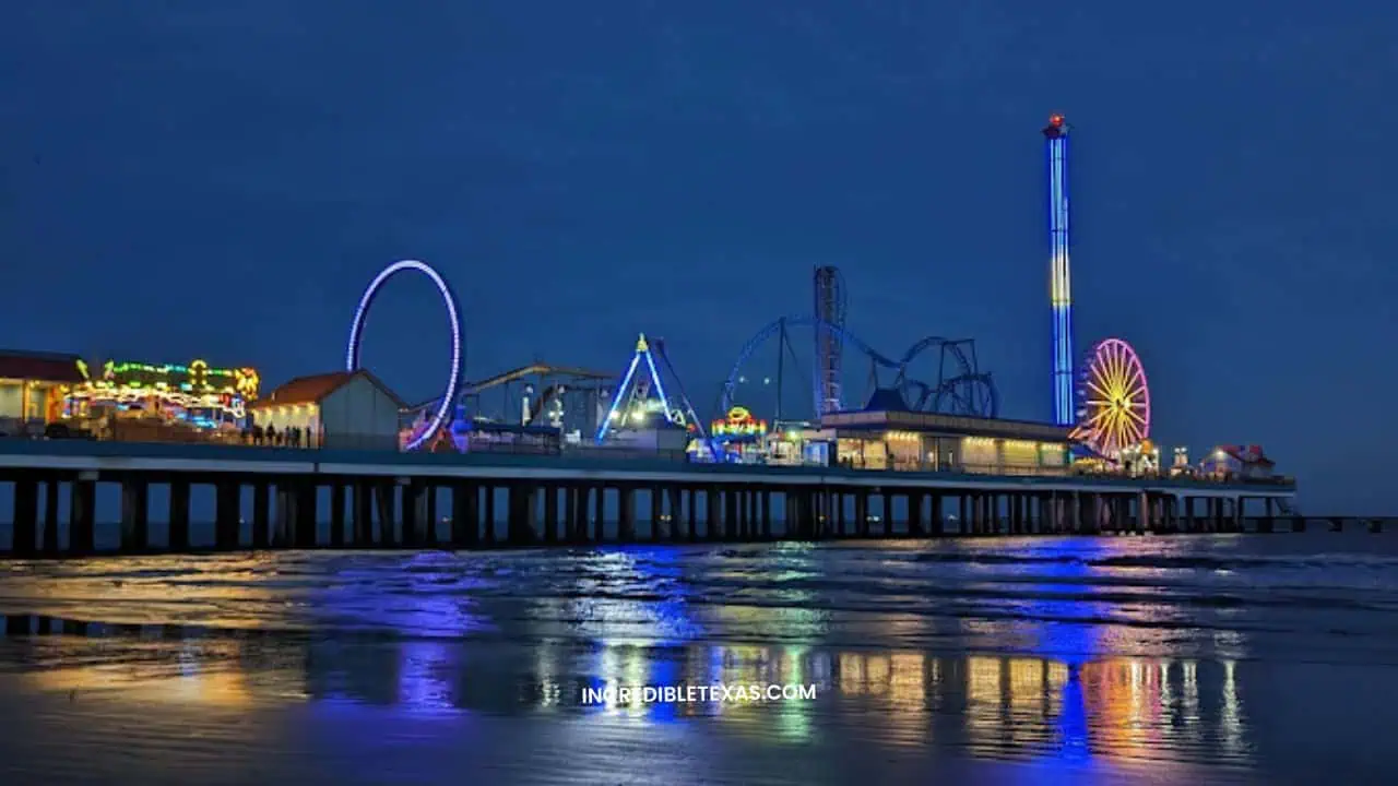
Visitors seeking diverse urban culture alongside beach recreation find dozens of activities along Seawall Boulevard and the historic Strand district. For family vacation itineraries, exploring things to do in Galveston with kids pairs historic museum tours with coastal pier fishing and dolphin sightseeing cruises.
Top Galveston Beaches and Coastal Activities
Stewart Beach and East Beach serve as the primary managed shoreline parks on the eastern end of the island. Stewart Beach provides family amenities including chair rentals, clean restrooms, freshwater rinse showers, and certified seasonal lifeguards.
East Beach permits alcohol consumption and hosts live music events, sandcastle competitions, and summer festivals throughout the warmer months. Travelers looking for uncrowded coastal landscapes can drive southwest to Galveston Island State Park, which offers kayak launches and quiet shoreline hiking trails.
- Primary Access: Interstate 45 south causeway from the mainland.
- Family Hub: Stewart Beach park with concessions and lifeguard coverage.
- Historic Landmark: The 1892 Bishop’s Palace and 1877 tall ship Elissa.
- Signature Outdoor Activity: Deep-sea sportfishing charters departing Galveston Yacht Basin.
Historic Strand Dining and Resort Accommodations
The Strand Historic District features nineteenth-century iron-front commercial buildings housing antique shops, art galleries, and local candy factories. Dining ranges from legendary seafood establishments like Gaido’s, serving wild Gulf shrimp since 1911, to casual gumbo bars along the harbor docks.
Resort accommodations on Galveston Island accommodate both historic architecture lovers and beachfront vacationers. The Grand Galvez offers historic luxury along Seawall Boulevard, while the San Luis Resort provides modern poolside cabanas and Gulf-view balconies.
Mustang Island: State Park Dunes, Paddling Trails, and Campgrounds
Mustang Island spans 18 miles along the central Texas coast between Corpus Christi and Port Aransas, offering wide sandy beaches and coastal dune ecosystems. The island is accessible from the south via Park Road 22 from Corpus Christi or from the north via the free TxDOT vehicle ferry in Aransas Pass.
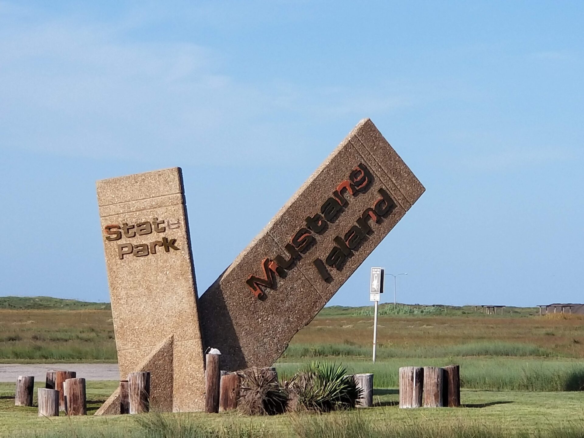
Outdoor enthusiasts flock to the state park for beach camping, kayak fishing, and migratory birding. Planning your trip with our detailed Mustang Island State Park guide ensures you secure entrance reservations and campground permits before holiday peak dates arrive.
Kayaking and Coastal Birding Highlights
The park features the Mustang Island State Park Paddling Trail, a network of three marked routes totaling twenty miles across the shallow back bays of Corpus Christi Bay. Paddlers explore the North Trail, Shamrock Cove Trail, and Ashum Trail, observing black-bellied whistling ducks, reddish egrets, and resident bottlenose dolphins.
Official day-use admission is seven dollars for adults, while children twelve and under enter free, as detailed on the Texas Parks and Wildlife Mustang Island Fees and Facilities Portal. The shallow seagrass flats provide productive waters for sight-casting to schooling redfish and speckled trout during spring and autumn tides.
- Park Entrance Fee: $7 per adult daily; children 12 and under enter free.
- Paddling Trail Length: 20 miles of marked shallow-water kayak routes.
- Top Bird Species: Roseate spoonbills, brown pelicans, and long-billed curlews.
- Key Water Activity: Wade fishing and kayak casting in Shamrock Cove.
Beach Camping Logistics and Visitor Tips
Mustang Island State Park provides both developed and primitive camping options along its five-mile Gulf beachfront. Fifty developed campsites sit behind the dunes, providing water, fifty-amp electrical connections, picnic tables, and nearby restrooms with hot showers for twenty dollars per night.
Travelers planning Mustang Island State Park camping can reserve drive-up beach sites or electric campsites up to five months ahead of time. Campers who prefer waking up next to the surf can select primitive drive-up beach campsites along a 1.5-mile stretch of hard-packed sand for ten dollars nightly.
Tip
Purchase an annual Texas State Parks Pass for seventy dollars if you plan to camp more than three weekends; the pass provides unlimited free entry for you and all guests in your vehicle.
Padre Island: The World's Longest Undeveloped Barrier Island
Padre Island is the longest barrier island in the world, stretching roughly 113 miles along the lower Texas coast from Corpus Christi down to the Rio Grande delta. The northern two-thirds of the island remain entirely wild, protected by the federal government under the stewardship of the National Park Service.
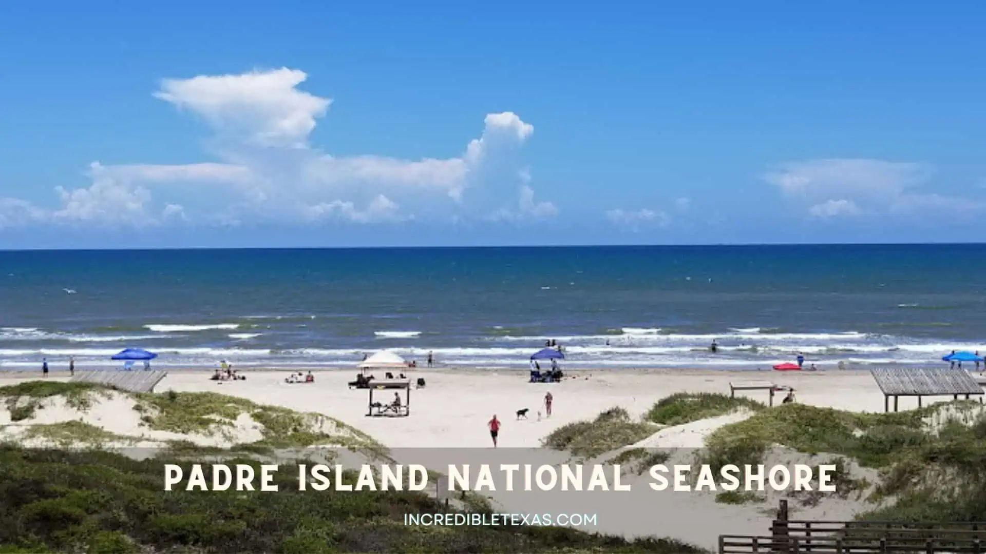
Travelers exploring Corpus Christi coastal attractions can reach the national seashore entrance in thirty minutes by driving across the JFK Causeway. The contrast between suburban amenities and untouched wilderness makes North Padre Island a favorite destination for adventurous vacationers.
Padre Island National Seashore and Conservation
Padre Island National Seashore protects 66 miles of undeveloped coastline, representing the longest undeveloped barrier island seashore on Earth. The park preserves rare coastal prairie habitats, dynamic shifting sand dunes, and hypersaline lagoon wetlands along the Laguna Madre.
Visitors pay a 25-dollar vehicle entrance fee valid for seven consecutive days, which can be purchased at the gate or online via the National Park Service Padre Island Fees and Passes Schedule. The Malaquite Visitor Center features museum exhibits, shaded oceanview decks, a bookstore, and fully accessible boardwalk ramps leading directly to the surf.
- Undeveloped Shoreline: 66 contiguous miles of protected national seashore.
- Vehicle Entrance Pass: $25 per private vehicle (valid for 7 consecutive days).
- Developed Camping: $8 per night at Malaquite Campground and Bird Island Basin.
- Wildlife Protection: Primary nesting grounds for endangered Kemp’s ridley sea turtles.
Remote Beachcombing, Windsurfing, and Sea Turtle Releases
South Beach at the national seashore permits primitive driving for sixty consecutive miles down to the Mansfield Channel. Four-wheel-drive vehicles are mandatory past mile marker 5 due to deep sand and loose shell banks.
Self-registration for Padre Island National Seashore camping takes place at campground kiosks near Malaquite Beach. Bird Island Basin on the western bay shoreline ranks among the top windsurfing and kiteboarding spots in North America, thanks to steady Gulf winds and warm shallow water. Between mid-June and August, visitors can gather at dawn near the Malaquite pavilion to witness newly hatched Kemp’s ridley sea turtle releases.
South Padre Island: Tropical Resorts, Nightlife, and Water Sports
South Padre Island occupies the southern tip of the barrier system, famous for clear turquoise waters, fine white sand, and a lively entertainment district. Connected to the mainland town of Port Isabel by the 2.5-mile Queen Isabella Memorial Causeway, the resort town welcomes millions of annual travelers.
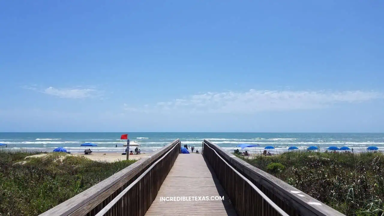
Vacationers will find high-rise luxury condominiums, beachfront restaurants, and full-service marinas offering offshore sportfishing charters. Reviewing our guide to things to do in South Padre Island helps you balance relaxed beach days with parasailing adventures and sunset dining.
Family Eco-Tours and Sea Turtle Conservation
South Padre Island balances active tourism with notable marine conservation efforts. Sea Turtle, Inc. operates a rehabilitation center on Padre Boulevard where visitors can meet resident non-releasable turtles and tour hospital rehabilitation tanks.
Next door, the South Padre Island Birding, Nature Center and Alligator Sanctuary provides over 4,800 feet of elevated wooden boardwalk through bayfront tidal wetlands. Popular South Padre Island attractions include the historic Port Isabel Lighthouse, dolphin watch excursions, and family sandcastle clinics. Outdoor South Padre Island activities include bayside kiteboarding, parasailing over the Gulf, and horseback riding on the beach.
- Main Access Point: Queen Isabella Memorial Causeway (TX-100) from Port Isabel.
- Conservation Center: Sea Turtle, Inc. rehabilitation facility and educational center.
- Family Nature Trail: 4,800 feet of raised wetland boardwalk at the municipal birding center.
- Public Transit: The Island Metro shuttle bus offers free transportation along Padre Boulevard.
Nightlife, Dining, and Bayfront Lodging
The entertainment scene on South Padre Island features waterfront dance venues, bayside cocktail lounges, and open-air beach bars. Clayton’s Beach Bar, recognized as the largest open-air beach bar in Texas, regularly hosts regional concerts and summer weekend fireworks.
Local menus highlight fresh Gulf catches, ranging from grilled red snapper tacos at Ceviche Ceviche to bayview dining at Sea Ranch Restaurant. Lodging accommodates groups of every size, featuring upscale beachfront properties like the Isla Grand Beach Resort and Margaritaville Beach Resort.
Matagorda Island: Remote Wilderness and Undisturbed Birding
Matagorda Island is an uninhabited 38-mile barrier island situated between Matagorda Bay and San Antonio Bay on the middle Texas coast. The island operates as a cooperatively managed wildlife preserve under the Texas Parks and Wildlife Department and the U.S. Fish and Wildlife Service.
With no paved roadways, commercial electricity, or public utility lines, Matagorda Island delivers total solitude for seasoned coastal backpackers. Visitors step into an untouched maritime environment where coastal dunes and cordgrass prairies support thriving native wildlife populations.
Saltwater Inshore Fishing and Bayside Kayaking
Anglers consider the back bays surrounding Matagorda Island some of the most productive saltwater fisheries in the entire Gulf region. Protected flats around Cedar Bayou and Espiritu Santo Bay offer exceptional sight-casting for redfish, speckled trout, and black drum.
Reaching the island requires a private boat or a chartered water taxi departure from Port O’Connor, located seven miles north across the bay. Day use of the Matagorda Island Wildlife Management Area is completely free, as confirmed on the Texas Parks and Wildlife Matagorda Island Wildlife Management Area Portal.
- Island Dimension: 38 miles of road-free, uninhabited barrier coastline.
- Logistical Requirement: Access exclusively by private watercraft or chartered bay taxi.
- Departure Port: Port O’Connor docks across Espiritu Santo Bay (7 miles transit).
- Public Permits: Day use is free; primitive camping requires an Annual Public Hunting Permit or Limited Public Use Permit.
Wildlife Habitats and Lighthouse Excursions
Matagorda Island protects over 56,000 acres of coastal salt marsh that serve as crucial wintering grounds for endangered whooping cranes. Birders have recorded nearly four hundred avian species across the island, including peregrine falcons, white-tailed hawks, and thousands of wintering waterfowl.
The historic 1852 Matagorda Island Lighthouse stands near the northern end of the island, surviving multiple nineteenth-century hurricanes and the Civil War. Visitors exploring the island must carry all required drinking water, sun protection, insect repellent, and food, as there are zero facilities on-site.
San Jose Island: Shelling and Secluded Shorelines
San Jose Island, affectionately known by locals as St. Jo Island, is a privately owned 21-mile barrier island located just north of Port Aransas. Under the Texas Open Beaches Act, the entire Gulf shoreline below the mean high-tide line is open to the public for day-use exploration.
Motor vehicles are completely prohibited on the island, leaving the shoreline quiet and unblemished. Travelers spending time enjoying Port Aransas weekend activities can easily add a morning shelling trip across the ship channel to their coastal itinerary.
North Jetty Fishing and Beachcombing
Because motor vehicles cannot access San Jose Island, its beaches offer exceptional shelling opportunities. Beachcombers regularly discover intact sand dollars, lightning whelks, scotch bonnets, and angel wings washed ashore after morning high tides.
Anglers walk the granite boulders of the North Jetty to cast into deep shipping channel currents. The rocky structure attracts feeding Spanish mackerel, redfish, mangrove snapper, and speckled trout, providing productive surf and jetty fishing without boat ownership.
- Vehicle Policy: Strictly pedestrian-only; all motorized carts and vehicles prohibited.
- Shoreline Length: 21 miles of uncrowded, undisturbed shelling territory.
- Top Marine Finds: Intact lightning whelks, sand dollars, and shark teeth.
- Angler Hotspot: Granite boulders along the Aransas Pass North Jetty.
Jetty Boat Ferry Schedules and What to Pack
Visitors travel to San Jose Island aboard the Jetty Boat passenger ferry, which departs daily from Fisherman’s Wharf in downtown Port Aransas. Boarding the San Jose Island ferry Port Aransas day-trippers use at Fisherman’s Wharf costs twenty-five dollars for an adult round trip, while child fares cost twelve dollars, as detailed by the Fisherman’s Wharf Port Aransas Jetty Boat Service.
The ferry crossing takes less than ten minutes to cross Aransas Pass. There are zero restrooms, potable water spigots, or shaded pavilions on the island, so travelers must pack backpacks with extra water bottles, reef-safe sunscreen, snacks, and durable shell collection bags.
Warning
San Jose Island is privately owned beyond the high-tide line. Respect posted conservation boundaries, stay strictly on the public beach, and pack out all food wrappers and trash.
Follet’s Island: Free Beach Camping and Coastal Quiet
Follet’s Island is a 13-mile barrier island located in Brazoria County, situated between San Luis Pass to the northeast and the village of Surfside Beach to the southwest. Crossed lengthwise by County Road 257, known locally as the Bluewater Highway, this island provides direct vehicular access to the Gulf.
Travelers looking for budget-friendly beach getaways will appreciate the absence of commercial boardwalks and high-rise developments. Linking an island campout with nearby Freeport coastal attractions offers a peaceful coastal weekend within a 75-minute drive of metropolitan Houston.
Drive-On Beach Camping and RV Boondocking
Follet’s Island is famous for offering completely free drive-on beach access and primitive camping directly on the sand. Unlike many Texas municipal beaches that mandate parking permits, Brazoria County allows visitors to camp along designated public stretches for up to fourteen consecutive nights at no charge.
Campers seeking Follets Island free beach camping can set up tents or park self-contained campers along Brazoria County Road 257 for up to fourteen nights. Hard-packed sand makes driving manageable for standard passenger vehicles during dry conditions, though drivers should avoid soft dunes where tires can quickly lose traction.
- Geographic Extent: 13 miles along Brazoria County Road 257 (Bluewater Highway).
- Camping Policy: Free primitive beach camping permitted for up to 14 consecutive nights.
- Vehicle Access: Direct drive-on beach entrances without municipal permit fees.
- Key Regulation: Strictly street-legal motorized vehicles; glass containers strictly banned.
Surfside Beach Village Dining and Amenities
At the western tip of Follet’s Island, the small coastal village of Surfside Beach offers helpful traveler supplies and dining. Fresh seafood cafes and bait shops provide ice, firewood, and tackle before you drive onto the sand.
Local favorites like the Red Snapper Inn serve fresh blackened snapper and Greek-seasoned shrimp in a relaxed, family-friendly setting. While seasonal portable toilets are stationed along select highway turnouts from spring through autumn, boondockers should arrive self-contained with adequate fresh water.
Brazos Island: Wild Gulf Coast History at Boca Chica
Brazos Island, historically referred to as Brazos Santiago Island, marks the southernmost barrier island in the state of Texas. Located near the mouth of the Rio Grande twenty miles east of Brownsville, this remote coastal area connects with Boca Chica Beach.
The island features a rugged landscape where Gulf waves meet windswept coastal dunes and salty tidal flats. In recent years, Brazos Island has garnered international interest as the coastal backdrop to orbital spaceflight tests launched from the adjacent SpaceX Starbase facility.
Civil War Heritage and Modern Space Exploration
Brazos Island carries deep military history stretching across multiple centuries. General Zachary Taylor established a strategic military depot here in 1846 during the Mexican-American War, and Union forces occupied the island throughout the American Civil War.
The surrounding flats saw the final land engagement of the Civil War at the Battle of Palmito Ranch in May 1865. Today, visitors driving along State Highway 4 can view historical markers alongside the soaring production facilities and rocket launch towers of Starbase.
- Historical Significance: Site of Taylor’s 1846 depot and the final land battle of the Civil War.
- Modern Landmark: Adjacent to SpaceX Starbase rocket launch facilities at Boca Chica.
- Park Management: 217-acre undeveloped state park property overseen by Texas Parks and Wildlife.
- Access Route: State Highway 4 east from Brownsville directly to the Gulf shoreline.
Surf Fishing and Primitive Shoreline Access
Brazos Island State Park consists of 217 acres of undeveloped barrier beach where visitors can surf, beachcomb, and fish without admission fees. The waters near the Brazos Santiago Pass support bull redfish, black drum, and speckled trout throughout the autumn run.
There are no park facilities, restrooms, or running water anywhere along Brazos Island. Visitors should check Cameron County temporary road closure schedules prior to traveling, as Highway 4 closes intermittently during active rocket flight operations.
Pelican Island: Maritime Heritage and Harbor Pier Fishing
Pelican Island sits directly north of Galveston Island across the Galveston Channel, connected by a two-lane vehicular causeway. The island functions as a hub for maritime education and historic preservation, hosting both Texas A&M University at Galveston and Seawolf Park.
Day-trippers can explore preserved naval vessels, watch commercial cargo freighters transit the channel, and cast lines from lighted saltwater fishing piers. The proximity to downtown Galveston makes Pelican Island an easy educational half-day excursion.
Seawolf Park and Galveston Naval Museum Historic Vessels
Seawolf Park is home to the Galveston Naval Museum, where visitors can tour two historic World War II warships berthed on-site. The USS Cavalla, a Gato-class submarine famous for sinking the Japanese aircraft carrier Shokaku, offers self-guided interior tours of its torpedo rooms and crew quarters.
Moored alongside is the USS Stewart, one of only two preserved Edsall-class destroyer escorts in existence. Adult museum admission is 14 dollars, while vehicle parking at Seawolf Park costs 10 dollars, as outlined on the Galveston Naval Museum Admission and Historic Ships Schedule.
- Naval Museum Exhibits: WWII submarine USS Cavalla and destroyer escort USS Stewart.
- Seawolf Park Parking: $10 per passenger vehicle for daily park entry.
- Museum Admission: $14 for adults; discounts for veterans, seniors, and children.
- Academic Presence: Maritime academy campus of Texas A&M University at Galveston.
Saltwater Pier Angling and Causeway Access
At Pelican Island Seawolf Park Galveston anglers and military history fans can tour WWII warships and fish around the clock. The park features one of the most popular public fishing piers on the upper Texas coast, jutting into the deep waters of Galveston Harbor. Anglers target seasonal flounder during the autumn migration, along with speckled trout, redfish, and Gulf croaker.
The pier is illuminated for nighttime angling, and paid parking covers pier fishing access during daylight hours. Visitors access the park via the Pelican Island Causeway bridge off 51st Street in Galveston.
Ward Island: The Island University and Scenic Bayside Trails
Ward Island is a 240-acre semi-insular landmass located on the south side of Corpus Christi, surrounded by the waters of Corpus Christi Bay and Oso Bay. The island serves entirely as the home campus for Texas A&M University-Corpus Christi, widely known as the Island University.
Connected to the mainland along Ocean Drive, the campus provides public walking trails, waterfront lawns, and marine research facilities. Travelers exploring the coastal bend can enjoy peaceful scenic walks along palm-lined shores with views of the downtown skyline.
TAMU-Corpus Christi Campus Exploration and Oso Bay Wetlands
On Ward Island Corpus Christi Texas visitors can walk palm-lined pedestrian paths around the scenic bayfront university campus. The campus features the Harte Research Institute for Gulf of Mexico Studies, a leading scientific center dedicated to coastal conservation and wetland ecology. Paved pedestrian paths meander through natural salt marshes, where students and visitors regularly observe coastal shorebirds and wading herons.
The university grounds provide public access to shoreline viewing areas overlooking Oso Bay, as highlighted on the Texas A&M University-Corpus Christi Island Campus Guide. Shaded benches and manicured lawns offer tranquil spots for reading, photography, and evening sunset walks.
- Campus Setting: 240-acre island university campus surrounded by Oso and Corpus Christi bays.
- Research Hub: Harte Research Institute for Gulf of Mexico Studies.
- Outdoor Recreation: Paved shoreline walking paths and coastal birdwatching boardwalks.
- Access Corridor: Ocean Drive causeway along the southern Corpus Christi shoreline.
Visitor Parking and Public Shoreline Access
Visitors can enter the campus freely during daylight hours via Ocean Drive. Metered public parking spots and dedicated visitor garages are available near the Bayside parking garage and university library.
Anglers frequently fish from the public shoreline along the south causeway connecting to Oso Bay, catching spotted seatrout and drum on incoming tides. The university setting provides an accessible, paved island experience without requiring ferry transits or off-road vehicles.
Seasonal Travel Guide: Spring, Summer, vs. Fall Island Trips
Choosing the ideal season to visit Texas barrier islands depends on whether your priority is ocean swimming, wildlife photography, or serious sportfishing. The coastal weather shifts dramatically across the seasons, creating distinct advantages for travelers during each part of the year.
Understanding local weather patterns, gulf water temperatures, and wildlife migration schedules will help you pack effectively and avoid seasonal booking bottlenecks.
Spring Wildflowers and Bird Migrations
Spring running from March through May delivers daytime temperatures in the pleasant mid-seventies, making it comfortable for outdoor hiking and tent camping. Coastal wildflowers bloom across barrier dunes, while hundreds of migratory songbird species land in coastal oak mottes after transiting the Gulf.
Travelers should note that March brings peak Spring Break vacation crowds to South Padre Island and Port Aransas. Booking camping permits and hotel rooms several months in advance is critical if your vacation coincides with regional university break dates.
- Temperature Range: Average highs between 72°F and 82°F.
- Key Seasonal Highlight: Neotropical bird migrations and blooming dune wildflowers.
- Crowd Factor: Very heavy during mid-March Spring Break; peaceful and quiet in April and May.
- Recommended Gear: Windbreakers, light layers, and birding binoculars.
Summer Water Sports and Warm Gulf Swimming
Summer spanning June through August provides the warmest ocean swimming conditions, with Gulf water temperatures frequently reaching 84 to 87 degrees. Clear waters near South Padre Island make this the prime season for snorkeling, parasailing, and jet ski rentals.
Daytime heat regularly exceeds ninety degrees with high humidity, requiring generous sunscreen and hydration. Booking lodging with air conditioning and swimming pools provides essential afternoon relief after sunny beach mornings.
- Temperature Range: Average highs between 88°F and 95°F with high humidity.
- Key Seasonal Highlight: Warmest Gulf water temperatures for swimming and boat sports.
- Crowd Factor: Consistent weekend crowds at popular resort beaches through mid-August.
- Recommended Gear: UPF 50 sun shirts, broad-spectrum sunscreen, and canopies for beach shade.
Fall Solitude and Fishing Runs
Autumn running from September through November is widely considered by coastal locals to be the best time to visit Texas islands. Summer family crowds dissipate as schools resume, while daytime temperatures drop into the comfortable low eighties.
Fall also brings the legendary flounder run and bull redfish migration through coastal channels, creating exceptional fishing conditions across island jetties. Hurricane season runs through November, so travelers should monitor regional marine weather forecasts when finalizing travel dates.
- Temperature Range: Average highs between 75°F and 85°F; pleasant evenings.
- Key Seasonal Highlight: Bull redfish migration, flounder run, and quiet shorelines.
- Crowd Factor: Lowest visitor volume of the warm seasons; affordable lodging rates.
- Recommended Gear: Saltwater fishing tackle, lightweight rain shell, and evening insect repellent.
Frequently Asked Questions About Texas Island Vacations
Which Texas island is best for a family vacation?
South Padre Island and Galveston Island offer the best family vacations due to their calm swim beaches, waterparks, and walkable attractions. Families seeking wildlife and nature prefer the shallow paddling trails and uncrowded dunes of Mustang Island.
Can you drive your vehicle on Texas island beaches?
Yes, Texas Open Beaches laws permit public vehicle driving on designated stretches of Follet’s Island, Mustang Island, and Padre Island National Seashore. Drivers must observe posted speed limits, yield to pedestrians, and use four-wheel drive on soft sands.
How do you get to San Jose Island without a vehicle bridge?
Visitors reach San Jose Island by boarding the Jetty Boat passenger ferry from Fisherman’s Wharf in Port Aransas for a quick transit across Aransas Pass. The ferry charges twenty-five dollars round trip for adults and operates on a walk-up, first-come schedule.
What is the longest barrier island in Texas?
Padre Island is the longest barrier island in Texas and the world, spanning approximately 113 miles along the lower Gulf Coast. The northern section features Padre Island National Seashore, while the southern terminus is home to the town of South Padre Island.
What is the best season to visit Texas islands?
Spring and autumn provide comfortable temperatures between seventy and eighty-five degrees, making them ideal for coastal birdwatching, surf fishing, and camping. Summer delivers the warmest Gulf waters for swimming and parasailing but brings peak holiday crowds.