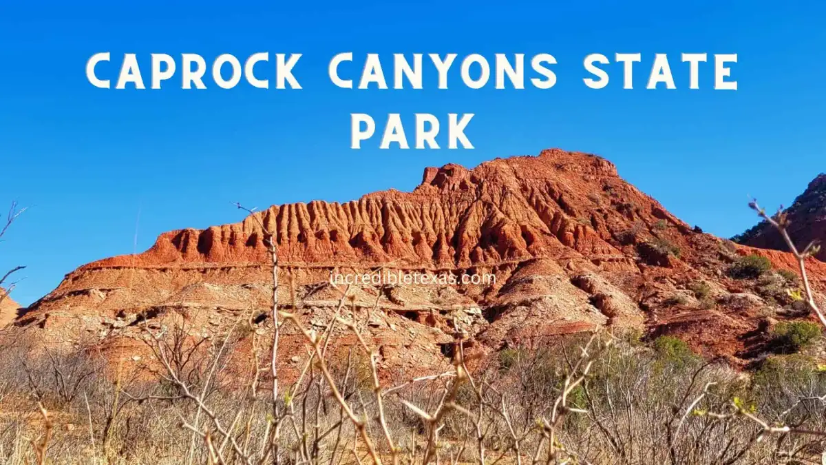
Caprock Canyons encompasses 15,313 rugged acres of red sandstone escarpment in the Texas Panhandle, situated approximately 100 miles southeast of Amarillo. The park serves as the permanent sanctuary for the official Texas State Bison Herd and provides access to extensive multi-use trail networks.
Key takeaways
- Caprock Canyons State Park charges a daily entry fee of $5 per adult (free for children 12 and under), with advance reservations strongly recommended through Texas Parks and Wildlife.
- The park protects the state bison herd across 10,000+ open roaming acres, where rangers mandate a strict 50-yard safety buffer for all visitors.
- Over 90 miles of multi-use trails cross the park, led by the rugged Haynes Ridge Overlook and the 64-mile Caprock Canyons Trailway reaching historic Clarity Tunnel.
- Between April and October, Clarity Tunnel shelters an estimated 500,000 Mexican free-tailed bats that emerge nightly around sunset.
- Campers choose between developed 30-amp and 50-amp utility sites at Honey Flat ($17 to $22 nightly), equestrian corrals at Wild Horse, and remote backcountry hike-in zones ($12 nightly).
Caprock Canyons State Park Address, Hours, and Entry Fees
Caprock Canyons State Park & Trailway is located at 850 State Park Road in Quitaque, Texas 79255. The park grounds remain open daily year-round, giving travelers access to canyon overlooks, hiking routes, and camping loops.
Because Caprock Canyons ranks among the top 10 best state parks in Texas, daily visitor caps are enforced during peak seasons. Travelers should reserve day passes and overnight campsites up to five months ahead to prevent being turned away at the gate.
Entry Fees and State Park Pass Savings
Daily entry costs $5 per adult aged 13 and older, while children 12 and under enter free. The standard caprock canyons entrance fee is $5 per adult, which is waived for annual Texas State Park Pass holders.
According to the Texas Parks and Wildlife Caprock Canyons Fees and Facility Portal, day-use permits apply to all vehicle occupants in addition to nightly campsite fees. Travelers can secure caprock canyons reservations online through Texas Parks and Wildlife up to five months ahead of their trip.
Frequent state park visitors should consider purchasing the $70 annual Texas State Park Pass. This pass grants unlimited free entry for the pass holder and all passengers in their non-commercial vehicle across more than 80 state parks.
Park Office Hours and Gate Access
The park visitor center operates daily from 8:30 AM to 5:00 PM, with staff closing the counter briefly between 12:00 PM and 1:00 PM for lunch. Visitors arriving after office hours must utilize the self-pay iron ranger kiosk at the entrance or present an existing digital confirmation code.
Drivers should monitor their fuel levels carefully before entering the park canyon roads. Gasoline is not sold inside park boundaries, making Quitaque the primary fueling outpost for vehicles and trail supplies.
The Official Texas State Bison Herd: Conservation and Safety
Caprock Canyons State Park serves as the official sanctuary for the Texas State Bison Herd, roaming freely across more than 10,000 contiguous acres of canyon grassland. These animals represent the direct descendants of the historic Southern Plains bison rescued in 1878.
Visitors frequently spot bison grazing along the main park drive, resting near the Honey Flat camping loops, or wallowing in prairie dust bowls. Maintaining situational awareness is critical because these massive wild animals move with unexpected speed and agility.
History of the 1878 Goodnight Bison Herd
In 1878, cattleman Charles Goodnight and his wife Mary Ann Goodnight gathered orphaned wild bison calves across Palo Duro Canyon to prevent their total regional extinction. This private rescue established the legendary Goodnight foundation herd on the JA Ranch.
As detailed by the Texas Parks and Wildlife Official State Bison Herd History, the herd was donated to the state in 1997 and permanently moved to Caprock Canyons. In 2011, the Texas Legislature officially designated them as the State Bison Herd of Texas.
Genetic Significance and Modern Conservation
Scientific DNA testing confirmed that the Caprock Canyons herd retains rare genetic markers distinct from other North American plains bison. Their genetic heritage represents the final pure lineage of the historic Southern Plains population.
Wildlife biologists monitor the herd through annual medical checks, microchipping, and managed grazing pastures. Their natural foraging behavior and soil wallowing restore native prairie sod, allowing indigenous grasses and birds to flourish.
Bison Safety Rules and the 50-Yard Standard
Park rangers enforce a mandatory 50-yard safety buffer between human visitors and all bison. Approaching closer than half a football field constitutes a park violation and invites territorial charges.
Hikers should use the simple field test known as the “rule of thumb.” Extend your arm straight ahead and raise your thumb toward the bison; if your thumb fails to completely cover the animal’s silhouette, you are dangerously close and must quietly back away.
Important
If a bison stops grazing, stares directly at you, paws the earth, or raises its tail upright, the animal is agitated. Never run. Walk backward slowly while keeping your eyes on the animal until you reach a safe distance or vehicle shelter.
Geological Evolution of the Caprock Escarpment
The colorful canyon walls at Caprock Canyons expose more than 250 million years of continuous sedimentation and erosion. When exploring caprock canyon state park texas travelers witness distinct Permian and Triassic sedimentary formations that define the edge of the Llano Estacado.
These dramatic cliffs place the park alongside other famous landmarks in Texas that highlight the state’s ancient natural history. Active stream erosion continues to chisel deep ravines and carve towering red monuments.
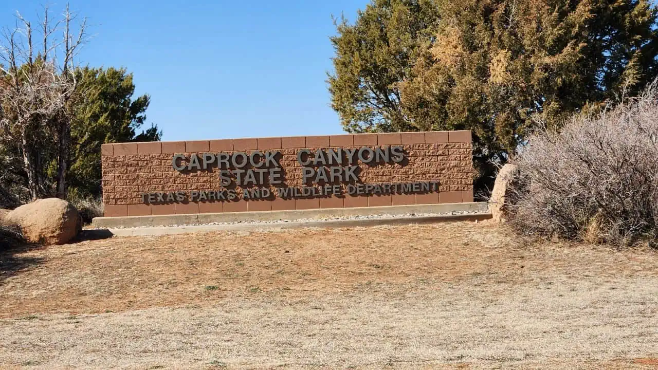
Rock Layers and the Quartermaster Formation
The lowest visible rock strata belongs to the Quartermaster Formation, deposited during the Permian Period roughly 260 million years ago. These layers feature deep crimson shales, siltstones, and brilliant white veins of satin spar gypsum.
Geologists at the UT Austin Bureau of Economic Geology Panhandle Research document how shifting ancestral seas created alternating mudstone beds and mineral deposits. Above the red Permian rocks lie the orange sandstones of the Triassic Trujillo and Tecovas formations, capped by durable Tertiary Ogallala caliche.
Sedimentary Erosion and Canyon Hoodoos
The Little Red River and its network of tributaries cut down through softer siltstones over millions of years. This intense drainage carved steep cliffs, box canyons, and freestanding rock towers known as hoodoos.
Windblown dust and summer flash floods continue to shape these fragile earth structures today. Hikers must stay on designated paths to prevent soil compaction and avoid accelerating the natural erosion of delicate canyon ridges.
Flora and Plant Adaptations in Semi-Arid Red Rock
Plant species throughout Caprock Canyons have evolved specialized survival mechanisms to endure harsh Panhandle conditions. Summer heatwaves, intense sunlight, and prolonged dry spells require deep root systems and moisture-retaining tissues.
The park transitions from high-plains shortgrass prairie along the rims to dense desert scrub and riparian thickets in canyon bottoms. This vegetation stabilizes fragile red clay soils and provides essential browse for local herbivores.
Honey Mesquite and One-Seed Juniper
Honey mesquite dominates the canyon flats and dry arroyos, utilizing taproots that descend dozens of feet to reach subterranean groundwater. Its nitrogen-fixing nodules enrich nutrient-poor desert soils, fostering secondary plant growth under its canopy.
One-seed juniper clings to steep talus slopes and wind-scoured rim edges. These slow-growing evergreen trees endure severe winter freezes and provide critical winter berries for migrating birds and small mammals.
Cacti and Desert Wildflowers
Prickly pear and tree cholla grow in dense colonies across rocky ridges and open plains. Their sharp spines deflect foraging herbivores, while their thick waxy pads store water collected during brief desert thunderstorms.
Following spring rains, colorful blooms carpet the canyon floors and washes. Visitors can observe yellow Engelmann daisies, purple verbena, scarlet Indian paintbrush, and orange globe mallows blooming against the red sandstone earth.
Wildlife Biodiversity Beyond the Bison
While the bison herd commands public attention, Caprock Canyons supports an intricate web of mammalian predators, reptiles, and migratory birds. The convergence of plains and canyons creates diverse microhabitats with reliable spring seeps.
Early morning and twilight hours offer optimal opportunities for wildlife observation. Animals seek shade under canyon overhangs during the heat of the day, emerging as canyon shadows stretch across the valley floor.
The Bats of Clarity Tunnel
Clarity Tunnel serves as a vital maternity and migratory roost for approximately 500,000 Mexican free-tailed bats each year. The bats occupy the historic 742-foot railway tunnel from late April through October before journeying southward for winter.
Watching the clarity tunnel bats during their evening flight remains one of the most memorable wildlife encounters in the Panhandle. At dusk during midsummer, thousands of bats pour from the western portal in a dark, swirling funnel cloud. This colossal colony consumes thousands of pounds of agricultural crop moths and mosquitoes every night.
Predators and Panhandle Mammals
Mule deer navigate the steep, broken canyon ledges with agile footing, feeding on mountain mahogany and juniper brush. Black-tailed prairie dogs inhabit sprawling colony towns near the park entrance, barking vocal alerts when hawks circle overhead.
These herbivore populations support top predators, including bobcats, coyotes, badgers, and grey foxes. Solitary mountain lions maintain expansive home ranges across the Caprock Escarpment, though sightings by human visitors remain rare.
Panhandle Birding and Raptor Watching
The park checklist records over 175 resident and migratory bird species across varied canyon elevations. Golden eagles nest along high cliff ledges, using powerful thermal updrafts along the escarpment to hunt rabbits and prairie dogs.
Greater roadrunners dash across desert roads in pursuit of whiptail lizards and grasshoppers. In brushy canyon draws, birders frequently spot canyon wrens, painted buntings, ladder-backed woodpeckers, and Mississippi kites during late spring.
Comprehensive Hiking Trail Guide
Caprock Canyons State Park offers more than 25 miles of internal hiking trails in addition to the 64-mile regional Trailway. Exploring caprock canyons hiking trails requires advance preparation for varied surfaces, including loose scree, exposed caprock slickrock, and packed clay paths.
Hikers should review the official Texas Parks and Wildlife Caprock Canyons Trail and Facility Map Portal before starting any journey. Trail surfaces include loose red scree, slickrock gypsum, and packed caliche that become greasy when wet.
Haynes Ridge Overlook Trail
The Haynes Ridge Overlook Trail represents the most demanding and scenic hike inside park borders. This 2.3-mile one-way route ascends over 600 vertical feet to reach the highest observation crest in the park at 3,180 feet.
From the top ridge, panoramic vistas stretch for miles across the rugged canyon amphitheater and the endless Llano Estacado plains. Hikers often compare this trek to routes detailed in our Palo Duro Canyon State Park hiking guide, though Caprock Canyons delivers far greater solitude.
Eagle Point Trail and the Natural Bridge
Eagle Point Trail covers two miles of moderate terrain connecting Lake Theo to the scenic Eagle Point parking overlook. The trail features rolling red hills, gypsum vein crossings, and expansive vistas of the canyon rim.
A short spur trail leads directly to the Natural Bridge, a fascinating geological span carved through sandstone by water runoff. This route is well suited for families seeking scenic viewpoints without severe elevation climbs.
Upper North Prong and Fern Cave
The Upper North Prong Trail traverses two miles into a deep canyon hollow beneath the sheer cliffs of Haynes Ridge. The path follows a gravel wash bed flanked by towering cottonwood trees and red sandstone monoliths.
Near the canyon head sits Fern Cave, a natural rock alcove with a continuous spring drip. The cool, shaded microclimate supports a lush colony of maidenhair ferns growing in direct contrast to the arid desert surroundings.
Wild Horse Draw and Prairie Dog Town
Wild Horse Draw provides a gentle one-mile stroll through the upland prairie country near the park headquarters. The flat, hard-packed surface makes it an easy option for hikers of all ages and fitness levels.
The trail skirts the edge of an active prairie dog town, offering close-up looks at social burrows and vocal sentinel behavior. Visitors frequently spot bison bulls grazing in the adjacent grassy flats during the morning hours.
The Caprock Canyons Trailway: A 64-Mile Journey
The Caprock Canyons Trailway is a continuous 64-mile rail-trail corridor converted from the historic Fort Worth and Denver South Plains Railway. The trailway crosses Floyd, Briscoe, and Hall counties, passing through expansive farmland, rugged canyons, and 46 railway bridges.
The crushed stone and caliche grade remains open to hikers, mountain bikers, and horseback riders. Due to remote conditions and extreme distances between access points, trail users must plan logistics and water caches with diligence.
Trailway Sectors and Logistics
The Trailway is divided into several distinct route segments anchored by dedicated trailheads in Estelline, Turkey, Quitaque, and South Plains. The most popular sector is the 13-mile trek from Monk’s Crossing trailhead to Clarity Tunnel.
Primitive camping spots sit at designated clearings along the corridor, though all users must carry in all potable water. Summer users must pack a minimum of one gallon of water per person per day because natural water sources along the railroad bed are non-existent.
Equestrian and Mountain Bike Regulations
Mountain bikers should equip their tires with puncture-resistant tubes or tubeless sealant to counter sharp goathead thorns common along the trail shoulders. A gravel bike with wide tires or a hardtail cross-country mountain bike works best on the coarse railway ballast.
Horseback riders must present a negative Coggins test certificate issued within the past 12 months for every animal brought onto state park property. Horses must be walked across all wooden railway bridges to prevent slipping on timber trestles.
Camping and Campground Options at Caprock Canyons
Overnight camping lets visitors experience canyon sunsets and clear nighttime temperatures after hot Panhandle afternoons. Securing Caprock Canyons State Park camping reservations allows travelers to choose from diverse camping setups ranging from full-utility RV spaces to remote primitive clearings.
| Campground / Sector | Site Count | Nightly Rate | Utilities / Water | Best For |
|---|---|---|---|---|
| Honey Flat (50-Amp) | 10 Sites | $22 | 50-Amp Electric & Water | Large RVs and travel trailers |
| Honey Flat (30-Amp) | 25 Sites | $17 | 30-Amp Electric & Water | Standard RVs and car campers |
| Lake Theo Walk-In | 10 Sites | $14 | Water nearby (pack-in) | Lake access and tent campers |
| Little Red Tent Area | 10 Sites | $14 | Primitive (pack-in water) | Quiet tenting with shade shelters |
| South Prong Primitive | 6 Sites | $12 | Backcountry dry camping | Backpackers and ridge hikers |
| Wild Horse Equestrian | 12 Sites | $22 | Water hookup & horse corrals | Trailway horseback riders |
Honey Flat Electric Campsites
Honey Flat campground serves as the primary developed camping area, featuring paved parking pads, shaded picnic tables, fire rings, and upright lantern posts. Restrooms equipped with hot showers and flush toilets are centrally located within short walking distance of all loops.
Campers must note that roaming bison regularly enter the Honey Flat loops to graze on campground turf. Keep your campsite clean and maintain distance if an animal approaches your picnic table or awning.
Primitive and Backcountry Camping
Backpackers seeking quiet wilderness can reserve hike-in sites in the South Prong and North Prong sectors or along the Trailway. These sites require packing in all equipment and carrying out all waste, following strict Leave No Trace principles.
Open campfires are prohibited in primitive zones; campers must use containerized fuel backpacking stoves for all cooking. Composting toilets are located near major trail junctions, but backcountry campers should always bring a trowel and personal hygiene supplies.
Wild Horse Equestrian Camping
The Wild Horse camping sector accommodates equestrian travelers with horse trailers and riding rigs. Each designated campsite includes two sturdy pipe corrals, a water spigot for stock watering, and a shaded picnic pavilion.
Riders can mount up directly from their campsites to access park trails and the Trailway junction. Reservations for these specialized sites require booking through the Texas Parks and Wildlife centralized telephone center or web portal.
Hammock and Equipment Regulations
Campers utilizing hammocks must comply with specific Texas State Parks tree-protection mandates. Hammock tree straps must measure at least two inches in width to prevent damaging fragile bark on slow-growing desert trees.
Hammocks may only be attached to healthy trees measuring at least eight inches in diameter at the strap height. Screws, nails, wire, or thin cordage are strictly forbidden, and hammocks must never be suspended from campground shade shelters or pavilion rafters.
Water Activities at Lake Theo
Lake Theo is a 120-surface-acre impoundment situated near the park entrance, offering a cool contrast to the arid canyon slopes. Spending an afternoon at Lake Theo Caprock Canyons gives anglers and paddlers a refreshing desert oasis surrounded by red canyon walls.
A designated shoreline swimming beach allows visitors to cool off during midsummer afternoons. There are no lifeguards stationed at the lake, so adult supervision is required for all children entering the water.
Fishing Opportunities and Free Tackle Loaners
Anglers can fish for largemouth bass, channel catfish, and sunfish from the shoreline or the accessible wooden fishing pier. Under Texas fishing regulations and license exemptions, you do not need a state fishing license when fishing inside Texas State Parks.
The park headquarters participates in the Texas Tackle Loaner program, loaning rods, reels, and basic terminal tackle free of charge. Visitors only need to supply their own fresh bait, which can be acquired at convenience stores in Quitaque.
Paddling and Swim Beach Rules
Paddlers are welcome to launch canoes, kayaks, and stand-up paddleboards from the Lake Theo boat ramp. Only non-motorized watercraft and boats operating strictly at no-wake trolling speeds are permitted on the lake.
Gasoline motors must not generate wake on Lake Theo to protect shoreline vegetation and preserve calm water for swimmers. Personal flotation devices must be aboard for every paddler, and children under 13 must wear a life jacket at all times while on the water.
Accessibility and ADA Features
Caprock Canyons State Park strives to provide meaningful outdoor access for visitors with mobility impairments. The park visitor center, headquarters restrooms, and Lake Theo pavilion offer wheelchair-accessible ramps, designated disabled parking, and accessible doorways.
At Honey Flat campground, select electric campsites offer paved, level concrete pathways connecting directly to accessible shower buildings. The Lake Theo fishing pier includes wheelchair-height railings and stabilized approach ramps for anglers of all abilities.
Drone Rules and Photography Regulations
Operating recreational unmanned aerial systems (drones) is prohibited across all Caprock Canyons State Park property without prior written authorization. Drones create audible disturbance that panics the free-roaming bison herd and agitates nesting raptors along canyon rim cliffs.
Commercial filmmakers and scientific researchers can submit formal filming permit applications through park administrative offices several weeks in advance. Operating a drone without an approved permit carries Class C misdemeanor citations and immediate confiscation of equipment.
Nearby Dining and Essential Supplies in Quitaque
The historic town of Quitaque sits three miles west of the park entrance, acting as the primary resupply hub for canyon travelers. Travelers can find home-style cooking, cold drinks, and basic camping gear along Main Street.
Visitors seeking local meals can stop at local cafes in town for hot breakfast plates, burgers, and iced tea. Allsup’s Convenience Store operates around the clock, providing 24-hour gasoline pumps, crushed ice, ice-cold beverages, and packaged snacks.
For travelers planning extended regional road trips to explore red rock vistas, museums, and historical towns across the rolling plains, consult our comprehensive guide to things to do in Briscoe County TX.
Visitor Itineraries: 1 to 3 Days in the Panhandle
Planning an itinerary around daylight hours and seasonal weather ensures an enjoyable trip through this remote Panhandle landscape. These sample schedules balance wildlife observation, scenic viewpoints, and strenuous hikes.
1-Day Highlights Itinerary
- Morning (7:30 AM to 11:00 AM): Enter the park at sunrise to spot bison feeding in the Honey Flat grasslands. Hike the moderate two-mile Eagle Point Trail to inspect the Natural Bridge before temperatures climb.
- Midday (11:30 AM to 2:00 PM): Enjoy a shaded picnic at Lake Theo, explore the exhibits inside the visitor center, and drive slowly past the prairie dog town.
- Afternoon & Sunset (2:30 PM to 7:00 PM): Walk the Wild Horse Draw Trail, browse souvenirs at the park store, and conclude your evening watching the golden sunset illuminate the red canyon walls from the Canyon Rim Overlook.
3-Day Ultimate Exploration Itinerary
- Day 1: Canyon Foundations & Wildlife: Settle into your Honey Flat campsite, tour the prairie dog town, and complete the Eagle Point and Mesa trails. Spend late afternoon paddling or relaxing along the Lake Theo shore.
- Day 2: Rim Ascent & Rugged Backcountry: Hit the trail by 7:30 AM to tackle the strenuous Haynes Ridge Overlook Trail. Connect down the Upper North Prong Trail to discover Fern Cave before returning along the canyon wash.
- Day 3: The Trailway & Bat Flight: Rent mountain bikes or hike from Monk’s Crossing along the Caprock Canyons Trailway. In summer, time your visit for sunset at Clarity Tunnel to witness thousands of Mexican free-tailed bats exiting into the twilight.
Seasonal Weather and Canyon Safety
The Texas Panhandle features an intense semi-arid climate characterized by dramatic seasonal and diurnal temperature swings. Canyon visitors can experience scorching afternoon heat followed by brisk evening winds.
Hikers should check local forecasts before departing on any trail and carry proper gear for sudden changes in weather. Cell phone service is unreliable inside the canyon, making self-reliance essential.
Summer Heat and Flash Flood Precautions
Summer temperatures within the canyon basin frequently surpass 105 degrees Fahrenheit between noon and 5:00 PM. High canyon walls trap heat and reflect sunlight, causing ground-level temperatures to feel far hotter than regional forecasts indicate.
Schedule all strenuous uphill hikes for early morning hours, concluding trail activity before 11:00 AM. Always carry at least one gallon of drinking water per person daily, and monitor canyon washes for sudden flash floods triggered by distant upstream storms.
Winter Conditions and Panhandle Winds
Winter brings sharp cold fronts known as Blue Northers that drop ambient temperatures by 30 to 40 degrees within an hour. High sustained winds sweep across the exposed rims of the Llano Estacado, creating harsh wind chills.
Winter visitors should pack thermal base layers, windproof shells, and rated cold-weather sleeping bags for camping. Winter visits provide exceptional clarity for canyon photography and virtually empty hiking trails.
Human History and Cultural Heritage
Archaeological excavations confirm that humans have found shelter and water in Caprock Canyons for over 10,000 years. The red sandstone provided natural defensive protection and abundant springs in an otherwise unforgiving open prairie.
The Texas State Historical Association Caprock Canyons Entry records extensive prehistoric activity and subsequent pioneer cattle ranching. Respecting archaeological sites ensures this heritage remains intact for future generations.
Folsom Hunters and Indigenous Peoples
Excavations near Lake Theo uncovered prehistoric projectile points, butchered bones, and stone tools associated with the ancient Folsom culture. Nomadic hunters used the canyon draws to trap giant extinct bison species during the late Pleistocene Epoch.
Centuries later, Comanche and Kiowa tribes used these canyons as winter quarters to escape fierce winds blowing across the open plains. Natural seeps, wild game, and native plums made the sheltered canyon bottoms a strategic winter stronghold.
The Ranching Era and State Park Creation
Following the Red River War of 1874, pioneer cattlemen established massive Panhandle ranches across the canyon territory. Charles Goodnight partnered with John Adair to form the sprawling JA Ranch, which encompassed more than a million acres.
In 1973, the State of Texas purchased the land from the estate of Theo Geisler to preserve its unique topography and cultural history. Caprock Canyons State Park officially opened to the public in 1982, followed by the acquisition and conversion of the railroad trailway in the 1990s.
Night Sky Photography and Stargazing Tips
Located far from the light pollution of major metropolitan centers, Caprock Canyons State Park offers some of the darkest night skies in the state. On moonless nights, the sprawling arc of the Milky Way is visible to the naked eye from horizon to horizon.
The park frequently hosts astronomy programs and ranger-led star parties at the Lake Theo amphitheater. Campers can witness thousands of stars while listening to distant coyote howls across the canyon floor.
Dark Sky Viewing and Camera Settings
To capture stunning night-sky images, photographers should mount a digital camera with manual exposure capabilities onto a sturdy tripod. Use a fast, wide-angle lens with a focal length of 14mm to 24mm and an aperture of f/2.8 or wider.
Set your camera sensitivity between ISO 3200 and ISO 6400 with a shutter speed of 15 to 25 seconds to prevent trailing star motion. Use a red-beam headlamp to preserve your natural night vision while navigating canyon campsites.
Frequently Asked Questions About Caprock Canyons
Do you need a reservation to visit Caprock Canyons State Park?
Yes, advance reservations are strongly recommended for both day use and overnight camping through the Texas Parks and Wildlife online reservation portal. The park frequently hits entry capacity on peak spring and fall weekends, turning away drive-up visitors without bookings.
How much does it cost to get into Caprock Canyons State Park?
Daily admission is $5 per person for adults aged 13 and older, while children 12 and under enter free of charge. Visitors holding an annual Texas State Park Pass ($70 per year) receive free entry for themselves and all vehicle passengers.
What is the safest distance for viewing bison at Caprock Canyons?
The Texas Parks and Wildlife Department mandates a strict 50-yard minimum safety distance from all bison at all times. If a bison raises its tail, paws the dirt, or stops grazing to watch you, slowly back away until the animal resumes normal behavior.
When is the best time to see the bats at Clarity Tunnel?
Mexican free-tailed bats occupy Clarity Tunnel annually from April through October, with peak populations roosting during July and August. Spectators should arrive near the tunnel entrance at dusk with headlamps and protective brimmed hats to watch the evening emergence flight.
Can you fish at Lake Theo without a fishing license?
Yes, under the Texas Parks and Wildlife Free Fishing in State Parks program, visitors can fish from the shoreline or pier at Lake Theo without a state fishing license. Daily park entrance fees still apply, and anglers must adhere to statewide bag and length limits.
How difficult is the Haynes Ridge Overlook Trail?
The Haynes Ridge Overlook Trail is rated as strenuous, climbing more than 600 vertical feet across loose red scree and exposed caprock ledges. Hikers should budget two to three hours for the ascent, start before 10:00 AM in warm months, and carry at least two liters of water.
Essential Packing List for the Panhandle
Visiting Caprock Canyons requires thoughtful preparation due to the remote desert environment and absence of commercial stores inside the park. Having the right equipment ensures your exploration remains comfortable and safe.
- Hydration Gear: Carry a minimum of one gallon of potable water per person per day; pack insulated bottles to keep water cool.
- Sun Protection: Wear a wide-brimmed sun hat, UV-blocking sunglasses, lightweight long-sleeve sun shirts, and high-SPF sunscreen.
- Supportive Footwear: Sturdy hiking boots with aggressive lugged traction are essential for navigating loose scree, clay, and rocky ledges.
- Offline Maps & Navigation: Download digital topographic maps and park trail maps to your phone before arrival, as cellular reception drops inside the canyon.
- First Aid & Trail Tools: Pack tweezers for removing cactus spines, blister treatments, electrolyte powder packets, a whistle, and a compact headlamp with spare batteries.
From its ancient red rock amphitheaters to the thundering hooves of the state bison herd, Caprock Canyons State Park stands out as one of the best places to visit in Texas for travelers seeking genuine solitude and untamed western heritage.