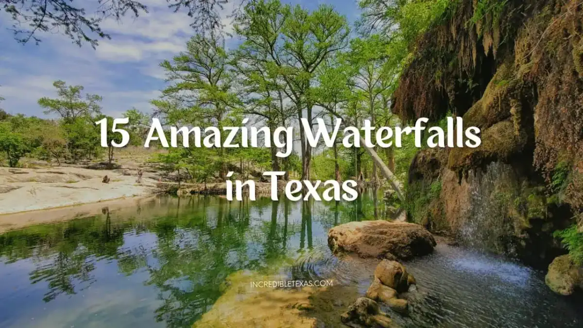
Texas holds surprising diversity in natural cascades, ranging from 70-foot mossy travertine walls in the Hill Country to 175-foot desert pour-offs in West Texas. While some waterfalls require advance county permits or multi-mile rocky scrambles, others sit within urban state parks featuring designated limestone swimming basins.
Key takeaways
- Capote Falls in Presidio County drops 175 feet as the tallest waterfall in Texas, though it resides on private ranch land and remains inaccessible to the public without express landowner permission.
- Madrid Falls in Big Bend Ranch State Park drops 100 feet and ranks as the tallest publicly accessible waterfall in the Texas state park system.
- Colorado Bend State Park preserves Gorman Falls, a 70-foot spring-fed cascade where swimming and climbing are strictly prohibited to safeguard fragile calcite mineral deposits.
- Hamilton Pool Preserve and Westcave Outdoor Discovery Center require advance reservations weeks ahead, and swimming at Hamilton Pool is never guaranteed due to rainfall runoff and rockfall hazards.
- Pedernales Falls and McKinney Falls offer reliable water flow near Austin, though swimming is strictly forbidden at the main Pedernales cascade due to turbulent limestone hydraulics.
At-a-Glance Guide to the 15 Best Waterfalls in Texas
Texas waterfalls span five distinct geographic regions, ranging from accessible Hill Country state parks to remote desert pour-offs requiring high-clearance four-wheel-drive vehicles. Finding rewarding hiking trails in texas with waterfalls requires checking seasonal water flow, booking day-use vehicle permits in advance, and verifying current swimming regulations before setting out.
The following comparison table highlights key logistical specifications for all 15 notable cascades across the state, comparing them with the top state parks in Texas for hiking, camping, and outdoor exploration.
| Waterfall Name | Region / Setting | Estimated Drop | Entry / Access Cost | Swimming Status | Trail Difficulty |
|---|---|---|---|---|---|
| Gorman Falls | Colorado Bend State Park | 70 feet | $5 per adult (13+) | Prohibited (Travertine) | Moderate (3.0 mi round-trip) |
| Hamilton Pool Waterfall | Dripping Springs / Travis County | 50 feet | $12 reservation + $8 gate | Conditional / Restricted | Easy to Moderate (0.5 mi round-trip) |
| Pedernales Falls | Johnson City / Blanco County | 50-ft cascade series | $6 per adult (13+) | Prohibited at falls | Easy Overlook (0.5 mi round-trip) |
| McKinney Falls | Austin / Travis County | Upper & 15-ft Lower | $6 per adult (13+) | Permitted in Onion Creek | Easy (0.5 to 2.8 mi routes) |
| Krause Springs Waterfall | Spicewood / Burnet County | 30 feet | $10 adult / $6 child | Permitted in natural pool | Easy stroll down stairs |
| Westcave Preserve Falls | Southwest Travis County | 40 feet | $20 adult tour fee | Prohibited (Protected) | Moderate guided (1.0 mi loop) |
| Capote Falls | Presidio County / Sierra Vieja | 175 feet | Private land access | Prohibited | Strenuous off-trail scramble |
| Madrid Falls | Big Bend Ranch State Park | 100 feet | $5 park entrance | Prohibited / Arid wash | Strenuous backcountry (4.0 mi) |
| Mexicano Falls | Big Bend Ranch State Park | 80 feet | $5 park entrance | Prohibited / Arid wash | Moderate to Strenuous (1.0 mi) |
| Cattail Falls | Big Bend National Park | 80 feet | $30 park vehicle pass | Prohibited (Fragile) | Moderate (3.0 mi round-trip) |
| The Window Pour-Off | Big Bend National Park | 200-ft canyon notch | $30 park vehicle pass | None (Dry pour-off) | Moderate to Strenuous (5.6 mi) |
| Dolan Falls | Devils River State Natural Area | 10 feet (Class IV) | TPWD paddling permit | Prohibited on banks | Watercraft portage only |
| Boykin Springs Waterfall | Angelina National Forest | 10 to 15 feet | $3 day use / USFS pass | Permitted in creek | Easy (1.5 mi Sawmill Trail) |
| Beef Creek Falls | Jasper County Timberlands | 15 feet | Private timber holdings | Prohibited without escort | Moderate unmarked terrain |
| Wichita Falls | Lucy Park / Wichita County | 54 feet (Man-made) | Free public admission | Prohibited in river pool | Easy paved walkway (0.5 mi) |
Best Waterfalls Near Austin and the Texas Hill Country
The most visited texas hill country waterfalls cluster along spring-fed limestone aquifers and persistent rivers within a two-hour drive of Austin and San Antonio. These sites offer scenic hiking trails, shaded picnic grounds, and natural river pools. Several of these cascades make exceptional day trips from Austin for hikers and nature photographers.
Gorman Falls (Colorado Bend State Park)
Colorado Bend State Park protects Gorman Falls, a 70-foot spring-fed waterfall that tumbles down a sheer limestone cliff covered in green moss and maidenhair ferns. The waterfall is formed by mineral-rich spring water that deposits dissolved calcium carbonate, gradually building living travertine rock formations over thousands of years.
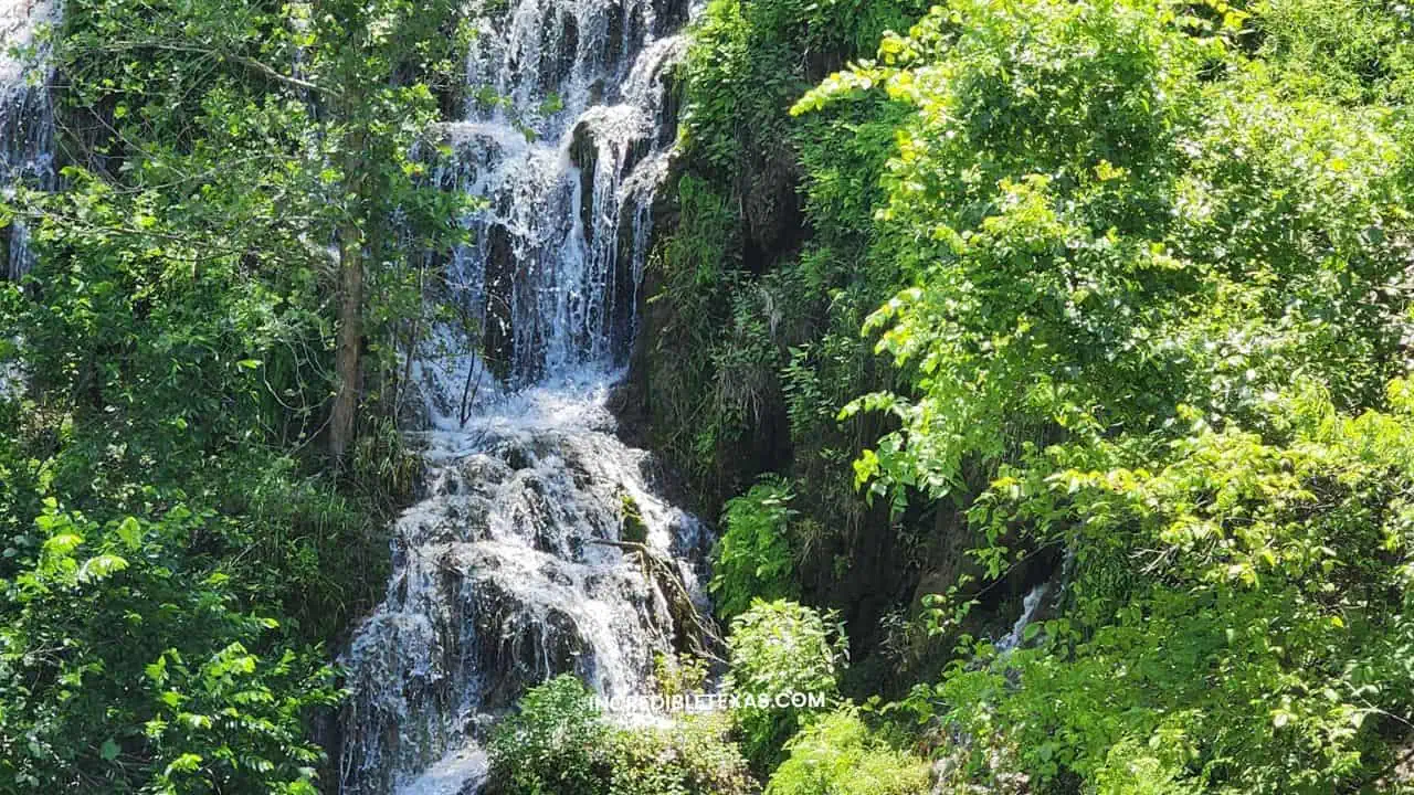
- Location: Colorado Bend State Park, San Saba County (near Bend, TX)
- Estimated Drop: 70 feet
- Trail Length: 3.0 miles round-trip over rough, unshaded limestone
- Admission: $5 per adult (13+), children 12 and under free
- Swimming Permitted: Strictly prohibited to protect travertine deposits
The hike to Gorman Falls follows a rocky, exposed path with little shade across open cedar and limestone terrain. The final approach requires descending a steep, slippery rock staircase fitted with a steel cable handrail. Visitors must wear supportive trail runners or hiking boots with aggressive tread.
Because travertine is soft and easily eroded by foot traffic, entering the water or stepping past the viewing deck railing is strictly prohibited. For complete trail maps and backcountry rules, read our dedicated Colorado Bend State Park visitor guide. Plan your trip and secure advance day passes directly through the Texas Parks and Wildlife Department Colorado Bend State Park Portal.
Tip
Summer temperatures on the exposed Gorman Falls Trail frequently exceed 100 degrees Fahrenheit by midday. Start hiking by 8:00 AM and pack a minimum of two liters of drinking water per person.
Hamilton Pool Waterfall (Travis County)
Hamilton Pool Preserve features a 50-foot waterfall that spills over a massive semi-circular limestone box canyon into a jade-green natural swimming hole. The preserve was created thousands of years ago when the ceiling of an extensive underground river cavern collapsed due to natural erosion.
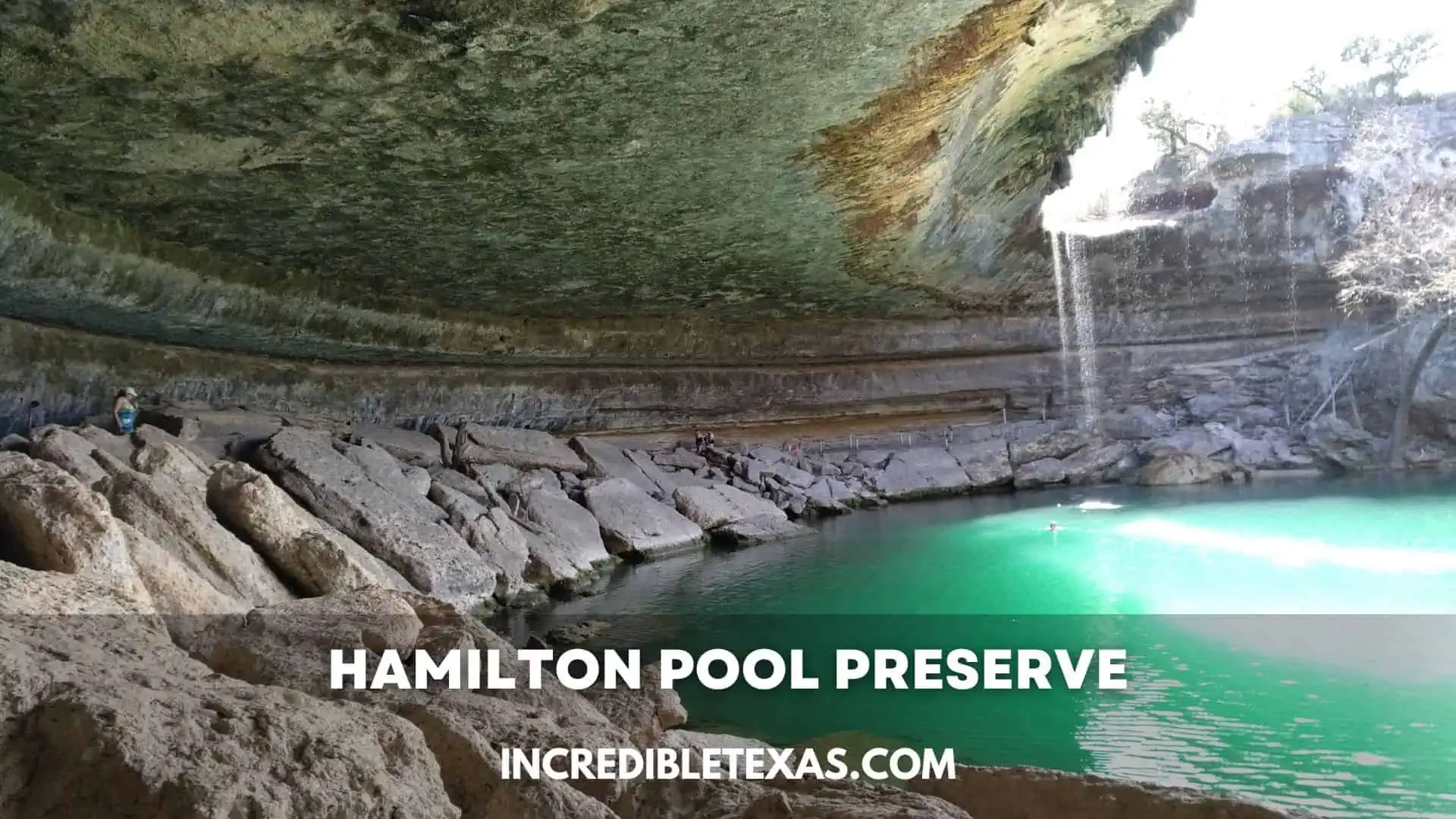
- Location: Travis County Parks, Dripping Springs, TX
- Estimated Drop: 50 feet
- Trail Length: 0.5 miles round-trip from the parking lot
- Admission: $12 online vehicle reservation plus $8 cash per adult at the gate
- Swimming Permitted: Conditional; often closed for rockfall hazards and bacteria
Access to Hamilton Pool Preserve requires an advance timed reservation booked online months ahead for peak spring and summer weekends. Entry is divided into two separate daily time slots: morning (9:00 AM to 12:30 PM) and afternoon (2:00 PM to 5:30 PM).
Swimming is never guaranteed with your entrance fee. Following heavy rain, urban runoff triggers high bacteria levels that suspend swimming access, while safety concerns over falling rock fragments keep the trail under the limestone overhang closed. Verify water conditions via the Travis County Parks Hamilton Pool Preserve Reservation Portal on the morning of your visit.
Pedernales Falls (Pedernales Falls State Park)
Pedernales Falls State Park features a dramatic geological cascade where the Pedernales River drops approximately 50 feet across a 3,000-foot run of tilted limestone bedrock. The river cuts through 300-million-year-old Pennsylvanian limestone, forming deep potholes, swirling trenches, and terraced rapids.
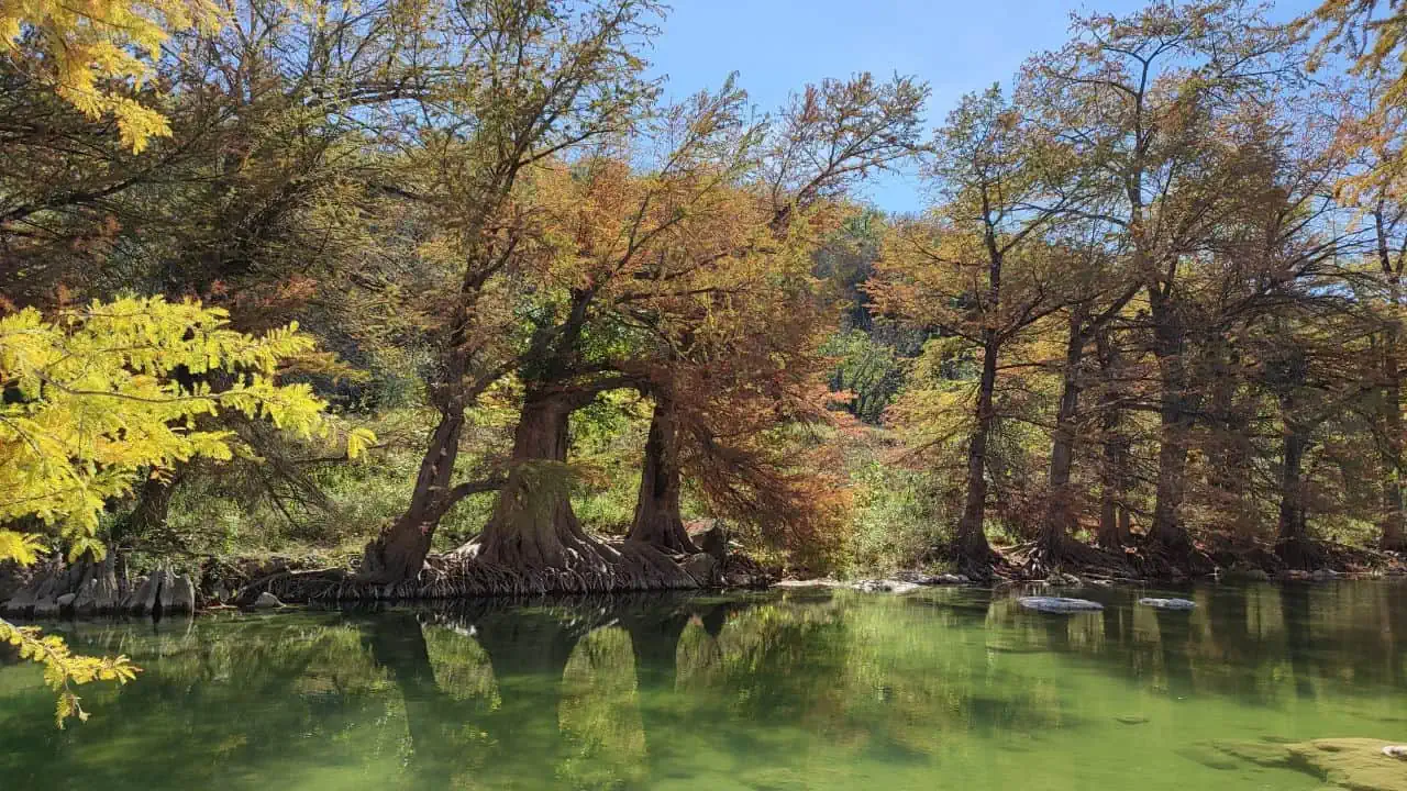
- Location: Pedernales Falls State Park, Johnson City, TX
- Estimated Drop: 50-foot elevation drop across a series of river terraces
- Trail Length: 0.5-mile walk to the main scenic overlook
- Admission: $6 per adult (13+), children 12 and under free
- Swimming Permitted: Strictly prohibited at the falls; allowed downstream
The main falls overlook provides expansive views of rushing currents carving through white limestone channels. Walking along the dry rock shelves offers exceptional photography, but visitors must exercise caution because wet river limestone is exceptionally slick.
Swimming, wading, and tubing are strictly prohibited at the falls area due to violent underwater hydraulics and the ever-present danger of flash flooding. Visitors who wish to swim can hike to designated river access beaches downstream near Trammell’s Crossing. Book your entry pass through the Texas Parks and Wildlife Department Pedernales Falls Overview.
McKinney Falls (Austin Urban State Park)
McKinney Falls State Park offers urban waterfall access just 13 miles southeast of downtown Austin, where Onion Creek cascades over broad limestone shelves. As one of the few waterfalls in texas you can swim in without private entry restrictions, the park features two distinct waterfall locations: Upper Falls and Lower Falls.
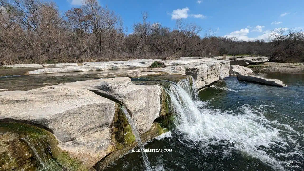
- Location: McKinney Falls State Park, Austin, TX
- Estimated Drop: Upper Falls (8 to 10 feet), Lower Falls (12 to 15 feet)
- Trail Length: 0.5-mile path to Lower Falls; 2.8-mile paved Onion Creek Loop
- Admission: $6 per adult (13+), children 12 and under free
- Swimming Permitted: Yes, in designated natural pools along Onion Creek
Upper Falls drops into a deep natural swimming basin where visitors frequently relax on broad rock ledges. Lower Falls features a wider limestone shelf that connects hikers to the historic McKinney Homestead Trail when creek water levels permit safe crossing.
Park management strictly enforces water safety and conservation rules. To reduce shoreline litter, coolers, ice chests, outside food, alcohol, and pets in the water are prohibited at both Upper and Lower Falls. Review rules and book passes through the Texas Parks and Wildlife Department McKinney Falls Facility Guide.
Krause Springs Waterfall (Spicewood)
Krause Springs stands out among the top swimming holes with waterfalls in texas, operating continuously as a family-owned retreat in Spicewood since 1955. The property features 32 natural freshwater springs that discharge thousands of gallons of cool, 68-degree water into an expansive natural swimming pool framed by bald cypress trees.
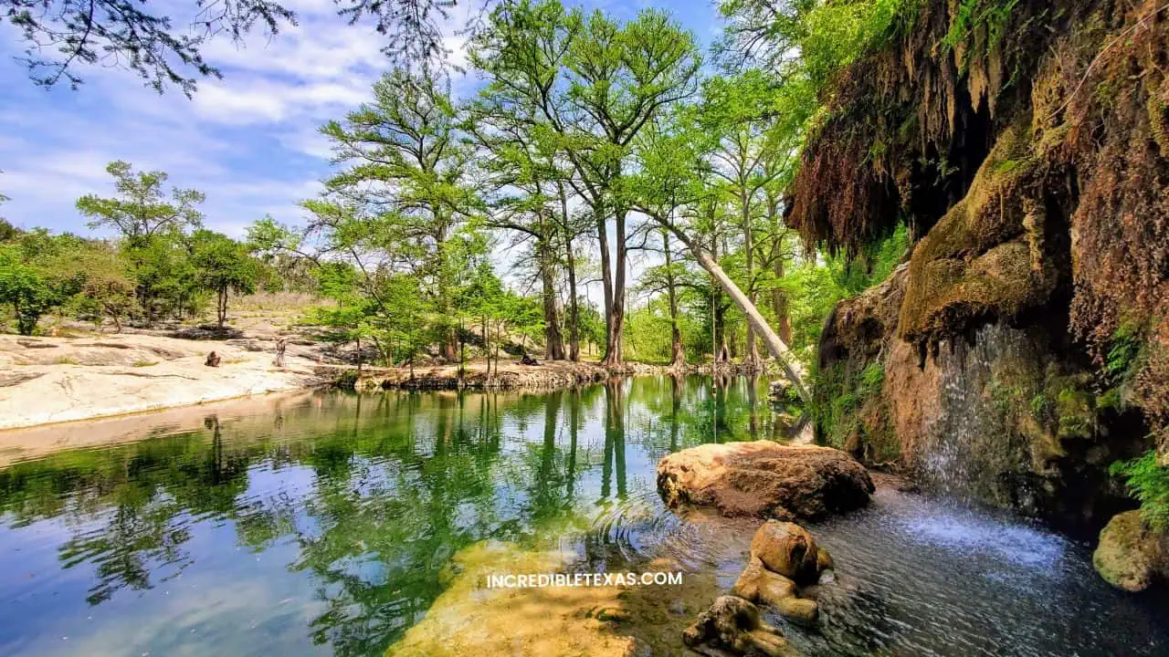
- Location: 424 County Road 404, Spicewood, TX
- Estimated Drop: 30 feet
- Trail Length: Short descent down granite stairways from the garden terrace
- Admission: $10 per adult (12+), $6 per child (4 to 11), free for ages 3 and under
- Swimming Permitted: Yes, in both the man-made spring pool and the lower natural basin
The main waterfall drops 30 feet down a fern-draped granite rock wall directly into the lower swimming hole. Swimmers can swim right under the cold falling water or relax along rocky banks shaded by massive cypress trees.
Krause Springs maintains an old-school payment policy, so visitors should bring cash to pay the entrance fee at the front gate. Pets are strictly prohibited on the property, and glass containers are banned throughout the swimming grounds.
Westcave Preserve Falls (Westcave Outdoor Discovery Center)
Westcave Outdoor Discovery Center protects a 76-acre ecological preserve in southwest Travis County, located just one mile down the road from Hamilton Pool. The sanctuary centers on a sheltered, 100-foot-deep limestone box canyon crowned by a 40-foot waterfall that plunges into a tranquil emerald pool.
- Location: Westcave Preserve, Round Mountain / Dripping Springs area
- Estimated Drop: 40 feet
- Trail Length: 1.0-mile round-trip guided tour
- Admission: $20 per adult (16+), $10 for children (4 to 15)
- Swimming Permitted: Strictly prohibited; scientific and conservation preserve
To safeguard the delicate microclimate, rare plant species, and nesting golden-cheeked warblers, visitors may access the canyon only via staff-guided educational tours on weekends. Self-guided walking in the grotto canyon is forbidden.
The guided hike lasts approximately 90 minutes and includes descending a 100-step wooden staircase down the canyon wall. Sturdy walking shoes are required, and pets are not permitted. Reserve tour slots in advance via the Westcave Outdoor Discovery Center Canyon Tour System.
Dramatic Waterfalls in West Texas and Big Bend
Remote big bend waterfalls are characterized by rugged canyon pour-offs that surge dramatically following desert thunderstorms and high-elevation rainfall. Reaching these remote desert cataracts requires sturdy footwear, ample drinking water, and often high-clearance four-wheel-drive transportation, making West Texas a standout destination on any Texas bucket list destinations journey.
Capote Falls (Presidio County)
Among the most remote natural waterfalls in texas, Capote Falls holds the title of the tallest waterfall in the state, plunging 175 feet over a vertical volcanic cliff in the rugged Sierra Vieja mountain range. Located northwest of Marfa in remote Presidio County, this massive pour-off is fed by perennial springs along Capote Creek, sustaining an isolated desert oasis.
- Location: Sierra Vieja Mountains, Presidio County, TX
- Estimated Drop: 175 feet
- Trail Length: Unmarked backcountry route requiring landowner consent
- Admission: Private property; requires explicit advance permission
- Swimming Permitted: No public access
Despite widespread misinformation on travel forums, Capote Falls is entirely situated on private ranch land belonging to the historic Brite Ranch. There is no public road, trail easement, or state park access to the falls.
Trespassing on private West Texas ranch lands is strictly illegal and dangerous due to severe desert exposure and zero mobile reception. Hikers should respect landowner property rights and seek alternative public cascades in Big Bend Ranch State Park.
Madrid Falls (Big Bend Ranch State Park)
Madrid Falls is the second tallest waterfall in Texas and the tallest waterfall accessible on public land in the state, cascading 100 feet down a vertical canyon wall. The falls are located in the remote interior of Big Bend Ranch State Park, south of Sauceda Ranger Station.
- Location: Big Bend Ranch State Park, Presidio County, TX
- Estimated Drop: 100 feet
- Trail Length: 4.0 miles round-trip over rough, unmaintained desert terrain
- Admission: $5 state park day-use fee
- Swimming Permitted: Prohibited; fragile desert riparian habitat
Reaching the Madrid Falls Trailhead requires a rugged backcountry drive along primitive, unpaved ranch roads where high-clearance four-wheel-drive vehicles are mandatory. The subsequent hike traverses rocky arroyos, loose scree slopes, and cactus-strewn hillsides.
Because Madrid Falls is partially fed by seasonal desert runoff, water flow varies considerably throughout the year. The most reliable flows occur in late summer and early autumn following monsoon rains across the Chihuahuan Desert.
Mexicano Falls (Big Bend Ranch State Park)
Mexicano Falls is an 80-foot pour-off located within a rocky canyon just off the scenic river corridor in Big Bend Ranch State Park. The falls cascade over jagged volcanic rock into a shaded grotto populated by desert ferns and cottonwood trees.
- Location: Big Bend Ranch State Park, along FM 170 (River Road)
- Estimated Drop: 80 feet
- Trail Length: 1.0 mile round-trip from Mexicano Falls Trailhead
- Admission: $5 state park day-use fee
- Swimming Permitted: Prohibited; seasonal pool
The trail to Mexicano Falls is shorter and more accessible than the Madrid Falls route, winding up a boulder-filled canyon wash. The hike passes near the historic Crawford-Smith Ranch ruins, adding rich cultural history to the outdoor trek.
Like many desert cataracts, Mexicano Falls is ephemeral, slowing to a gentle trickle during dry winter and spring months. For the best photography, visit within 48 hours of significant regional rainfall.
Cattail Falls (Big Bend National Park)
Counted among the most secluded hidden waterfalls in texas, Cattail Falls is an 80-foot cascade tucked away on the western slopes of the Chisos Mountains in Big Bend National Park. The waterfall cascades down a sheer rhyolite cliff into a shaded, spring-fed pool surrounded by oaks, ferns, and weeping willows.
- Location: Western slope of Chisos Mountains, Big Bend National Park
- Estimated Drop: 80 feet
- Trail Length: 3.0 miles round-trip from the unpaved access road
- Admission: $30 per vehicle Big Bend National Park entry fee
- Swimming Permitted: Strictly prohibited to protect endangered desert wildlife
The trail to Cattail Falls begins off the primitive Old Maverick Road and winds across desert grasslands before entering a narrow, shaded mountain canyon. The final quarter-mile climbs over slick boulders and loose gravel.
Cattail Falls provides critical drinking water for black bears, cougars, and nesting birds in an arid desert environment. Swimming, wading, and disturbing the pool vegetation are strictly prohibited by federal park rangers.
The Window Pour-Off (Big Bend National Park)
The Window Trail is one of the most famous hikes in Big Bend National Park, guiding hikers 2.8 miles from the Chisos Basin down through Oak Creek Canyon to a dramatic 200-foot V-shaped pour-off. While water flow is intermittent, seasonal rains create a spectacular pour-off that drops hundreds of feet into the desert below.
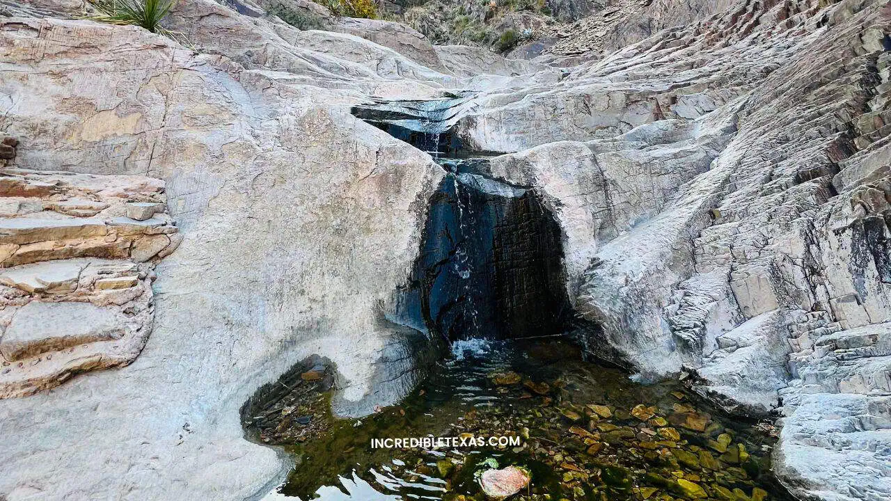
- Location: Chisos Basin, Big Bend National Park
- Estimated Drop: 200-foot cliff notch drop
- Trail Length: 5.6 miles round-trip (900 feet of elevation change)
- Admission: $30 per vehicle (valid for 7 consecutive days)
- Swimming Permitted: None (Dry drop-off)
The hike down through Oak Creek Canyon features towering canyon walls and polished stone steps carved by centuries of torrential water flow. The trail terminates abruptly at the polished pour-off notch, which frames dramatic views of the desert floor.
Hikers must exercise extreme caution near the edge of the pour-off. The slickrock surrounding the opening has been worn glass-smooth by water and foot traffic, creating an extreme slip and fall hazard. Review park alerts at the National Park Service Big Bend Visitor Portal.
Dolan Falls (Devils River State Natural Area)
Dolan Falls is an iconic 10-foot waterfall spanning the free-flowing Devils River in Val Verde County, approximately 45 miles north of Del Rio. Regarded as one of the largest natural volume waterfalls in Texas, Dolan Falls features roaring rapids that tumble across wide limestone ledges into deep crystalline pools.
- Location: Devils River, Val Verde County, TX
- Estimated Drop: 10 feet (spanning the river width)
- Trail Length: Zero hiking access; paddle-in watercraft route only
- Admission: TPWD Devils River Access Permit (DRAP) required
- Swimming Permitted: Prohibited on private riverbanks; portage only
Unlike municipal or state parks with pedestrian hiking trails, Dolan Falls has no road, vehicle, or land hiking access. The land on both sides of the falls is privately owned by The Nature Conservancy as part of the protected Dolan Falls Preserve.
The only lawful way to see Dolan Falls is by completing a self-supported downriver paddling expedition requiring advance permits from Texas State Parks. Dolan Falls is a hazardous Class IV drop where paddlers must portage their gear along designated gravel bars to avoid capsizing. Review regulations at the Texas Parks and Wildlife Department Devils River State Natural Area Rules.
Shaded Waterfalls in East and North Texas
Shaded east texas waterfalls offer tranquil woodland settings under tall pine canopies and accessible municipal park trails. These cascades provide peaceful stops for travelers touring the Piney Woods or road-tripping through North Texas. Visitors touring Lucy Park can discover other things to do in Wichita Falls to complete an urban nature itinerary.
Boykin Springs Waterfall (Angelina National Forest)
Boykin Springs Recreation Area is located deep in the longleaf pine woodlands of the Angelina National Forest in East Texas. For travelers searching for waterfalls near houston tx, Boykin Springs sits roughly two and a half hours northeast of the metro area, featuring a tiered stone waterfall and natural rock rapids along Boykin Creek constructed by the Civilian Conservation Corps in the 1930s.
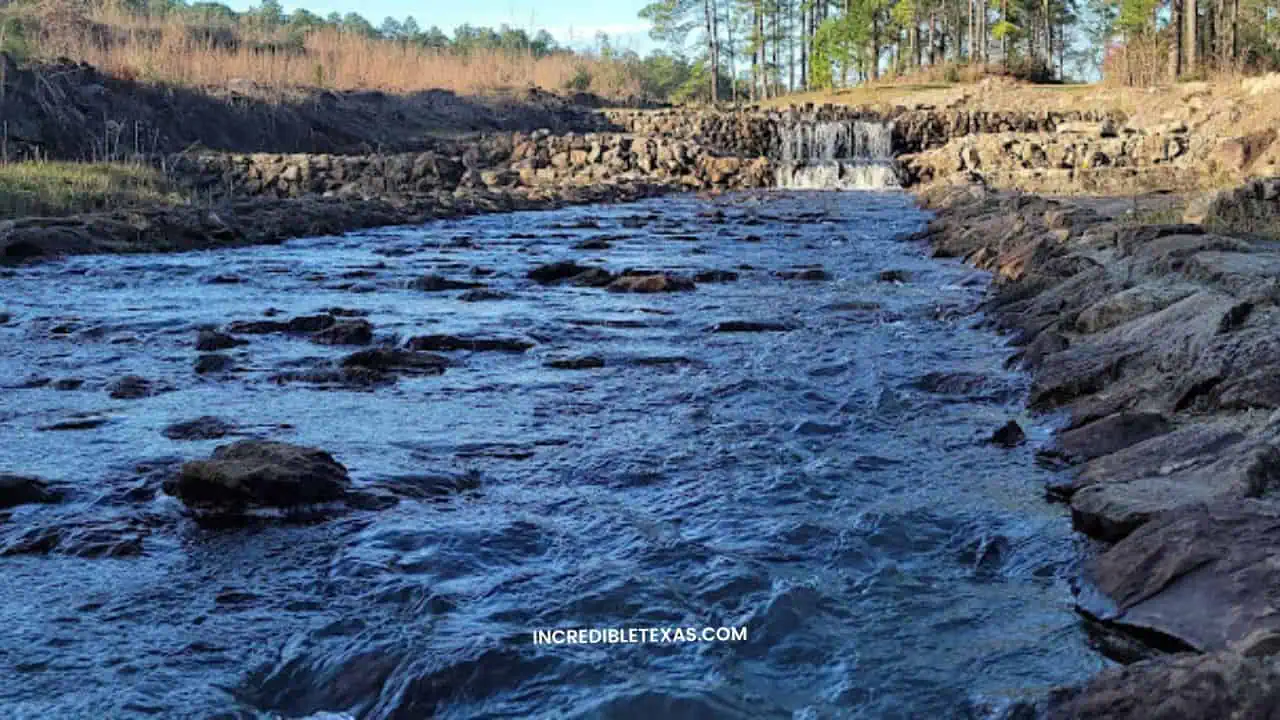
- Location: Angelina National Forest, Zavalla, TX (Jasper / Angelina County)
- Estimated Drop: 10 to 15 feet over historic rock spillways
- Trail Length: 1.5-mile gentle walk along the Sawmill Hiking Trail
- Admission: $3 day-use vehicle fee (or USFS annual pass)
- Swimming Permitted: Yes, in the natural creek pools below the spillway
The Sawmill Hiking Trail meanders alongside spring-fed Boykin Creek, connecting the picnic area with the historic Aldridge Sawmill ruins. Shaded by towering loblolly pines, the trail is flat, well-maintained, and suitable for hikers of all experience levels.
The clear, shallow pools below the stone waterfall provide a pleasant wading spot for families during humid East Texas summers. Campsites with tent pads and picnic tables are available nearby on a first-come, first-served basis.
Beef Creek Falls (Jasper County Timberlands)
Beef Creek Falls is a secluded 15-foot cascade located in northern Jasper County along a tributary of Hog Creek near the Sam Rayburn Reservoir. The waterfall tumbles down a sandstone ledge surrounded by dense ferns and hardwood forest.
- Location: Hog Creek watershed, Jasper County, TX
- Estimated Drop: 15 feet
- Trail Length: Unmarked woodland route
- Admission: Private commercial timberland; unpermitted entry prohibited
- Swimming Permitted: No public access
Contrary to erroneous claims published by scraper websites, Beef Creek Falls is not located within Davy Crockett National Forest and features no public recreation area. The land has historically been owned by private timber companies, including Temple-Inland holdings.
Because the falls sit on private property, unpermitted access constitutes criminal trespass under Texas law. Visitors seeking authorized waterfall hikes in East Texas should visit Boykin Springs in the Angelina National Forest instead.
Wichita Falls (Lucy Park Urban Cascade)
Located within Lucy Park along the Wichita River, Wichita Falls is a 54-foot man-made tiered waterfall built to recreate the city’s original natural falls, which were washed away during a massive flood in 1886. The waterfall is visible from Interstate 44 and serves as a prominent community landmark.
- Location: Lucy Park, 100 Sunset Drive, Wichita Falls, TX
- Estimated Drop: 54 feet
- Trail Length: 0.5-mile flat, paved concrete walking path
- Admission: Completely free public park admission
- Swimming Permitted: Prohibited in the artificial pond basin
The waterfall operates via a recirculating water pump that pushes 3,500 gallons of river water per minute over tiered rock terraces into a decorative pond basin. The surrounding park offers lighted walking trails, disc golf, and shaded picnic pavilions.
The paved trail from the main parking lot is stroller and wheelchair accessible, making Wichita Falls the easiest cascade to visit in northern Texas. The falls operate year-round, though water pumps may be temporarily disabled during freezing winter weather.
Essential Regulations, Swimming Safety, and Reservation Rules
Visiting waterfalls in Texas requires strict adherence to state park guidelines, flash flood warnings, and environmental conservation rules. While natural swimming is celebrated across Texas, many fragile waterfalls forbid water contact to safeguard travertine rock and municipal water quality. Travelers pairing waterfall hikes with overnight stays can explore camping spots near Austin to secure base camps close to the river trails.
The primary ground realities and safety regulations for Texas waterfalls include:
- Advance Day-Use Reservations: Texas State Parks (including Colorado Bend, Pedernales Falls, and McKinney Falls) cap visitor numbers to prevent trail overcrowding. Securing an online day pass up to 30 days in advance is essential for weekend visits.
- Flash Flood Dangers: Texas Hill Country rivers can rise rapidly within minutes from distant upstream rainfall, turning peaceful streams into deadly flash floods. If you notice rising water, increased current speed, or muddy water discoloration, immediately move to high ground away from riverbeds.
- Travertine and Rock Conservation: Spring-fed formations like Gorman Falls and Westcave Preserve took thousands of years to develop through mineral precipitation. Stepping on, scraping, or climbing these formations causes irreversible ecological destruction.
- Cooler and Container Restrictions: Parks like McKinney Falls strictly prohibit coolers, ice chests, alcohol, and glass bottles near the water to eliminate plastic pollution and safety hazards. Pack reusable stainless-steel water flasks in a backpack instead.
- Footwear Requirements: River limestone beds become slick with river algae. Water shoes with rubber traction outsoles or sturdy hiking boots are mandatory for safe footing along rocky banks.
Texas Waterfall Road Trip: Timing, Gear, and Planning Tips
The best time to plan a Texas waterfall road trip is during spring from March through May, when seasonal rainfall fills river basins and native wildflowers bloom along park trails. Early autumn offers cooler hiking weather, whereas mid-summer visits require early morning arrivals to avoid extreme midday heat, as part of a scenic tour through the things to do in the Texas Hill Country.
Consider the following essential planning recommendations:
- Purchase a Texas State Parks Pass: If your itinerary includes visits to Colorado Bend, Pedernales Falls, McKinney Falls, and Big Bend Ranch, the $70 annual pass pays for itself by waiving daily entrance fees for the cardholder and all passengers in their vehicle.
- Pack Essential Sun and Water Protection: Texas trails offer minimal tree canopy across limestone flats. Pack broad-brimmed hats, polarized sunglasses, reef-friendly mineral sunscreen, and at least one liter of drinking water for every hour you plan to hike.
- Download Offline Maps Before Departure: Mobile cell service is notoriously weak or completely absent in canyon environments like Colorado Bend, Pedernales Falls, and Big Bend Ranch State Park. Download offline maps and GPS tracks before leaving urban areas.
- Respect Leave No Trace Principles: Many Texas waterfalls feature fragile riparian ecosystems supporting endemic fish and salamanders. Pack out all personal trash, avoid using chemical soaps in natural streams, and keep leashed pets away from sensitive aquatic zones.
Frequently Asked Questions About Waterfalls in Texas
Review clear answers to common traveler questions regarding natural Texas cascades, swimming access, permit requirements, and regional locations.
Does Texas have any natural waterfalls?
Yes, Texas features numerous natural waterfalls carved through ancient limestone riverbeds, volcanic pour-offs, and spring-fed aquifers. The most prominent natural cascades include Gorman Falls in Colorado Bend State Park, Pedernales Falls, and Madrid Falls in Big Bend Ranch State Park.
What is the highest waterfall in Texas?
Capote Falls in Presidio County is the tallest waterfall in Texas, plunging roughly 175 feet over a sheer volcanic cliff in the Sierra Vieja Mountains. Madrid Falls in Big Bend Ranch State Park is the second tallest at 100 feet and represents the tallest cascade accessible on public parkland.
Which waterfalls in Texas can you swim in?
Visitors can swim in Onion Creek at McKinney Falls State Park and within the spring-fed pool beneath the falls at Krause Springs in Spicewood. In contrast, swimming is strictly prohibited at Gorman Falls and the immediate Pedernales Falls cascades for conservation and safety reasons.
Are there waterfalls near Dallas and Fort Worth?
North Texas features Prairie Creek Waterfall in Richardson, which drops over a scenic stone ledge surrounded by wooded park trails. Travelers in Fort Worth can also visit Airfield Falls Conservation Park, home to Tarrant County’s only natural waterfall.
Do you need reservations to visit Texas waterfalls?
Advance reservations are mandatory at Hamilton Pool Preserve and highly recommended for day-use passes at Colorado Bend, Pedernales Falls, and McKinney Falls State Parks. Popular Hill Country parks frequently hit maximum vehicle capacity early on spring and summer weekends.