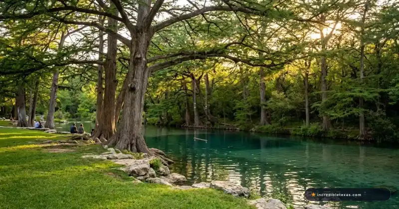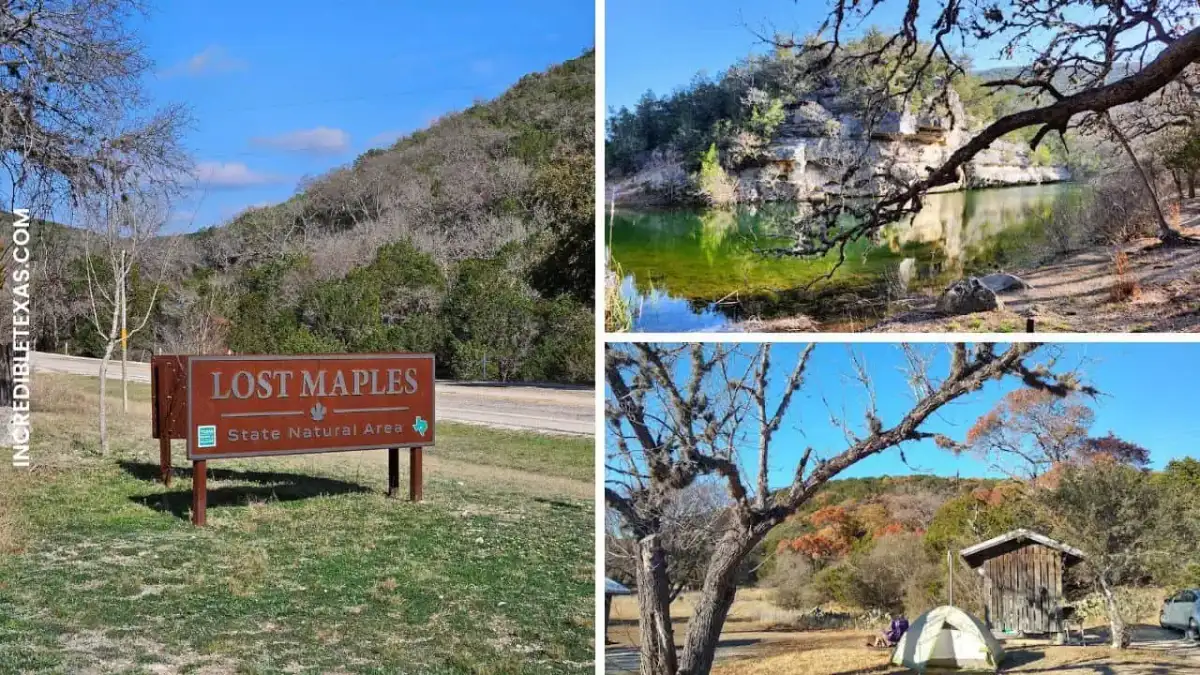
Lost Maples State Natural Area in Vanderpool protects 2,900 acres of steep limestone canyons, spring-fed streams, and an isolated population of bigtooth maples in the upper Sabinal River canyon. Standard admission is $6 per adult, while children 12 and under enter free. Because the park strictly caps day-use access at 250 passenger vehicles, travelers visiting during peak autumn foliage must secure online day-pass reservations weeks in advance. Many outdoor travelers planning a regional Hill Country circuit pair their visit with our comprehensive Garner State Park guide located 30 miles southwest.
The park is celebrated across the state for its dramatic autumn leaf displays, but lost maples state natural area tx also serves as an exceptional year-round destination for backpackers, birdwatchers, and dark-sky observers. When traveling to lost maples texas, understanding local trail ratings, water requirements, and camping regulations ensures a rewarding visit.
Lost Maples State Natural Area at a Glance
Lost Maples State Natural Area encompasses 2,900 protected acres in Bandera and Real counties, featuring over 10 miles of trails, 28 electric campsites, and 8 hike-in backcountry camping areas. The park protects relic ice-age flora along the Edwards Plateau, where cooler, sheltered canyon microclimates allow Uvalde bigtooth maples to thrive hundreds of miles away from standard Rocky Mountain forests.
The table below provides a quick logistical overview of key park facilities, trails, and camping accommodations to help map out your itinerary.
| Facility / Trail | Category | Specs / Distance | Entry / Nightly Cost | Key Highlights & Best For |
|---|---|---|---|---|
| Maple Trail | Hiking Route | 0.4 miles (one way) | Included with $6 entry | Shaded bigtooth maple grove along Sabinal River; ideal for families and casual walkers |
| East Trail | Hiking Route | 3.1-mile loop | Included with $6 entry | Monkey Rock, The Grotto, and 450-foot climb to Sabinal Valley overlook; best for day hikers |
| West Trail & West Rim | Hiking Route | 3.6-mile loop | Included with $6 entry | Mystic Canyon, steep limestone ridge switchbacks, and spring pools; best for rugged trekking |
| Developed Campsites | Campground | 28 sites with 30-amp electric & water | $20/night (+ daily entry) | Picnic tables, shade shelters, fire rings, and heated restroom showers; best for RVs and car campers |
| Primitive Campsites | Backcountry | 8 areas (1.0 to 3.2 mi hike-in) | $10/night (+ daily entry) | Backpacking tent camping, composting toilets nearby, containerized stoves only; best for wilderness solitude |
| Upper Sabinal River | Day-Use Water | Clear spring-fed creek & pond | Included with $6 entry | Shoreline fishing without a license, birdwatching, and shaded picnic areas; best for relaxation |
Getting There, Hours, and Day-Pass Reservations
Lost Maples State Natural Area is located at 37221 FM 187, Vanderpool, TX 78885, approximately 5 miles north of Vanderpool and roughly 86 miles northwest of downtown San Antonio. The park grounds open daily from 8:30 AM to 4:30 PM for office services, with gates remaining open for registered overnight campers.
Reaching this remote vanderpool texas state park involves driving along scenic, winding Hill Country corridors such as Ranch Road 337 and FM 187. Because public transport does not serve the area, private vehicle travel is required. Hikers traveling from Austin should plan for a 2.5-hour drive via US-290 West to Fredericksburg, then south through Kerrville on Highway 16 before connecting to Ranch Road 337 and FM 187.
Park Headquarters Hours and Self-Pay Station
The park headquarters and visitor center operate daily from 8:30 AM to 4:30 PM, providing physical trail maps, state park merchandise, and check-in services. Visitors arriving outside normal office hours for day use must use the self-pay kiosk located immediately adjacent to the headquarters entrance door.
The headquarters features wheelchair-accessible restrooms, outdoor interpretive exhibits describing the regional canyon geology, and the only reliable public Wi-Fi hotspot in the entire park. Cellular mobile networks drop completely several miles before reaching the park entrance, making this headquarters Wi-Fi connection vital for downloading offline GPS maps before beginning your hike.
Vehicle Capacity Limits and Online Reservations
To preserve fragile canyon ecology and prevent hazardous traffic backups along narrow two-lane FM 187, the park enforces a strict cap of 250 passenger vehicles at any given time. During peak autumn weekends in October and November, this limit is typically reached before 9:30 AM.
Visitors planning to explore lost maples state park texas should secure day passes up to 30 days in advance through the official Texas Parks and Wildlife Lost Maples portal. When the park reaches capacity, park rangers turn away non-reserved vehicles at the front gate, and roadside parking along FM 187 is strictly prohibited and ticketed by county law enforcement.
Important
Advance day-pass reservations are mandatory to guarantee entry during peak fall foliage weekends. Never drive to the park in late October or November without a confirmed barcode from TPWD, as turnaround rates for drive-up visitors exceed 80% on sunny weekends.
Best Time to Visit for Fall Foliage
The best time to see autumn foliage at Lost Maples State Natural Area is typically between the last two weeks of October and the first two weeks of November. The colorful transformation of Uvalde bigtooth maples from summer green to brilliant yellow, orange, and deep red creates the most sought-after autumn foliage display in the American Southwest.
Because bigtooth maple leaves respond to microclimates inside protected canyons, the color progression varies each year based on summer rainfall patterns and the timing of early autumn cold fronts. Plentiful late-summer rain followed by crisp, clear nights with temperatures dropping into the 40s produces the most striking leaf displays.
Foliage Timing and Weekly Color Reports
Rather than guessing when leaves will peak, travelers should monitor the official TPWD Lost Maples Fall Foliage Color Report. Park naturalists publish comprehensive updates every Wednesday from October through late November, detailing percentage turn across specific trail zones like the Maple Trail, Caney Creek, and the upper East Trail.
In addition to maples, visitors can observe the golden foliage of Texas red oaks, green ash, and Lacey oaks scattered across the limestone slopes. If an early freeze or torrential thunderstorm hits the canyon, leaves can drop rapidly, so traveling during the middle of the projected peak window offers the safest opportunity for photography.
Spring Wildflowers and Off-Peak Visits
While autumn commands the largest crowds, spring visits between March and May offer spectacular displays of Texas bluebonnets, Indian paintbrush, and mountain laurel without the intense parking pressure. Hikers pairing canyon visits with regional wildflower drives can explore our comprehensive guide to Texas bluebonnet trails for peak bloom routes across the Hill Country. Spring also brings optimal temperatures for strenuous canyon hikes before summer heat arrives.
Winter provides tranquil trail conditions and crisp Hill Country air for backpackers, while summer brings quiet swimming and wading in the spring-fed pools along the Sabinal River. Visiting on a Tuesday or Wednesday outside peak autumn allows you to enjoy the quiet solitude of the limestone canyons almost entirely to yourself.
Lost Maples State Natural Area Camping and Overnight Stays
Camping at Lost Maples State Natural Area includes 28 drive-up campsites equipped with water and 30-amp electrical hookups, alongside 8 designated primitive hike-in camping areas scattered across the backcountry. Electric sites cost $20 per night, while primitive backcountry permits cost $10 per night, in addition to standard daily entrance fees. Securing a reservation for lost maples camping requires booking early, especially during autumn weekends. Both developed RV sites and hike-in tent spots make lost maples state park camping versatile for different styles of travel.
Travelers comparing overnight Hill Country options often evaluate the park alongside our Pedernales Falls State Park guide for canyon hiking and river-oriented camping. At Lost Maples, camping is designed to maintain a low environmental impact, with quiet hours strictly observed from 10:00 PM to 6:00 AM.
Campsites with Electricity and Water Hookups
The 28 developed campsites in the main campground loop accommodate tents, camper vans, and RVs up to 35 feet in length. Each site includes a 30-amp electric hookup, potable water spigot, picnic table, elevated lantern post, and a ground fire ring with an attached cooking grill.
Restrooms with hot showers and flush toilets are situated within easy walking distance of all 28 sites. During the winter season from December through February, TPWD offers a discounted weekly camping rate of $120. Check-out time for all developed sites is 12:00 PM, and check-in begins at 2:00 PM. Up to eight people and two passenger vehicles are permitted per developed campsite.
Primitive Backcountry Hike-In Campsites
Backpackers can choose from eight primitive camping areas, labeled Zone A through Zone H, located 1.0 to 3.2 miles from the trailhead parking lots along the East and West trails. These sites offer true backcountry seclusion situated deep beneath limestone bluffs and shaded canyon woodlands.
Primitive sites do not have vehicular access, running water, or electricity. Campers must carry all necessary gear, food, sleeping systems, and hydration supplies in backpacks. Composting pit toilets are positioned near camping areas B, C, and E, but campers in other zones must practice strict Leave No Trace sanitation principles.
Lost Maples Primitive Camping Rules
Because Lost Maples is classified as a State Natural Area, resource conservation rules are significantly stricter than standard recreation parks. Consult the TPWD Lost Maples Campsite Fees page for specific seasonal closures, such as periodic resting of Area C for vegetation recovery.
- Campfire Prohibitions: Ground campfires, charcoal grills, and wood fires are strictly prohibited in all primitive backcountry camping areas. Only self-contained, containerized canister fuel stoves are permitted for cooking.
- Water Independence: No treated drinking water exists along the backcountry trail network. Surface water in creeks is seasonal and must be filtered, but backpackers should carry all drinking water (minimum one gallon per person per day).
- Waste Management: All trash, food scraps, and packaging must be packed out completely. Pack-it-in, pack-it-out enforcement is absolute.
- Occupancy Limits: A maximum of six people are permitted per primitive campsite permit.
- Pet Regulations: Dogs are permitted in primitive areas but must remain on a leash no longer than six feet at all times. Owners must bury or carry out pet waste.
Warning
Ground fires and charcoal are strictly banned in all primitive camping areas at Lost Maples. Rangers regularly patrol backcountry trails and issue citations for unauthorized campfires. Bring a canister backpacking stove for all hot meals and coffee.
Lost Maples State Natural Area Hiking Trails and Landmarks
The network of lost maples state natural area trails spans over 10 miles of rugged Hill Country terrain, ranging from level valley strolls to steep, rocky canyon ascents gaining more than 450 feet of vertical elevation. Exploring lost maples hiking takes visitors past striking natural features including Monkey Rock, The Grotto, and expansive Sabinal Valley overlooks. Carrying an official lost maples state park map is essential for navigating trail junctions in the canyon.
Bicycles are permitted only on the first mile of trail leading out from the main parking lot, after which all trails become pedestrian-only footpaths to prevent soil erosion and protect hikers on steep ascents. Reviewing the TPWD Lost Maples Trail Map and Guide before departure helps align your group's fitness with trail demands.
Maple Trail: Gentle Autumn Foliage Walk
The 0.4-mile Maple Trail is the most accessible route for visitors seeking classic autumn foliage without strenuous physical exertion. Originating near the trailhead parking area, the trail parallels the clear, spring-fed waters of the Sabinal River beneath a dense canopy of bigtooth maples, Lacey oaks, and Texas red oaks.
The trail surface consists of packed dirt and smooth gravel, making it accessible for young children, older travelers, and casual walkers wearing sturdy sneakers. Educational markers identify native tree species, and shaded stone benches along the riverbank offer quiet spots to take in the seasonal colors.
East Trail: Monkey Rock, The Grotto, and Scenic Overlook
The 3.1-mile East Trail loop is the most celebrated hiking route in lost maples natural area. Beginning at the eastern trailhead, the path winds past towering limestone cliffs where natural spring seepages support delicate maidenhair ferns at The Grotto, a naturally sheltered rock alcove that stays significantly cooler than the surrounding valley floor.
Further along the trail stands Monkey Rock, an unmistakable natural limestone outcrop carved by millennia of water erosion that strikingly resembles the head of a primate. Beyond Monkey Rock, the trail climbs a challenging 450-foot vertical ascent up a rough limestone staircase to the scenic ridge overlook. The panoramic view from the summit across the Sabinal River canyon is the most photographed vantage point in the park.
West Trail and West Rim: Rugged Backcountry Climbs
The 3.6-mile West Trail and interconnected 2.4-mile West Rim Trail offer a demanding backcountry wilderness experience. Winding through the secluded corridor of Mystic Canyon, hikers navigate rocky creek beds, dry washes, and steep switchbacks that reward careful footing.
The West Rim route climbs to the top of 2,200-foot limestone cliffs, providing sweeping 360-degree vistas across untouched Edwards Plateau canyons. Due to loose rock, exposed ledges, and steep grades, sturdy ankle-supporting hiking boots and trekking poles are strongly recommended for this section.
Tip
Download offline digital trail maps on your phone before arriving in Vanderpool. Cellular service drops to zero inside the limestone canyons, making paper trail maps or offline GPS navigation apps indispensable.
Things to Do Beyond Hiking: Birding, Fishing, and Dark Skies
Beyond hiking, Lost Maples provides exceptional opportunities for birdwatching, shoreline fishing, and night-sky observation. The park is recognized as an Important Bird Area, providing critical nesting habitat for rare avian species like the endangered golden-cheeked warbler and the black-capped vireo between April and July.
Birders can also spot year-round canyon residents, including green kingfishers along the Sabinal River, zone-tailed hawks soaring above the limestone rims, and Scott's orioles in the plateau grasslands. For travelers interested in other aquatic state park experiences in the Texas Hill Country, our Inks Lake State Park guide details lakefront paddling and granite landscape adventures.
Anglers can fish for sunfish, largemouth bass, and rainbow trout in the Sabinal River and the park's spring-fed day-use pond. Under Texas State Parks regulations, no fishing license or trout stamp is required when fishing from the bank or pier inside park boundaries. Anglers must practice respectful catch-and-release or abide by posted creel limits.
When the sun sets, Lost Maples transforms into an astronomy destination. Designated as a Bortle Class 3 dark-sky site, the park experiences virtually zero artificial light pollution, allowing stargazers to observe the Milky Way arching clearly across the canyon bluffs on moonless nights. Visitors taking lost maples state natural area photos will also find dramatic night-sky composition opportunities against the limestone cliff silhouettes.
Nearby Hill Country Stops and Itinerary Planning
Because Lost Maples sits in an isolated rural pocket of the Hill Country, building a multi-day itinerary around the park enhances your travel experience. The tiny hamlet of Vanderpool, located five miles south, features local apple orchards and rustic cabins, but offers limited dining and fuel options. Travelers researching places to stay near lost maples state park can explore cabin rentals and bed-and-breakfasts in nearby Utopia, Leakey, and Vanderpool.
For sit-down dining and supplies, Utopia sits 15 miles south, while Leakey is located 20 miles west along the stunning scenic curves of Ranch Road 337. Bandera, celebrated as the Cowboy Capital of the World, lies 40 miles east, offering historic honky-tonks, dude ranches, and traditional Texas barbecue. Travelers seeking another iconic natural area in central Texas often combine this trip with our guide to Enchanted Rock State Natural Area for pink granite dome climbing.
Lost Maples State Natural Area Frequently Asked Questions
Where is Lost Maples State Natural Area located?
Lost Maples State Natural Area is located at 37221 FM 187 in Vanderpool, Texas 78885, roughly five miles north of town along the Sabinal River. The park sits approximately 86 miles northwest of San Antonio and 140 miles west of Austin in the Texas Hill Country.
The drive takes roughly two hours from downtown San Antonio and about two and a half hours from Austin along scenic Hill Country highways.
How much does it cost to enter Lost Maples State Natural Area?
Day-use admission at Lost Maples costs $6 per day for adults and visitors ages 13 and older. Children 12 and under enter free of charge. Texas State Parks Pass holders receive free entry for themselves and all passengers in their non-commercial vehicle.
Campsite fees are charged separately from daily entrance fees, with electric sites costing $20 per night and primitive hike-in sites costing $10 per night.
When is the best time to see fall colors at Lost Maples State Natural Area?
Peak fall color at Lost Maples typically unfolds from late October through the middle of November. The exact timing shifts each autumn depending on summer moisture and rainfall, followed by early season cold snaps that shock the bigtooth maples into bright, colorful foliage. For broader regional context on statewide cold fronts, consult our guide on when does fall start in Texas.
Visitors should check the Texas Parks and Wildlife Department weekly foliage report online before traveling, as colors can peak rapidly and leaves can drop after heavy autumn rains.
What are the Lost Maples primitive camping rules?
Lost Maples primitive camping rules require using containerized canister fuel stoves only, strictly banning wood or charcoal campfires. Campers must hike in all drinking water, carry out all trash, leash pets, and camp only in designated zones A through H with a six-person limit.
Composting toilets are available at several zones, but campers should prepare for rugged backpacking conditions with no electricity or potable water.
Are dogs allowed at Lost Maples State Natural Area?
Dogs are welcome on all hiking trails and at campsites within Lost Maples State Natural Area, provided they remain on a secure leash no longer than six feet at all times. Pets are prohibited inside state park buildings, and owners must collect and pack out pet waste.
Hikers bringing canine companions should carry ample water for their pets, especially on steep, rocky trails where heat and sharp limestone can strain paws.
Is cell service available inside the park?
Cell service is not available inside the canyon trails or primitive campgrounds at Lost Maples State Natural Area due to steep limestone bluffs. Free public Wi-Fi access is available around the park headquarters building, where visitors can download offline trail maps before hiking.
It is strongly recommended to download driving directions and digital maps before leaving larger towns like Kerrville or Bandera.
Which trails are best for a short visit?
The 0.4-mile Maple Trail and 1.0-mile East-West Trail are the best routes for a short visit to Lost Maples. Both feature flat terrain following the Sabinal River corridor, providing excellent maple viewing and shaded resting areas without climbing steep canyon walls.
Visitors with two to three hours can also hike the initial section of the East Trail to view Monkey Rock and The Grotto before returning to the main parking area.
What should visitors do if the park reaches capacity?
When Lost Maples reaches its strict 250-vehicle capacity limit, park rangers close the FM 187 gate to all drive-up traffic without reservations. Visitors should always reserve guaranteed day passes online via Texas Parks and Wildlife up to 30 days ahead of their travel date.
If you arrive without a reservation and find the park full, consider exploring nearby outdoor alternatives such as our recommended Frio River Texas guide for swimming and river access in Concan, or head south to Garner State Park.