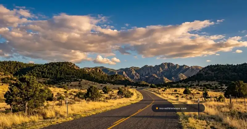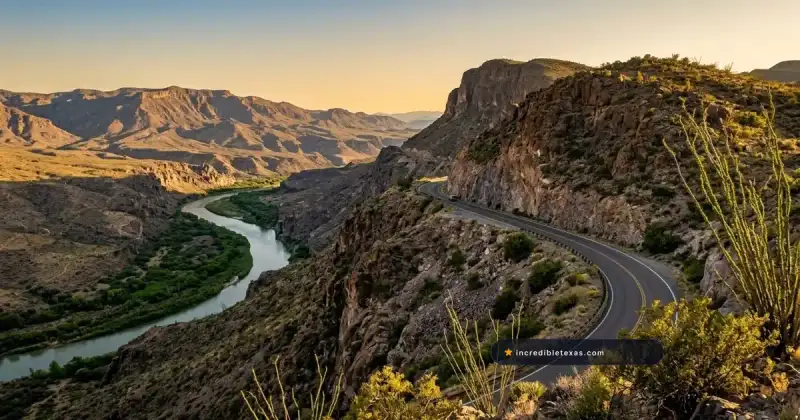
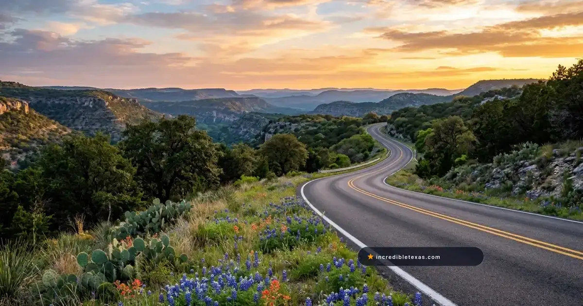
Texas offers some of the most dramatic driving landscapes in North America, spanning more than 313,000 miles of public highways that cut across rugged desert canyons, limestone ridges, alpine sky islands, and dense pine forests. From the sheer cliffs of the Rio Grande to the switchbacks of the Western Hill Country, navigating these remote corridors reveals a side of the Lone Star State far removed from crowded interstate freeways.
Note
Cluster Navigation: This master cornerstone guide anchors our complete Texas scenic byway series, providing a ranked overview of each marquee route and linking directly to our dedicated field guides for every highway corridor.
Key takeaways
- Texas contains more than 313,000 miles of public roadways spanning Chihuahuan Desert canyons, limestone Hill Country ridges, alpine sky islands, and dense pine forests.
- The top-ranked route is FM 170 (The River Road), following the Rio Grande across Big Bend Ranch State Park with 15 percent roller-coaster grades and volcanic canyon drop-offs.
- Mountain routes such as the Davis Mountains Scenic Loop reach elevations above 6,700 feet, requiring downshifting and vigilance for free-range cattle on unfenced pastures.
- Remote West Texas routes like Pinto Canyon Road and the Lonesome Highway require carrying surplus drinking water, full fuel reserves, and offline maps due to total cellular dead zones.
Overview of Texas Scenic Byways and Highway Driving
Texas scenic drives span four distinct geographic regions: the arid desert canyons of the Trans-Pecos, the rolling limestone hills of Central Texas, the high-elevation sky islands of the Davis Mountains, and the hardwood canopies of the East Texas Pineywoods. Each corridor offers paved access to dramatic geological landmarks and state parks.
Exploring the state by car requires understanding the vast distances between regions. A driver leaving the piney bayous must drive over 800 miles to reach the western mountain peaks, crossing several distinct ecological zones along the journey.
Connecting these distant geographic hubs into a cohesive multi-day itinerary is made simple with our curated guide to the best places to visit in Texas, which details essential state parks, cultural attractions, and regional gateways.
Geographic Corridors and Geological Diversity
The geological variety across Texas highway corridors creates entirely different driving environments within a single day of travel. In Central Texas, the Balcones Escarpment forms a rugged transition zone where underground aquifers and spring-fed creeks have carved deeply incised limestone canyons, creating the twisting ascents found along the Devils Backbone and the Twisted Sisters.
Further west in the Trans-Pecos, ancient volcanic eruptions and tectonic uplift produced isolated mountain ranges known as sky islands. These formations rise thousands of feet above the surrounding Chihuahuan Desert floor, providing cool alpine refuges along State Highway 118 and dramatic desert escarpments along State Highway 54.
According to official safety reports published by the Texas Department of Transportation Highway Safety Guidelines, rural highway driving presents unique hazards. Motorists must stay vigilant for sudden livestock encounters on unfenced open ranges, long distances between emergency response hubs, and dramatic pavement temperature fluctuations that accelerate tire wear during hot summer afternoons.
| Texas Driving Region | Signature Highway Corridors | Average Elevation | Peak Travel Season | Primary Road Hazard |
|---|---|---|---|---|
| Big Bend / Trans-Pecos | FM 170, TX-54, FM 2810 | 2,200 to 4,800 feet | October to April | Extreme heat, flash floods, no cell service |
| Davis Mountains | TX-118, TX-166, Spur 78 | 4,900 to 6,791 feet | March to May, Sept to Nov | Winter black ice, steep grades, free-range cattle |
| Texas Hill Country | RR 335, RR 336, RR 337, RM 32 | 1,100 to 2,400 feet | March to May, Oct to Dec | Blind curves, low water crossings, heavy deer activity |
| East Texas Pineywoods | TX-21, TX-147, FM 705 | 200 to 600 feet | October to November | Logging truck traffic, sudden rain squalls, wildlife |
Seasonal Windows and Weather Considerations
Selecting the proper season makes the difference between an unforgettable road trip and a grueling endurance test. Across the Trans-Pecos and Big Bend regions, summer temperatures frequently exceed 105 degrees Fahrenheit in canyon riverbeds, turning highway breakdowns into dangerous medical emergencies.
Mid-autumn through early spring provides crisp mornings, mild daytime highs in the upper 60s, and crystal-clear atmospheric transparency ideal for photography.
In the Texas Hill Country, spring brings blooming carpets of bluebonnets and wildflowers along roadside rights-of-way, though popular corridors like Ranch Road 337 see heavy weekend motorcycle congestion.
For the East Texas Pineywoods, late October through mid-November is the signature travel window, when sweetgum, sumac, and red maple canopies provide the richest fall foliage colors anywhere in the state.
1. FM 170 The River Road: Big Bend Canyon Byway
Farm to Market Road 170, known as The River Road, stretches 50 miles between Terlingua and Presidio along the Rio Grande. Featuring 15 percent roller-coaster highway grades, the Big Hill overlook, and volcanic cliffs inside Big Bend Ranch State Park, it is widely considered the most dramatic drive in Texas.
Tracing the southern border of the state, FM 170 clings tightly to the contours of the Rio Grande as the river carves through ancient volcanic calderas, towering basalt canyon walls, and rugged desert washes.
For step-by-step route milestones, scenic overlooks, and hiking trailheads along this route, explore our complete guide to driving FM 170 The River Road.
Route Profile, Big Hill, and Rio Grande Views
The signature engineering feat of FM 170 is the ascent over the Big Hill, located roughly midway between Lajitas and Redford. The highway climbs aggressively out of the river corridor along a 15 percent grade, curving past sheer rock cuts before reaching a scenic crest that sits more than 300 feet directly above the muddy loops of the Rio Grande.
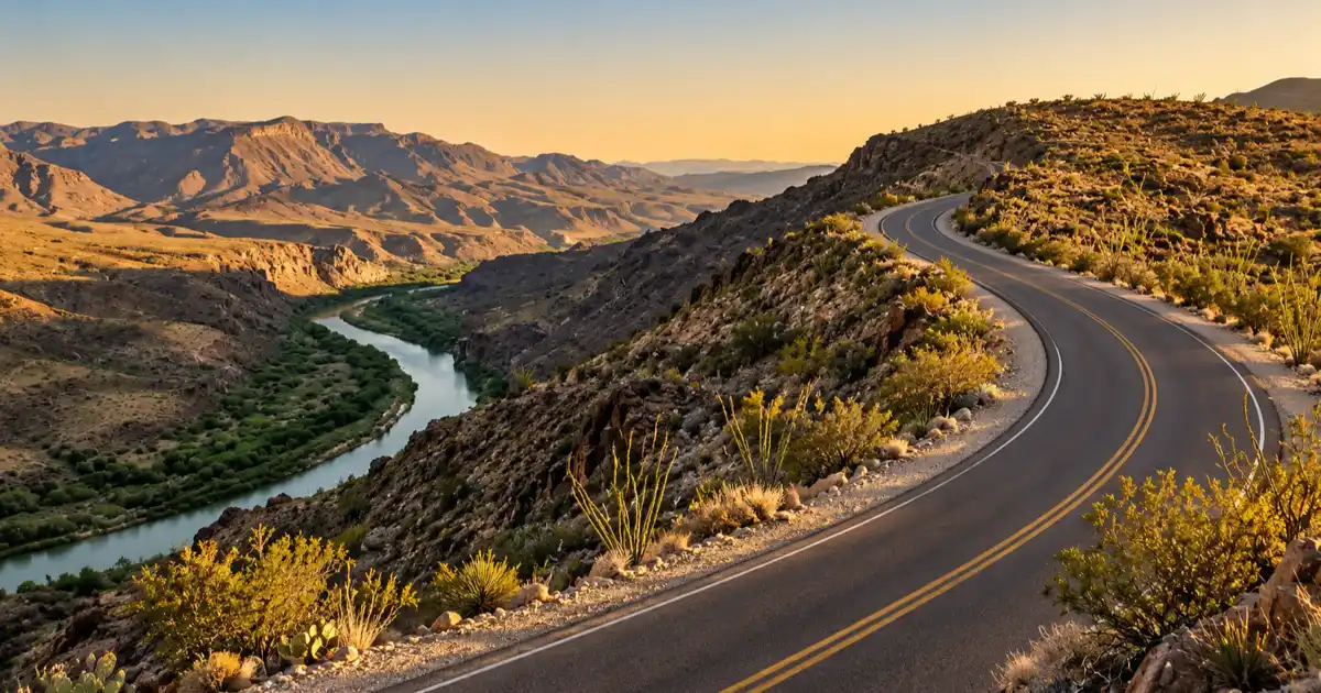
From the paved pullout at the summit of the Big Hill, drivers look down into the river canyon where dense green stands of river cane outline the United States and Mexico border. Across the water, the sheer cliffs of the Sierra Rica in Chihuahua, Mexico, rise dramatically against the desert skyline.
Descending the western flank of the Big Hill requires steady braking and low-gear engine control. The roadway drops rapidly into narrow arroyo canyons that remain prone to gravel runoff after storms.
According to trail and access information maintained by Texas Parks and Wildlife Big Bend Ranch State Park, the FM 170 corridor serves as the sole paved artery accessing signature backcountry trailheads. Locations like Closed Canyon, the Hoodoos Recreation Area, and the Contrabando Movie Set require state park day-use permits for recreational exploration outside of the highway right-of-way.
| River Road Driving Metric | Official Specification | Traveler Planning Detail |
|---|---|---|
| Corridor Length | 50.2 miles | Paved two-lane highway between Terlingua and Presidio |
| Maximum Road Grade | 15 percent | Located on the eastern and western approaches to the Big Hill |
| Typical Driving Time | 1.5 to 2.5 hours | Allow extra time for trailhead stops and photography pullouts |
| Fuel Availability | Terlingua, Study Butte, Presidio | Zero fuel services along the 45-mile stretch through the park |
| Cellular Coverage | Unreliable to none | Cellular service drops immediately after exiting Lajitas westbound |
Driving Logistics, Steep Grades, and Fuel Stops
Driving FM 170 requires mechanical respect for mountain desert terrain. The roller-coaster dips and climbs test cooling systems and brakes, especially in overloaded vehicles or recreational trailers. Drivers towing travel trailers longer than 24 feet should exercise extreme caution, as the steep approach angles on arroyo dips can cause trailer hitches to drag on the asphalt.
Fuel management is critical along this isolated corridor. Always verify fuel levels before leaving Study Butte or Terlingua when traveling westbound, as no services exist until reaching Presidio, 50 miles away.
In the event of heavy summer thunderstorms, dry desert arroyos like Madera Canyon and Panther Bluff wash can flash-flood across the pavement within minutes. These flash flows deposit thick layers of silt and loose volcanic rock that can trap low-clearance vehicles.
2. The Twisted Sisters: Hill Country Canyon Curves
The Twisted Sisters comprises Ranch Roads 335, 336, and 337 in the Western Texas Hill Country, forming a 100-mile paved loop through Medina, Real, and Edwards counties. Renowned for more than 200 off-camber curves, steep limestone canyon bluffs, and crystal spring-fed rivers, it attracts motorcyclists and sports car drivers statewide.
This challenging circuit loops through the most rugged portion of the Edwards Plateau, carving along ridge crests high above the headwaters of the Frio, Nueces, and Llano rivers.
Before planning your weekend journey through these technical switchbacks, consult our detailed Twisted Sisters road trip guide for comprehensive curve-by-curve warnings and town stopovers.
The 100-Mile Triangle and Ridge Crests
The Twisted Sisters triangle connects the small rural communities of Medina, Leakey, Camp Wood, and Rocksprings. Ranch Road 337 between Medina and Leakey serves as the scenic centerpiece of the loop, climbing out of narrow cypress-lined river bottoms onto soaring limestone ridges that deliver 20-mile vistas across the surrounding canyonlands.
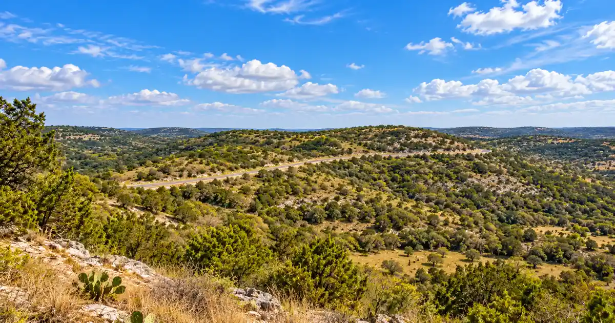
As the road crests these high plateaus, drivers encounter multiple scenic pullouts that overlook deep limestone gorges. The transition from lush river valleys shaded by massive bald cypress trees to arid mountain cedar caprocks occurs within minutes, offering dramatic changes in scenery at every rise.
Ranch Road 335 follows the upper canyon of the Nueces River, featuring tight curves that trace the base of towering chalk bluffs. Here, clear spring water seeps directly from the rock strata beside the pavement.
| Twisted Sisters Segment | Highway Designation | Mileage | Notable Route Feature |
|---|---|---|---|
| Eastern Arm | Ranch Road 337 (Medina to Leakey) | 29.5 miles | Dramatic ridge crests, steep ascents, 20-mile valley vistas |
| Western Arm | Ranch Road 337 (Leakey to Camp Wood) | 21.0 miles | Frio to Nueces divide, roller-coaster dips, tight switchbacks |
| Northwestern Leg | Ranch Road 335 (Camp Wood to TX-41) | 29.0 miles | Nueces River headwaters, limestone canyon walls, cattle guards |
| Northeastern Leg | Ranch Road 336 (TX-41 to Leakey) | 26.5 miles | High plateau ranching pastures, off-camber curves, heavy deer herds |
Off-Camber Curves, Free-Range Cattle, and Pavement Etiquette
The technical difficulty of the Twisted Sisters demands complete driver focus. Many curves are off-camber, meaning the surface slopes away from the direction of the turn, which can pull vehicles toward the outer edge if taken at excessive speeds.
In addition, loose gravel washed down from ranch driveways frequently litters the apex of tight turns following summer rainstorms.
Wildlife represents another constant factor. Edwards and Real counties harbor dense white-tailed deer and free-ranging exotic axis deer populations. These animals routinely bound across blind turns at dawn and dusk.
Portions of Ranch Road 335 and Ranch Road 336 cross unfenced ranchlands where cattle wander onto the warm asphalt, requiring strict adherence to posted advisory speeds.
3. Davis Mountains Scenic Loop: Highest Highway in Texas
The Davis Mountains Scenic Loop forms a 75-mile alpine circuit along State Highway 118 and Highway 166 west of Fort Davis. Climbing to 6,791 feet at Mount Locke, this roadway marks the highest public paved highway in Texas, cutting through granite palisades, pinyon-oak woodlands, and remote cattle ranches.
Ascending into the heart of the Trans-Pecos sky islands, this alpine loop provides a striking contrast to the surrounding desert plains, offering cooler temperatures, pine-covered slopes, and panoramic viewpoints across volcanic caldera rims.
To plan your stops at historic forts, state parks, and star parties, read our in-depth Davis Mountains scenic loop guide.
Skyline Drives, McDonald Observatory, and High Elevations
Leaving Fort Davis along State Highway 118, the highway winds northwest through Limpia Canyon, flanked by dramatic columnar basalt formations and towering cottonwood groves.
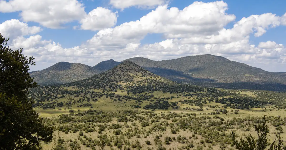
The road ascends steadily past the entrance to Davis Mountains State Park, where a scenic spur leads up to Skyline Drive. This elevated ridge provides panoramic views of the historic frontier fort below and the high mountain peaks to the west.
Continuing up Highway 118, the route climbs into Mount Locke, the site of the world-renowned McDonald Observatory. A short spur road leads directly to the observatory summit at 6,791 feet, where visitors can view giant research telescopes and gaze out across dozens of mountain summits stretching toward Mexico.
West of the observatory, the loop transitions onto State Highway 166, circling the jagged volcanic mass of Mount Livermore, the second-highest peak in Texas at 8,378 feet.
According to facility and trail logs from Texas Parks and Wildlife Davis Mountains State Park, the high-elevation terrain shelters sensitive pinyon-juniper-oak woodlands and black bear populations. Drivers along Highway 118 should remain alert for wildlife moving across the roadway between protected state park lands and private mountain ranches.
| Davis Mountains Metric | Verified Specification | Travel Planning Consideration |
|---|---|---|
| Loop Distance | 75.0 miles | Paved two-lane loop starting and ending in Fort Davis |
| Peak Highway Elevation | 6,791 feet | Mount Locke summit spur at McDonald Observatory |
| Average Route Elevation | 5,200 feet | Pinyon pine and alligator juniper alpine climate zone |
| Key Anchor Stops | Fort Davis National Historic Site, McDonald Observatory | Observatory star parties require reservations weeks in advance |
| Fuel Services | Fort Davis only | Zero fuel stations along the entire 70-mile mountain loop |
Weather Shifts, Winter Black Ice, and Descending Grades
Operating at elevations between 5,000 and 6,700 feet means weather conditions can change rapidly. Summer afternoons often generate sudden alpine thunderstorms with heavy hail, dropping temperatures by 30 degrees in minutes.
In winter and early spring, cold Pacific fronts can coat high-elevation passes with invisible black ice, particularly along shaded north-facing mountain cuts near Madera Canyon Rest Area.
The southern leg of the loop along Highway 166 crosses wide-open high-plains grasslands where crosswinds can buffet high-profile vehicles.
Because Fort Davis is the only town along the entire loop with active services, travelers should start the circuit with a full tank of fuel, plenty of drinking water, and warm layers regardless of the season.
4. The Devils Backbone: Central Texas Limestone Ridge
The Devils Backbone follows Ranch to Market Road 32 along a 24-mile limestone ridge between Wimberley and Blanco in the Central Texas Hill Country. Overlooking the Blanco River and Canyon Lake basins, this scenic byway delivers sweeping panoramic vistas, historic stone roadhouses, and classic rolling oak savannas.
Perched atop a narrow geologic fault ridge, RM 32 provides one of the easiest and most accessible scenic getaways for travelers based in Austin or San Antonio.
For driving tips, ghost lore, and scenic overlook coordinates, read our comprehensive guide to the Devils Backbone scenic drive.
Limestone Vistas, Panoramic Overlooks, and Roadhouses
Ranch to Market Road 32 runs east to west across the southern spine of Hays and Comal counties. As the roadway climbs onto the crest of the Devils Backbone, the terrain drops away on both sides. This ridge delivers uninterrupted views extending across the Blanco River valley to the north and the rolling hills feeding Canyon Lake to the south.
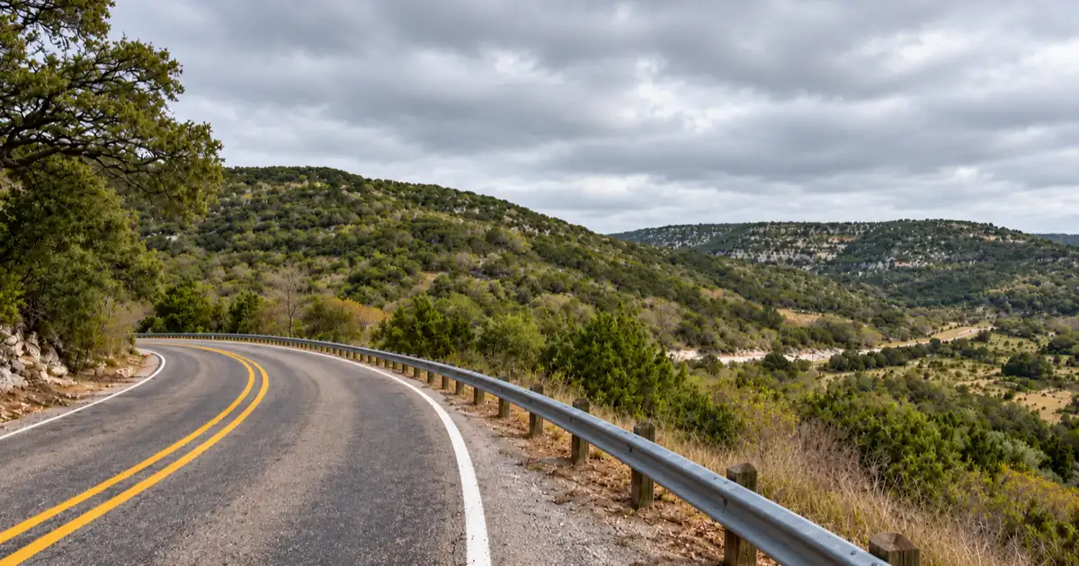
The focal point for travelers is the Devils Backbone Scenic Overlook, located near the intersection of RM 32 and FM 12. This paved roadside rest area sits on an exposed limestone outcropping, providing a shaded picnic pavilion and informational markers detailing the geological faulting that created the ridge.
Along the route, historic establishments like the Devils Backbone Tavern, operating in a stone structure dating to the 1930s, provide authentic local character and roadside hospitality.
| Devils Backbone Drive Metric | Route Detail | Local Planning Information |
|---|---|---|
| Highway Mileage | 24.0 miles | Ranch to Market Road 32 between Wimberley and Blanco |
| Driving Duration | 35 to 50 minutes | Short scenic connector easily combined with Blanco or Wimberley day trips |
| Elevation Range | 1,050 to 1,380 feet | Elevated limestone ridge overlooking surrounding river valleys |
| Pavement Quality | Smooth paved asphalt | Excellent two-lane surface with gentle vertical undulations |
| Scenic Overlook Access | Paved roadside park | Free public parking pullout with picnic tables and panoramic views |
Traffic Pacing, Narrow Shoulders, and Pullout Etiquette
While RM 32 is an easy drive without extreme mountain switchbacks, it carries a 60 mph speed limit and serves as an active commuter corridor between San Marcos, Canyon Lake, and Blanco.
Local delivery trucks and commuter vehicles move quickly along the ridge, meaning leisure travelers should avoid creeping along the roadway at low speeds.
Drivers wishing to photograph the landscape or take in the views should always utilize designated paved pullouts rather than stopping on the narrow shoulders.
The road features several blind crests where approaching traffic cannot see stationary vehicles parked half-on the asphalt. During weekend mornings, bicyclists frequently ride the rolling hills, requiring motorists to give plenty of clearance when passing along narrow curves.
5. Texas Pineywoods Autumn Loop: Forest Foliage Byways
The Texas Pineywoods Autumn Loop traverses 145 miles across State Highway 21 and Highway 147 through Angelina and Sabine national forests in Deep East Texas. Peak autumn transforms the towering loblolly pine canopies with hardwood colors of sweetgum, red maple, and southern red oak surrounding reservoir lakes.
Far removed from the arid canyons of West Texas, this lush forest route envelops travelers in a canopy of towering pines, Spanish moss, and tranquil lakeside coves.
For the finest seasonal timing, detour loops, and park campgrounds, see our Texas Pineywoods fall foliage driving guide.
El Camino Real, Historic Towns, and Reservoir Crossings
State Highway 21 traces the ancient corridor of El Camino Real de los Tejas, a Spanish colonial thoroughfare that connected Mexico City with early missions in East Texas and Louisiana.
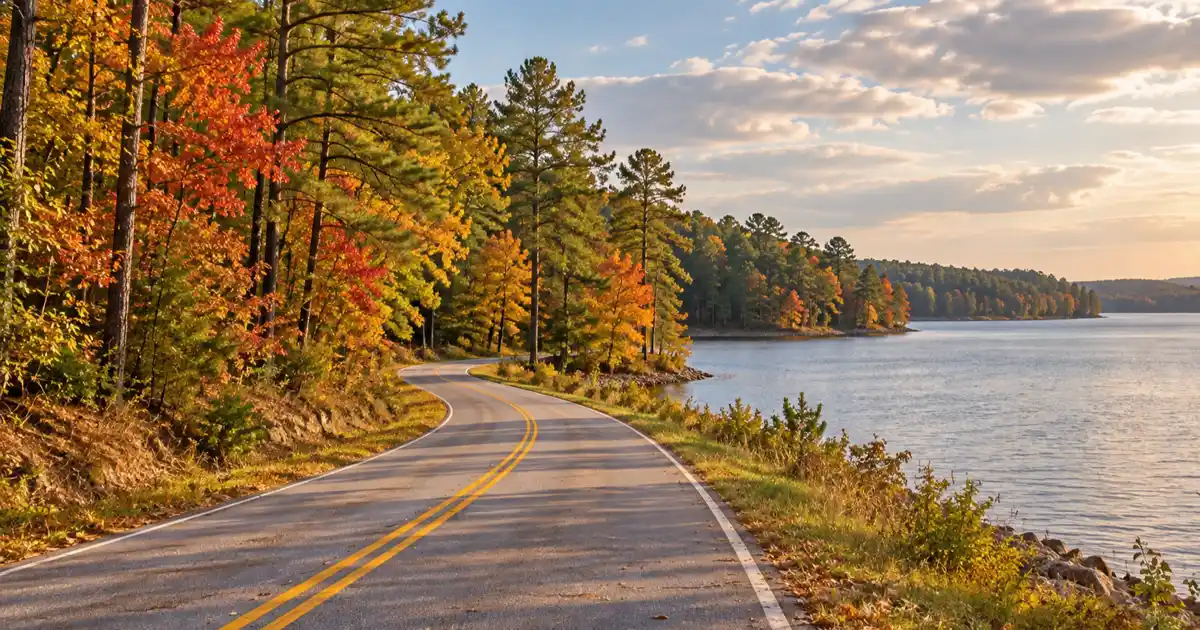
Driving this route east from Crockett through Alto and Nacogdoches surrounds travelers with rich history, passing Caddo Mounds State Historic Site and some of the oldest European settlements in Texas.
East of Nacogdoches, the route links with State Highway 147, descending south through the heart of Angelina National Forest. The highway crosses vast causeways spanning the open waters of Sam Rayburn Reservoir, where expansive lake vistas open up on either side of the pavement.
Thick stands of loblolly and shortleaf pine crowd the roadside rights-of-way, punctuated by pockets of hardwood bottomlands where tupelo and bald cypress trees grow along slow-moving bayou creeks.
| Pineywoods Autumn Metric | Route Specification | Traveler Planning Detail |
|---|---|---|
| Complete Circuit Distance | 145.0 miles | Loops across TX-21, TX-147, and TX-103 through Angelina National Forest |
| Peak Foliage Window | Late October to mid-November | Hardwood leaves turn following the first sustained autumn cold fronts |
| Historic Highway Status | El Camino Real National Historic Trail | Historic markers, Spanish mission sites, and Caddo Indian mounds |
| Waterway Crossings | Sam Rayburn Reservoir, Neches River | Expansive bridge causeways with scenic public boat launch pullouts |
| Forest Access | Angelina and Sabine National Forests | Hundreds of miles of forest service roads, hiking trails, and recreation areas |
Peak Autumn Timing, Sweetgum Displays, and Forest Stops
Unlike northern states where maple trees dominate the foliage season, East Texas relies on a distinct mix of hardwood species for its autumn colors.
The show begins in late October as sweetgum trees turn brilliant shades of yellow, orange, and deep purple, while poison ivy vines climb high into pine trunks in streaks of scarlet. By the second week of November, southern red oaks and blackgums reach peak color.
Travelers should plan stops at Boykin Springs Recreation Area inside Angelina National Forest, where a scenic spring-fed creek flows past historic Civilian Conservation Corps stone structures.
Because this region supports an active timber industry, drivers must remain vigilant for loaded logging trucks entering the highway from unpaved forest service roads, especially around blind forest curves during early morning hours.
6. The Lonesome Highway: West Texas High Plains Approach
The Lonesome Highway along State Highway 54 runs 54 miles from Van Horn north to the base of El Capitan in Guadalupe Mountains National Park. Characterized by straight desert asphalt cutting across barren salt basin flats toward dramatic 3,000-foot limestone cliffs, it stands as an iconic Texas road trip visual corridor.
This desolate stretch of two-lane highway captures the vast, solitary scale of the Chihuahuan Desert, offering travelers a visual journey across wide-open desert grasslands toward the highest mountain range in Texas.
For telephoto lens suggestions, sunrise pullouts, and travel logistics, refer to our photographic guide to the Lonesome Highway.
Highway 54 Desert Flats and El Capitan Horizons
Departing Van Horn, State Highway 54 heads due north across the Salt Basin, a flat, arid graben flanked by the Sierra Diablo mountains to the west and the Delaware Mountains to the east.
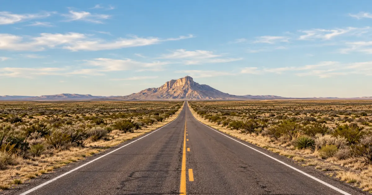
The road stretches straight ahead for dozens of miles across open Chihuahuan Desert flats populated by creosote bush, soaptree yucca, and sparse desert grasses.
As drivers travel northward, the massive limestone wedge of El Capitan gradually rises above the horizon. What begins as a pale gray silhouette grows into an imposing 8,085-foot mountain wall that dominates the windshield.
The sheer contrast between the flat desert highway and the vertical limestone ramparts of the Guadalupe escarpment creates one of the most photographed road trip vistas in the American Southwest.
Official approach corridors documented by the National Park Service Guadalupe Mountains Directions designate Highway 54 as the primary southern access corridor connecting Interstate 10 with the Pine Springs Visitor Center, marking it as a critical route for travelers seeking to hike Guadalupe Peak or explore McKittrick Canyon.
| Highway 54 Driving Metric | Official Specification | Road Trip Planning Detail |
|---|---|---|
| Route Distance | 54.0 miles | Two-lane highway connecting Van Horn to US-62/180 |
| Highway Speed Limit | 75 mph | Wide open desert speeds with long sightlines and minimal intersections |
| Visual Centerpiece | El Capitan (8,085 feet) | Dominates the northern horizon for more than 30 consecutive driving miles |
| Service Outposts | None between endpoints | Zero gas stations, stores, or water points along the entire 54-mile corridor |
| Cellular Signal Strength | Weak to non-existent | Strong dead zones across the center of the Salt Basin |
Crosswinds, Remote Mileages, and Van Horn Logistics
The flat, open terrain of the Salt Basin leaves Highway 54 completely exposed to fierce desert winds that sweep down from the Guadalupe Mountains.
Wind gusts frequently exceed 50 mph during spring months, creating severe crosswind hazards for high-profile RVs, camper vans, and commercial trucks. Drivers should keep both hands firmly on the steering wheel and reduce speeds when high wind warnings are posted.
Because Highway 54 has no intermediate towns, gas stations, or emergency call boxes, travelers should completely refuel their vehicles in Van Horn before setting out.
Always carry at least two gallons of emergency drinking water per passenger, ensure spare tires are properly inflated, and download digital navigation maps before leaving town.
7. Pinto Canyon Road: Remote Overlanding Descent
Pinto Canyon Road follows Farm to Market Road 2810 south from Marfa for 52 miles, descending through rugged Chinati Mountain volcanic rimrock toward the Rio Grande valley. Transitioning from smooth blacktop into unpaved switchbacks with 14 percent gravel grades, it offers an authentic West Texas backroad overlanding adventure.
This rugged track represents the untamed frontier of Texas backroad travel, linking the high-desert art colony of Marfa with the remote borderlands of the Rio Grande.
For vehicle clearance recommendations, gravel tire pressures, and ranch gate etiquette, see our complete Pinto Canyon Road overlanding guide.
Marfa High Plains to Chinati Mountain Volcanic Escarpment
The first 32 miles of FM 2810 south of Marfa are smoothly paved, crossing wide, rolling desert grasslands where historic cattle ranches graze under wide open skies.
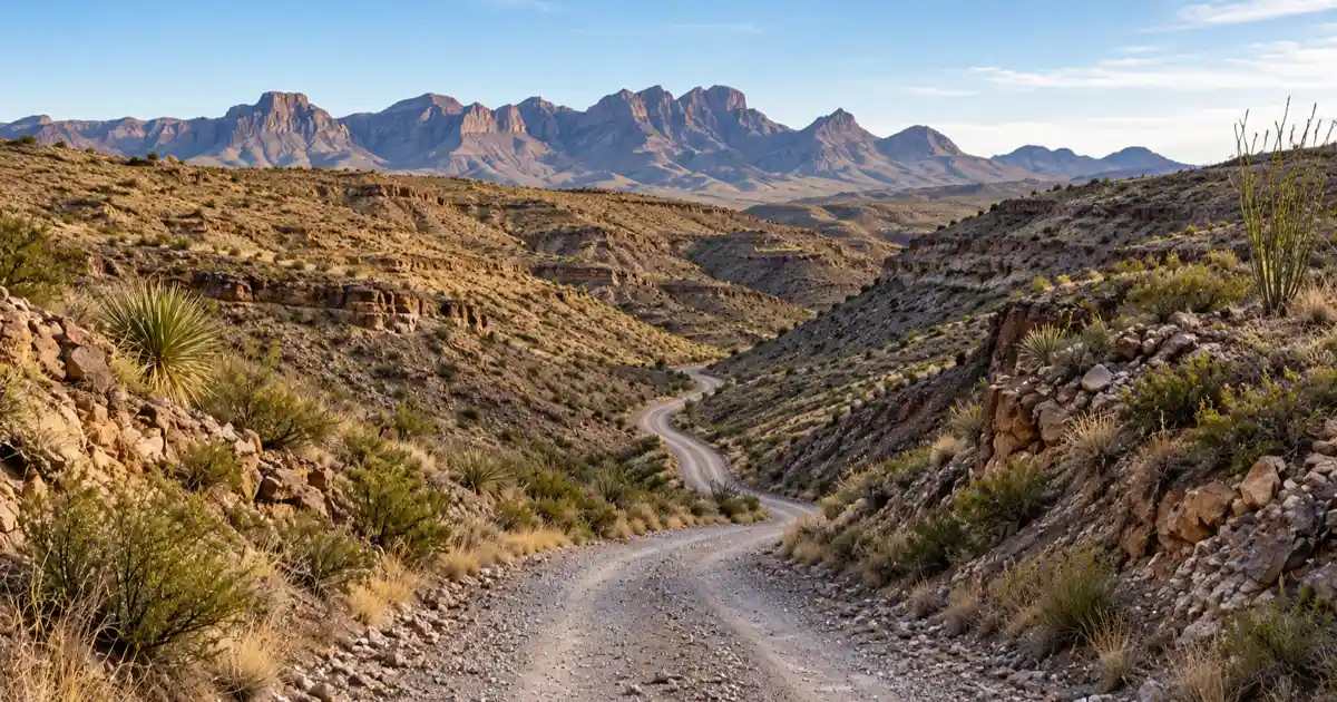
The road offers unobstructed views of the Marfa plateau and the distant Davis Mountains to the north before reaching the boundary of the rugged Chinati Mountains.
At mile marker 32, the pavement abruptly ends, and the route transforms into an unpaved county-maintained dirt road. Almost immediately, the road begins its dramatic descent into Pinto Canyon, dropping more than 2,000 vertical feet through a series of narrow gravel switchbacks carved into sheer volcanic canyon cliffs.
The landscape shifts rapidly from high plains into a maze of multicolored rhyolite cliffs, desert ocotillo, and towering canyon spires.
Historical archives maintained in the Texas State Historical Association Highway Development History document how remote farm-to-market and ranch-to-market roadways were engineered during the mid-20th century to connect isolated rural ranches to county seats, explaining why corridors like FM 2810 maintain paved alignments across flat valleys before terminating into unpaved mountain access roads.
| Pinto Canyon Driving Metric | Verified Detail | Overlanding Planning Note |
|---|---|---|
| Total Road Length | 52.0 miles | 32 miles paved, followed by 20 miles of rugged unpaved gravel |
| Road Surface Transition | Pavement ends at mile 32 | Transition requires reducing speed and engaging high-clearance gear |
| Maximum Descent Grade | 14 percent | Steep gravel switchbacks descending into Pinto Canyon wash |
| Recommended Vehicle | High-clearance truck or SUV | Not recommended for low-slung passenger sedans or rental cars |
| Emergency Services | Non-existent | Remote border corridor with zero cellular coverage and rare traffic |
High-Clearance Requirements, Flash Floods, and Border Isolation
The unpaved portion of Pinto Canyon Road requires thoughtful vehicle preparation. While four-wheel drive is not always mandatory during dry conditions, high ground clearance is essential to navigate embedded volcanic boulders, deep washboard ruts, and gravel washes without puncturing oil pans or damaging vehicle undercarriages.
Passenger cars with low profiles risk bottoming out on rocky drainage dips.
During the late summer monsoon season from July through September, heavy cloudbursts over the Chinati Mountains can send flash floods tearing through the canyon floor.
Pinto Canyon Road crosses the wash multiple times without bridges, creating impassable torrents of mud and water that can strand travelers for hours. Drivers should never attempt to cross moving water in desert washes and must pack sufficient emergency food and water for unexpected delays.
Essential Planning, Vehicle Preparation, and Road Safety
Safely navigating remote Texas scenic highways requires proactive vehicle preparation, offline mapping, and hydration planning. West Texas corridors routinely lack cellular coverage and feature fuel gaps exceeding 70 miles, while Hill Country canyon byways demand lowered speeds around blind curves and unexpected livestock crossings.
Driving across rural Texas requires a higher level of self-sufficiency than traveling along major interstate corridors.
Whether tackling the alpine curves of the Davis Mountains or the desolate salt flats of Highway 54, taking simple preventative measures ensures a smooth and memorable road trip across the state.
Fuel Gaps and Rural Gas Station Strategy
Fuel management is the most common challenge faced by travelers exploring rural Texas highways. Corridors like FM 170 between Terlingua and Presidio, the Davis Mountains Loop west of Fort Davis, and Highway 54 north of Van Horn have zero fuel services for 50 to 75 consecutive miles.
Furthermore, smaller ranch towns may only have a single two-pump station that operates on automated credit card readers. These pumps can go offline during rural power blips or satellite connection drops.
A reliable rule of thumb for Texas road trippers is to fill up whenever the fuel gauge reaches half a tank. Top off your vehicle before leaving gateway hubs such as Alpine, Fort Davis, Marfa, Kerrville, or Crockett.
If you plan to explore unpaved side roads like Pinto Canyon or remote trails inside Big Bend Ranch State Park, carrying a certified five-gallon fuel container in your truck bed provides valuable peace of mind.
Vehicle Demands: Brakes, Tires, and Cooling Systems
Texas scenic byways place intense mechanical stress on vehicles. High-elevation mountain climbs along Highway 118 and the steep 15 percent grades of FM 170 demand properly functioning cooling systems, especially when outside ambient temperatures top 95 degrees.
Ensure engine coolant is fresh, fan belts are tight, and transmission fluid levels are full before attempting mountain passes.
Brakes are equally vital. Descending steep canyon grades requires shifting the transmission into a lower gear to utilize engine braking rather than riding the brake pedal continuously, which causes brake fluid to boil and pads to glaze over.
Inspect your tire tread and check tire pressures before departure, as hot asphalt causes tire air pressure to expand rapidly. Always carry a fully inflated spare tire, a functional jack, and a solid wooden block to support the jack on soft desert sand or gravel shoulders.
Cellular Dead Zones and Offline Navigation Tools
Modern travelers rely heavily on smartphone navigation apps, but cellular coverage drops to zero across large swaths of the Trans-Pecos, Big Bend, and remote Hill Country canyons. Never assume that digital maps will load dynamically while driving along FM 170, Highway 54, or FM 2810.
Before departing your hotel or campground, download offline maps for the entire region using Google Maps or specialized navigation apps.
Keeping a physical Texas road atlas in your glove compartment remains an essential backup. For backcountry overlanding routes, carry a satellite SOS device, as roadside assistance services cannot be summoned by phone in major dead zones.
| Road Trip Emergency Item | Recommended Specification | Purpose on Rural Texas Highways |
|---|---|---|
| Emergency Drinking Water | 2 gallons per person per day | Essential for desert heat survival during mechanical breakdowns |
| Offline Digital Maps | Downloaded regional map packages | Navigating cellular dead zones across Trans-Pecos and Hill Country |
| Full-Size Spare & Jack | Checked pressure with wooden jack board | Repairing punctures caused by sharp volcanic rock and road debris |
| First Aid & Trauma Kit | Sterile gauze, splints, antiseptic, tape | Treating remote injuries hours away from emergency trauma care |
| Satellite Communicator | Garmin inReach or similar device | Summoning emergency search and rescue in cellular dead zones |
| Portable Jump Starter | Lithium-ion battery jump pack | Restarting dead batteries without relying on passing motorists |
Frequently Asked Questions About Texas Scenic Drives
What is the single most scenic drive in Texas?
FM 170, known as The River Road, is widely recognized as the most scenic drive in Texas due to its dramatic canyon cliffs along the Rio Grande and 15 percent grades over the Big Hill. Stretching between Terlingua and Presidio, the route offers unmatched desert views inside Big Bend Ranch State Park.
Are Texas scenic byways safe for standard passenger cars?
Most Texas scenic byways, including the Twisted Sisters, Davis Mountains Loop, Devils Backbone, and FM 170, are fully paved and accessible to standard passenger cars. Only unpaved adventure routes like the southern gravel segment of Pinto Canyon Road require high-clearance vehicles.
What is the best time of year to take a Texas road trip?
Late autumn from October through November and early spring from March through April offer the finest driving weather across Texas with moderate temperatures and clear skies. Summer brings extreme desert heat exceeding 105 degrees in West Texas, while late November delivers peak fall foliage across the East Texas Pineywoods.
Do Texas scenic highways have entrance fees or tolls?
Public highways and farm-to-market roads in Texas are free to drive with no toll charges or entry permits required for through traffic. However, stopping to hike, camp, or use facilities inside adjacent state or national parks along these routes requires paying standard park day-use entrance fees.
How should drivers prepare for rural Texas fuel gaps?
Drivers should fill their fuel tanks whenever the gauge drops below half and top off before leaving major hubs like Alpine, Fort Davis, Marfa, or Kerrville. Rural West Texas highways feature gas station gaps spanning 70 to 100 miles, and automated pumps in remote settlements may occasionally experience payment network outages.
Can you complete the Twisted Sisters in a single afternoon?
While the 100-mile Twisted Sisters loop can technically be driven in three hours without stopping, travelers should dedicate a full four to six hours to navigate its sharp curves safely and enjoy scenic stops. Spending extra time allows for river overlook visits, barbecue lunches in Leakey, and cautious driving around blind canyon turns.