Lake O’ the Pines Texas Guide: Camping, Fishing, Boat Ramps, and Tips
Lake O’ the Pines is the East Texas lake you choose when you want tall pine shade, Corps campgrounds, practical boat ramps, and fishing water near Jefferson, Longview, and Marshall. Use this Lake O’ the Pines Texas guide to choose the right access point before you reserve a campsite, tow a boat, or plan a quiet shoreline day.
You will get more from the lake if you treat it as a spread-out reservoir rather than one single park. If your trip has extra time, nearby Caddo Lake State Park gives you a very different swamp-and-cypress day trip after your Lake O’ the Pines stay.
Start with your main activity, then match that activity to a campground, ramp, beach, or day-use area. That one decision keeps you from wasting your first hour driving around a reservoir that spans several counties and many access points.
Plan your visit to Lake O’ the Pines Texas
Lake O’ the Pines works best when you plan around access instead of a single scenic overlook. You have federal recreation areas, private marinas, public ramps, fishing access, and nearby town stops, so your first choice should be where you want to spend most of your day.
For the federal facility overview, address, phone, and recreation-area status context, start with the Corps Lakes Gateway for Lake O’ the Pines. Then use Recreation.gov and the specific facility page for current reservations, alerts, rates, and day-use details.
| Planning need | Best starting point | Why it helps |
|---|---|---|
| First camping trip | Recreation.gov campground pages | You can compare reservable campgrounds, site types, alerts, and listed rates before you drive. |
| Boat launch day | USACE ramp list plus current facility notices | Some ramps are free, some are fee areas, and ramp status can change after high water or repairs. |
| Fishing trip | TPWD lake page and current regulations | You can check species, vegetation, access, and special rules before you buy bait. |
| Family day use | Lakeside, Johnson Creek, Alley Creek, or Brushy Creek pages | These pages help you verify swimming, picnic, restrooms, and group-use details. |
| Lake-level-sensitive trip | Water Data for Texas | Recent storage and elevation help you plan launching, swimming, and shoreline expectations. |
If you only have one day, keep the plan simple. Choose a ramp or park, bring a backup nearby access point, and save Jefferson or Marshall for food, antiques, or a short town walk after the lake.
If you are reserving a campsite, read the selected facility page carefully before you pay. Alerts, burn restrictions, off-road-vehicle rules, visitor cutoff times, and firewood guidance can vary by facility and season.
Where Is Lake O’ the Pines and What Makes It Different?
Lake O’ the Pines sits in the Pineywoods of Northeast Texas, with Jefferson as the easiest small-town reference point. TPWD places it on Big Cypress Creek in the Cypress River Basin, about 25 miles northeast of Longview, in Marion, Morris, Upshur, and Camp counties.
TWDB places the reservoir about eight miles west of Jefferson on Big Cypress Bayou. That geography matters because a Jefferson-based trip often feels quieter and more rural than a lake trip built around a large metro marina.
The lake is also tied to Ferrell’s Bridge Dam, a federal flood-control and water-supply project. TWDB says construction began in 1955 and the lake was placed into operation in 1959, which helps explain why you see a practical Corps recreation layout instead of one compact private resort district.
For you, the practical difference is simple: Lake O’ the Pines is spread out, wooded, and access-point driven. You should decide whether you want a developed campground, a free ramp, a swim beach, a fishing dock, or a quiet picnic area before choosing your entrance.
If your trip is mainly about trophy-bass reputation, you may also want to compare the nearby Lake Fork TX guide. Lake O’ the Pines still has strong fishing appeal, but its broader mix of camping, boating, swimming, and town add-ons makes it easier for a mixed-interest group.
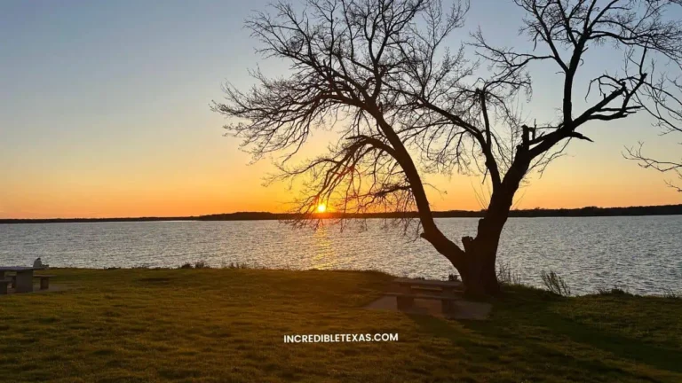
The name fits the experience. You spend much of the day moving through tall pine shade, coves, and shorelines that feel more Pineywoods than big-city lakefront.
Best Lake O’ the Pines Camping Areas to Choose
Lake O’ the Pines camping is strongest when you match your rig, group size, and water plans to a specific campground. Recreation.gov lists eight campgrounds at the lake, with several large developed areas and smaller day-use or group options.
The Lake O’ the Pines Recreation.gov gateway listed major campground price ranges during the May 10, 2026 source check. Alley Creek and Johnson Creek were shown from $18 to $175 per night, while Brushy Creek and Buckhorn Creek were shown from $18 to $44 per night.
| Campground | Best fit | Official details to verify |
|---|---|---|
| Johnson Creek | RV and tent camping with a swim-beach feel | 63 RV sites, 22 tent sites, group camping, boat ramp, playground, and swim beach |
| Alley Creek | Developed camping on the north shore | 49 RV sites, 30 tent sites, group camping, boat ramp, playground, and swim beach |
| Brushy Creek | A developed campground with fishing and swim amenities | 62 RV sites, 37 tent sites, courtesy dock, fishing dock, boat ramp, and swim beach |
| Buckhorn Creek | A south-end campground plan near the dam side | Use Recreation.gov to verify current site types, rates, alerts, and availability |
| Lakeside Day Use | Group picnic, swim, and day-use planning | Group shelter, boat ramp, dock, swimming beaches, and volleyball court |
Which campground is best for RVs?
Start with Johnson Creek, Alley Creek, or Brushy Creek if you want developed RV camping with water and electric hookups. Each one has a large site inventory, restrooms with showers, and lake recreation close enough that you do not need to drive every time someone wants to fish or swim.
Johnson Creek has the biggest RV count in the researched Recreation.gov pages, while Alley Creek and Brushy Creek also give you developed campground structure. If you care about a specific site length, shade, or waterfront feel, use the site map and photos on Recreation.gov before choosing.
Which campground feels best for a swim-and-picnic trip?
Look first at Johnson Creek, Alley Creek, Brushy Creek, and Lakeside Day Use if swimming or picnicking is central to your day. Recreation.gov facility pages list swim beaches at multiple developed areas, while Lakeside adds a group picnic shelter, dock, and volleyball court.
You should still treat swimming as a current-conditions decision. Lake level, weather, park alerts, and staffing can affect comfort and access, so check the chosen facility page the day before you go.
What should you check before reserving?
Check the rate, site type, cancellation rules, posted alerts, and whether your chosen site fits your equipment. You should also verify fire restrictions before packing wood or planning open-flame cooking.
For a nearby Pineywoods camping comparison, Lake Bob Sandlin State Park gives you a state-park alternative with a different reservation system and a smaller lake setting. That comparison helps if your group wants trails and state-park structure more than a larger Corps reservoir.
Boat Ramps, Swimming Areas, and Day Use Access
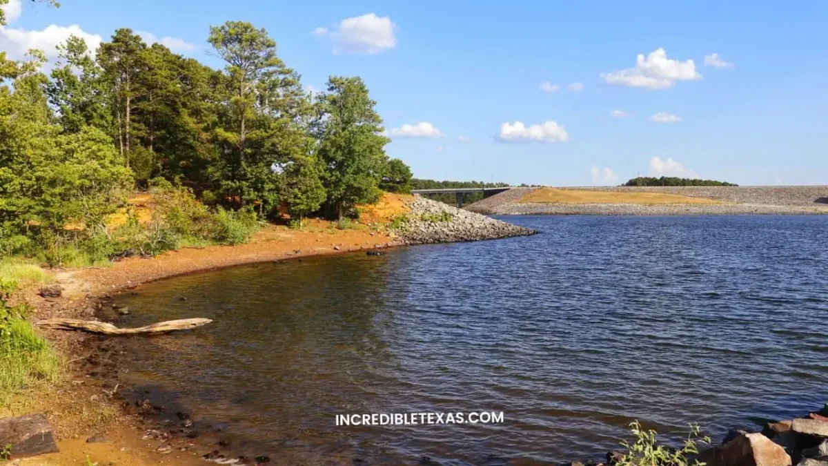
Lake O’ the Pines is a strong boating lake because access is spread around the reservoir instead of concentrated in one launch zone. For Lake O’ the Pines boat ramps, USACE says the lake has 16 total, including 12 day-use ramp facilities and four ramps available for campers.
The TPWD public access page says boating and fishing access is provided by the Corps of Engineers, Marion County, and private marinas. TPWD also notes that launch fees are charged at most boat ramps, while the Corps maintains five free ramps in addition to developed park areas.
| Access style | Good fit | Planning note |
|---|---|---|
| Fee day-use ramp | You want a developed park feel near a known access point | Confirm the current fee and payment method before you launch. |
| Free day-use ramp | You want a simpler launch and less facility structure | Verify current conditions because repairs, water level, and flood damage can affect ramps. |
| Campground ramp | You are staying overnight and want launch access close to camp | Confirm campground rules and whether day-use access is available at the same ramp. |
| Day-use swim area | You want beach time without an overnight stay | Check the facility page for swim area, picnic, and group-use details before leaving. |
Which ramp should you try first?
If you are new to the lake, choose a developed ramp tied to your main activity rather than chasing the nearest pin on a map. Lakeside, Johnson Creek, Alley Creek, and Brushy Creek give you more facility context than a bare ramp, which is useful if your group includes non-boaters.
If you already know how to launch and want a simpler day, the free-ramp list gives you room to build a backup plan. Lake levels and repair notes can change quickly, so keep one alternate ramp on the same side of the lake.
If you are comparing big East Texas boating trips, Toledo Bend Reservoir Texas is the larger border-reservoir option. Lake O’ the Pines is easier to pair with Jefferson and Marshall, while Toledo Bend is the stronger choice when the lake itself is the whole trip.
For swimming, focus on named recreation areas rather than random shorelines. Recreation.gov pages list swim beaches at developed campground or day-use areas, which gives you a clearer starting point for parking, restrooms, and picnic plans.
Fishing Lake O’ the Pines Without Guesswork
Fishing Lake O’ the Pines works well for you if you like a mixed warm-water fishery with enough structure to keep repeat trips interesting. The TPWD Lake O’ the Pines page lists largemouth bass, spotted bass, blue, channel, and flathead catfish, white bass, crappie, sunfish, and chain pickerel as predominant species.
TPWD also notes aquatic vegetation across 15 to 20 percent of the lake surface, with hydrilla, buttonbush, water primrose, and American lotus in the mix. That matters because vegetation, creek channels, timber, brush, and artificial fish habitat can shape where you start your morning.
Do not treat the lake as a regulation-free fishing spot. TPWD says the reservoir has special regulations on some fishes, and the Big Cypress Bayou below Ferrell’s Bridge Dam has a live nongame fish transport rule that also connects to Texas waters of Caddo Lake.
Do you need a Texas fishing license?
In most public-water fishing situations, you should expect to need a current Texas fishing license with the right endorsement unless a specific exemption applies. Use the local TPWD lake page for lake-specific rules, then use the broader Texas fishing license and regulations overview for cost and license-planning context.
If you are fishing with kids, from a guide boat, or around a campground, check the rules before you assume an exemption. The fastest mistake is buying bait, launching, and only then realizing your group needed a license or had a species-specific limit to follow.
Where should you start if you are new to the lake?
Begin at a developed access area with restrooms, parking, and a known ramp or fishing dock. TPWD says boating and fishing access is provided by the Corps of Engineers, Marion County, and private marinas, so you have public and private starting points.
If you fish from a boat, check the ramp and water level first. If you fish from the bank, use official access descriptions and visible facilities rather than assuming every shoreline pull-off is public, safe, or legal.
Your best fishing day will usually come from matching season, species, structure, and access. For a casual group, that may mean a campground dock and evening bank fishing; for a serious angler, that may mean studying TPWD habitat information and launching early.
Water Level, Seasons, and Safety Checks
Check the Lake O’ the Pines water level before a ramp-heavy or swim-heavy trip. The Water Data for Texas reservoir page listed the lake at 99.8 percent full as of May 7, 2026, with a mean water level of 228.47 feet and surface area of 17,617 acres.
The same source listed a most recent instantaneous reading of 228.45 feet at 11:30 pm on May 7, 2026, which was 0.05 feet below conservation pool. Those numbers were close to full at the time checked, but they are not a promise for your trip date.
Lake level affects more than boat launching. It can change beach width, shoreline mud, submerged hazards, courtesy docks, and whether a normally comfortable swimming edge feels practical.
You should also check facility alerts, especially after storms or extended rain. USACE facility reports and Recreation.gov pages can show partial closures, flood damage, burn bans, or repair notes that matter more than the general lake description.
Pack for a Corps reservoir, not a resort pool. Bring life jackets, sun protection, drinking water, closed-toe shoreline shoes, and a plan for any current fee or payment method where fees apply.
If you bring a boat, inspect safety gear before you leave home. USACE emphasizes life jackets on its boating page, and the lake is large enough that wind, coves, and changing traffic can make a casual outing feel more serious.
Easy Itinerary From Jefferson, Longview, or Marshall
Jefferson is the easiest base if you want the lake and a historic small-town finish in the same day. You can spend the morning at a recreation area, return to town for lunch or antiques, then head back toward the water for a late-day view.
From Longview, build more driving time into the day and keep your access choice firm before you leave. TPWD places the lake about 25 miles northeast of Longview, but your actual drive depends heavily on which shore, ramp, or campground you choose.
Marshall also pairs naturally with the lake because Recreation.gov campground pages point readers toward nearby Marshall attractions and area roads tied to Texas Wildflower Trail routes. That makes spring and early-summer drives feel like part of the trip instead of dead time between stops.
For a simple one-day plan, choose one developed park for the first half of the day. Swim, picnic, fish, or launch there, then use Jefferson or Marshall as the low-effort second half instead of trying to sample too many lake entrances.
For a two-night trip, spend the first day settling into camp and learning your closest ramp or beach. Use the second day for a boat morning, a town afternoon, and a sunset return to your chosen side of the lake.
If you want a nearby state-park add-on, Martin Creek Lake State Park gives you another East Texas lake stop with a different management style. That add-on works best when you have a full weekend instead of one packed day.
Do not build the itinerary around exact drive times from a generic map search alone. Pick the campground, ramp, or day-use area first, then route to that exact entrance.
When Lake O’ the Pines Is the Right Pick
Lake O’ the Pines is the right pick when you want a practical, wooded East Texas reservoir with camping, ramps, fishing, and enough room for different trip styles. It is especially useful when your group includes both anglers and people who mainly want shade, picnic time, or a swim beach.
Choose it over a more urban lake when you want quieter coves and Pineywoods scenery. Choose a different lake if your priority is lakefront nightlife, a dense restaurant district, or a resort-style waterfront strip.
- Choose Lake O’ the Pines for Corps campgrounds, mixed fishing, boating, and Jefferson-area small-town add-ons.
- Choose a specific campground or ramp before you leave because the reservoir is too spread out for casual wandering.
- Check Recreation.gov, USACE, TPWD, and Water Data for Texas close to your trip date because the useful details are current-status details.
- Keep a backup ramp, backup picnic area, or town stop in your plan so weather or facility alerts do not break the whole day.
The best version of the trip is not complicated. You pick one base, verify the official pages, bring the right gear, and let the lake feel unhurried.
Lake O’ the Pines FAQ
Is Lake O’ the Pines good for swimming?
Yes, Lake O’ the Pines swimming can work well when you choose a developed area that lists a swim beach or swimming site. Recreation.gov facility pages identify swim-related amenities at places such as Johnson Creek, Alley Creek, Brushy Creek, and Lakeside Day Use, but you should still check current facility alerts, lake level, weather, and posted signs before you count on swimming.
Do you need reservations for camping at Lake O’ the Pines?
Yes, you should expect to use Recreation.gov for reservable USACE campground sites. The lake gateway lists eight campgrounds, with developed sites, group areas, and day-use options, so before you reserve, compare site type, equipment length, alerts, cancellation terms, and whether your chosen area has the ramp, beach, or restroom setup you want.
How many boat ramps are at Lake O’ the Pines?
USACE says Lake O’ the Pines has 16 boat ramps, including 12 day-use ramp facilities and four ramps available for campers. Some day-use ramps are listed with fees while others are listed as free, so check the current ramp table, lake level, and facility alerts before towing a boat because repairs, flooding, and low-water conditions can affect access.
What fish are in Lake O’ the Pines?
TPWD lists largemouth bass, spotted bass, blue catfish, channel catfish, flathead catfish, white bass, crappie, sunfish, and chain pickerel as predominant fish species. The lake also has aquatic vegetation and enhanced habitat structure, so your best starting point depends on season, target species, and whether you fish from a boat, dock, or shoreline access.
Where is Lake O’ the Pines in Texas?
Lake O’ the Pines is in Northeast Texas near Jefferson and Longview. TPWD places it on Big Cypress Creek in the Cypress River Basin, about 25 miles northeast of Longview, in Marion, Morris, Upshur, and Camp counties, while TWDB describes it as about eight miles west of Jefferson on Big Cypress Bayou.
Is Lake O’ the Pines full right now?
It was close to full during the May 10, 2026 source check, but you should verify again before your trip. Water Data for Texas listed Lake O’ the Pines at 99.8 percent full as of May 7, 2026, with a mean water level of 228.47 feet, and lake levels change enough that you should use the current reservoir page for day-of-trip planning.