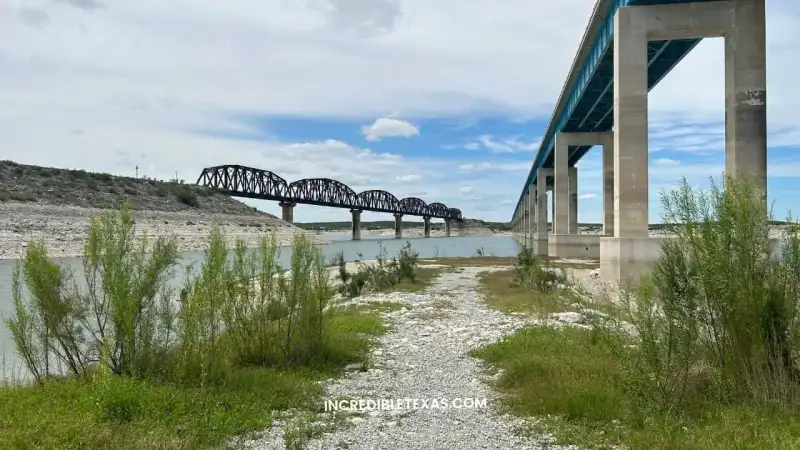
Spanning 181,600 acres with 1,200 miles of shoreline along the Sabine River, Toledo Bend Reservoir Texas ranks as the largest reservoir in Texas and fifth-largest in the United States. Providing world-class largemouth bass fishing and primitive lakeside camping, this massive border impoundment attracts tournament boaters and outdoor enthusiasts across the Piney Woods.
Key takeaways
- Toledo Bend Reservoir encompasses 181,600 surface acres and 1,200 miles of shoreline along the Texas-Louisiana state line.
- The reservoir is managed jointly by the Sabine River Authority of Texas (SRA-TX) and Sabine River Authority of Louisiana, maintaining a conservation pool of 172.0 feet msl.
- A reciprocal license agreement allows properly licensed Texas or Louisiana resident and non-resident anglers to fish all shared boundary waters from a boat.
- Black bass regulations enforce a 14-inch minimum length limit and an 8-fish daily bag limit in any combination of largemouth and smallmouth bass.
- The Texas shoreline features public launches, private full-service marinas, and primitive camping across 3,650 acres at North Toledo Bend Wildlife Management Area.
What to Expect at Toledo Bend Reservoir
The reservoir is Texas’s largest body of freshwater, covering 181,600 acres along the Sabine River on the Louisiana border. Managed by the Sabine River Authority of Texas, it combines vast open-water cruising, flooded timber flats, and nation-leading tournament action that routinely places it among the best fishing lakes in Texas.
The impoundment stretches for 65 miles between Newton, Sabine, and Shelby counties on the western bank. Hydrological status is monitored through the Texas Water Development Board Toledo Bend Water Data Portal, tracking pool fluctuations against the normal conservation mark of 172.0 feet mean sea level.
Because of its colossal geographic scale, the lake features distinct ecological zones. The southern basin offers deep, clear water near the dam, while the mid-lake sector around Huxley and Indian Mounds features dense submerged timber and sprawling hydrilla beds that provide sanctuary for game fish.
Fishing Regulations, Species, and Border Water Rules
Border water angling on the reservoir operates under a mutual interstate agreement. Dedicated Toledo Bend fishing trips provide productive action across all four seasons. Under the Texas Parks and Wildlife Department Toledo Bend Fishery Overview, any angler with a valid resident or non-resident freshwater license from either Texas or Louisiana may fish these Texas Louisiana border waters from a boat without purchasing an additional state permit.
Anglers targeting trophy largemouth bass must observe specific harvest limits. The lake enforces a 14-inch minimum length limit for black bass with an 8-fish daily bag limit. Crappie anglers enjoy exceptional winter slab fishing beneath deep timber stands, while catfish enthusiasts land massive blue and flathead catfish in main river bends.
Anglers seeking nearby family-friendly fishing alternatives with sheltered coves can review our Martin Creek Lake State Park camping guide further north. A state consumption advisory is also in effect for the reservoir, recommending limited intake of specific predator species due to naturally occurring environmental mercury.
Texas-Side Boat Ramps, Marinas, and Public Launches
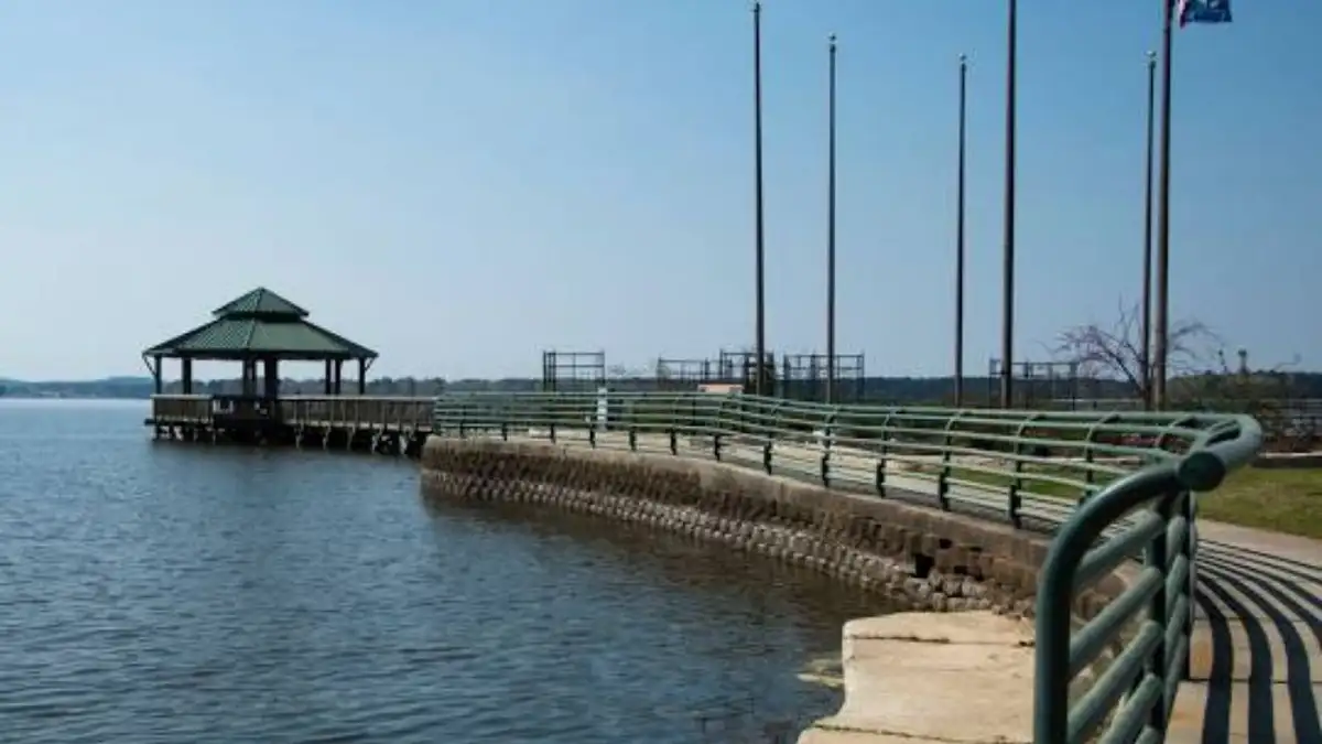
Public boat launches are spaced across the Texas bank to ensure safe ingress regardless of wind direction. Facilities are overseen under the Sabine River Authority of Texas Reservoir Operations Guide, which operates multiple designated park sites equipped with concrete multi-lane ramps.
| Facility Name | County / Sector | Managing Agency | Ramp Type | Key Amenities |
|---|---|---|---|---|
| SRA Park Site 1A | Newton County (South) | Sabine River Authority | Paved dual-lane | Courtesy dock, restrooms, lighted parking |
| Pleasure Point (Site 2) | Sabine County (Mid-Lake) | Sabine River Authority | Paved dual-lane | Picnic pavilions, RV hookups, fish cleaning station |
| Indian Mounds (Site 3) | Sabine County (Mid-Lake) | Sabine River Authority | Concrete multi-lane | Deep-water access, shaded day-use grounds |
| Huxley Bay Marina | Shelby County (North) | Commercial Marina | Concrete ramp | Marine fuel, live bait shop, lodging, slips |
| Fin & Feather Resort | Sabine County (Hemphill) | Commercial Resort | Paved dual-lane | Full RV hookups, tackle shop, cabins, dining |
Selecting proper Toledo Bend boat ramps depends on local wind conditions. Main-lake swells can build rapidly during southern breezes, making sheltered cove ramps along Six Mile Creek or Indian Mounds safer for trailering small watercraft.
Full-service marinas near Hemphill and Shelbyville supply non-ethanol marine fuel, live minnows, and transient boat slips. These commercial docks allow traveling anglers to keep boats moored on the water throughout multi-day tournaments.
Camping Options and North Toledo Bend WMA
Campers will find a spectrum of accommodations ranging from luxury waterfront RV parks to secluded primitive tent camping. Toledo Bend camping is especially popular during mild autumn and spring tournament weekends.
The North Toledo Bend Wildlife Management Area provides 3,650 acres of public land along the upper reservoir in Shelby County. Managed by TPWD under agreement with SRA-TX, the area offers free primitive camping for self-sufficient outdoorsmen. The WMA lacks drinking water, electricity, and restrooms, requiring visitors to pack in all supplies and practice Leave No Trace principles.
Travelers looking for state-operated campgrounds with full electrical connections, hot showers, and manicured nature loops can compare these wild acres against Atlanta State Park camping spots on Wright Patman Lake.
Tip
Always carry heavy-duty insect repellent when staying along the shoreline or exploring North Toledo Bend WMA. Dense East Texas bottomland hardwood forests harbor thick populations of ticks and mosquitoes during warmer months.
Navigation Safety, Water Hazards, and Best Seasons
Navigating Toledo Bend Lake requires caution due to hundreds of thousands of submerged tree stumps left behind when the valley was flooded in the 1960s. The Sabine River Authority maintains marked boat lanes that are clear-cut of obstructions, allowing vessels to travel on plane safely.
Boaters should never run on plane outside the marked buoy lanes. Striking a submerged hardwood stump can destroy lower outboard units or capsize light watercraft. Operators should maintain slow idle speeds whenever venturing into tributary coves or shallow timber flats.
Autumn, winter, and early spring deliver the finest largemouth bass fishing conditions, when cooler water temperatures bring predator fish into shallow vegetation. Anglers wanting peaceful forested day trips off the water can combine their excursion with Daingerfield State Park hiking trails tucked in the pine forest.
Nearby East Texas Parks and Road Trip Pairings
Toledo Bend serves as an ideal anchor for exploring the deep Piney Woods region of East Texas. Sabine National Forest borders large segments of the western reservoir shoreline, providing scenic overlooks and protected hiking paths beneath towering loblolly pines.
Historic downtown Hemphill and Jasper offer antique shops, regional museums, and authentic southern cafes serving fried catfish and peach cobbler. Traveling anglers comparing Texas border waters can discover other prominent destinations in our curated index of the best lakes in Texas.
Pairing a fishing expedition with local heritage creates a balanced regional holiday. Whether pitching heavy jigs into submerged timber or watching golden sunrises over mist-covered bays, the reservoir remains a benchmark of Texas outdoor sporting life.
Frequently Asked Questions
Where is the reservoir located along the state line?
Toledo Bend Reservoir straddles the Sabine River along the Texas-Louisiana border approximately 24 miles northeast of Jasper. On the Texas side, the reservoir stretches across Newton, Sabine, and Shelby counties in the heart of the Piney Woods.
How large is the reservoir surface area?
The impoundment covers 181,600 surface acres with 1,200 miles of shoreline, making it the largest reservoir in Texas and one of the largest man-made lakes in North America. Its enormous volume holds nearly 4.5 million acre-feet of water at normal conservation pool elevation.
What sport fish species live in the lake?
Toledo Bend supports thriving populations of largemouth bass, black and white crappie, blue and channel catfish, white bass, striped bass, and redear sunfish. The lake earned national acclaim after repeatedly being ranked the top bass fishery in America by Bassmaster Magazine.
Do anglers need both state licenses to fish boundary waters?
Anglers holding a valid Texas or Louisiana fishing license can legally fish the shared open waters of Toledo Bend Reservoir without purchasing a secondary out-of-state license. This reciprocal agreement applies when fishing from a boat anywhere between the Texas and Louisiana banks.
Can visitors camp on the Texas side of the lake?
Visitors can camp on the Texas shoreline at commercial RV parks, marinas, and primitive designated campsites inside North Toledo Bend Wildlife Management Area. The WMA offers year-round primitive tent camping with no running water or restroom facilities, requiring complete pack-in pack-out preparation.