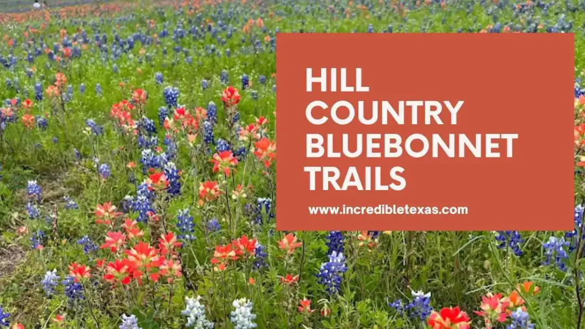
The annual bloom across Texas Hill Country bluebonnet trails turns thousands of rural pasture acres into vivid cobalt fields from late March through mid-April. Mapping out proper Texas bluebonnet driving routes requires verified road guidance, realistic parking strategies, and strict respect for private ranch property lines along iconic country lanes like Willow City Loop and Highway 281.
Key takeaways
- Texas Hill Country bluebonnets typically reach peak color between late March and mid-April, with blooms spreading northward into North Texas through late April.
- Willow City Loop delivers a rugged 13-mile scenic drive north of Fredericksburg, but every foot of roadside property is private ranchland where trespassing is strictly prohibited.
- Ennis features more than 40 miles of mapped rural driving trails scouted weekly by the Ennis Garden Club, offering the state’s most organized road network.
- Texas state law does not forbid picking bluebonnets, but harvesting plants on state park land or stepping past private fences violates state statutes.
- State agencies like the Texas Department of Transportation sow approximately 30,000 pounds of native wildflower seeds annually across 800,000 acres of highway corridors.
When Do Hill Country Bluebonnet Trails Peak in 2026?
Hill Country bluebonnet trails reach peak flower density between March 20 and April 15 during normal meteorological cycles. Winter rainfall totals, cumulative sunshine hours, and late winter temperature fluctuations govern whether individual pasture patches blossom early or align with early April festival schedules.
Wildflower spotters track a geographical wave that begins in South Texas and moves gradually north toward Central Texas and the Red River. Southern counties around San Antonio and Austin see rosette growth and early petals as early as late February.
Higher elevation pastures in Gillespie, Burnet, and Llano counties require more sustained soil warming. Those rural corridors hit their densest visual blankets during the final week of March and the opening ten days of April.
Regional Bloom Progression Across Central Texas
Bluebonnet season Texas travels northward across distinct growing zones over an eight-week window. The southern boundary of the Hill Country along Interstate 35 and Highway 90 awakens first, providing early roadside color for early-season travelers.
By early April, the heart of the Hill Country around Fredericksburg, Marble Falls, and Burnet displays full floral blankets. The floral wave then migrates north toward Dallas, Fort Worth, and Ellis County, where the Ennis trail network reaches prime condition toward mid-April.
Late April signals the transition from bluebonnets to warmer-season native species. Orange Indian paintbrushes, pink evening primroses, and yellow coreopsis take over as daytime temperatures climb into the mid-80s.
Weather Conditions and Soil Moisture Factors
Texas bluebonnets require consistent autumn and winter moisture to establish robust root rosettes beneath the soil line. Adequate rainfall between October and January creates the biological foundation for dense, multi-stemmed spring flower spikes.
Severe autumn droughts lead to scattered, low-density patches on rocky slopes. Conversely, excess rainfall paired with sustained overcast skies can delay blooms by several weeks while encouraging competing grasses to overtop the young seedlings.
Sudden March cold snaps pause budding without destroying hardy native plants. Travelers should consult local road condition reports and regional flower trackers before finalizing weekend itineraries.
Comparing the Top Hill Country Wildflower Routes
Selecting the best places to see bluebonnets in Texas depends on your travel style, route preferences, and time constraints. Some motorists favor narrow backroads and remote granite hills, while others prefer paved multi-lane corridors with direct access to local cafes and historic squares.
The matrix below summarizes essential metrics for major wildflower drives, regional circuits, and dedicated parklands across Central Texas.
| Destination / Trail | Primary County | Route Format | Peak Bloom Window | Access Fee | Primary Highlight |
|---|---|---|---|---|---|
| Willow City Loop | Gillespie | 13-mile narrow loop | March 25 – April 10 | Free public road | Rugged granite canyons and deep meadow blooms |
| Ennis Bluebonnet Trails | Ellis | 40+ miles of country roads | April 5 – April 25 | Free ($5 festival) | Mapped rural circuits and Lake Bardwell shorelines |
| Burnet Bluebonnet Trail | Burnet | 35-mile highway circuit | March 28 – April 14 | Free driving routes | Inks Lake proximity and annual festival activities |
| Marble Falls to Kingsland | Burnet & Llano | 20-mile lakeside drive | March 25 – April 12 | Free public roads | The Slab river crossing and Highland Lakes views |
| Muleshoe Bend Recreation Area | Travis | 9 miles of dirt/gravel trails | March 20 – April 10 | $5 per adult | Expansive shoreline fields along Lake Travis |
| Lady Bird Johnson Wildflower Center | Travis | Curated botanical gardens | March 15 – April 20 | $15 – $18 per adult | 900+ native plant species and curated photo lawns |
Evaluating these routes helps travelers build balanced day trips that blend scenic windshield touring with pedestrian walking opportunities.
Drivers seeking casual scenic wildflower drives often combine Willow City Loop with Highway 16, whereas hikers prefer dedicated recreation parks with secure off-road parking.
Willow City Loop: Route Map, Driving Rules, and Logistics
Willow City Loop bluebonnet trail is a 13-mile two-lane country road situated approximately 15 miles north of Fredericksburg. The route winds through rugged granite outcrops, narrow creek crossings, and open pastures that fill with dense wildflower carpets each spring.
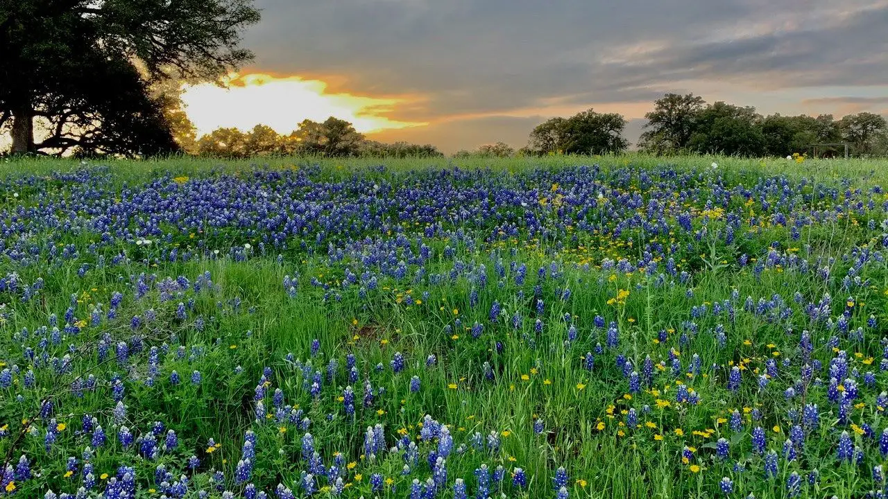
Motorists access the loop from Ranch Road 1323 in Willow City, heading north and west before rejoining State Highway 16. The road features steep elevation drops, hairpin curves, and narrow cattle guards that demand slow driving speeds and heightened vigilance.
Weekend congestion frequently clogs the loop between 10:30 AM and 3:30 PM throughout late March and early April. Savvy road trippers schedule their drive for early weekday mornings when soft golden sunlight illuminates the canyon without bumper-to-bumper vehicle traffic.
Navigating the 13-Mile Ranch Route
The Willow City Loop roadway narrows to a single lane across low-water concrete crossings and low-lying creek beds. Drivers must yield right-of-way to oncoming traffic and allow adequate clearance for local ranch utility vehicles.
Cellular data reception drops significantly along the bottom of the canyon. Downloading offline GPS map layers before departing Fredericksburg ensures reliable navigation throughout the rural Gillespie County backcountry.
After completing the northern loop, drivers can head south down State Highway 16 toward historic downtown Fredericksburg attractions to browse local German bakeries and historic Main Street shops.
Critical Parking and Private Property Regulations
Every acre of land bordering Willow City Loop is privately held ranch property. Landowners fiercely protect their pastures, working cattle herds, and agricultural fences from unauthorized entry.
Stopping in the middle of travel lanes to snap photos is strictly prohibited by county traffic enforcement. Motorists must pull their vehicles completely onto unpaved shoulders where turnouts are wide enough to clear all four tires from the pavement.
Climbing over barbed-wire fences, opening livestock gates, or walking pets into private pastures constitutes criminal trespass under Texas law. Local sheriff deputies patrol the loop during peak bloom weekends and issue citations to violators.
Important
Never park in front of ranch gates or cattle guards along Willow City Loop. Working ranchers need immediate 24-hour roadway access for livestock trailers, feed trucks, and emergency equipment.
Ennis Bluebonnet Trails: Mapped Routes and Festival Details
Ennis bluebonnet trail map routes encompass over 40 miles of rural country roads located 35 miles south of downtown Dallas in Ellis County. The Texas State Legislature officially named Ennis the Bluebonnet City of Texas in 1997, honoring its expansive, community-maintained floral trails.
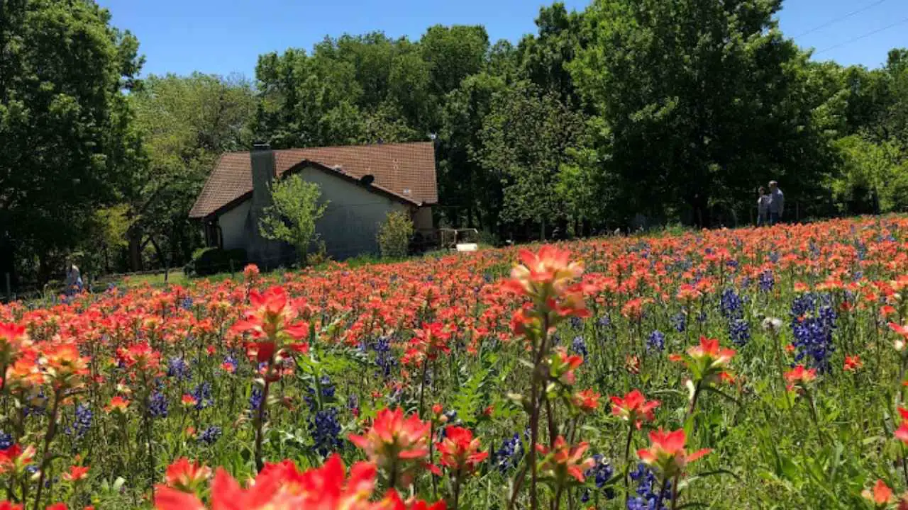
Volunteers from the Ennis Garden Club drive and evaluate these rural roads each week throughout April. They record flower densities, bloom maturation, and road safety conditions to guide visiting motorists toward the fullest displays.
Travelers can download route guides or review digital bloom assessments directly through the City of Ennis Official Bluebonnet Trails Map and Bloom Guide before hitting the pavement. This structured reporting system eliminates the guesswork often associated with rural wildflower scouting.
North, West, and South Driving Circuits
The Ennis trail network divides into three primary driving circuits, each highlighting distinct agricultural terrain. The North Trail leads motorists past expansive hay pastures, gentle rolling hills, and historic farmsteads framed by deep blue ribbons.
The West Trail skirts the wooded shorelines and recreation parks of Lake Bardwell. This route provides dramatic visual contrast between open blue lake waters and colorful roadside wildflowers, making it a favorite for landscape photographers.
The South Trail features older oak groves, quiet farm-to-market lanes, and lower traffic volumes. This circuit suits travelers seeking a peaceful afternoon drive away from festival crowds.
Ennis Welcome Center Resources and Annual Festival
The Ennis Welcome Center, located at 201 NW Main Street in downtown Ennis, serves as the operational headquarters for all wildflower travelers. The facility operates seven days a week during April, handing out printed trail maps with color-coded bloom ratings.
Staff members provide real-time guidance on road construction detours, gravel shoulders, and pasture conditions. Picking up a physical paper map provides reliable route backup when rural mobile reception fluctuates.
Each April, downtown Ennis hosts the Ennis Bluebonnet Festival weekend celebration. The three-day street festival brings live country music, regional wine tastings, food trucks, and artisan vendor booths to the historic downtown district.
Highland Lakes Circuit: Burnet, Marble Falls, and Lake LBJ
The Highland Lakes region combines pink granite hills, sparkling reservoir waters, and extensive wildflower corridors across Burnet and Llano counties. The Texas Legislature designated Burnet as the Bluebonnet Capital of Texas in 1981, recognizing the area's rich botanical heritage.
Motorists traveling through Burnet, Marble Falls, and Kingsland encounter roadside bluebonnets, golden coreopsis, and red Indian blankets against rugged granite backdrops. This geographic diversity makes the Highland Lakes circuit a standout Texas wildflower road trip destination.
The region provides ample opportunities to pair scenic drives with lakeside dining, swimming holes, and state park hiking adventures. A full day loop allows travelers to experience both mountain-style topography and wide reservoir shorelines.
Burnet and the Annual Bluebonnet Festival
Burnet bluebonnet trail routes radiate outward from the historic courthouse square along State Highway 29, Ranch Road 2341, and Farm-to-Market Road 963. These secondary arteries wind through quiet cattle pastures that explode with wildflowers during late March.
Every April, the town hosts the Burnet Bluebonnet Festival, drawing more than 30,000 visitors over three days. The event features a downtown parade, classic car show, carnival midway, and live evening concerts.
Travelers heading west from Burnet along Park Road 4 can access our Inks Lake State Park camping and trails guide to explore granite hiking trails lined with hillside flowers. Park visitors can also consult the Texas Parks and Wildlife Department Inks Lake Fee Schedule and Facility Map for entrance rates and campsite reservations.
Marble Falls, Kingsland, and The Slab Crossing
The route connecting Marble Falls to Kingsland along Ranch to Market Road 1431 offers sweeping vistas of Lake LBJ and the Colorado River channel. Marble Falls bluebonnets blanket the highway shoulders, creating colorful foregrounds against sparkling open water.
Just west of Kingsland, travelers discover The Slab, a popular low-water crossing where Ranch Road 3404 traverses the wide granite bed of the Llano River. Shallow, clear river water flows gently over smooth pink granite shelves bordered by clusters of bluebonnets.
Families frequently stop at The Slab to wade in the river shoals and take family photos on sunny spring afternoons. After exploring the riverbanks, visitors can head into Kingsland or Marble Falls for lunch and homemade fruit pies.
Nature Preserves and State Parks for Walking Wildflower Trails
Windshield touring offers scenic roadside panoramas, but walking through wildflower meadows requires protected public parkland. Designated state parks, river reserves, and botanical centers provide safe walking paths away from highway traffic and private property conflicts.
These protected recreation sites protect fragile native root systems, provide clean visitor restrooms, and offer secure parking lots. Exploring on foot allows visitors to observe pollinators, take close-up macro photos, and enjoy the sweet scent of blooming lupines.
Muleshoe Bend Recreation Area Shoreline Fields
Muleshoe Bend Recreation Area encompasses 1,200 acres along a scenic bend of Lake Travis in western Travis County near Spicewood. When spring water levels recede, hundreds of acres of exposed lake basin transform into dense, uninterrupted carpets of Muleshoe Bend bluebonnets.
The park features over 9 miles of multi-use trails suitable for hiking, trail running, and mountain biking through wildflower meadows. Visitors can reserve primitive lakefront campsites to watch the morning sun rise directly over cobalt fields.
The park is managed by the Lower Colorado River Authority and is open daily from sunrise to sunset. Details on entry fees and seasonal rules are verified through the Lower Colorado River Authority Muleshoe Bend Park Rules and Permits, where adult day-use permits cost $5 and children 12 and under enter free.
Lady Bird Johnson Wildflower Center Curated Trails
The Lady Bird Johnson Wildflower Center serves as the official state botanical garden and arboretum of Texas, spanning 284 acres in southwest Austin. Established in 1982 by former First Lady Lady Bird Johnson and actress Helen Hayes, the facility focuses entirely on native plant conservation.
Visitors can wander manicured demonstration gardens, restored Texas savannas, and expansive wildflower meadows showcasing Lady Bird Johnson Wildflower Center bluebonnets. Paved, ADA-accessible paths ensure visitors of all mobility levels can experience native spring blooms up close.
For complete details on garden exhibits, seasonal bloom updates, and admission guidelines, explore our comprehensive Lady Bird Johnson Wildflower Center visitor guide.
McKinney Falls State Park Hiking Corridors
McKinney Falls State Park sits just 13 miles southeast of downtown Austin, offering a natural sanctuary where Onion Creek cascades over limestone ledges. During spring, the park's 9 miles of multi-use trails wind through open fields blanketed with bluebonnets and Mexican hats.
The 2.8-mile Onion Creek Hike and Bike Trail provides a smooth, paved circuit ideal for families with strollers and wagons. The 3.1-mile Homestead Trail takes hikers across limestone creek beds to historic stone ruins surrounded by native wildflowers.
Day-use admission is $6 per adult, while children 12 and under enter free of charge. Visitors should secure online entry passes through the Texas Parks and Wildlife Department McKinney Falls Entrance Portal, as the park frequently reaches capacity during peak April weekends.
Highway 281 and Highway 290 Scenic Driving Itinerary
State Highways 281 and 290 form the backbone of Central Texas road tripping, linking major urban centers with rural agricultural towns. Combining these two roadways creates a complete circular loop that highlights diverse terrain, roadside markets, and expansive wildflower corridors.
This 120-mile scenic driving loop can easily be completed in a single day, or stretched into a relaxed weekend getaway. Motorists travel past peach orchards, limestone bluffs, and working cattle ranches decorated in rich spring colors.
Highway 281 Corridor: Burnet to Johnson City
The Highway 281 bluebonnets corridor stretches north to south from Burnet through Marble Falls down to Johnson City. Wide highway shoulders and gently rolling hills make this section one of the most accessible routes for viewing wildflowers from the vehicle.
Roadside medians and fence lines along Highway 281 feature dense ribbons of bluebonnets mixed with bright yellow Engelmann daisies. Motorists can pull into farm stands and scenic turnouts to sample local peach ciders and fresh baked goods.
Before leaving the northern portion of this corridor, review our overview of things to do across Burnet County for ideas on cavern tours, historic train rides, and lakefront recreation.
Highway 290 Corridor: Johnson City to Fredericksburg
Turning west at Johnson City places travelers onto the Highway 290 wildflower route, widely known as the Texas Wine Trail. This 30-mile stretch passes dozens of estate vineyards, tasting rooms, and farm markets framed by blooming pastures.
A popular stop along Highway 290 is Wildseed Farms, the largest working wildflower seed farm in the United States. Visitors can walk free admission demonstration gardens, photograph 200 acres of production wildflower fields, and purchase native seeds for their own home gardens.
Continuing west into Gillespie County reveals classic Fredericksburg bluebonnets along pasture fences and historic limestone homesteads. The route terminates in Fredericksburg, where travelers can celebrate a day on the road with authentic German dining.
Texas Wildflower Laws: Roadside Safety, Etiquette, and Private Property
Understanding Texas wildflower etiquette and legal regulations ensures a safe, respectful road trip for everyone. While springtime photography is a beloved annual tradition, safety hazards and landowner rights require careful attention along public highways.
Every year, law enforcement agencies respond to avoidable highway accidents caused by distracted motorists stopping abruptly in travel lanes. Respecting state statutes and common courtesy keeps rural roads open and enjoyable for all travelers.
Debunking the Flower-Picking Myth Under Texas Statutes
A widespread urban legend insists that is it illegal to pick bluebonnets in Texas under state penal code. In reality, Texas statutes contain no specific law that bans picking the official state flower on ordinary public land.
However, state law strictly prohibits damaging, destroying, or removing plant life inside Texas State Parks, municipal nature preserves, and state-managed historical sites. Removing wildflowers from protected parklands can result in misdemeanor citations and fines.
Furthermore, entering private ranchland to pick flowers constitutes criminal trespass under Texas Penal Code Section 30.05. Even if a property lacks a fence, walking beyond the public highway right-of-way without landowner consent is against the law.
TxDOT Highway Safety and Vehicle Pull-Off Guidelines
The Texas Department of Transportation manages highway beautification through a dedicated roadside vegetation initiative dating back to the 1930s. Proper roadside parking regulations are vital when stopping to photograph roadside blooms.
According to the Texas Department of Transportation Wildflower Program Guidelines, motorists must signal before slowing down and pull their vehicles completely off the paved roadway onto level grassy shoulders. Drivers must never park on blind curves, over hill crests, or inside road construction zones.
Note
The Texas Department of Transportation purchases and sows roughly 30,000 pounds of native wildflower seeds annually across more than 800,000 acres of highway rights-of-way, coordinating mowing delays until seed heads mature and drop.
Parents and photographers must also watch for natural ground hazards when posing in tall meadow grass. Fire ant mounds, stinging nettle, and venomous rattlesnakes frequently nest in thick wildflower patches, making closed-toe shoes essential for field exploration.
Frequently Asked Questions About Hill Country Bluebonnet Trails
Clear answers to the most common questions travelers ask when planning spring wildflower trips across the Texas Hill Country.
When is peak bluebonnet season in the Texas Hill Country?
Texas Hill Country bluebonnets generally reach peak bloom from late March through the second week of April, depending on winter rainfall and temperatures. Areas farther north, such as Ennis, typically hit full color one to two weeks later in mid-April.
Is it illegal to pick bluebonnets in Texas?
Picking bluebonnets is not forbidden by any specific Texas state statute. However, picking vegetation inside Texas State Parks or crossing fence lines onto private ranchland constitutes illegal property damage and criminal trespass.
Can visitors pull over and take photos along Willow City Loop?
Drivers may pull over briefly on designated unpaved road shoulders along Willow City Loop, provided all four tires clear the roadway. Walking onto pastures, climbing ranch fences, or blocking cattle gates is strictly prohibited by local landowners and county law enforcement.
How do travelers get the official Ennis bluebonnet trail map?
Visitors can pick up updated paper trail maps directly at the Ennis Welcome Center in downtown Ennis throughout the month of April. Real-time bloom reports and digital route maps are also accessible on the Visit Ennis mobile application and city tourism website.
What fees are required to visit Muleshoe Bend Recreation Area?
The Lower Colorado River Authority charges a day-use entry fee of $5 per adult, while children 12 and under receive free admission. Visitors can pay at the entry gate using cash or credit card, or present an active LCRA annual park pass.