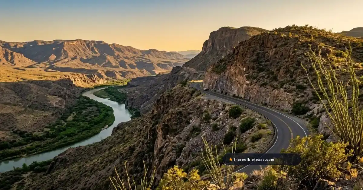
Farm to Market Road 170 cuts through the rugged canyon volcanic badlands of Far West Texas along the Rio Grande, forming the iconic southern border of Big Bend Ranch State Park. Known historically as El Camino del Rio, this remote highway delivers one of North America’s most visually arresting driving experiences.
Part of our comprehensive guide to the Most Scenic Drives in Texas. Discover all seven iconic Lone Star scenic byways, mountain passes, and backcountry routes.
Key takeaways
- FM 170 stretches 50 miles between Lajitas and Presidio, tracking the Rio Grande canyon rim through Big Bend Ranch State Park.
- The Big Hill reaches a 15% highway grade over Santana Mesa, providing the steepest paved grade and widest panorama in Texas.
- Roadside stops like Closed Canyon and The Hoodoos offer short, rewarding walks into narrow slot canyons and sculpted rock formations.
- Big Bend Ranch State Park requires a $5 per adult day-use fee for accessing trailheads, picnic areas, and river launches off FM 170.
- Cell service is nonexistent along the highway corridor, requiring downloaded offline maps, full fuel tanks, and extra drinking water.
Route Overview: Driving Texas FM 170 from Lajitas to Presidio
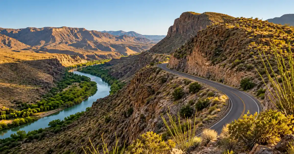
FM 170, known as El Camino del Rio or The River Road, spans 50 scenic miles along the Texas-Mexico border between Lajitas and Presidio. Flanking the southern edge of Big Bend Ranch State Park, the paved two-lane route delivers dramatic volcanic canyon views, roller-coaster grade changes, and immediate Rio Grande access.
Geographic Setting Along the Rio Grande Border
The highway follows the serpentine trench of the Rio Grande as it slices through the Chisos volcanic plateau and the Bofecillos Mountains. Across the emerald river ribbon, the sheer limestone bluffs and barren desert peaks of the state of Chihuahua, Mexico rise thousands of feet into the desert sky.
Drivers experience sudden ecological shifts from riparian cottonwood galleries along the riverbank to arid uplands populated by ocotillo, lechuguilla, and giant candelilla. Road-trippers arriving from the north via Marfa can cross south to Presidio or link in from the historic Shafter ghost town on US-67.
Drive Time, Speed Limits, and Road Surface Conditions
Covering the 50-mile span between the Barton Warnock Visitor Center near Lajitas and Fort Leaton outside Presidio takes approximately 90 minutes without stopping. Posted speed limits fluctuate between 45 and 55 miles per hour, but the undulating terrain demands slower speeds around blind curves.
The roadbed is completely paved with asphalt, yet it lacks broad shoulders and features numerous steep drainage dips known locally as dip crossings. When heavy rains sweep across the mountains, gravel and mud wash into these low points, demanding alert driving.
| Route Specification | Verified Detail | Field Note |
|---|---|---|
| Total Distance | 50.2 miles | Between Lajitas and Presidio along FM 170 |
| Road Surface | Two-lane asphalt | Fully paved, narrow gravel shoulders |
| Average Speed | 35 to 45 mph | Driven slower than posted limit for safety |
| Through Drive Time | 1.5 to 2 hours | Nonstop driving duration |
| Recommended Trip Time | 4 to 6 hours | Includes trail walks, pullouts, and photos |
| Fuel Availability | None on route | Fill tank in Terlingua, Lajitas, or Presidio |
Conquering The Big Hill: 15% Grades and Dom Rock Overlook
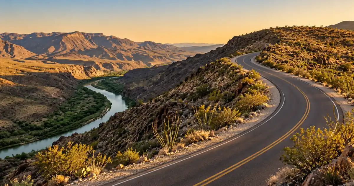
The Big Hill on FM 170 climbs over Santana Mesa with an unforgiving 15% grade, making it the steepest paved highway grade on the Texas state road system. At the summit pullout, travelers look out over Dom Rock, made famous in the 1985 film Fandango, with panoramic views of the Rio Grande canyon and mountains in Chihuahua, Mexico.
Climbing Santana Mesa and Driving the Steepest Highway Grade
Approaching from either direction, the highway angles upward sharply, twisting through banked curves carved directly into dark igneous cliffs. Modern vehicles easily negotiate the climb, but drivers should manually downshift into second gear on descents to avoid brake fade.
Commercial trucks and heavy motorhomes avoid this route due to the rapid grade transition and sharp crest. Cyclists and motorcycle riders consider this ascent one of the top bucket-list climbs in the state, battling both gradient and desert crosswinds.
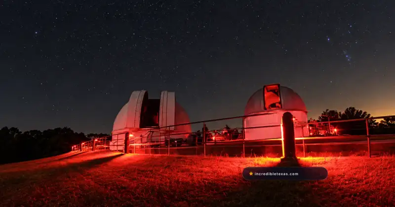
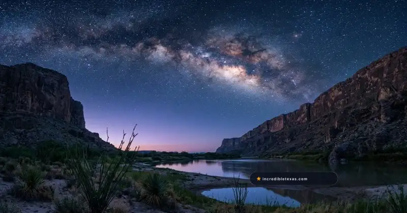
Night travelers driving through this corridor will also observe unpolluted Bortle Class 1 dark skies protected under the Greater Big Bend International Dark Sky Reserve.
The Fandango Dom Rock Overlook and Photography Pullout
At the highest summit marker of The Big Hill, TxDOT constructed a wide paved pullout equipped with stone guardrails. Standing here hundreds of feet above the canyon floor reveals a 270-degree vista of Colorado Canyon and the Mexican mountain wilderness.
Just below the road crest sits the distinctive volcanic boulder known as Dom Rock. Film fans recognize this landmark as the climatic desert scene in the Kevin Costner movie Fandango. The viewpoint provides exceptional sunset photography as amber desert light illuminates the canyon gorge.
Important
Drivers towing heavy bumper-pull travel trailers or operating motorhomes exceeding 30 feet should use US-67 through Marfa and Alpine instead of crossing The Big Hill. The 15% grade generates severe transmission overheating during summer ascents and risks brake failure on the steep descent toward Tapado Canyon.
Must-Stop Roadside Highlights: Closed Canyon, The Hoodoos, and Contrabando
The signature stops along FM 170 include Closed Canyon, a 1.4-mile hike into a deep volcanic slot canyon, and The Hoodoos, an easy 1.1-mile trail among balanced rock pillars. Farther west, the Contrabando Trailhead and Madera Canyon provide shaded rest areas and historic film set ruins beside the Rio Grande.
Hiking the Slot of Closed Canyon Trail
Closed Canyon represents one of the only true walkable slot canyons in Texas accessible directly from a paved highway. Located 22 miles east of Presidio, the gravel trailhead lot accommodates approximately fifteen vehicles.
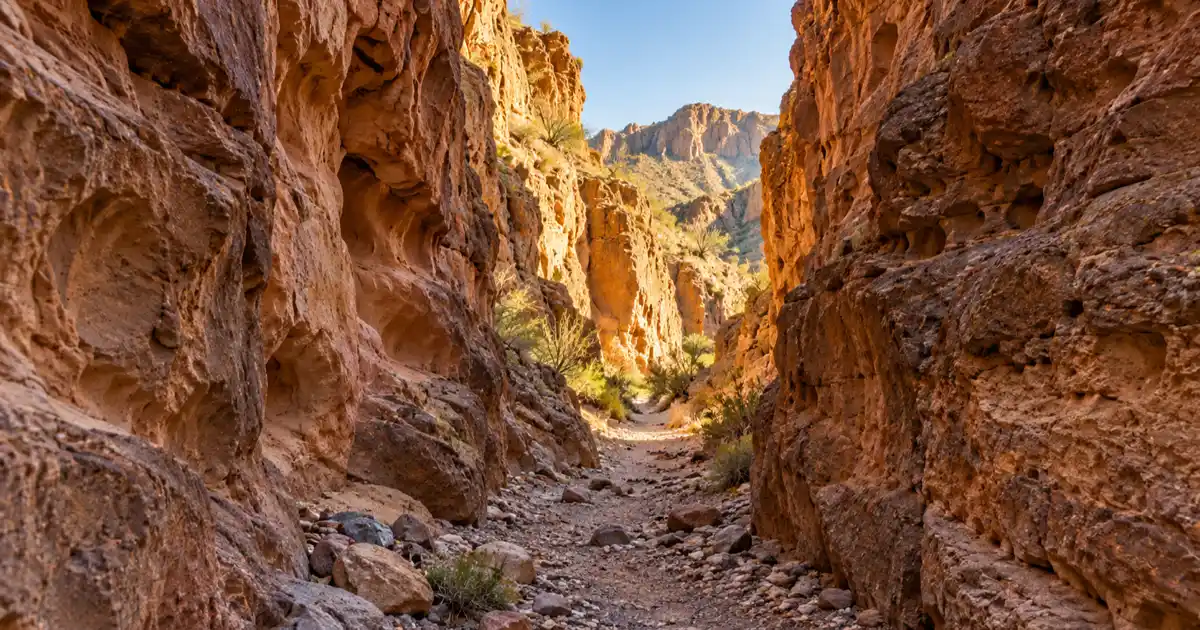
The trail follows a smooth gravel wash that narrows rapidly between sheer vertical walls rising 150 feet overhead. Cool desert breezes funnel through the chasm, offering natural air conditioning during warm mornings. The route terminates at a steep rock pour-off roughly 0.7 miles in, where casual walkers must turn back.
Wandering Among The Hoodoos and River Access Put-Ins
Situated 16 miles west of Lajitas, The Hoodoos day-use area features surreal mushroom-shaped balanced rocks and spires carved from volcanic ash deposits. A gentle 1.1-mile loop trail winds past these geological oddities directly down to a cobblestone beach on the Rio Grande.
This stop features shaded picnic ramadas, informational panels, and a concrete boat ramp used by river outfitters to launch canoes and rafts into Colorado Canyon. Travelers looking for cooler alpine forest drives after exploring these desert canyons can head north toward the scenic ridges of Davis Mountains State Park.
Contrabando Trailhead and Historic West Texas Filming History
The Contrabando historic area marks the trailhead for over 25 miles of hiking and mountain biking paths within the park. The site preserves weathered adobe structures originally built for the 1985 western film Uphill All the Way, later featured in Streets of Laredo.
While historic river floods damaged several outer adobe sets in 2008, the historic Casner family home and working corrals remain standing. Visitors can examine original mud-and-straw adobe construction, rough-hewn pine vigas, and interpretive exhibits recounting frontier border trade.
| Stop Name | Milepost Location | Round-Trip Trail | Key Geological or Historic Feature | Facilities |
|---|---|---|---|---|
| The Hoodoos | Mile 16 (from Lajitas) | 1.1-mile loop | Balanced volcanic ash spires & river beach | Shaded picnic ramadas, boat ramp |
| Madera Canyon | Mile 18 | 0.5-mile walk | Riparian cottonwood canyon & picnic tables | Restrooms, picnic tables, river access |
| Closed Canyon | Mile 22 | 1.4-mile out-and-back | 150-foot sheer volcanic slot canyon walls | Gravel parking, interpretive kiosk |
| The Big Hill | Mile 24 | Scenic pullout | 15% highway grade & Fandango Dom Rock | Paved parking, panoramic stone overlook |
| Contrabando | Mile 28 | 25+ trail network | Western movie set casitas & adobe ruins | Vault toilet, trail kiosks, corrals |
Park Permits, Visitor Centers, and Day-Use Regulations
Driving FM 170 requires no toll, but stopping to hike, picnic, or launch watercraft within Big Bend Ranch State Park requires a $5 daily pass per adult. Passes and permits can be purchased at the Barton Warnock Visitor Center in Lajitas or Fort Leaton State Historic Site near Presidio.
Barton Warnock Visitor Center and Fort Leaton Historic Site
The eastern gateway to the River Road is anchored by the TPWD Barton Warnock Visitor Center Guide located one mile east of Lajitas. Open daily from 8:00 AM to 4:30 PM, the center features an exceptional 2.5-acre desert botanical garden, regional natural history exhibits, and a comprehensive bookshop.
At the western terminus near Presidio, travelers can tour the Texas Historical Commission Fort Leaton State Historic Site. Constructed in 1848 by trader Ben Leaton, this sprawling adobe fortress preserves one of the largest historic earthen compounds in the Southwest, exhibiting frontier tools and wagon artifacts.
Big Bend Ranch State Park Day-Pass Fees and River Access Permits
Visitors who intend to explore park trailheads along FM 170 must purchase a daily entrance pass. According to the Texas Parks and Wildlife Department Big Bend Ranch State Park Entrance Fees, adult day-use admission is $5 per day, while children ages 12 and under enter free.
Holders of the Texas State Parks Pass receive free unlimited day-use admission for their entire vehicle. If you plan to float the Rio Grande, a river use permit must be obtained at either visitor center before putting in your watercraft.
For detailed hiking routes, mountain biking loops, and interior 4WD roads through Sauceda Ranch, consult our complete Big Bend Ranch State Park guide.
| Facility / Permit | Operating Hours | Standard Cost | Location / Access |
|---|---|---|---|
| Barton Warnock Center | Daily 8:00 AM - 4:30 PM | $5 day-use / park pass | 21800 FM 170, Lajitas |
| Fort Leaton Historic Site | Daily 8:30 AM - 4:30 PM | $5 adults, kids 12 & under free | 16952 FM 170 E, Presidio |
| Day-Use Trail Permit | Sunrise to sunset | $5 per adult (ages 13+) | Valid at all FM 170 trailheads |
| River Running Permit | Day or overnight trip | Varies by outfitter / self-serve | Required for river put-ins |
Essential Field Preparation: Desert Survival, Fuel, and Safety Protocols
Driving the River Road demands thorough desert preparation due to zero cellular reception, open-range livestock, and sudden flash floods across low-water arroyos. Travelers must top off fuel in Lajitas, Terlingua, or Presidio, carry one gallon of drinking water per person per day, and monitor summer heat indices.
Cell Service Dead Zones and Offline Navigation
Once travelers pass the Barton Warnock Visitor Center driving west, cellular signal drops completely and remains absent until reaching the outskirts of Presidio. Smartphone map applications that rely on live data will fail to navigate.
Download offline maps on Google Maps or Gaia GPS prior to leaving your lodging. Hikers should photograph trailhead interpretive maps with their phone cameras to ensure they understand trail junctions and turnaround points. If you are basing your journey in Brewster County, take time to tour the historic porch culture in Terlingua Ghost Town.
Flash Flood Arroyos, Summer Heat, and Pet Leash Rules
Summer temperatures along the Rio Grande corridor routinely exceed 110 degrees Fahrenheit between May and September. Hikers should finish all canyon walks before 10:00 AM and carry electrolyte replacements in addition to water.
During monsoon thunderstorms in July and August, sudden cloudbursts miles away can send torrents of water and debris crashing through low-water crossings. Never drive into standing or flowing water across the highway pavement.
Pets must remain on a hand-held leash no longer than six feet and are confined to areas within 1/4 mile of roads and vehicle campsites. Rough volcanic rocks heat up quickly and can blister canine paw pads within minutes.
Warning
Flash floods occur rapidly along FM 170 even when skies overhead are completely clear. If you encounter running water or deep gravel sediment deposited across a dip crossing, stop your vehicle and wait for waters to recede rather than risking an engine stall or rollover.
Frequently Asked Questions About FM 170 The River Road
Is FM 170 in Texas paved all the way from Lajitas to Presidio?
Yes, FM 170 is fully paved with two asphalt lanes across the entire 50-mile stretch between Lajitas and Presidio. While paved, the route has narrow shoulders, steep vertical dips, and sharp curves that require careful speed control. North of Presidio, adventurous high-clearance drivers can connect with Pinto Canyon Road (FM 2810) at Ruidosa for remote gravel overlanding through the Chinati Mountains to Marfa.
What is the steepest highway grade on FM 170 River Road?
The Big Hill section of FM 170 reaches a 15% grade as it ascends Santana Mesa. This makes it the steepest paved highway grade on the Texas state highway network.
How long does it take to drive FM 170 River Road?
Driving the 50 miles straight through without stopping takes approximately 1.5 to 2 hours at conservative speeds. Travelers stopping for overlooks, Closed Canyon, and The Hoodoos should budget 4 to 6 hours for a complete excursion.
Do you need a state park pass to drive FM 170?
No fee or permit is required simply to drive through on the state highway. However, if you park at trailheads, use picnic sites, or launch watercraft within Big Bend Ranch State Park, you must pay the $5 daily entry fee per adult.
Can RVs and travel trailers drive over The Big Hill on FM 170?
Large RVs, motorhomes over 30 feet, and heavy bumper-pull travel trailers are strongly discouraged from crossing The Big Hill due to the 15% grade, tight switchbacks, and transmission overheating risks. Smaller campervans and truck campers handle the grade without issue if drivers downshift on descents.
Are dogs allowed on hiking trails along FM 170 in Big Bend Ranch State Park?
Dogs are permitted along FM 170 only within 1/4 mile of public roads and designated campgrounds on a hand-held leash no longer than six feet. Pets are strictly prohibited on backcountry hiking trails, including Closed Canyon, due to rough volcanic terrain and extreme heat.
Is there cell phone service along FM 170 The River Road?
Cellular service is essentially nonexistent along the entire corridor between Lajitas and Presidio. Travelers must download offline GPS maps and trail guides before departing either town.