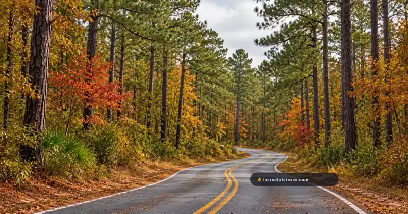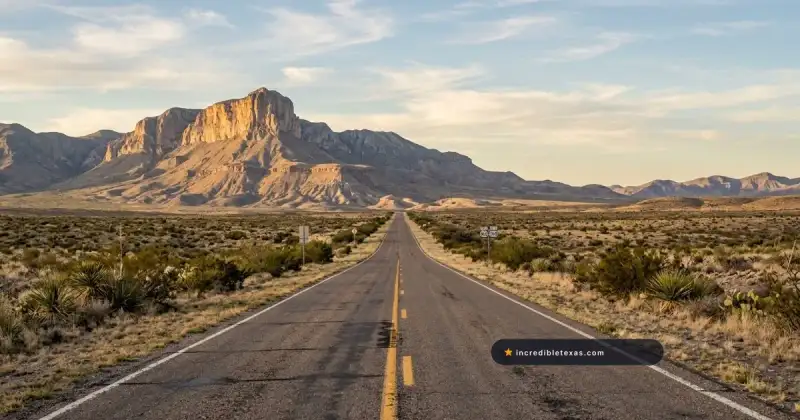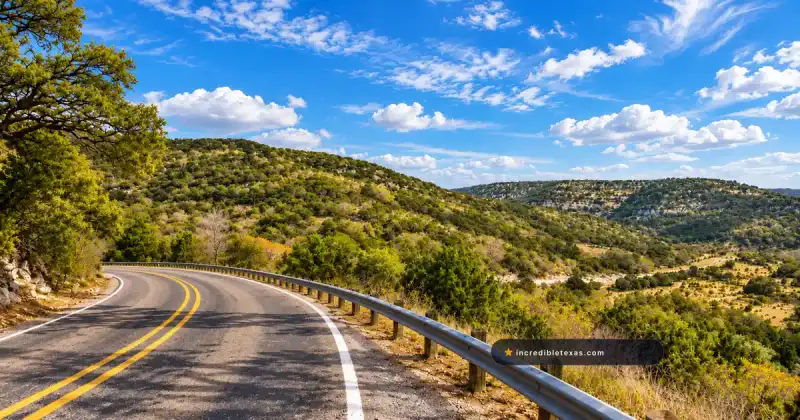
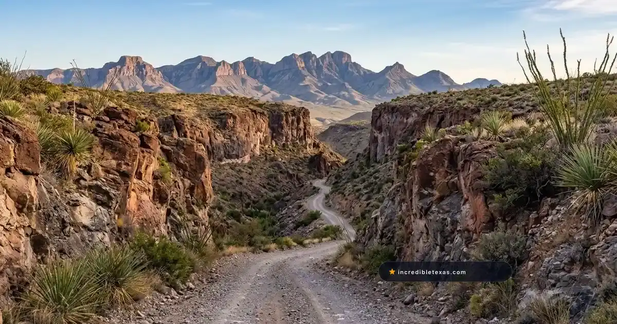
Pinto Canyon Road, officially designated as Farm to Market Road 2810, is widely considered one of the most secluded and visually dramatic backcountry overland routes in the American Southwest. Beginning at the courthouse square in Marfa, Texas, the roadway rolls southwest across thirty-two miles of high-desert grasslands.
Near the southern rim of the Marfa Plateau, the road drops into a rugged twenty-mile unpaved canyon descent that terminates at the Rio Grande border community of Ruidosa.
For overland enthusiasts, desert photographers, and adventurous road trippers, Pinto Canyon Road offers an encounter with pure West Texas solitude. Along this remote passage, drivers descend more than two thousand vertical feet through sheer volcanic palisades, dry gravel arroyos, and desert scrublands flanked by the towering ramparts of the Chinati Mountains. Navigating this corridor requires mechanical self-reliance, high-clearance running gear, and careful preparation for absolute isolation.
Key takeaways
- Pinto Canyon Road (FM 2810) covers 52 total miles between Marfa and Ruidosa, comprising 32 paved miles followed by 20 unpaved, rocky gravel miles.
- High-clearance trucks, SUVs, or off-road crossovers with sturdy all-terrain tires are strongly recommended for the steep canyon descent.
- The route drops from an elevation of 4,685 feet in Marfa to 2,840 feet at the Rio Grande basin in Ruidosa.
- There are zero gas stations, tow facilities, water sources, or cellular service zones along the 52-mile stretch.
- Flash floods during July and August summer monsoons make dry creek crossings hazardous; avoid this road during or immediately following rainstorms.
Route Blueprint: Navigating the 52-Mile Run from Marfa to Ruidosa
The transition from urban pavement to rocky wilderness on FM 2810 presents two entirely different driving environments. The journey starts smoothly on broad ranchland asphalt before narrowing into a twisting, single-lane caliche and volcanic gravel track that negotiates steep grades down through the canyon floor.
The Paved Plateau: Marfa to Milepost 32
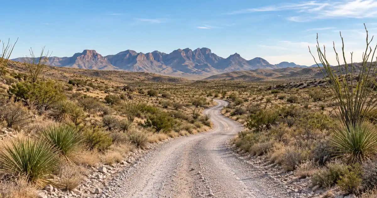
Departing Marfa heading southwest along South Highland Avenue, FM 2810 immediately stretches into open cattle pasture on the Marfa Plateau. For thirty-two miles, the road is a maintained, two-lane asphalt highway that rolls gently over wide swells of grama grass and prickly pear at an elevation hovering around 4,800 feet.
To the south and west, the jagged profile of the Chinati Mountains grows steadily larger against the horizon. Traffic on this initial paved segment is exceptionally sparse, consisting almost entirely of local ranch trucks and occasional utility vehicles. While paved, the asphalt features occasional dips and cattle guards where drivers must maintain attentive speed control.
At Milepost 32, the asphalt ends abruptly at a cattle guard marked by TxDOT warning signs indicating the termination of state pavement maintenance. Beyond this boundary, the road transitions into a county-maintained gravel and dirt track, marking the true entrance to Pinto Canyon.
The Unpaved Canyon Descent: Milepost 32 to Ruidosa
Once past the pavement terminus, the character of the roadway transforms completely. The road narrows to roughly one-and-a-half vehicle widths and begins a steep, winding descent into the upper reaches of Pinto Canyon. The route follows the natural drainage of Pinto Creek, carving through volcanic tuff, basalt ledges, and loose river gravel.
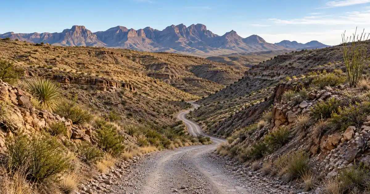
Drivers encounter several switchbacks with blind corners and unprotected drop-offs where oncoming vehicles must carefully negotiate passing space. The terrain shifts rapidly from open grassland plateau to towering canyon walls striped with desert varnish and studded with giant ocotillo, lechuguilla, and sotol.
The final twelve miles into Ruidosa wind through sandy arroyos and rocky washouts that crisscross the canyon bottom before merging into the fertile river floodplain. At the western terminus, FM 2810 dead-ends directly into the paved ribbon of the FM 170 River Road scenic drive, opening southward passage toward Presidio and Big Bend Ranch State Park.
| Mile Marker | Road Surface | Elevation | Key Landmark | Navigational Notes |
|---|---|---|---|---|
| Mile 0.0 | Paved Asphalt | 4,685 ft | Marfa (US-90 / Highland Ave) | Top off fuel tank, check spare tire pressure |
| Mile 15.4 | Paved Asphalt | 4,790 ft | Marfa Plateau Grasslands | Rolling pasture, active open-range livestock |
| Mile 32.1 | Pavement Terminus | 4,920 ft | Canyon Rim Cattle Guard | End of state maintenance; air down tires if desired |
| Mile 38.6 | Gravel & Caliche | 3,850 ft | Upper Pinto Canyon Switchbacks | Steep descent, tight curves, blind rocky corners |
| Mile 44.2 | Rough Dirt & Rock | 3,310 ft | Pinto Creek Wash Crossings | Dry arroyos, loose cobbles, slow rocky crawl |
| Mile 52.0 | Dirt to Asphalt | 2,840 ft | Ruidosa (Junction with FM 170) | Sacred Heart Church ruins; junction with River Road |
Vehicle Demands: Clearance, Tires, and 4WD Necessity
Attempting Pinto Canyon Road in an ill-equipped vehicle creates serious risks of mechanical breakdown or tire failure in an area where commercial recovery services can take twenty-four hours to organize and cost thousands of dollars. Understanding your vehicle’s mechanical specifications is fundamental before departing Marfa.
Ground Clearance and Chassis Protection
Standard low-slung passenger sedans, sports cars, and minivans are not suitable for the unpaved twenty-mile descent on FM 2810. While local ranchers occasionally navigate parts of the route in two-wheel-drive work trucks, their vehicles possess substantial suspension clearance and heavy commercial truck tires.
A minimum of eight inches of ground clearance is strongly advised. Embedded rhyolite boulders, exposed rock ledges, and steep drainage channels cut across the road surface. Vehicles lacking sufficient clearance risk cracking oil pans, tearing catalytic converters, or high-centering in deep gravel ruts.
Four-wheel drive is not strictly mandatory under bone-dry, freshly graded conditions, but having low-range four-wheel drive or an advanced all-wheel-drive system provides crucial engine braking on downhill gravel switchbacks and dependable traction when climbing through soft creek gravel. Travelers organizing their departure as part of a broader Marfa weekend itinerary should inspect vehicle undercarriages and fluid levels before leaving town.
Tire Durability and Spare Tire Readiness
The volcanic rock that makes up Pinto Canyon is notoriously sharp. Chert, fractured rhyolite, and jagged basalt flakes litter the gravel roadbed, posing a constant hazard for thin sidewall passenger tires.
Vehicles should be fitted with sturdy all-terrain tires featuring reinforced multi-ply sidewalls (such as Load Range E or robust trail-rated compounds). Lowering tire pressure slightly to between twenty-two and twenty-eight pounds per square inch can improve ride comfort, expand tire contact patches over loose stone, and reduce puncture vulnerability.
Every vehicle must carry a fully inflated, full-size spare tire matching the dimensions of the mounted wheels. Donut spares or temporary emergency inflator kits are completely inadequate on rough desert caliche. In addition, drivers should carry a reliable hydraulic bottle jack, a solid wood jacking base block for soft dirt, and a heavy-duty tire plug kit paired with a portable 12-volt air compressor.
Caution
Operating passenger cars with low-profile street tires along FM 2810 frequently results in unrepairable sidewall slices. Never enter the unpaved canyon section without confirming that your spare tire is properly inflated and that your lug wrench fits your wheels.
Landscape Spectacle: Chinati Mountains and Volcanic Canyons
The geological drama of Pinto Canyon stems from ancient volcanic cataclysms that reshaped the Trans-Pecos region tens of millions of years ago, creating an ecological sanctuary between high mountain peaks and low desert arroyos.
Geology of the Chinati Caldera and Canyon Cliffs
According to research published by the Texas State Historical Association Handbook of Texas: Pinto Canyon, Pinto Canyon forms a natural erosional pass cut through volcanic deposits between the Chinati Mountains to the east and the Sierra Vieja range to the northwest.
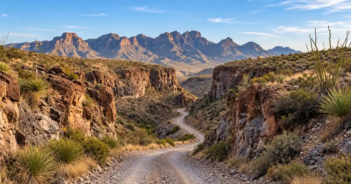
The towering peaks visible throughout the drive originated from the massive Chinati Caldera eruption roughly thirty-two million years ago. As ash flows cooled into thick layers of ignimbrite and welded tuff, subsequent faulting and water erosion carved vertical canyon amphitheaters, spires, and hanging cliffs.
The vegetation reflects a harsh yet resilient botanical community. Giant candelilla plants, yellow-flowering lechuguilla, strawberry cactus, and towering sotol stalks grip rocky crevices, while cottonwoods, desert willows, and honey mesquite cluster in the sub-surface moisture of deep arroyos. Travelers pausing at night along the highway right-of-way can observe unpolluted Bortle Class 1 night skies protected under the Greater Big Bend International Dark Sky Reserve.
Chinati Mountains State Natural Area Boundary Context
South of Pinto Canyon Road lies the vast and wild boundary of Chinati Mountains State Natural Area. Spanning approximately 39,000 acres of roadless desert peaks, deep box canyons, and springs, this public reserve encompasses Chinati Peak itself, which tops out at 7,728 feet above sea level.
According to the Texas Parks and Wildlife Department Chinati Mountains State Natural Area Overview, the property was acquired to safeguard unique desert biodiversity, including rare montane plant colonies and crucial wildlife corridors for mountain lions, bighorn sheep, and black bears.
Travelers must note that Chinati Mountains State Natural Area remains completely closed to general public access as TPWD develops resource management and facilities plans. The lands bordering both sides of FM 2810 are private working ranches; drivers must remain strictly within the public road right-of-way and respect all locked gates and boundary fencing.
| Elevation Zone | Elevation (ft) | Dominant Vegetation | Key Animal Species |
|---|---|---|---|
| Marfa Plateau | 4,600 - 4,950 ft | Blue grama, tobosa grass, yucca elata | Pronghorn antelope, Swainson’s hawk |
| Upper Pinto Canyon | 3,800 - 4,500 ft | Ocotillo, sotol, lechuguilla, prickly pear | Mule deer, rock squirrel, scaled quail |
| Lower Canyon Wash | 2,840 - 3,500 ft | Honey mesquite, desert willow, candelilla | Mountain lion, javelina, canyon wren |
Arriving at Ruidosa: Historic Ruins and the River Road Junction
Reaching the bottom of the twenty-mile dirt descent delivers travelers to Ruidosa, a quiet and historically rich settlement positioned along the Rio Grande plain. Once a thriving agricultural and trading village, Ruidosa today offers a poignant glimpse into nineteenth-century borderland history.
Sacred Heart Catholic Church and Adobe Outposts
The architectural centerpiece of Ruidosa is the historic Sacred Heart Catholic Church (Iglesia El Sagrado Corazón). Built around 1914 out of sun-dried adobe bricks, the structure features heavy earthen walls, hand-hewn wooden roof timbers, and twin belfries that overlook the desert flats.
Though partially weathered by seasonal flash rains and decades of desert sun, the church stands as a moving monument to the Hispanic families who farmed cotton, corn, and melons along the river bottomlands. Visitors can view and photograph the exterior facade from the roadside while respecting property perimeters.
Scattered throughout Ruidosa are crumbling adobe ruins, stone corrals, and hand-dug irrigation ditches that date back to frontier trading days. The pace of life here is peaceful and completely detached from modern commercial bustle.
Connecting to FM 170 and Presidio Travel Routes
At the southern terminus of FM 2810, the dirt path connects directly to Texas State Farm to Market Road 170. Turning right (northwest) leads toward the historic ghost community of Candelaria, where the pavement terminates near the old hot springs and river bluffs.
Turning left (southeast) follows FM 170 down the river for eighteen paved miles into Presidio, where travelers can find full services including gas stations, restaurants, hotels, and vehicle repair shops. From Presidio, explorers can continue north along US-67 past the Shafter ghost town silver mines back to Marfa, creating a spectacular 120-mile circular loop.
Alternatively, travelers can continue southeast from Presidio through the entrance gates of Texas Parks and Wildlife Department Big Bend Ranch State Park, following the iconic fifty-mile River Road route toward Lajitas and Terlingua.
Remote Desert Survival: Fuel, Communication, and Weather Risks
Driving through remote Presidio County requires serious outdoor self-reliance. When you turn onto FM 2810, you enter one of the most sparsely populated counties in the United States, where help is never quick to arrive.
Zero Cellular Signal and Offline Mapping
Cellular telephone coverage ends roughly ten miles southwest of Marfa and does not return until your vehicle approaches the city limits of Presidio on FM 170. For more than forty continuous miles, mobile devices will show no signal.
Standard smartphone navigation apps that depend on continuous cellular data connection will crash or lose routing capabilities. Download full offline map regions via Google Maps, OnX Offroad, or Gaia GPS prior to leaving Marfa.
A reliable satellite communicator (such as a Garmin inReach, ZOLEO, or Apple Emergency SOS via satellite) is an indispensable safety tool. If your vehicle suffers mechanical failure or catastrophic tire damage, a satellite messenger provides your only direct lifeline to Presidio County Sheriff dispatchers or emergency roadside assistance.
In contrast to high paved routes like the Davis Mountains Scenic Loop, where developed visitor centers and park headquarters are accessible, Pinto Canyon is pure backcountry.
Flash Flood Arroyos and Monsoon Hazards
During the North American monsoon season between July and September, intense desert thunderstorms can develop rapidly over the Chinati Mountains. The lower section of FM 2810 crosses multiple dry washes and arroyos that funnel thousands of gallons of stormwater toward the Rio Grande.
According to Texas Department of Transportation Rural Road Safety Guidelines, never drive into moving water or deep sediment deposits. A dry gravel arroyo can become a churning mudflow within twenty minutes of a cloudburst occurring miles away upstream.
If you encounter a flowing creek bed or thick deposits of wet caliche mud across the road, park on high, dry ground and wait for the water to dissipate. Most desert flash floods recede within one to three hours. Attempting to cross flowing arroyos risks vehicle swamping, chassis rollover, and life-threatening emergencies.
Warning
Summer temperatures in Pinto Canyon and Ruidosa frequently exceed 105 degrees Fahrenheit between late May and early September. Carry at least two gallons of drinking water per person per day, high-protein rations, and emergency electrolytes.
Frequently Asked Questions About Pinto Canyon Road
Can a standard sedan drive Pinto Canyon Road?
Driving a low-clearance sedan, sports car, or passenger minivan on Pinto Canyon Road is not recommended. The unpaved twenty-mile descent features steep switchbacks, embedded volcanic boulders, deep caliche ruts, and loose gravel arroyos that can scrape undercarriages, puncture oil pans, or cause tire blowouts. High-clearance SUVs, trucks, and all-wheel-drive crossovers with sturdy tires handle the terrain far more safely.
Is Pinto Canyon Road in Texas paved all the way?
No, FM 2810 is not paved all the way. The first 32 miles heading southwest from Marfa are paved two-lane asphalt. At Milepost 32, the state pavement ends, and the final 20 miles down through Pinto Canyon to Ruidosa consist of an unpaved, rugged dirt and gravel road.
Is four-wheel drive mandatory for FM 2810?
Four-wheel drive is not strictly mandatory during dry, recently graded road conditions, but a vehicle with high ground clearance (minimum eight inches) and durable all-terrain tires is necessary. Four-wheel drive is strongly advised if there has been any recent rainfall, as caliche mud becomes slick and creek crossings can become soft and impassable for two-wheel-drive vehicles.
How long does it take to drive from Marfa to Ruidosa on FM 2810?
Driving the 52 miles from Marfa to Ruidosa typically takes between two and two-and-a-half hours. The paved 32-mile stretch takes roughly 35 to 45 minutes, while the 20-mile unpaved canyon descent requires slow, cautious speeds of 10 to 20 miles per hour to protect tires and navigate rocky switchbacks.
Is Chinati Mountains State Natural Area open to the public?
No, Chinati Mountains State Natural Area is currently closed to the general public. While the state natural area borders the southern side of Pinto Canyon Road, Texas Parks and Wildlife Department has not yet opened trails, campgrounds, or public access gates. All land surrounding FM 2810 is private property, and visitors must stay within the public road right-of-way.
Are there gas stations or services along Pinto Canyon Road?
There are zero gas stations, convenience stores, water refill stations, or repair shops along the entire 52-mile length of FM 2810. You must fuel your vehicle in Marfa before departure or in Presidio after reaching FM 170. Ruidosa is a tiny residential community with no commercial facilities.