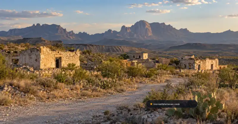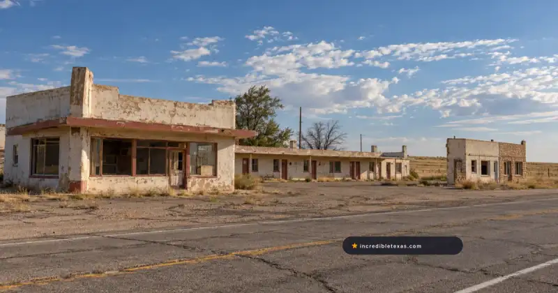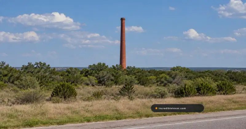
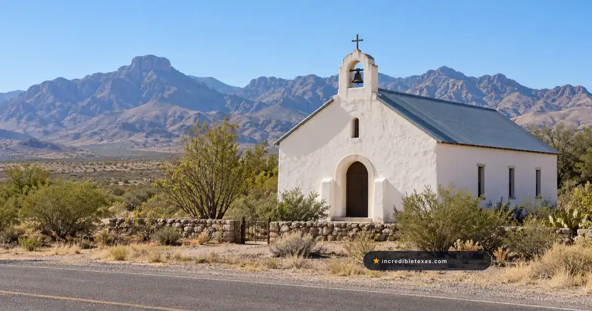
Tucked into a rugged canyon along the eastern base of the Chinati Mountains, the historic settlement of Shafter preserves the dramatic remnants of Texas’ greatest hard-rock mining bonanza. Today, the shafter texas ghost town draws desert travelers and photographers along US Highway 67 to explore crumbling stone miner cabins, silent mill foundations, and the legendary lore of the Presidio Silver Mine.
Note
Part of our comprehensive Texas Ghost Towns Road Trip Guide. Explore our full frontier itinerary, boomtown histories, and regional itineraries.
Key takeaways
- Shafter is situated in Presidio County along US Highway 67, roughly 43 miles south of Marfa and 18 miles north of Presidio.
- The Presidio Silver Mine produced over 30 million ounces of silver from more than 100 miles of underground shafts between 1883 and 1942.
- Travelers can view stone and adobe ruins, St. Stephen Catholic Church, and the historic hillside cemetery directly from public roads.
- The surrounding mine shafts and mill buildings sit on posted private land, requiring visitors to practice respectful roadside observation.
Plan your visit
Verified
- Location
- US Highway 67, Presidio County, TX 79843
- Hours
- Public highway right-of-way: Daylight hours
- Admission
- Free roadside viewing; private property restricted
- Best time to go
- October through April; late afternoon golden hour
Silver Capital of Texas: John Spencer and the Presidio Mining Company
In 1880, freighter John W. Spencer discovered rich argentiferous ore in Presidio County, leading to the creation of the Presidio Mining Company in 1883 and yielding more than 30 million ounces of silver before closing in 1942.
The story of john w spencer shafter silver began in September 1880 when Spencer noticed rich silver outcroppings while grazing draft animals near Cibolo Creek. Spencer carried mineral samples to Fort Davis, partnering with Colonel William R. Shafter to purchase the surrounding mineral acreage.
Historical archives from the Texas State Historical Association Handbook of Texas: Shafter record that military officers partnered with California investors to organize the presidio mining company shafter enterprise. The rich ore body earned widespread fame as the Silver Capital of Texas.
Operating through deep vertical shafts and elaborate horizontal tunnels, the shafter silver mine texas operation extracted argentite and cerargyrite continuously for nearly six decades. The settlement became the undisputed economic cornerstone of Trans-Pecos hard-rock mining.
Life and Labor in a Remote Chinati Mountain Boomtown
Shafter expanded to nearly 4,000 residents during its twentieth-century mining peaks, developing distinct Anglo and Mexican residential sections, wooden company stores, schools, saloons, and deep timbered stopes across 100 miles of shafts.
Miners endured brutal working conditions underground, breaking hard limestone and quartz rock with heavy sledgehammers and dynamite in oppressive heat. Surface reduction mills crushed raw ore into fine powder before cyanide extraction tanks recovered refined silver bars for rail shipment.
The remote chinati mountains ghost town developed a distinct cultural identity shaped by resilient Mexican and Anglo mining families. Unlike the quicksilver operations highlighted in our Terlingua Ghost Town travel guide, Shafter relied on silver extraction, sustaining an active community with bakeries, social clubs, and baseball teams.
When wartime labor diverted toward military production in 1942 and underground water pumps failed to keep pace with flooding, the company suspended operations. The sudden closure stripped the community of its primary employer, initiating a rapid decline into ghost town status.
What Remains Today: Stone Cabins, St. Stephen Church, and Mill Foundations
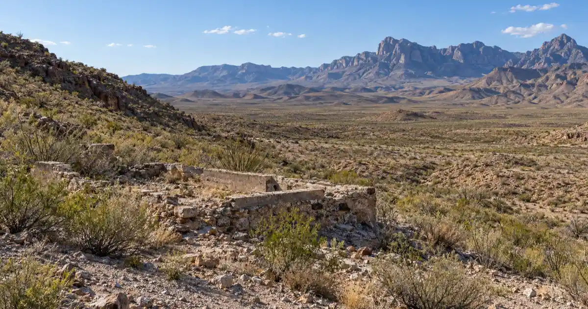
Travelers along US Highway 67 view stone and adobe miner homes, the historic facade of St. Stephen’s Catholic Church, crumbling company offices, and industrial tailing mounds against the Chinati Mountains.
Exploring shafter texas history along the highway reveals dozens of roofless stone cabins stepping up the arid canyon slopes. Local builders utilized native volcanic fieldstone and sun-dried adobe bricks, creating durable structures that continue to resist desert wind and rain.
At the center of the village stands St. Stephen Catholic Church, a simple mission-style sanctuary built in the late nineteenth century to serve local mining families. The silent white facade contrasts with the weathered volcanic hills, echoing the architectural style seen at the Lobo ghost town railroad outpost to the north.
Across Cibolo Creek, the concrete foundations of the original ore mill and roasting furnaces sprawl across the hillside. These massive masonry steps stand as structural remnants of industrial processing in one of the most remote regions of the state.
| Historic Landmark | Construction Period | Original Role | Current Visual Condition |
|---|---|---|---|
| St. Stephen Catholic Church | 1890s | Parish chapel for immigrant miners | Intact historic facade and bell tower |
| Miner Adobe Cabins | 1885-1920 | Residential quarters for company workers | Roofless stone and adobe wall ruins |
| Presidio Mill Foundations | 1890-1913 | Ore crushing and cyanide reduction plant | Multi-tiered concrete foundations |
| Shafter Hillside Cemetery | 1885-1945 | Community burial ground | Wrought-iron crosses and stone cairns |
| Cibolo Creek Bridge | 1930s | Highway 67 stream crossing | Historic concrete highway bridge |
Photographing the Historic Hillside Cemetery in Shafter
Perched on a caliche bluff overlooking Cibolo Creek, the Shafter Cemetery features hand-wrought iron crosses, hand-carved limestone markers, and offerings honoring generations of Mexican miners and frontier pioneers.
A short dirt track leads to the shafter historic cemetery, situated on an elevated terrace with sweeping views of the surrounding canyon. The graveyard holds hundreds of hand-fashioned wrought-iron crosses that cast intricate silhouettes against the warm afternoon sky.
Many markers display tender Spanish inscriptions, decorative glass marbles, and sun-bleached artificial flowers. The graves document early infant mortality, mining cave-in casualties, and victims of the devastating 1918 influenza epidemic.
Photographers should visit during late afternoon when the low angle of the sun illuminates the iron filigree and highlights the rugged textures of the mountain backdrop. Always remain on established paths and avoid disturbing fragile offerings.
Private Property Boundaries and Safe Roadside Viewing Etiquette
Most mining shafts and surviving structures in Shafter sit on posted private land where trespassing is strictly forbidden, making the public right-of-way along US Highway 67 the best location for respectful exterior photography.
Deep vertical shafts, unstable stopes, and decaying timbers make abandoned mine workings exceptionally hazardous. Warning signs and perimeter fences clearly demarcate private ranchland throughout the shafter ghost town ruins, marking it as one of the most rugged presidio county texas ghost towns.
Travelers can safely pull onto the wide highway shoulders along US Highway 67 to photograph the historic district. A telephoto zoom lens allows visitors to document architectural details, stone masonry, and industrial remnants without entering private property.
Respecting local property owners helps preserve the remaining structures for future generations of roadside explorers and historians.
Planning Your Trip: The Scenic Highway 67 Drive from Marfa to Presidio
Shafter sits along one of the most dramatically scenic mountain drives in Texas, located 43 miles south of Marfa and 18 miles north of Presidio, providing direct connections to Fort Leaton and Big Bend Ranch State Park.
The drive along us highway 67 marfa to presidio descends more than two thousand feet from high-altitude desert grasslands into the rugged canyon of Cibolo Creek. Along the route, travelers experience sweeping vistas of volcanic peaks, dry arroyos, and sheer canyon walls.
After touring the roadside ruins in Shafter, travelers can continue south to the border town of Presidio and explore the historic adobe compound at Texas Parks and Wildlife Department Fort Leaton State Historic Site.
From Presidio, adventure seekers can drive the legendary River Road along FM 170 into the vast backcountry canyonlands of Texas Parks and Wildlife Department Big Bend Ranch State Park. Travelers basing their journey in surrounding hubs can consult our Alpine Texas visitor guide to coordinate fuel, lodging, and supply stops.
Frequently Asked Questions About Shafter Texas
Can you go inside the silver mines at Shafter?
No, all historic underground shafts and mill buildings are located on private mining property and are strictly closed to the public due to extreme hazards like collapsed stopes and deep vertical drops. Visitors can safely observe and photograph surface ruins from public shoulders along US Highway 67.
Is Shafter Texas completely abandoned?
While the historic commercial core and mining works stand abandoned, a small handful of residents still live in rural homes scattered around the Shafter area. Visitors must respect local privacy and obey all posted private property signage.
Where is Shafter located along US Highway 67?
Shafter is located in Presidio County in Far West Texas along US Highway 67, approximately 43 miles south of Marfa and 18 miles north of the Mexican border city of Presidio. The scenic drive descends through the Chinati Mountains into the Cibolo Creek valley.
Why did the Presidio Silver Mine close in 1942?
The mine ceased operations in 1942 because of severe wartime labor shortages, declining ore grades, and costly water flooding inside the deepest shafts. Depressed silver prices after World War II prevented the company from resuming deep commercial extraction.