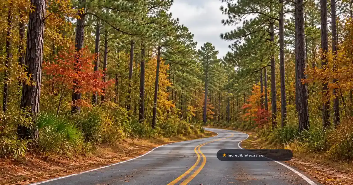
While travelers often associate autumn in Texas with the limestone canyons and bigtooth maples of Central Texas, the East Texas Pineywoods delivers one of the most extensive displays of deciduous fall color in the southern United States.
Spanning hundreds of thousands of acres across Angelina and Sabine National Forests, this scenic driving route threads through dense canopies where fiery sweetgums, scarlet red maples, and golden oaks stand in sharp relief against towering loblolly and longleaf pines.
Connecting historic Spanish colonial thoroughfares with winding lake causeways, this road trip links Nacogdoches, San Augustine, and deep national forest recreation areas into a cohesive 145-mile autumn loop. Travelers can spend two unhurried days exploring shaded hiking trails, photographing historic sawmill ruins, and crossing expansive reservoirs bordered by copper-colored bald cypress groves.
Key takeaways
- The East Texas Pineywoods foliage loop covers 145 miles connecting Nacogdoches, San Augustine, Zavalla, and Hemphill.
- Peak fall foliage arrives later than northern states, typically between November 10 and November 30.
- Key routes include State Highway 21 (El Camino Real), State Highway 147, State Highway 87, and FM 63.
- Standout roadside stops include Boykin Springs, the historic Aldridge Sawmill ruins, and Red Hills Lake Recreation Area.
- Public highway driving is free, while developed U.S. Forest Service recreation sites charge $3 to $5 day-use fees.
Route Blueprint: The East Texas Pineywoods Autumn Loop
The driving route forms an expansive loop across deep East Texas, allowing motorists to start in either Nacogdoches or Lufkin. The circuit passes through rolling terrain, heavily timbered creek bottoms, and wide lake bridges that display contrasting forest canopies.
Highway Legs and National Forest Corridors
Departing historic Nacogdoches heading east on State Highway 21, the road traces the ancient corridor of El Camino Real de los Tejas. For thirty-five miles, drivers roll through gentle hills framed by mature sweetgum trees, red maples, and family cattle ranches before arriving in San Augustine.
From San Augustine, the route heads south along State Highway 147, cutting through the eastern parcel of Angelina National Forest. This segment crosses the northern reaches of Sam Rayburn Reservoir over elevated causeways where open water reflects golden shoreline hardwoods.
Continuing south to Zavalla, travelers take State Highway 63 east toward the Angelina River basin, with forest road spurs leading directly to Boykin Springs. Crossing eastward into Sabine County, State Highway 87 leads north through the heart of Sabine National Forest and along the edge of Toledo Bend Reservoir back toward San Augustine.
While Lost Maples State Natural Area foliage hikes offer concentrated canyon pockets, this East Texas drive delivers hundreds of continuous miles of forest canopy.
Mileage, Drive Times, and Gateway Towns
The complete driving circuit covers approximately 145 miles. Driven continuously without long stops, the loop requires three-and-a-half to four hours of windshield time along paved two-lane state highways.
However, leaf peeping in East Texas is best experienced at a relaxed tempo. Budgeting a full weekend allows ample time for woodland trail walks, historical museum visits in Nacogdoches, and picnic lunches along quiet national forest lakes.
Gateway communities provide comfortable lodging and dining. Nacogdoches offers boutique hotels, local bakeries, and antique shopping districts. San Augustine provides historic bed-and-breakfasts, while Jasper and Lufkin offer full municipal traveler services and fuel stations.
| Highway Segment | Route Designation | Distance | Primary Forest Agency | Highlight Features |
|---|---|---|---|---|
| Northern Arc | State Highway 21 | 35 miles | Private & Forest Buffer | El Camino Real, San Augustine historic square |
| Central Causeway | State Highway 147 | 28 miles | Angelina National Forest | Sam Rayburn bridge crossing, Bannister WMA |
| Southern Forest Spur | TX-63 to Forest Rd 300 | 22 miles | Angelina National Forest | Boykin Springs, Neches River bottomlands |
| Eastern Lake Rim | State Highway 87 | 36 miles | Sabine National Forest | Toledo Bend shoreline, Red Hills Lake |
| Western Return | TX-7 to Nacogdoches | 24 miles | Angelina Timber Corridor | Rolling pine hills, hardwood farm margins |
Fall Foliage Science: Hardwoods, Cypress, and Pine Canopies
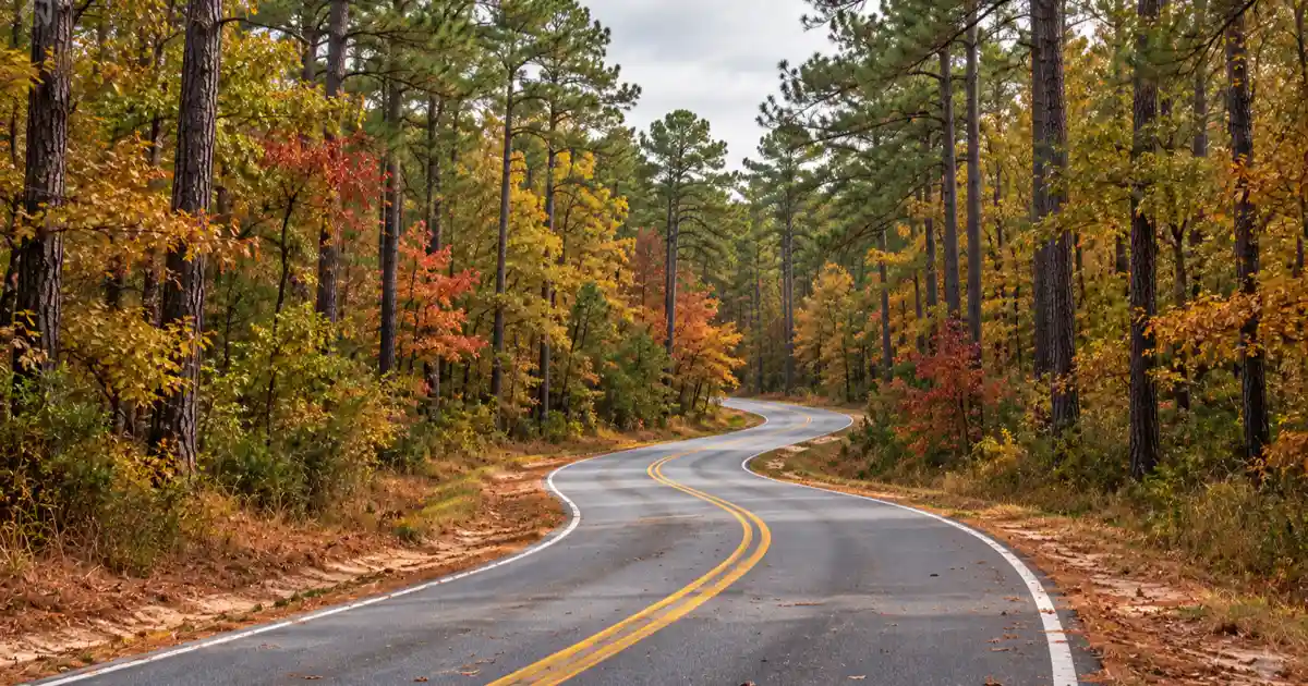
The unique visual appeal of East Texas autumn foliage lies in its rich plant diversity. Unlike monoculture pine plantations, the national forests preserve natural river drainages and mixed hardwood slopes that produce layers of contrasting color.
Key Hardwood Species and Canopy Colors
The brilliant colors of the Pineywoods come from dozens of native hardwood species growing along moist bottomlands and rolling uplands. As shorter daylight hours and cool autumn evenings slow chlorophyll production, underlying pigments transform the canopy.
Sweetgum trees (Liquidambar styraciflua) are the most prolific color producers in East Texas, turning deep purple-red, brilliant crimson, orange, and pale yellow often on the same branch. Red maples (Acer rubrum) provide shocks of vivid scarlet along creek beds, while flowering dogwoods turn deep wine-red.
Southern red oaks, post oaks, and white oaks provide warm bronze and amber tones that linger into early winter. Along lake shorelines and bayous, bald cypress trees (Taxodium distichum) transition into a rich rusty copper.
These distinct hues stand out dramatically against the dark green needles of towering loblolly and shortleaf pines. Further north in Morris County, Daingerfield State Park fall foliage displays similar hardwood mixtures around its spring-fed lake basin.
Optimal Bloom and Peak Foliage Calendar
East Texas experiences its peak autumn color significantly later than northern regions or high-altitude mountain ranges. According to regional seasonal tracking by the Texas Parks and Wildlife Department Martin Dies Jr State Park Guide, the prime viewing window occurs between November 10 and November 30.
The exact timing depends on autumn weather conditions. Crisp nighttime temperatures in the low 40s paired with warm, sunny days accelerate anthocyanin production, yielding the most brilliant red and purple leaves.
Prolonged summer droughts can cause leaves to brown and drop prematurely, whereas adequate late-summer rainfall followed by a clear, dry October produces striking mid-November canopies. By the first week of December, most hardwood leaves have dropped, though bald cypress trees often hold their copper needles well into the holidays.
| Tree Species | Common Habitat | Autumn Color Range | Peak Viewing Window |
|---|---|---|---|
| Sweetgum | Moist creek bottoms and slopes | Yellow, orange, vivid scarlet, purple | Nov 10 - Nov 25 |
| Red Maple | Riparian corridors and swamps | Bright scarlet, glowing crimson | Nov 12 - Nov 28 |
| Flowering Dogwood | Forest understory beneath pines | Rich wine-red, purple | Nov 05 - Nov 20 |
| Southern Red Oak | Upland sandy ridges | Deep amber, bronze, russet | Nov 15 - Dec 05 |
| Bald Cypress | Lake perimeters and sloughs | Rusty copper, burnt orange | Nov 20 - Dec 10 |
Angelina National Forest: Boykin Springs and Sam Rayburn Causeways
Encompassing over 153,000 acres in the heart of East Texas, Angelina National Forest contains some of the region’s finest old-growth pine savannas, clear spring-fed creeks, and massive lake recreation areas.
Boykin Springs Recreation Area and the Sawmill Trail
Located off State Highway 63 between Zavalla and Jasper, Boykin Springs Recreation Area serves as the outdoor crown jewel of Angelina National Forest. Operated by the U.S. Forest Service, the site centers on a tranquil spring-fed lake constructed by the Civilian Conservation Corps in the late 1930s.
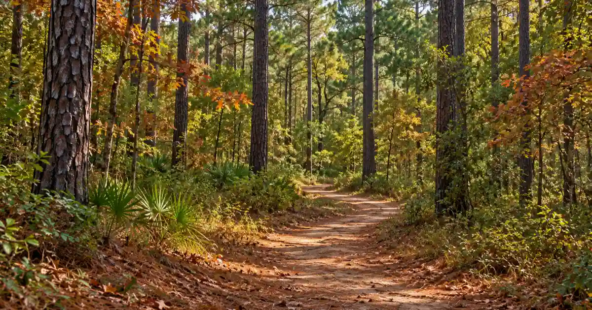
A nine-foot stone waterfall spillway creates a gentle rushing sound that echoes through the surrounding longleaf pines. The day-use area features shaded picnic tables, stone fire rings, and a historic CCC open-air picnic pavilion.
The site also serves as the western trailhead for the 5.5-mile Sawmill Hiking Trail. Following the winding banks of Boykin Creek, the footpath passes through dense fern-filled hardwood bottoms before reaching the dramatic concrete ruins of the historic Aldridge Sawmill.
In mid-November, the trail canopy forms a golden tunnel of sweetgums and dogwoods. Travelers can consult our comprehensive Angelina National Forest camping and hiking guide for detailed trail mileage and campsite reservations.
Crossing State Highway 147 Causeway Over Big Sam
Driving north from Zavalla along State Highway 147 delivers one of the most scenic bridge crossings in Texas. The highway crosses the midsection of Sam Rayburn Reservoir over an expansive concrete causeway spanning open water.
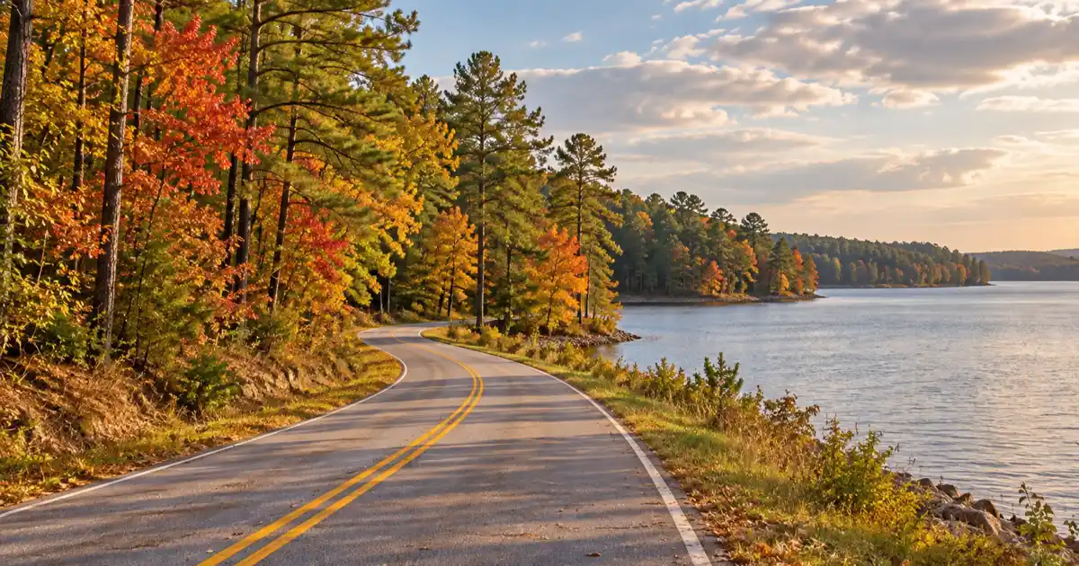
Covering 114,500 surface acres, Sam Rayburn is the largest lake located entirely within Texas. From the center of the causeway, motorists enjoy panoramic vistas across thousands of acres of water framed by timbered peninsulas.
In late autumn, the shoreline hardwoods create a multi-colored ribbon between the blue reservoir waters and the evergreen pine ridges. Cassels-Boykin County Park, situated on the southern shore of the bridge, offers an ideal spot to pull off, stretch your legs, and photograph passing sailboats and migratory waterbirds.
Tip
Forest Road 300 leading into Boykin Springs is paved, but interior forest roads connecting to primitive trailheads are unpaved gravel. During autumn rains, these gravel tracks remain passable for standard passenger vehicles, provided drivers stay on established roadbeds.
Sabine National Forest: Red Hills Lake and Toledo Bend Rims
Stretching along the Louisiana state line in Sabine, San Augustine, and Shelby counties, the 160,000-acre Sabine National Forest protects dense pine uplands and hardwood-choked ravines bordering Toledo Bend Reservoir.
Red Hills Lake Recreation Area and Beech Ravines
Situated along State Highway 87 north of Hemphill, Red Hills Lake Recreation Area is a peaceful 17-acre impoundment built by the CCC in the 1930s. The quiet lake is sheltered by steep earthen banks covered in towering loblolly pines, American beech, and southern red oaks.
According to regional fisheries and wildlife data from the Texas Parks and Wildlife Department Sam Rayburn Reservoir Overview, these forested watersheds provide vital recreational access. Red Hills Lake offers developed campsites with water and electric hookups, a sandy swimming beach, and a half-mile nature trail.
The nature trail winds through deep beech ravines where golden beech leaves remain attached to branches long after other hardwoods have dropped, creating a golden understory that glows in late afternoon sunlight. Shaded picnic sites overlooking the water provide an ideal rest stop during an autumn road trip.
Highway 87 and Toledo Bend Scenic Overlooks
State Highway 87 serves as the primary north-south scenic corridor through Sabine County, running parallel to the vast western shoreline of Toledo Bend Reservoir. With 185,000 surface acres of water, Toledo Bend is one of the largest manmade reservoirs in the South.
As Highway 87 winds through national forest tracts, numerous marked forest roads lead east toward quiet shoreline coves, boat ramps, and public fishing piers. Motorists can pull into Indian Mounds Recreation Area or Lakeview Recreation Area to enjoy wide-angle views across the reservoir into Louisiana.
Creek channels entering the lake are rich in bald cypress trees draped in Spanish moss, providing classic southern wetland photography against autumn foliage. Travelers planning angling excursions or extended reservoir stays can check our Sam Rayburn Reservoir visitor guide to contrast regional waterway amenities.
Historic Byways: El Camino Real and Cradle of Texas Landmarks
Beyond natural forest scenery, this autumn drive follows some of the most historically significant transportation corridors in Texas, linking centuries of pioneer settlement, indigenous trading routes, and Republic-era architecture.
Driving State Highway 21 Through San Augustine
State Highway 21 closely traces the original route of El Camino Real de los Tejas, the Spanish royal road established in the 1690s to connect Mexico City with Spanish missions in East Texas and Louisiana.
According to the National Park Service El Camino Real de los Tejas Guide and historical archives from the Texas State Historical Association Handbook of Texas: Old San Antonio Road, this ancient path carried Spanish soldiers, Native American traders, and early Anglo-American settlers across the Pineywoods.
Driving this highway brings travelers into San Augustine, widely celebrated as the Cradle of Texas. The town square is anchored by the historic 1927 San Augustine County Courthouse and surrounded by antebellum homes and manicured oak lawns. Visitors can tour the historic 1839 Ezekiel Cullen House or stroll beneath shaded pecan and maple trees that line residential historic districts.
Autumn Walking Tours in Historic Nacogdoches
Nacogdoches anchors the western terminus of the scenic foliage loop. Founded in 1779 by Don Antonio Gil Y’Barbo, Nacogdoches holds the official title of the Oldest Town in Texas.
In autumn, downtown Nacogdoches is particularly charming. Red-brick streets along Main Street and Pilar Street are framed by historic storefronts, local art galleries, coffee roasteries, and independent restaurants.
The Ruby M. Mize Azalea Garden on the Stephen F. Austin State University campus features miles of paved accessible walking trails through twenty acres of native hardwood forest. While famous for spring blooms, the garden’s extensive Japanese maple collection turns dazzling shades of scarlet, purple, and gold during mid-November.
Travelers can combine this national forest drive with other regional destinations highlighted in our guide to East Texas hidden gems.
Frequently Asked Questions About Texas Pineywoods Fall Foliage
When is peak fall foliage in the Texas Pineywoods?
Peak fall foliage across Angelina and Sabine National Forests typically occurs between mid-November and late November, roughly November 10 through November 30. Cooler nighttime temperatures in the 40s trigger intense color changes in sweetgums, red maples, and dogwoods.
What is the best highway to drive for East Texas fall colors?
State Highway 21 (historic El Camino Real) between Nacogdoches and San Augustine, combined with State Highway 147 crossing Sam Rayburn Reservoir and FM 63 through Angelina National Forest, provides the most scenic concentration of mixed hardwoods and towering pines.
Are there entry fees to drive through Angelina and Sabine National Forests?
No, driving along public state and county highways through both national forests is completely free. Modest day-use fees ranging from $3 to $5 apply only if you utilize developed recreation areas, swim beaches, or boat ramps such as Boykin Springs or Red Hills Lake.
Can you hike to the Aldridge Sawmill during fall drives?
Yes, visitors can access the historic Aldridge Sawmill ruins via the 5.5-mile Sawmill Hiking Trail starting from Boykin Springs Recreation Area. The shaded path follows Boykin Creek through golden hardwood canopies and stands of longleaf pines.
Where should you stay during an East Texas fall foliage trip?
Nacogdoches and Lufkin offer the largest selection of boutique bed-and-breakfasts, historic inns, and modern hotels. Campers can reserve developed lakeside sites at Boykin Springs in Angelina National Forest or Red Hills Lake in Sabine National Forest.
Is there reliable cellular service throughout the national forests?
Cellular reception is intermittent and often completely unavailable in deep river bottoms and remote national forest tracts between Zavalla, Hemphill, and the Sabine River. Travelers should download offline navigation maps prior to departing major towns.