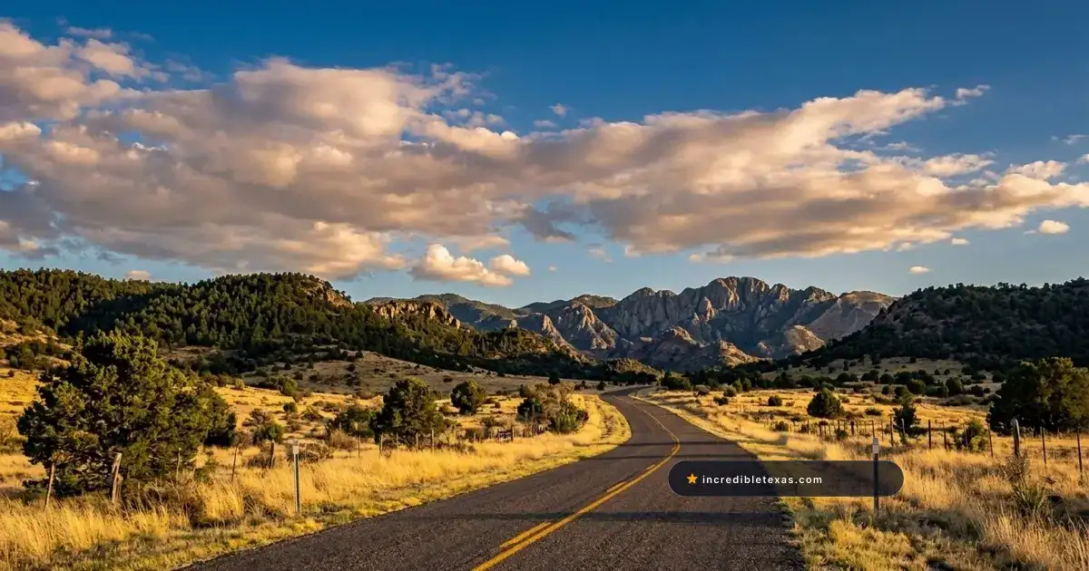
Rising above the desert plains of West Texas, the Davis Mountains form a cool, high-elevation sky island where ancient volcanic spires, pinyon pines, and rolling pastures create an alpine landscape unique in the Lone Star State. Encircling this rugged range, the 75-mile Davis Mountains Scenic Loop stands as the highest highway route in Texas.
Key takeaways
- The Davis Mountains Scenic Loop covers 75 miles along Texas State Highways 118 and 166, starting and finishing in Fort Davis.
- State Highway Spur 78 up Mount Locke reaches 6,791 feet, making it the highest paved highway in Texas.
- The loop traverses an isolated sky island ecosystem featuring pine forests, alligator junipers, and volcanic peaks like Sawtooth Mountain.
- Major roadside stops include McDonald Observatory, Madera Canyon Trail, Lawrence E. Wood Picnic Area, and Davis Mountains State Park.
- Fuel is available only in Fort Davis, with zero commercial services or cellular signal along the 60-mile backcountry loop.
Route Blueprint: Driving the 75-Mile Davis Mountains Scenic Loop
The Davis Mountains Scenic Loop spans 75 paved miles through Jeff Davis County, connecting Texas State Highway 118 and Texas State Highway 166 in a circular route beginning and ending in Fort Davis. Encircling the highest mountain range situated entirely within Texas, the drive delivers sweeping sky-island vistas, pine-forested canyons, and open grasslands.
Geographic Setting and the High-Desert Sky Island
Unlike the dry desert lowlands of the Chihuahuan Desert, the Davis Mountains represent an isolated sky island. Cooler temperatures and higher annual precipitation support botanical communities of ponderosa pine, alligator juniper, and Texas madrone that survived here since the last Ice Age.
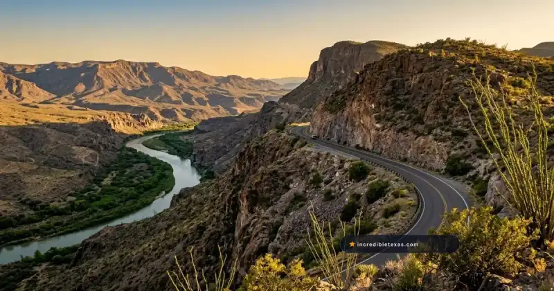
The terrain originated from massive volcanic eruptions roughly 35 million years ago, forming jagged basalt palisades and granite-like rhyolite spires. While travelers driving the desert canyon rims along FM 170 River Road in Big Bend experience arid river gorges, the Davis Mountains Scenic Loop delivers pine-scented mountain air and sweeping highland pasturelands.
Drive Distance, Direction Strategy, and Elevation Profiles
The complete loop covers 75.3 miles from downtown Fort Davis. From town at 4,900 feet, Texas Highway 118 climbs northwest past Davis Mountains State Park and McDonald Observatory, cresting at over 6,000 feet before winding through Madera Canyon.
At the northern junction near Mount Livermore, Highway 118 turns south onto Texas Highway 166, which traces the southern base of Sawtooth Mountain before returning east to Fort Davis. Driving clockwise is recommended because it positions travelers at McDonald Observatory and high canyon trailheads in the morning, leaving the wide afternoon skies and golden hour light for Highway 166.
| Highway Leg | Designation | Distance | Elevation Range | Key Scenic Highlight |
|---|---|---|---|---|
| Northern Arc | Texas Highway 118 | 38 miles (Fort Davis to TX-166) | 4,900 to 6,200 ft | McDonald Observatory & Madera Canyon |
| Summit Spur | State Highway Spur 78 | 1.8 miles (off TX-118) | 6,200 to 6,791 ft | Mount Locke & UT Research Telescopes |
| Western Arc | Texas Highway 166 | 24 miles (TX-118 to TX-17) | 5,100 to 6,000 ft | Sawtooth Mountain & Rockpile Park |
| Eastern Return | Texas Highway 17 | 13 miles (TX-166 to Fort Davis) | 4,900 to 5,200 ft | Rolling ranch pastures & Limpia Creek |
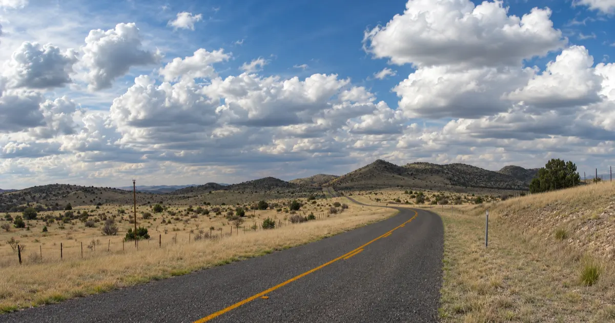
Climbing to Mount Locke: Spur 78 and McDonald Observatory
Rising off Highway 118 sixteen miles northwest of Fort Davis, State Highway Spur 78 climbs steeply up Mount Locke to reach McDonald Observatory at 6,791 feet. This mountain summit represents the highest paved state-maintained highway in Texas, offering 360-degree views across the Trans-Pecos mountain ranges.
Spur 78: The Highest Paved Highway in Texas
Spur 78 branches south from Highway 118, climbing nearly 600 vertical feet across 1.8 miles of sharply banked switchbacks. Guardrails line steep mountain drop-offs as the road winds past research staff residences and private telescope domes.
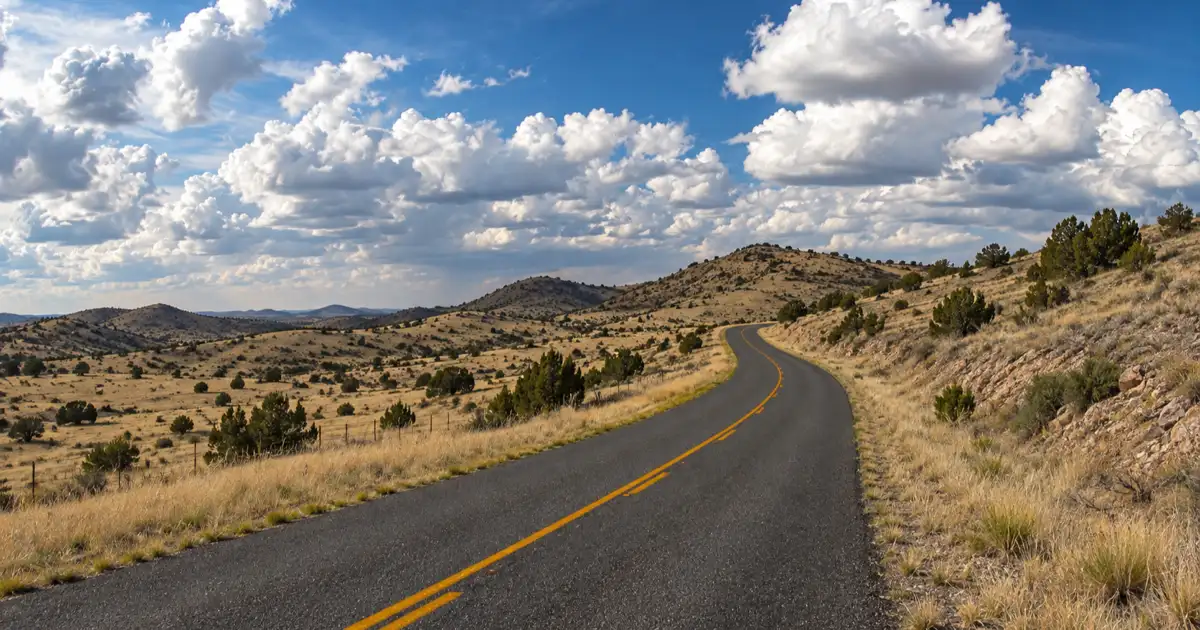
At the summit crest, drivers arrive at the parking terrace of the historic 107-inch Harlan J. Smith Telescope. The elevation of 6,791 feet provides a panoramic vista stretching south toward the Chisos Mountains in Big Bend and north toward the Guadalupe Mountains on the New Mexico border.
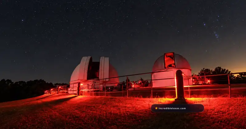
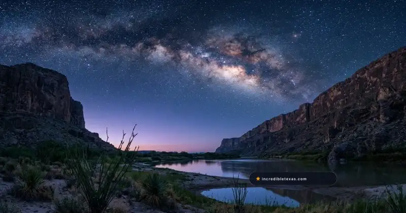
This high-altitude summit sits at the core of the Greater Big Bend International Dark Sky Reserve, ensuring unpolluted night skies for both astronomers and nighttime travelers.
Visiting the Telescopes and Star Party Logistics
The University of Texas at Austin operates McDonald Observatory as an active international research station. According to the University of Texas at Austin McDonald Observatory Visitor Programs, the Frank N. Bash Visitors Center welcomes daytime travelers with interactive science exhibits, solar telescope viewings, and theater presentations.
Evening visitors can attend the famous Star Parties held three nights per week in the outdoor amphitheater, where astronomers use laser pointers and research-grade telescopes to display constellations, nebulae, and distant galaxies. Travelers planning an evening visit should consult our McDonald Observatory Star Party tickets guide to secure advance reservations weeks before arrival.
Tip
Star party tickets frequently sell out 30 to 60 days in advance during summer months, spring break, and holiday weekends. Book online through the observatory portal before finalizing lodging, and bring a heavy winter coat, as summit temperatures plunge into the 40s even during midsummer.
Iconic Overlooks: Sawtooth Mountain, Madera Canyon, and Lawrence E. Wood Park
The western and northern sectors of the loop feature signature scenic pullouts, highlighted by the serrated jagged profile of Sawtooth Mountain at 7,686 feet along TX-166. Along TX-118, the Lawrence E. Wood Picnic Area provides shaded tables beneath ponderosa pines and access to the 2.5-mile Madera Canyon hiking trail.
Photographing Sawtooth Mountain Along Highway 166
Sawtooth Mountain is one of the most recognizable geological formations in Texas, rising 7,686 feet with a jagged volcanic ridge that resembles the teeth of a handsaw. Along Highway 166, TxDOT constructed a wide gravel pullout that frames the peak against open desert grasslands.
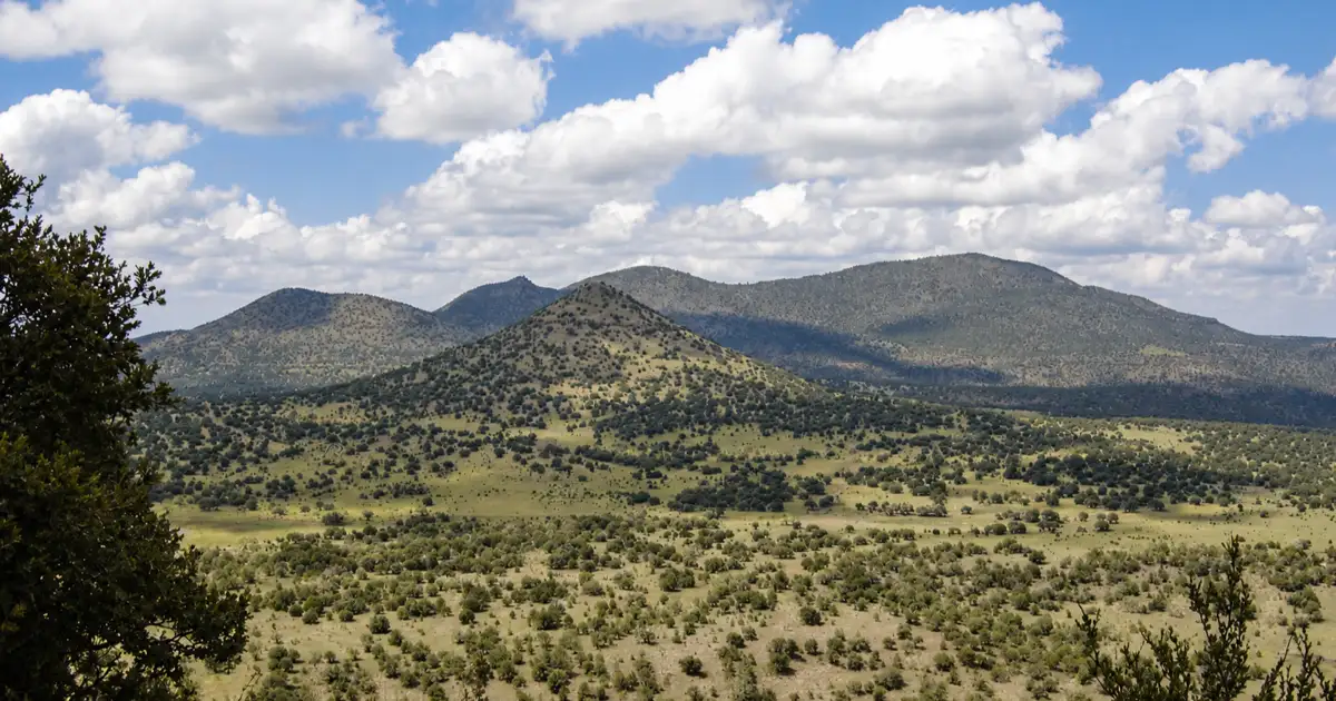
The western face of Sawtooth catches intense golden hour illumination during late afternoons, highlighting deep vertical fracture lines in the volcanic rock. Wide-angle lenses allow photographers to capture rustic barbed-wire ranch fencing and native bunchgrasses in the foreground.
Hiking the Madera Canyon Trail at Lawrence E. Wood Rest Area
Located at Milepost 25 along Highway 118, the Lawrence E. Wood Picnic Area is a shaded roadside park operated in cooperation with The Nature Conservancy. Native ponderosa pines, silverleaf oaks, and pinyon trees shade stone picnic tables along the dry creek bed.
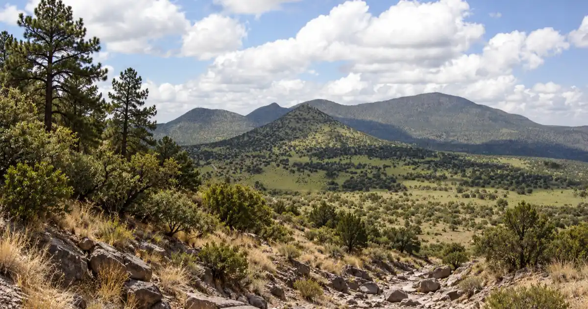
The site serves as the trailhead for the 2.5-mile Madera Canyon Trail loop. The footpath winds gently through the canyon floor, crossing gravel arroyos and climbing low basalt ridges that overlook the private wilderness of the Davis Mountains Preserve.
Rockpile Roadside Park and Volcanic Boulders
Situated on Highway 166 approximately 30 miles west of Fort Davis, Rockpile Roadside Park takes its name from massive clusters of weathered volcanic boulders scattered across the pastureland. The rounded rhyolite rocks were deposited during ancient volcanic flows and carved by wind erosion.
The roadside park offers shaded tables, historical markers detailing pioneer stagecoach routes, and safe spots for families to climb low rock slabs. With zero light pollution across this remote county, roadside pullouts along TX-166 offer prime night sky viewing within the Greater Big Bend International Dark Sky Reserve. It marks the midpoint of the western loop where open high-desert plains stretch toward the horizon.
| Stop Name | Highway & Milepost | Primary Feature | Facilities Available |
|---|---|---|---|
| Lawrence E. Wood Park | TX-118 (Mile 25) | Ponderosa pine grove & Madera Canyon hike | Shaded picnic tables, trail kiosk |
| McDonald Observatory | Spur 78 (off TX-118) | 6,791 ft summit & research telescopes | Visitors center, restrooms, cafe |
| Sawtooth Overlook | TX-166 (Mile 42) | View of 7,686 ft Sawtooth Mountain | Wide gravel highway pullout |
| Rockpile Roadside Park | TX-166 (Mile 48) | Giant weathered volcanic boulders | Shaded stone picnic tables |
| Point of Rocks | TX-166 (Mile 62) | Elevated roadside vista across grasslands | Paved parking, picnic tables |
Historic Gateways: Fort Davis and Davis Mountains State Park
The eastern gateway of the scenic loop is anchored by the historic mountain town of Fort Davis and Davis Mountains State Park. Travelers can explore restored 19th-century frontier army barracks at Fort Davis National Historic Site or drive the high ridgelines of Skyline Drive inside the state park.
Driving Skyline Drive at Davis Mountains State Park
Davis Mountains State Park encompasses 2,709 rugged mountain acres just four miles northwest of town. According to the Texas Parks and Wildlife Department Davis Mountains State Park Guide, the park features 16 miles of hiking trails, developed campgrounds, and the historic 39-room Indian Lodge built by the Civilian Conservation Corps.
A major highlight is Skyline Drive, a paved mountain road that climbs to scenic stone lookout shelters perched atop the ridge crest. The overlook reveals dramatic views across Keesey Canyon, the town of Fort Davis, and the surrounding volcanic mountains.
For comprehensive admission details, campground loop maps, and Indian Lodge reservation advice, review our complete Davis Mountains State Park visitor guide.
Exploring Fort Davis National Historic Site
Located at the base of Sleeping Lion Mountain on the edge of town, the National Park Service Fort Davis National Historic Site preserves one of the best-surviving frontier military posts in the American Southwest. Active from 1854 to 1891, the fort protected emigrants, mail coaches, and freight wagons on the San Antonio-El Paso road.
Visitors can tour twenty-four restored stone and adobe buildings, including officer quarters, barracks, and the post hospital. A self-guided walking tour through the compound brings the history of the legendary Buffalo Soldiers to life amidst towering red volcanic cliffs.
| Historic / Park Site | Location | Admission Cost | Highlights |
|---|---|---|---|
| Davis Mountains State Park | Park Road 3 (off TX-118) | $6 adults, kids 12 & under free | Skyline Drive, CCC Indian Lodge, hiking |
| Fort Davis Historic Site | Highway 17 (downtown) | $10 adults, kids 15 & under free | 24 restored frontier buildings & museum |
| Chihuahuan Desert Center | Highway 118 (south of town) | $7 adults, kids 12 & under free | 507-acre nature center & botanical gardens |
High-Altitude Mountain Driving Safety: Weather, Wildlife, and Fuel Realities
Driving the Davis Mountains Scenic Loop requires careful advance planning because the route reaches elevations above 6,700 feet where mountain weather shifts rapidly. Winter storms produce sudden highway icing, while summer afternoons bring intense lightning; travelers must fill fuel tanks in Fort Davis and watch for free-range cattle and mule deer.
Winter Snow and Summer Monsoon Lightning Storms
Because the scenic loop averages over 5,500 feet in elevation, winter temperatures regularly plunge into the teens between December and February. Passing Pacific fronts can deposit several inches of snow and black ice across Highway 118, particularly on shaded mountain curves near Mount Locke.
During the July and August monsoon season, intense afternoon thunderstorms develop quickly over the mountain peaks. Drivers should monitor skies for cloud-to-ground lightning, avoid exposed ridge pullouts during active strikes, and watch for rockfall washed onto the pavement by heavy rains.
Travelers basing their road trip in the region can find full grocery stores and vehicle mechanics in the nearby Alpine Texas gateway thirty minutes to the southeast.
Fuel Planning, Livestock on Highway 166, and Black Bear Cautions
There are zero fuel stations, convenience markets, or water sources along the 60-mile stretch of TX-118 and TX-166 between Fort Davis and the Highway 17 junction. Fill your gas tank completely in Fort Davis before beginning the loop to prevent running out of fuel in remote mountain gaps.
Highway 166 cuts through private working cattle ranches with multiple open-range grazing sections. Black Angus cattle, native mule deer, and javelinas frequently wander onto the roadbed, especially around blind curves during early morning and twilight hours.
The Davis Mountains also support the largest breeding population of black bears in Texas. Campers and picnickers at roadside parks must store all food in vehicle trunks and dispose of trash in bear-proof receptacles.
Warning
Black ice forms rapidly on Highway 118 near Mount Locke and Spur 78 during winter cold snaps, even when highways in Fort Davis are clear and dry. If winter weather is forecast, check road conditions with TxDOT before departing, and carry extra blankets, drinking water, and warm clothing in your vehicle.
Frequently Asked Questions About the Davis Mountains Scenic Loop
How long is the Davis Mountains Scenic Loop in Texas?
The complete Davis Mountains Scenic Loop measures approximately 75 miles, beginning and ending in the town of Fort Davis via Texas State Highways 118 and 166.
What is the highest highway in Texas?
State Highway Spur 78, which branches off Highway 118 to ascend Mount Locke to the McDonald Observatory, reaches an elevation of 6,791 feet, making it the highest paved public highway in Texas.
Is the Davis Mountains Scenic Loop paved the entire way?
Yes, both Texas Highway 118 and Texas Highway 166 are fully paved with two asphalt lanes across the entire 75-mile distance, making the drive suitable for all passenger vehicles, motorcycles, and RVs.
What direction should you drive the Davis Mountains Scenic Loop?
Driving clockwise (heading north out of Fort Davis on TX-118 and returning east on TX-166) is recommended so travelers can visit McDonald Observatory and Madera Canyon in the morning and photograph Sawtooth Mountain under afternoon golden hour light. Road trippers continuing north toward the New Mexico border can also follow The Lonesome Highway photo guide to photograph the dramatic vanishing-point view of El Capitan.
Where do you get gas along the Davis Mountains Scenic Loop?
Gasoline is available only in the town of Fort Davis. There are zero gas stations, convenience stores, or commercial services along the remaining 60 miles of backcountry highway on TX-118 and TX-166.
Can you visit McDonald Observatory while driving the scenic loop?
Yes, McDonald Observatory sits directly along Highway 118 sixteen miles northwest of Fort Davis. Daytime visitors can explore the Frank N. Bash Visitors Center and tour the summit telescopes, while evening star parties require advance ticket reservations.
What is the elevation of the Davis Mountains Scenic Loop?
The scenic loop begins around 4,900 feet in Fort Davis, climbs above 6,000 feet along Highway 118, and reaches 6,791 feet at the summit of Mount Locke on Spur 78, offering noticeably cooler temperatures than the surrounding desert floor.