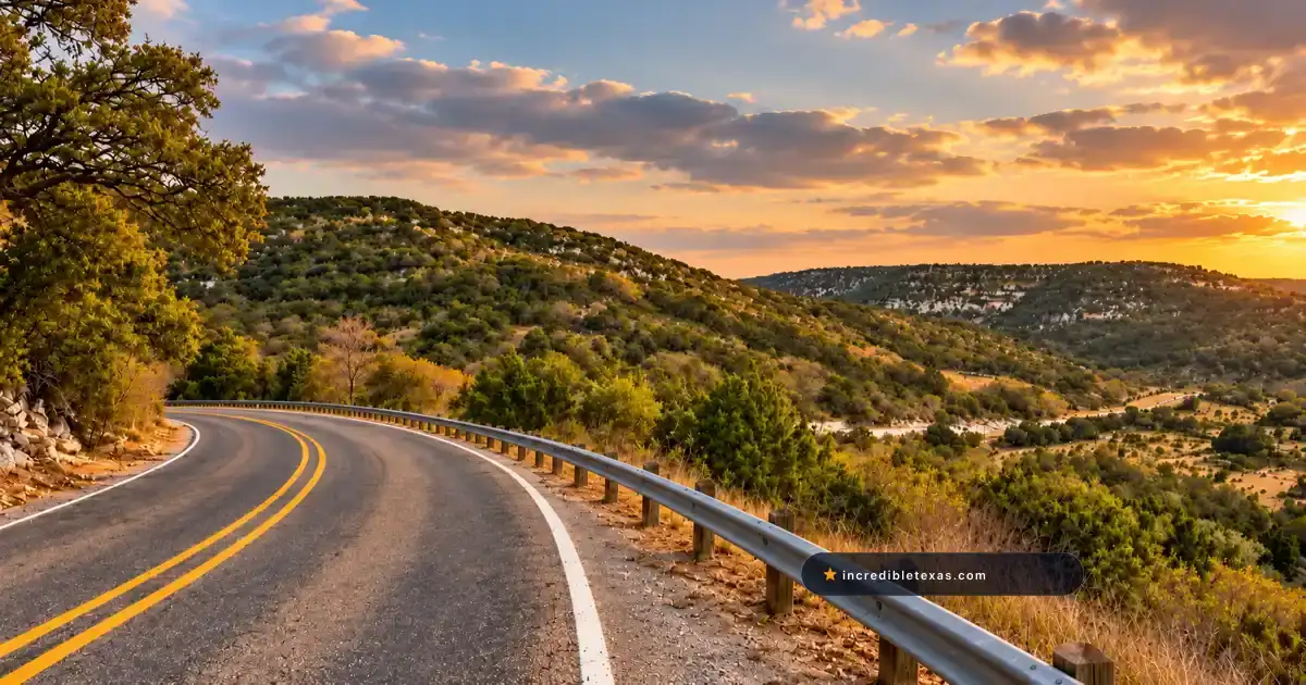
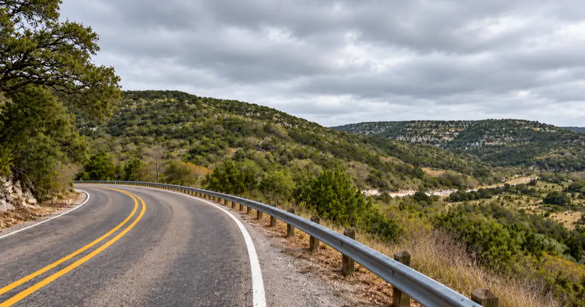
Ranch to Market Road 32 cuts across the spine of the Texas Hill Country, riding the crest of an ancient limestone ridge known across the Southwest as the Devil’s Backbone. Famous for sweeping valley vistas, century-old oak canopies, and pioneer roadhouse lore, this winding byway ranks among the most celebrated scenic drives in Central Texas.
Part of our comprehensive guide to the Most Scenic Drives in Texas. Discover all seven iconic Lone Star scenic byways, mountain passes, and backcountry routes.
Key takeaways
- The Devil’s Backbone spans 24 miles along RM 32, following a limestone ridge between Wimberley and Blanco.
- The official TxDOT Devil’s Backbone Overlook on the north side of RM 32 offers free shaded picnic tables and valley vistas.
- The historic Devil’s Backbone Tavern in Fischer dates back to the 1930s, featuring frontier stone architecture and Texas music lore.
- RM 32 is fully paved with two lanes, though narrow shoulders and blind crests require cautious speed control for cars and motorcycles.
- Dawn and dusk require extreme vigilance due to dense white-tailed deer herds crossing the highway along the ridge.
Route Blueprint: Driving Ranch to Market 32 from Wimberley to Blanco
The Devil’s Backbone scenic drive runs along Ranch to Market Road 32 for 24 miles between RM 12 south of Wimberley and US 281 south of Blanco. Carved along an ancient limestone escarpment, the two-lane paved highway delivers sweeping views across the Blanco and Guadalupe river valleys.
Geographic Setting and the Balcones Fault Ridge
The dramatic geology of the ridge originated over 30 million years ago along the Balcones Fault zone. According to the Texas State Historical Association Handbook of Texas: Devil’s Backbone, this tectonic displacement elevated the Edwards Plateau above the lower coastal plains, leaving a weathered spine of Cretaceous limestone.
As travelers navigate the crest, the land drops away sharply on both northern and southern flanks. Centuries of rainfall eroded deep ravines into the limestone, creating jagged rock outcrops that early settlers compared to the vertebrae of a spine.
While desert travelers head to Far West Texas for the steep volcanic climbs of FM 170 River Road in Big Bend, Central Texas road-trippers cherish RM 32 for its rolling cedar ridges and intimate valley views.
Drive Distance, Speed Limits, and the 51-Mile Loop
The direct drive across RM 32 covers 24 miles from the RM 12 junction near Wimberley to the intersection of US 281 south of Blanco. Posted speed limits range from 50 to 60 miles per hour, though sharp curves through the communities of Fischer and Hugo require deceleration to 35 miles per hour.
Many travelers convert the drive into a 51-mile loop starting in Blanco. Head south on US 281 to RM 32, travel east along the ridge to RM 12, turn north into Wimberley, and loop west back to Blanco along FM 2325 and FM 165. The complete circuit takes approximately two hours of leisurely driving.
| Highway Metric | Verified Detail | Traveler Advisory |
|---|---|---|
| Highway Designation | Ranch to Market Road 32 (RM 32) | Secondary state-maintained highway |
| Total Route Length | 24.2 miles | Between RM 12 and US 281 |
| Scenic Loop Distance | 51.4 miles | Blanco - RM 32 - Wimberley - FM 165 |
| Through Drive Time | 35 to 45 minutes | Direct transit without stops |
| Recommended Stop Time | 1.5 to 2.5 hours | Includes overlook picnic and Fischer stop |
| Road Surface | Paved asphalt | Two lanes, minimal paved shoulder |
Stopping at the Official Devil’s Backbone Overlook
The official Devil’s Backbone Overlook is a free TxDOT roadside park situated on the north side of RM 32 near Canyon Lake. Equipped with stone retaining walls, shaded picnic tables, and parking for approximately twelve vehicles, it provides the safest vantage point to photograph the Blanco River valley.
Overlook Amenities, Parking, and Shaded Picnic Facilities
The Texas Department of Transportation constructed the roadside rest area directly on the geological crest, utilizing native limestone masonry to build retaining walls and picnic pavilions. According to the Texas Department of Transportation Rural Road Safety Advisory, these roadside parks provide safe public access points while preserving regional highway heritage.
The pullout features paved parking spaces that accommodate standard passenger cars, pickup trucks, and motorcycles. Large motorhomes can pull through during weekday mornings, but parking is limited on sunny Saturday afternoons. The site includes covered picnic tables, trash receptacles, and historical informational placards explaining the Balcones Fault geology.
Travelers who enjoy combining scenic drives with rugged hiking and river camping can also review our trail guide for Garner State Park along the Frio River corridor.
Photography Perspectives Across the Blanco River Valley
Looking north from the stone terrace reveals layered mountain ridges carpeted in Ashe juniper, Spanish oak, and cedar elm. On clear mornings, visibility extends over fifteen miles toward the distant Wimberley Valley.
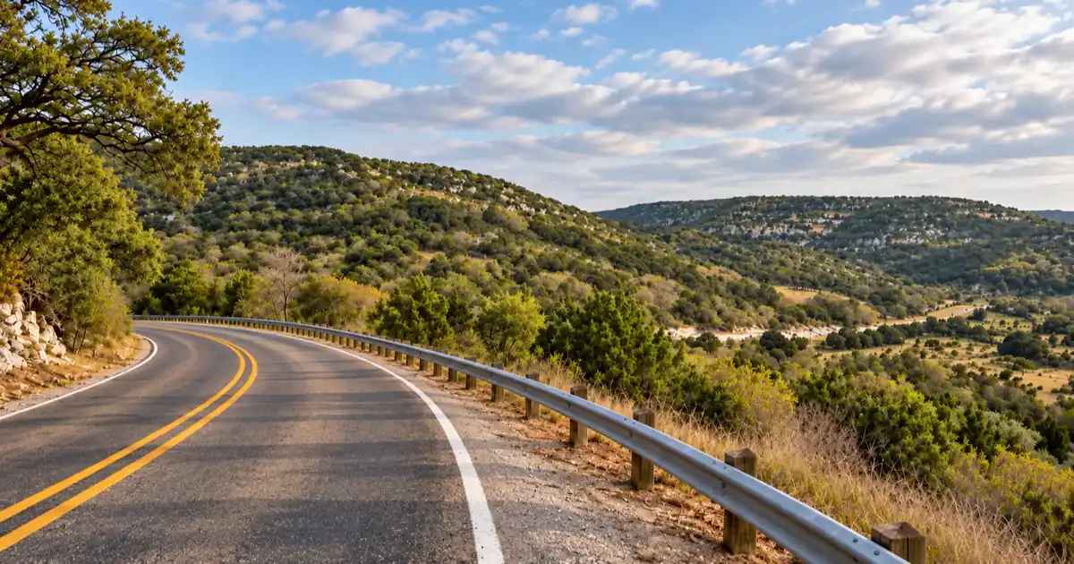
Late afternoon golden hour produces the most striking landscape lighting, casting long shadows across the canyon ravines and illuminating the pale limestone ledges. Photographers should bring telephoto lenses to isolate isolated ranch windmills and winding creek corridors in the valley below.
Tip
Arrive at the Devil’s Backbone Overlook thirty minutes before sunrise to capture low-lying mist settling across the Blanco River basin. The northern orientation of the overlook ensures soft, balanced light without direct solar lens flare.
The Historic Devil’s Backbone Tavern in Fischer
Located at the intersection of RM 32 and FM 484 in Fischer, the Devil’s Backbone Tavern is one of the oldest operating watering holes in the Texas Hill Country. Established in the 1930s just over the Comal County line to avoid neighboring dry laws, it features rustic stone masonry, an authentic iron jail door, and legendary ghost stories.
Prohibition History and the Comal County Line
The site began in the late 1890s as a frontier stagecoach stop, blacksmith shop, and post office serving the German immigrant settlement of Fischer. When national Prohibition was repealed in 1933, neighboring Hays County elected to remain dry, prohibiting the legal sale of alcoholic beverages.
Entrepreneurs capitalized on this regional restriction by establishing the tavern mere yards across the Comal County line, where beer sales were legal. Ranchers, cedar choppers, and travelers made the journey up the ridge to purchase cold beverages and socialise, establishing the venue as an essential community gathering point.
Frontier Jail Cells, Music Heritage, and Ghost Lore
The tavern building preserves thick caliche-mortared limestone walls, wood-plank ceilings, and a vintage 1930s shuffleboard table. Inside the property sits an iron jail cell door, used in pioneer days to detain unruly outlaws until county lawmen arrived from New Braunfels.
The bar earned national recognition among Americana music lovers after Texas singer-songwriter Todd Snider penned his celebrated track Ballad of the Devil’s Backbone Tavern. Over the decades, local storytellers have documented persistent paranormal folklore, claiming that spirits of Confederate soldiers and early pioneer women wander the stone porch after nightfall.
Travelers staying overnight in the area frequently book rustic cabins in town, as detailed in our guide to Wimberley family attractions, providing convenient access to evening tavern performances and daytime river excursions.
| Historic Era | Milestone Event | Architectural or Cultural Significance |
|---|---|---|
| 1890s | Frontier Blacksmith & Stage Stop | Native limestone stone structure and iron jail cell |
| 1930s | Tavern Establishment | Built on Comal County line to legally sell beer post-Prohibition |
| 1951 | Dancehall Pavilion Addition | Mid-century honky-tonk and polka music performances |
| 1990s | Todd Snider Song Inspiration | Musical recognition with the Ballad of the Devil’s Backbone Tavern |
| Present | Preserved Roadhouse | Live acoustic songwriting and operational vintage shuffleboard |
Rider and Driver Safety: Navigating Blind Crests, Wildlife, and Narrow Shoulders
Driving RM 32 demands continuous attention because the highway has narrow gravel shoulders, sharp drop-offs, and frequent blind vertical crests. Motorcyclists should watch for loose gravel on curve apexes, while drivers must maintain reduced speeds around dusk to avoid collisions with free-roaming white-tailed deer.
Motorcycle Hazards and Sharp Ridge Curves
Motorcyclists regard RM 32 as a popular touring route due to its elevation changes and fluid curve sequences. However, several tight radius turns feature negative camber and concealed driveways leading to private ranches.
Loose limestone caliche dust and pea gravel frequently wash across the asphalt from unpaved ranch gates following heavy thunderstorms. Riders should position themselves defensively and moderate cornering speeds, especially on blind crests near the Fischer store turnoff.
Travelers who enjoy challenging curve geometry can also plan trips to explore the canyon switchbacks of Lost Maples State Natural Area along the Sabinal River canyon.
White-Tailed Deer Cutoffs and Dusk Driving Caution
Comal, Hays, and Blanco counties sustain some of the highest white-tailed deer population densities in North America. As the sun sets, deer move from wooded creek canyons to graze along the grassy highway shoulders of RM 32.
Automobile drivers should dim high-beam headlights when encountering oncoming traffic and scan ditch margins continuously for reflective eyes. If an animal leaps onto the roadbed, brake firmly in a straight line rather than swerving into opposing lanes or steep roadside ditches.
Warning
White-tailed deer collisions peak sharply between October and January during the annual mating season. Maintain speeds below 45 miles per hour between sunset and sunrise along the entire 24-mile length of RM 32 to ensure adequate braking distance.
Nearby Hill Country Pairings: Wimberley, Blanco, and Canyon Lake
Travelers can easily combine the Devil’s Backbone drive with visits to nearby Hill Country towns. Wimberley offers boutique shopping and artisan markets on the eastern end, Blanco State Park provides river swimming to the west, and Canyon Lake delivers boating access just south of the ridge.
Exploring Wimberley Square and Market Days
At the eastern junction of RM 32, travelers arrive in the artistic village of Wimberley. Downtown Wimberley Square houses independent art galleries, specialty candy shops, and outdoor dining patios overlooking Cypress Creek.
Families visiting on the first Saturday of the month between March and December can browse hundreds of regional craft and antique vendors. Visitors can easily spend an afternoon strolling shaded creekside sidewalks and browsing local glassblowing studios before driving west onto the ridge.
Cooling Off at Blanco State Park and Canyon Lake Overlooks
Heading west along RM 32 brings travelers into the historic town of Blanco, home to the Blanco River. According to the Texas Parks and Wildlife Department Blanco State Park Guide, the park features spring-fed river pools, shaded CCC picnic pavilions, and riverside camping sites.
Visitors looking for night sky observation can consult our Blanco State Park stargazing guide to experience rural Bortle Class 3 skies. South of the ridge along FM 2673, travelers can also reach the limestone shoreline and scenic boat ramps of Canyon Lake.
| Day-Trip Stop | Distance from RM 32 | Primary Attraction | Recommended Duration |
|---|---|---|---|
| Wimberley Square | 5 miles north (via RM 12) | Boutique retail, dining, and Cypress Creek | 2 to 3 hours |
| Fischer Historic District | On route (junction FM 484) | 1930s tavern, historic post office, and church | 45 to 60 minutes |
| Devil’s Backbone Overlook | On route (Milepost 11) | Free TxDOT panoramic viewing terrace | 20 to 30 minutes |
| Canyon Lake Overlook | 8 miles south (via FM 306) | Reservoir vistas, dam walks, and water sports | 1 to 2 hours |
| Blanco State Park | 10 miles west (via US 281) | River swimming, kayaking, and camping | 2 to 4 hours |
Frequently Asked Questions About Devil’s Backbone Scenic Drive
Where does the Devil’s Backbone scenic drive start and end?
The core Devil’s Backbone route runs along Ranch to Market Road 32 between Ranch Road 12 south of Wimberley and US Highway 281 south of Blanco. The entire highway stretch measures approximately 24 miles.
Is the Devil’s Backbone in Texas dangerous to drive?
While paved and well-maintained, RM 32 has narrow shoulders, sudden dips, blind hills, and sharp curves along elevated drop-offs. Drivers and motorcyclists who maintain the posted speed limit and stay alert for wildlife navigate the road safely.
What makes the Devil’s Backbone Tavern in Fischer famous?
Built in the 1930s just across the Comal County border, the tavern is renowned for its frontier stone walls, historic shuffleboard, musical legacy from songwriter Todd Snider, and persistent ghost legends.
Is there an official scenic overlook on RM 32 Devil’s Backbone?
Yes, TxDOT maintains a paved roadside park and scenic overlook on the north side of RM 32 about halfway between Wimberley and Blanco. The site offers free parking and shaded stone picnic tables with wide valley vistas.
Why is it called the Devil’s Backbone in Texas?
Early frontier settlers gave the geological formation its name because the jagged limestone ridges and steep rocky spines resembled the vertebrae of a spine curving across the rugged landscape.
Is the Devil’s Backbone in Texas really haunted?
Local folklore describes the ridge as one of the most haunted regions in Texas, with stories of phantom Civil War soldiers, Native American spirits, and unexplained tavern occurrences dating back over a century.
How long does it take to drive the Devil’s Backbone on RM 32?
Driving the 24-mile route straight through takes about 30 to 40 minutes at normal highway speeds. Travelers who stop at the scenic overlook and explore the historic townsite of Fischer should plan for 1.5 to 2 hours.