Across the windswept shortgrass plains of northern Texas, the paved corridor of historic Route 66 stretches for 178 miles beneath enormous skies. Exploring texas panhandle ghost towns gives modern road travelers a chance to discover silent motor courts, abandoned roadside diners, and forgotten railroad depots bypassed when modern interstates replaced the Mother Road.
Road trippers fascinated by abandoned towns texas panhandle history can discover dozens of vintage landmarks. Touring these route 66 ghost towns texas preserves an authentic record of 20th-century American highway travel.
Note
Part of our comprehensive Texas Ghost Towns Road Trip Guide. Explore our complete statewide frontier itinerary, boomtown histories, and regional itineraries.
Key takeaways
- The 178-mile Texas Route 66 corridor features iconic ghost settlements including Glenrio, Jericho, Conway, and Alanreed.
- Glenrio is listed on the National Register of Historic Places, preserving 17 mid-century modern structures directly on the New Mexico border.
- The infamous 18-mile Jericho Gap highlights early 20th-century automotive struggles across deep Panhandle gumbo mud.
- All featured sites sit directly off Interstate 40 frontage roads and historic alignments, offering free 24-hour public exterior viewing.
Top Ghost Towns and Roadside Ruins Across the Texas Route 66 Corridor
The Texas Panhandle preserves iconic Route 66 ghost settlements along a 178-mile corridor from the Oklahoma border to New Mexico, highlighted by the Glenrio Historic District, Jericho’s former mud gap, Conway’s Bug Ranch, and Alanreed’s 1930 filling station.
Before modern multi-lane freeways linked coast to coast, two-lane blacktop carried millions of westward migrants, commercial truckers, and vacationing families. Each settlement along the Texas section competed intensely for traveler dollars, constructing neon-lit motels, service garages, and round-the-clock cafes.
When Interstate 40 completely bypassed older downtown bypass alignments during the 1960s and 1970s, traffic vanished overnight. Many business owners simply locked their front doors, leaving behind intact architectural time capsules of 20th-century American car culture. Exploring these evocative panhandle historic ruins provides a tangible link to the golden age of automotive exploration.
Motorists planning a full journey along the Mother Road can reference our detailed Route 66 Texas road trip guide for driving segments, mileage markers, and major metropolitan stops.
The following table summarizes the primary ghost settlements and roadside ruins scattered across the Texas Panhandle:
| Landmark Settlement | Mile Marker / Location | Peak Era & Function | Signature Preserved Feature | Visitor Access Status |
|---|---|---|---|---|
| Glenrio | I-40 Exit 0 (TX/NM Border) | 1930s–1960s Highway Stop | State Line Motel, Texaco station | Public road viewing (Loop 504) |
| Jericho | I-40 Exit 114 (Donley County) | 1902–1935 Rail & Mud Gap | Weathered garage ruins, cabins | Exterior road right-of-way |
| Conway | I-40 Exit 88 (Carson County) | 1920s–1950s Wheat & Service | Bug Ranch VW Beetles, elevators | Open roadside turnout |
| Alanreed | I-40 Exit 110 (Gray County) | 1880s–1950s Rail & Oil | 1930 Bradley 66 Service Station | Public street viewing |
| Texola Border | I-40 Exit 169 (OK/TX Border) | 1910s–1940s Border Outpost | Historic jail cell, border marker | Public street exploration |
Glenrio: The National Historic District Straddling the State Line
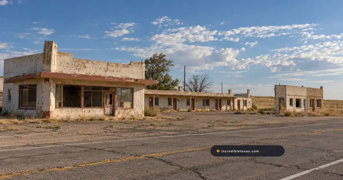
Situated at Exit 0 on Interstate 40 along the Texas-New Mexico border, Glenrio preserves iconic mid-century roadside architecture including the State Line Motel, Texas Longhorn Cafe, and vintage gas pumps listed on the National Register of Historic Places.
Glenrio was founded in 1903 as a siding on the Rock Island Railroad before evolving into a popular motor court destination along Route 66. Because the town sat squarely on the boundary line between Texas and New Mexico, business owners exploited legal quirks between the two states.
Deaf Smith County on the Texas side remained legally dry, meaning all saloons, bars, and package liquor stores operated across the line in Quay County, New Mexico. Conversely, Texas charged lower motor fuel taxes than New Mexico, prompting filling station operators to install their gasoline pumps on the Texas side of the street.
Visiting the glenrio ghost town texas section allows travelers to view the iconic glenrio state line motel, which famously welcomed westbound motorists with the greeting “First Motel in Texas” and eastbound drivers with “Last Motel in Texas.” Across the road stand the stone foundations of the Texas Longhorn Cafe and the metal canopies of a 1930s Texaco service station.
Detailed surveys from the National Park Service Glenrio Historic District Archive confirm that the district encompasses 17 historic structures representing the full evolution of American roadside hospitality. Interstate 40 bypassed the community in September 1975, causing immediate commercial abandonment.
Archival records from the Texas State Historical Association Handbook of Texas: Glenrio indicate that Glenrio’s population dropped to zero permanent residents within two decades of the highway bypass. Today, travelers can drive the quiet asphalt of State Loop 504 to photograph these silent roadside relics without paying any admission fee.
Jericho and the Notorious Mud-Bogged Jericho Gap
Located in Donley County near Alanreed, Jericho gained national notoriety during the 1920s for the Jericho Gap, an unpaved 18-mile clay section where motorists routinely got stuck, leaving behind weathered garage foundations and service station ruins.
Jericho began in 1902 as a railroad stop on the Chicago, Rock Island and Gulf Railway, shipping cattle and winter wheat from nearby ranches. When Route 66 was designated in 1926, the highway through Donley County remained a primitive dirt path cut directly through sticky Panhandle gumbo soil.
During spring and summer thunderstorms, the roadbed dissolved into an impassable morass known across the nation as the jericho gap route 66 hazard. Early automobiles lacking four-wheel drive sank to their axles, leaving travelers stranded for days in the prairie mud.
Local farmers turned the muddy road into a profitable business, charging motorists between $2 and $5 to haul vehicles out with heavy draft mules and tractors. Rumors circulated among early motorists that enterprising landowners deliberately watered the dirt track during dry spells to sustain their towing trade.
Historical entries in the Texas State Historical Association Handbook of Texas: Jericho describe how paved alignments in the 1930s eliminated the bottleneck, leading to the town’s steady decline. Modern motorists can view crumbling wooden tourist cabins, concrete foundation pads, and rusted automotive skeletons from the adjacent county road.
Conway: The Bug Ranch and Abandoned High-Plains Elevators
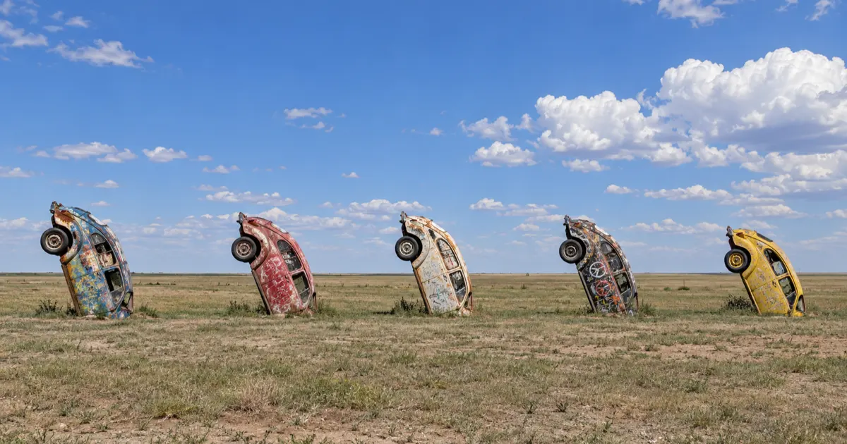
Positioned 25 miles east of Amarillo along Interstate 40, Conway features the whimsical Bug Ranch installation of five nose-down Volkswagen Beetles alongside abandoned roadside gas station structures and towering grain elevators.
Conway was established around 1903 following the construction of the Choctaw, Oklahoma and Texas Railroad. The community flourished for decades as a vital agricultural shipping hub for surrounding wheat farms, supported by general merchandise stores, blacksmith shops, and fuel stations.
In 2002, local business owner Tommy Crutchfield erected the bug ranch conway texas installation as a humorous homage to Cadillac Ranch, burying five vintage Volkswagen Beetles nose-first into the Panhandle ground. Over the following two decades, thousands of highway travelers have stopped to coat the curved steel car bodies in bright spray paint and signatures.
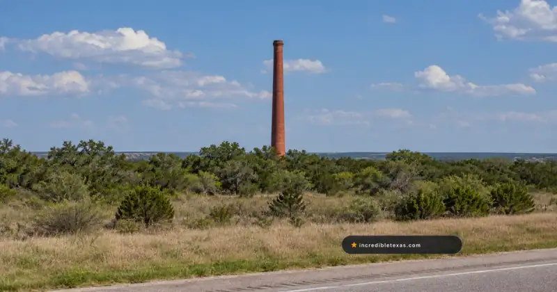
Adjacent to the art installation sit the vacant shells of a mid-century gas station, a rusted service garage, and towering concrete grain silos that dominate the surrounding prairie horizon. These agricultural structures remain private commercial property, but the Bug Ranch provides open public access right beside the frontage road.
According to documentation in the Texas State Historical Association Handbook of Texas: Conway, the community’s post office and rail depot closed after highway reroutes shifted traffic patterns toward larger commercial centers. Conway remains a favorite photographic stop for travelers heading east from Amarillo.
Alanreed: 1930 Bradley Station and Gray County Frontier Roots
Established in the 1880s as the oldest community in Gray County, Alanreed features the restored 1930 Bradley 66 Service Station, historic cemetery plots, and quiet streets bypassed by modern interstate traffic.
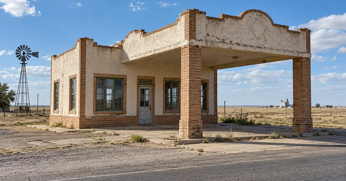
The town was originally settled in 1886 under the name Eldridge before being renamed Alanreed in 1902 to honor contractors working on the Rock Island line. During the 1920s Panhandle oil boom, Alanreed surged with oilfield wildcatters, freight wagons, and new mercantile businesses.
Visiting alanreed texas route 66 brings motorists to the corner of Third and McLean streets, where sits the historic Bradley 66 Service Station, constructed in 1930. The stucco-and-brick filling station is widely recognized as the oldest continuously preserved service station structure on Route 66 in Texas, complete with vintage red gasoline pumps and period oil signage.
Alanreed Cemetery, established in the late 19th century, holds the graves of early frontier ranchers, railroad workers, and oilfield pioneers who helped tame the southern high plains. Bypassed by Interstate 40 in 1953, the town settled into a peaceful rural cadence with a small handful of resident families.
Travelers looking to explore broader highway landmarks across Gray County can pair their visit with our guide to the best small towns on Route 66 in Texas, which features nearby historic districts in McLean and Shamrock.
Research published in the Texas State Historical Association Handbook of Texas: Alanreed notes that the town’s position at the edge of the scenic McClellan Creek valley made it an essential water stop for steam engines during the frontier era.
Driving Logistics: Interstate 40 Access, Roadbed Safety, and Etiquette
Exploring Panhandle ghost towns requires driving paved frontage roads and historic alignments off Interstate 40, strictly obeying private property boundaries around decaying buildings, and carrying plenty of drinking water in hot summer months.
The 178-mile drive across the Texas Panhandle can be completed comfortably in one or two days, allowing ample time for roadside photography and museum visits. Exits along Interstate 40 connect directly to original asphalt alignments, designated as historic business loops or county roads.
Motorists should practice proper historical preservation ethics when touring abandoned settlements. Many timber and stone structures have suffered severe weather degradation, making floors and roofs structurally unsound. Never enter locked buildings, break window glass, or remove vintage automotive artifacts from private parcels.
Weather conditions in the Panhandle fluctuate dramatically between seasons. Summer temperatures often surpass 100 degrees Fahrenheit with intense sun exposure, while winter brings sudden blizzard conditions with temperatures falling below 20 degrees Fahrenheit. Carrying at least two gallons of drinking water per person, sun protection, and a charged mobile device ensures a safe trip.
Travelers planning an extensive statewide road trip through historic mining camps, boomtowns, and ghost settlements can find regional itineraries, safety checklists, and driving tips in our master Texas Ghost Towns Road Trip Guide.
Frequently Asked Questions About Texas Panhandle Ghost Towns
What ghost towns are on Route 66 in Texas?
The primary ghost towns and bypassed historic communities along Texas Route 66 include Glenrio on the New Mexico state line, Jericho in Donley County, Conway in Carson County, and Alanreed in Gray County.
Can you visit Glenrio Texas?
Yes, travelers can exit Interstate 40 at Exit 0 to tour the historic State Loop 504 alignment. Visitors may freely photograph historic exterior facades from the public roadway but must not trespass inside deteriorating buildings.
What was the Jericho Gap on Route 66?
The Jericho Gap was an unpaved 18-mile stretch of notorious gumbo clay along early Route 66 in Donley County. During rainstorms, cross-country motorists routinely bogged down in heavy mud, creating a lucrative towing industry for local farmers.
What is the Bug Ranch in Conway Texas?
The Bug Ranch is a whimsical roadside art installation created in 2002 featuring five vintage Volkswagen Beetles buried nose-first in the prairie soil, paying homage to the famous Cadillac Ranch west of Amarillo.
Is it legal to explore Route 66 ghost towns in Texas?
Viewing and photographing historic structures from public roadways, highway turnouts, and county right-of-way zones is completely legal. Entering private lots or climbing inside fragile buildings is strictly prohibited under Texas trespass statutes.