Beyond the glass skyscrapers and crowded suburban loops of North Texas, dozens of forgotten 19th-century frontier towns lie hidden in plain sight. Taking day trips to ghost towns near dallas allows curious travelers, photographers, and history lovers to trace vanished railroad junctions and silent river crossings.
Explorers mapping out day trips from dallas ghost towns enthusiasts recommend will discover an extraordinary variety of frontier architecture, all located within a short drive of the metroplex.
Note
Part of our comprehensive Texas Ghost Towns Road Trip Guide. Explore our complete statewide frontier itinerary, boomtown histories, and regional itineraries.
Key takeaways
- Over a dozen historic settlements, abandoned mining towns, and bypassed county seats sit within a 30 to 90-minute drive of Dallas-Fort Worth.
- Top destinations include Thurber’s industrial coal ruins, Old Alton’s iron truss bridge, Penn Farm’s hand-hewn cedar barns, and Bluff Dale’s historic suspension bridge.
- Most outdoor bridge and streetscape sites offer free pedestrian access during daylight hours, while state park destinations require standard entrance fees.
- Respect private property borders around fragile historical ruins and pack sturdy footwear for unimproved trails.
Top Ghost Towns and Vanished Settlements Within Two Hours of DFW
Travelers researching ghost towns near dfw can explore five distinct historic sites within a 30 to 90-minute drive, including Thurber’s industrial coal ruins, Old Alton’s historic truss bridge, Penn Farm’s 1850s agricultural complex, Bluff Dale’s wire suspension bridge, and Spanish Fort’s Red River ruins.
During the late 19th century, the expansion of the Texas and Pacific Railway, Missouri-Kansas-Texas line, and Santa Fe Railroad reshaped regional commerce. Settlements bypassed by track surveyors withered almost overnight, while single-industry resource towns collapsed once underground veins ran dry.
When searching for ghost towns near fort worth, travelers often head west along Interstate 20 or southwest toward the Paluxy River valley. These corridors lead to dramatic industrial smokestacks and preserved frontier river crossings.
The following comparison table highlights the top vanished settlements and historic day trips within driving distance of the Dallas-Fort Worth metroplex:
| Landmark Settlement | Distance from DFW | Historic Era & Industry | Signature Preserved Feature | Visitor Access Status |
|---|---|---|---|---|
| Thurber | 75 miles west (I-20) | 1888–1935 Coal & Brick | 128-ft smokestack, Gordon Center | Free exterior; museum $5 |
| Old Alton | 40 miles north (FM 2499) | 1850–1856 County Seat | 1884 iron Pratt truss bridge | Free public park access |
| Penn Farm | 20 miles south (FM 1382) | 1859–1970 Agrarian | Hand-hewn cedar log barns | State park day-use fee ($7) |
| Bluff Dale | 70 miles southwest (US-377) | 1877–1910 Cotton & Rail | 1890 Paluxy wire suspension bridge | Free public bridge walk |
| Spanish Fort | 100 miles northwest (FM 103) | 1759–1880s Cattle Trail | Red River bluffs & historical markers | Free driving tour route |
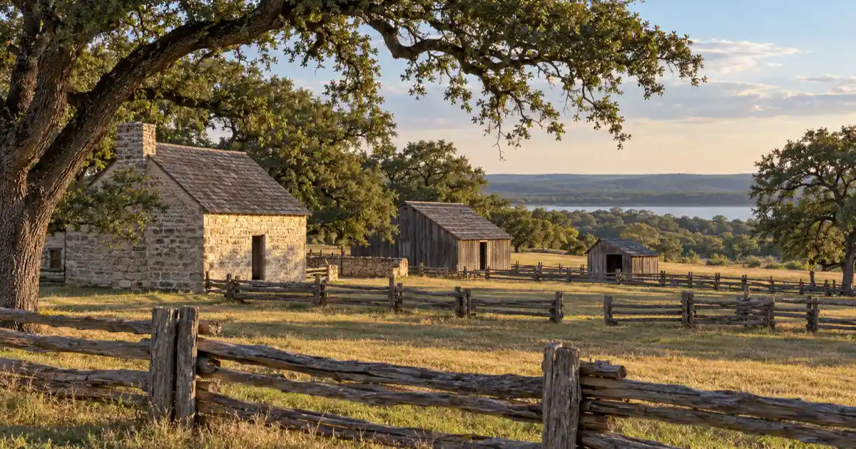
Thurber: The 128-Foot Smokestack and Company Coal Fiefdom
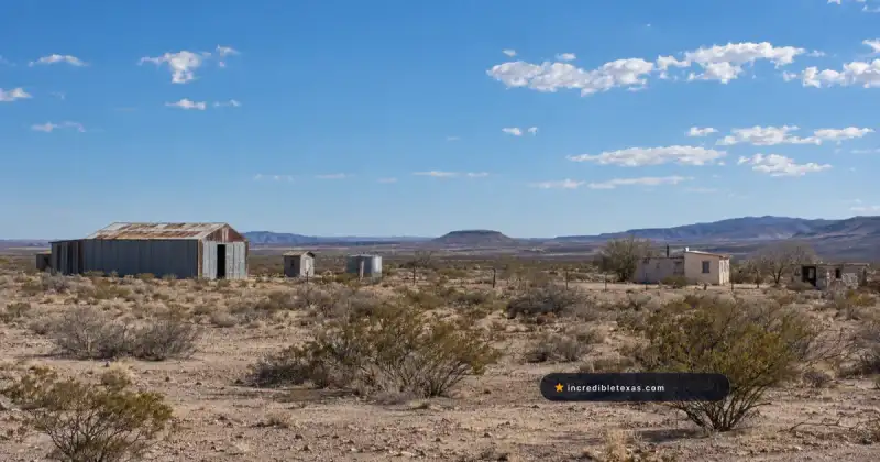
Situated 75 miles west of Fort Worth along Interstate 20, Thurber preserves a former company-owned coal boomtown of 10,000 residents anchored by an iconic 128-foot brick smokestack, Tarleton State University’s W.K. Gordon Center, and New York Hill.
Unlike typical frontier hamlets that grew organically, Thurber was established in 1888 as a closed company fiefdom by the Texas and Pacific Coal Company. Every grocery counter, residence, church, and doctor’s office belonged to corporate management, and workers received compensation in specialized metal scrip tokens.
Taking a thurber texas day trip provides direct access to the state’s most extensive industrial boomtown remains. At its zenith, miners representing over eighteen European nationalities dug millions of tons of bituminous coal from underground shafts. Vitrified paving bricks manufactured at Thurber’s kilns surfaced roads throughout the state, including the Fort Worth Stockyards and Austin’s Congress Avenue.
When locomotives converted from coal to petroleum following regional oil strikes in 1917, coal demand collapsed. The company systematically dismantled houses, sold off infrastructure, and closed operations by the mid-1930s.
Today, motorists traveling along Interstate 20 can spot the towering 128-foot brick chimney standing against the prairie horizon. For comprehensive planning tips, dining recommendations, and museum operating hours, consult our dedicated Thurber Texas ghost town guide.
Old Alton and Goatman’s Bridge: Vanished Denton County Seat
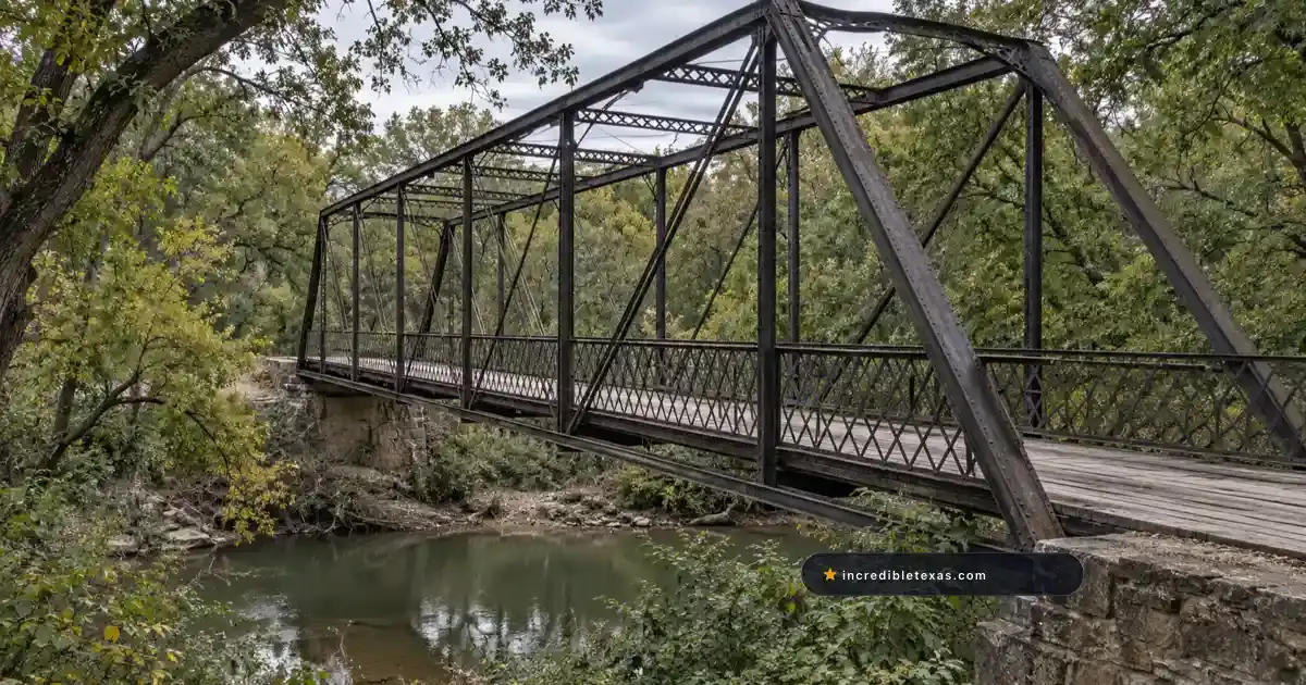
Located 40 miles north of Dallas in Denton County, Old Alton served as the county seat from 1850 to 1856 before being bypassed, leaving behind an 1884 King Iron Pratt through-truss bridge over Hickory Creek, woodland nature trails, and cemetery ruins.
Settlers first platted the townsite along Hickory Creek around 1850, erecting a two-story log courthouse, post office, general store, and blacksmith forge. When residents voted to move county administration northward to Denton in 1856 to occupy a more central geographic position, businesses and homesteaders relocated their timber buildings.
The site is frequently called old alton goatmans bridge due to local folklore associated with the iron crossing. According to historical documentation from the Texas State Historical Association Handbook of Texas: Alton, Old Alton quickly faded into farmland after the courthouse moved. In 1884, county commissioners contracted the King Iron Bridge Manufacturing Company of Cleveland, Ohio, to construct an iron Pratt through-truss bridge across Hickory Creek to serve area farmers.
The bridge carried vehicle traffic for over a century until a modern concrete bypass road opened downstream in 2001. Denton County subsequently converted the historic iron structure into a protected pedestrian landmark.
The surrounding forest hosts walking paths and a primitive kayak launch point. Local folklore has generated colorful urban legends regarding the span, making the iron bridge a popular subject for twilight photography.
Penn Farm at Cedar Hill: Preserved 1850s Agrarian Ruins
Located just 20 miles southwest of downtown Dallas inside Cedar Hill State Park on Joe Pool Lake, Penn Farm preserves rare 1859 hand-hewn cedar log barns, historic windmills, and stone cisterns constructed by pioneer settlers.
John Penn established homestead tracts here along the limestone escarpment in 1859, using local red cedar timber to craft sturdy barns and outbuildings. Successive generations of the Penn family farmed the acreage for over a century, gradually adding modern granaries, machine sheds, and automated windmills.
Visiting penn farm cedar hill state park allows travelers to inspect rare agricultural artifacts without driving far from the city. Visitors can walk self-guided gravel loops past original livestock pens, dry-laid stone foundations, and preserved farm machinery. Interpretive signage details how pioneer families adapted to harsh North Texas weather and managed sustainable livestock operations without electricity.
Access to the farm complex is included with daily admission to Cedar Hill State Park. Outdoor enthusiasts planning a full weekend can review campsite options and trail maps in our comprehensive Joe Pool Lake visitor guide.
Park rangers maintain the structures with authentic period techniques to prevent decay. Walking through the weathered cedar breezeways offers an immersive look at pre-industrial agrarian life in North Texas.
Bluff Dale and the Paluxy River Wire Suspension Bridge
Bluff Dale rests 70 miles southwest of Fort Worth in Erath County along US-377, featuring an intact 1890 wire-cable suspension bridge spanning the Paluxy River alongside limestone commercial storefronts from the 1890s railroad era.
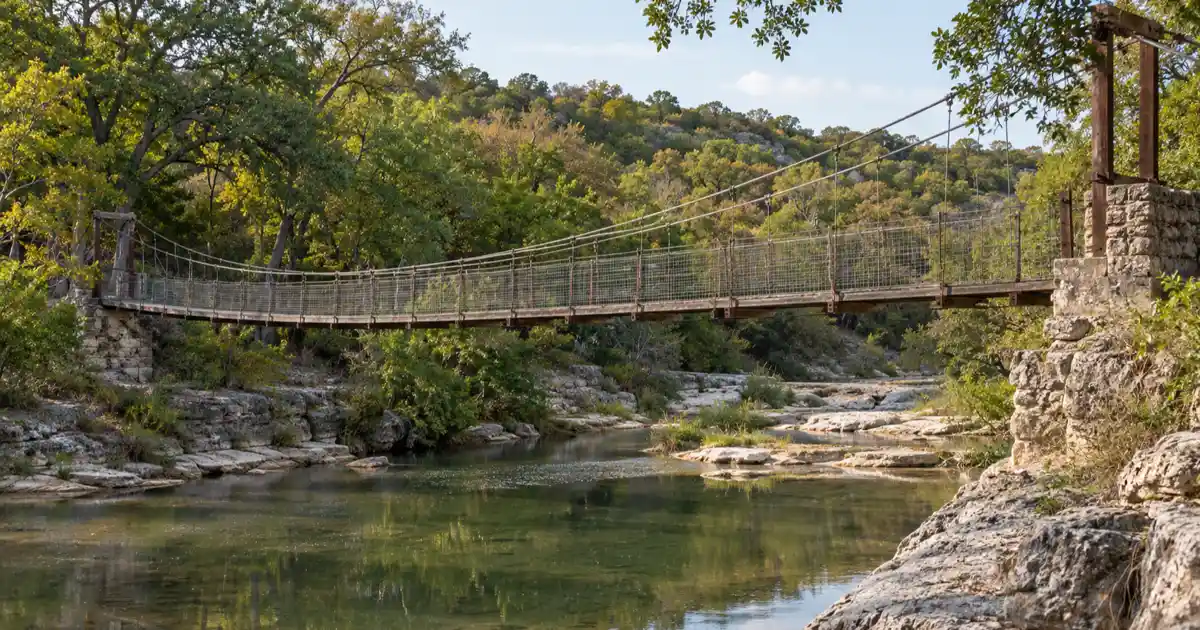
Pioneers initially settled along the Paluxy River in the 1870s, naming their community Bluff Springs after prominent limestone bluffs overlooking the water. When the Fort Worth and Rio Grande Railway built tracks through the valley in 1889, the village relocated slightly to meet the rail depot and adopted the name Bluff Dale.
The settlement’s crowning engineering achievement is the Bluff Dale Suspension Bridge, designed and constructed in 1890 by engineer F.E. Bilbie. Spanning roughly 200 feet across the Paluxy River, the bridge utilizes heavy wire cables anchored to massive deadmen stone footings.
Historical archives from the Texas State Historical Association Handbook of Texas: Bluff Dale note that the span is one of the few remaining historic wire-cable bridges in the state. While automobile traffic has been rerouted to a modern highway bypass, pedestrians can safely view and photograph the historic ironwork.
Downtown Bluff Dale features several turn-of-the-century stone storefronts, a historic bank building, and roadside eateries serving travelers driving between Fort Worth and Stephenville.
Spanish Fort: Red River Wichita Fortress and Chisholm Trail Hub
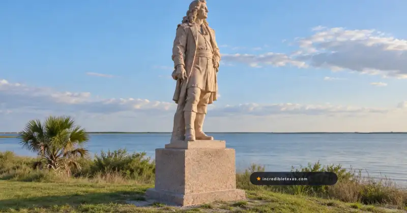
Positioned 100 miles northwest of Dallas on FM 103 in northern Montague County, Spanish Fort originated as an 18th-century fortified Taovaya village before evolving into a wild 1870s Red River cattle-crossing boomtown that vanished after railroad construction.
In the mid-1700s, Taovaya Indians constructed an elaborate fortified village on the southern bluffs of the Red River, complete with earthen breastworks and moat ditches. Spanish troops under Diego Ortiz Parrilla assaulted the fortification in 1759 but suffered defeat, leading later American settlers to erroneously believe the ruins were built by the Spanish army.
During the post-Civil War cattle drives of the 1870s, cowboys herding thousands of longhorns along the Chisholm Trail converged on Spanish Fort as the final Texas provisioning stop before crossing the treacherous Red River into Indian Territory. Saloons, gambling halls, supply stores, and hotels sprang up along the dusty streets.
Exploring the spanish fort texas ruins and historical markers provides a unique glimpse into 18th-century indigenous trade and 19th-century frontier commerce. Research recorded in the Texas State Historical Association Handbook of Texas: Spanish Fort details how businesses packed their merchandise and dismantled buildings to move near the railroad.
Today, Spanish Fort survives as a peaceful rural hamlet marked by state historical markers, quiet county roads, and scenic views overlooking the Red River floodplain.
Essential Day-Trip Logistics: Driving Routes, Legal Access, and Safety Tips
Planning a ghost town day trip from DFW requires respecting private property boundaries, monitoring weather for unpaved farm-to-market roads, carrying water in summer, and checking state park day-pass reservations.
Unlike commercial tourist attractions, historic ruins and vanished settlements frequently border private ranch land. Texas trespass laws are strictly enforced, so visitors should always remain on public road easements, designated park trails, or marked historic zones unless granted explicit landowner permission.
When mapping out your driving route, pair destinations logically along established highway corridors. For example, visiting Thurber combines naturally with Bluff Dale along Highway 377 and Interstate 20, while Old Alton pairs easily with historic sites around Denton and Lake Lewisville.
Travelers intending to explore broader frontier corridors across the state can reference our master Texas Ghost Towns Road Trip Guide for complete packing lists, vehicle recommendations, and seasonal weather advice.
Always verify operating schedules before setting out. While outdoor historic bridges remain accessible daily, museums such as the W.K. Gordon Center observe specific operating hours and holiday closures.
Frequently Asked Questions About Ghost Towns Near Dallas-Fort Worth
Are there any ghost towns near Dallas?
Yes, several historic ghost towns and vanished settlements sit within an hour of Dallas, including Old Alton in Denton County, the preserved 1850s agrarian settlement at Penn Farm inside Cedar Hill State Park, and the Red River frontier trading hub of Spanish Fort.
What is the closest ghost town to Fort Worth?
Thurber is located 75 miles west of Fort Worth on Interstate 20, making it an easy 75-minute drive. Closer historic homestead settlements like Penn Farm sit only 35 miles southeast of downtown Fort Worth.
Can you walk across the Old Alton Bridge?
Yes, the 1884 King Iron Pratt through-truss bridge is open exclusively to pedestrian foot traffic and connects to paved nature walking paths managed by Denton County Parks.
Is Thurber Texas free to visit?
Viewing the 128-foot brick smokestack, outdoor building foundations, and New York Hill scenic overlooks is free from public roads. The indoor W.K. Gordon Center museum charges a modest admission fee of five dollars for adults.
What should you bring on a North Texas ghost town day trip?
Pack sturdy walking shoes for rocky riverbeds, insect repellent for creek trails, plenty of drinking water, and offline mapping software since rural cellular coverage can drop along backroads.