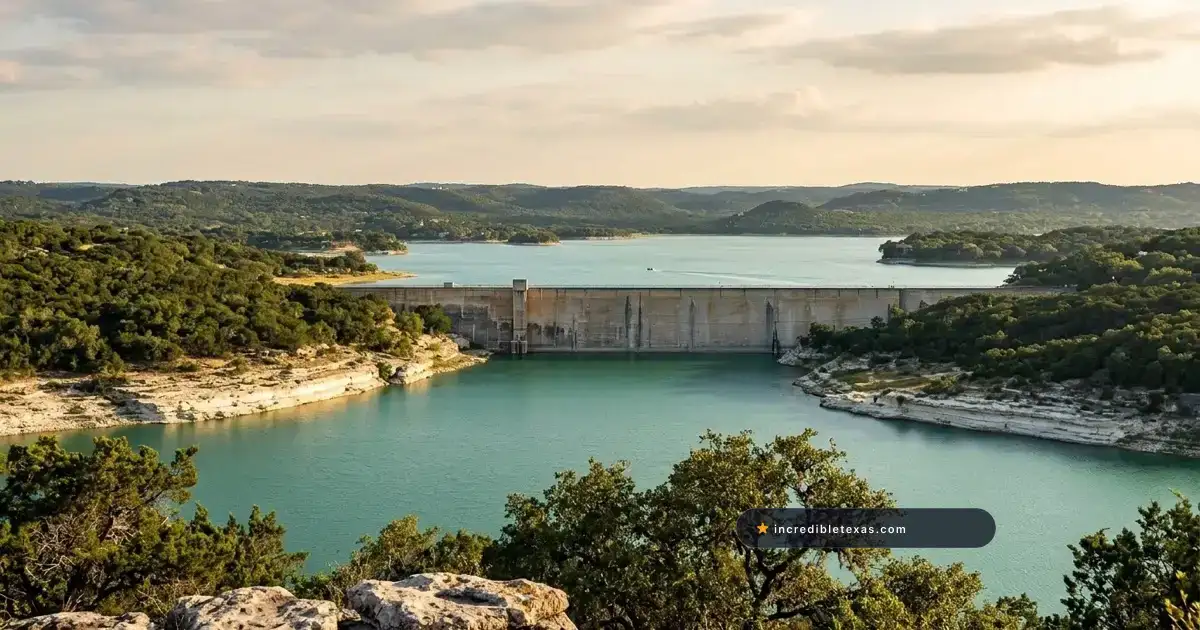
Medina Lake Texas trips reward travelers who check daily reservoir telemetry before hitching up a boat trailer or packing swim floats. Carved through steep limestone bluffs 38 miles northwest of downtown across Bandera and Medina counties, this 1913 irrigation reservoir swings sharply between canyon-filling floods and Hill Country drawdowns.
Visitors pairing a northwest drive with the top things to do in San Antonio get the best outing by planning around live gauge numbers, oak-shaded RV resorts in Lakehills, and reliable Medina River swim spots.
Key takeaways
- Medina Lake sits 38 miles northwest of San Antonio at roughly 27.2% conservation capacity (about 45 feet below its 1,064.2-foot full pool) in late October 2026 after rebounding from 3.9% in May.
- Bandera County Medina Lake Park at the end of Park Road 37 keeps boat ramps and water access closed during low water, opening Saturdays and Sundays from 9:00 AM to 5:00 PM for cash-only picnicking.
- Commercial campgrounds in Lakehills, including the 387-site Thousand Trails campground and the 95-site Lake Medina RV Resort, operate year-round with pools, full hookups, and shaded Hill Country pads.
- Texas Parks and Wildlife classifies Medina Lake as fully infested with zebra mussels, making immediate Clean, Drain, and Dry boat and gear drainage mandatory by state law.
- Reliable water backups within 25 minutes include Canyon Lake (around 96% full) for powerboating, Bandera City Park upstream for free river wading, and Paradise Canyon downstream ($35 per carload) for swimming.
Plan your visit
Verified
- Location
- Bandera & Medina Counties (38 mi NW of San Antonio)
- Hours
- County Park: Sat-Sun 9:00 AM to 5:00 PM (picnic only)
- Admission
- $5 Bandera residents, $10 non-residents (cash only)
- Best time to go
- March to May & October to November; check gauge first
Medina Lake Water Levels and 2026 Reservoir Conditions
Medina Lake water level readings govern every shoreline activity from Lakehills west to the Bandera County coves. At full conservation pool (1,064.20 feet above mean sea level), the reservoir spans 5,426 surface acres, reaches a 152-foot maximum depth near the dam, and stores 254,823 acre-feet of water.
Heavy Hill Country storms in July 2026 lifted Medina Lake current water level readings out of near-dead-pool territory. After dropping to just 3.9% full (9,819 acre-feet) in May 2026, summer flood inflows pushed storage near 30% before autumn evaporation settled late October 2026 readings around 27.2% full.
Warning
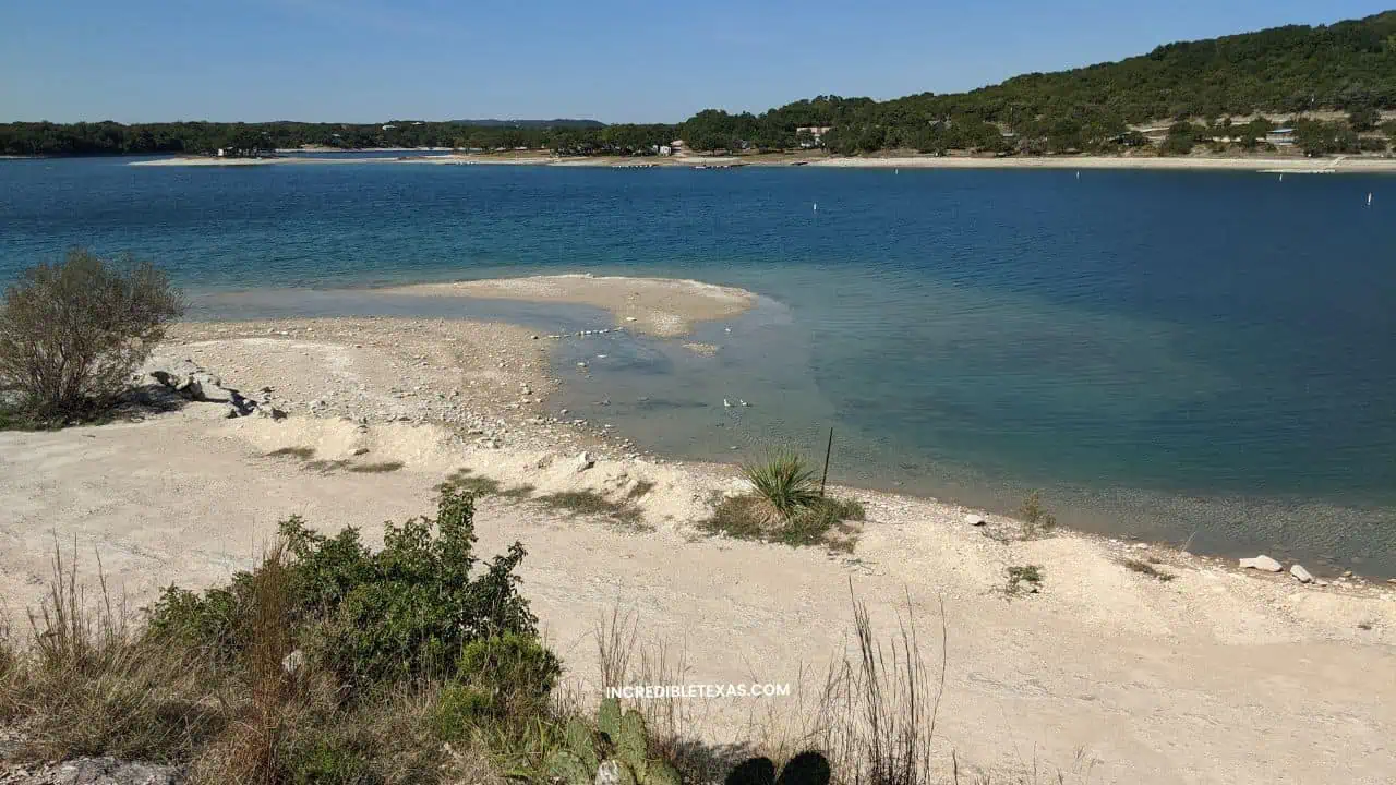
Why 27% Full Still Blocks Public Boat Ramps: Even at roughly 27.2% capacity (about 71,000 acre-feet), the water surface sits near 1,019 feet elevation. That leaves the shoreline roughly 45 vertical feet below full conservation pool, stranding public concrete boat ramps on Park Road 37 high above usable water.
Reading the Water Data for Texas Gauge Before You Drive
Checking how full is Medina Lake right now takes thirty seconds on the official Water Data for Texas Medina Lake Reservoir Gauge maintained by the Texas Water Development Board. Focus on two numbers rather than percentage alone: current water surface elevation in feet and feet below conservation pool.
When surface elevation drops more than 20 to 25 feet below the 1,064.20-foot conservation pool elevation, upper coves around Lakehills dry into caliche flats and exposed cypress roots. Deep canyon water remains visible along the eastern bluffs near Mico, yet public trailer turnarounds cannot safely reach the main channel.
Why an Irrigation Reservoir Fluctuates More Than Canyon Lake
Travelers comparing Medina Lake vs Canyon Lake often wonder why one reservoir sits nearly full while the other sits 45 feet low just one county away. Built between 1911 and 1912 by engineer Frederick Stark Pearson and impounded on May 7, 1913, Medina Dam was designed strictly as an agricultural water supply project rather than a constant-level recreation lake.
Today, the Bexar-Medina-Atascosa Counties WCID No. 1 Reservoir Operations district manages the dam and Diversion Lake system to deliver gravity-fed canal irrigation across roughly 33,000 acres of farmland near Castroville, La Coste, Natalia, and Devine. Porous karst limestone beneath the Balcones Fault Zone also recharges the Edwards Aquifer, accelerating drawdowns during dry summers.
Boaters who want guaranteed deep-water ramps, marina slips, and swim beaches should pivot 42 miles northeast of San Antonio using our Canyon Lake parks and boat ramp guide, where U.S. Army Corps of Engineers parks sit around 96% conservation capacity.
Shoreline Parks, Boat Ramps, and Access Around Lakehills and Mico
Public shoreline acreage and private marinas cluster around two unincorporated communities: Lakehills on the northern coves and Mico on the eastern cliffs near the 1913 concrete dam. Medina Lake boat ramps shift sharply between full-pool seasons and drought rules.
| Access Point or Backup | Location | Late 2026 Status | Entry or Launch Fee | Best Use |
|---|---|---|---|---|
| Bandera County Medina Lake Park | End of PR 37, Lakehills | Ramps closed; Sat-Sun 9 AM-5 PM picnic only | $5 resident / $10 non-resident (cash only) | Weekend oak picnicking |
| Red Cove Marina & Cafe | 255 CR 2611, Mico | Cafe open; call ahead for gravel launch | Cafe menu; private ramp fees vary | Burgers & eastern basin views |
| Bandera City Park | 1102 Maple St, Bandera | Open daily; river wading & kayak (>80 cfs) | Free general walk-in | Cypress-shaded river wading |
| Paradise Canyon | 2220 CR 2615, Rio Medina | Open Mar-Nov (Dec-Feb by reservation) | $35 per carload (up to 5); $3 extra | Calm spring-fed river swimming |
| Canyon Lake USACE Parks | Comal County (42 mi NE) | Ramps & beaches open (~96% full) | $5-$20 day-use vehicle pass | Powerboating & wakeboarding |
Bandera County Medina Lake Park on Park Road 37
This county peninsula park sits at the end of Park Road 37 flanking Popoon Creek and Plum Creek Cove in Lakehills. Under the Bandera County Medina Lake Park Official Status Notice, lake access, trailer parking, and boat launching stay closed until water safely reaches the concrete ramp.
Visitors can still enter on Saturdays and Sundays from 9:00 AM to 5:00 PM, weather permitting, strictly for dry-land picnicking. Bring crisp dollar bills before turning onto Park Road 37, because gate staff accept cash only rather than cards or checks.
During full-pool seasons, admission runs $5 per Bandera County resident with a Texas driver’s license, $10 per non-resident, and free for ages 5 and under (gates lock at 8:00 PM). Glass containers, firearms, and DJ speakers are strictly banned, while leashed dogs are welcome.
Red Cove Marina and FM 1283 Cliffs Near Mico
Driving east toward Mico along Farm to Market Road 1283 reveals the steepest canyon walls on the reservoir. Because the submerged river channel drops deepest near the eastern dam, Mico retains open water long after shallow Lakehills coves recede.
The Texas Parks and Wildlife Medina Lake Access Directory lists Red Cove off FM 1283 (255 County Road 2611, Mico) with a two-lane concrete ramp and an alternate low-water gravel launch. Red Cove Marina and Cafe also serves fresh burgers, sandwiches, and cold drinks, so boaters can call or stop in to verify gravel traction first.
Medina Dam Safety Buffer and Exposed Lakebed Rules
Never drive trucks, UTVs, or boat trailers onto exposed lakebed mud below paved or gravel launch lanes. Dry caliche crusts over saturated river silt trap four-wheel-drive axles within feet of the water line and trigger costly winch recoveries.
Under Bexar-Medina-Atascosa WCID No. 1 security orders, all watercraft are strictly prohibited within 300 feet of Medina Dam and Diversion Lake Dam. Boaters seeking wide-open ramps can compare regional reservoirs in our guide to the best lakes near San Antonio for boating and fishing.
Camping and RV Resorts Near Medina Lake
Medina Lake camping thrives year-round when travelers book Lakehills properties as scenic Hill Country basecamps rather than dockside boat slips. Live oak shade, resort swimming pools, abundant white-tailed deer, and quiet starlit ridges make Lake Medina TX RV parks appealing from October through May.
| Campground / Resort | Address in Lakehills | Sites & Lodging | Hookups & Max Rig | Key Amenities |
|---|---|---|---|---|
| Thousand Trails Medina Lake | 215 Spettle Rd | 387 RV, tent & cabin sites | 30/50-amp full hookups | Pool, hot tub, mini golf, sports courts, laundry |
| Lake Medina RV Resort | 1218 Leibolds Point | ~95 RV sites + 6 loft cottages | 30/50-amp; pads up to 150 ft | Pool, hot tub, pickleball, dog park, Wi-Fi |
Thousand Trails Medina Lake RV Campground in Lakehills
Set on a wooded peninsula at 215 Spettle Road, the Thousand Trails Medina Lake RV Campground Directory lists 387 RV, tent, and cabin sites open year-round. Non-water facilities run daily, including an outdoor swimming pool, hot tub, mini golf, sports courts, bathhouses, and laundry.
RV and tent check-in starts at 12:00 PM, cabin check-in starts at 4:00 PM, and check-out closes at 11:00 AM. Primary guests must be 21 or older, leashed pets are welcome, and non-member sites cap occupancy at six guests.
Tip
Book for Pool and Patio Comfort: Thousand Trails pauses shoreline water activities during drought periods. Request an oak-shaded interior pad near the pool and rec hall rather than paying extra for a perimeter lot overlooking dry cove flats.
Lake Medina RV Resort on Leibolds Point
Travelers hauling oversized fifth-wheels or Class A motorhomes often favor Lake Medina RV Resort at 1218 Leibolds Point, built across a historic 700-acre cattle ranch established in 1882. Roughly 95 oak-shaded full-hookup pads supply 30-amp and 50-amp service, free Wi-Fi, fire rings, and pull-through lanes accommodating big rigs up to 150 feet long.
Groups traveling without an RV can book one of six furnished one-bedroom cottages with upstairs lofts sleeping up to six guests. On-site perks include a swimming pool, spa, pickleball court, fenced dog park, and resident Hill Country deer browsing outside camp chairs at dusk.
Campers comparing state park tent loops against private hookup resorts can browse our roundup of campgrounds and RV resorts near San Antonio.
Fishing Medina Lake: Target Species and Zebra Mussel Laws
Medina Lake fishing rewards patient anglers who adapt to clear, fluctuating canyon water and steep rocky structure whenever legal access is available. According to the Texas Parks and Wildlife Medina Lake Fishing Overview, all sportfish in the reservoir follow standard statewide daily bag and minimum length regulations.
Because aquatic vegetation remains sparse during wide vertical water swings, fish concentrate tightly around submerged limestone ledges, flooded brush lines, bluff walls, and tributary creek channels. Summer rainfall pulses like the July 2026 inflow often trigger aggressive feeding schools in the main eastern basin.
Targeting Bass and Catfish Around Submerged Bluff Structure
Largemouth bass represent the marquee sportfish in the reservoir, holding along steep rocky drop-offs, boat house pilings when submerged, and drowned creek bends on Texas-rigged soft plastics, crankbaits, and jigs. White bass and stocked hybrid striped bass patrol open canyon water, chasing shad schools near dawn and dusk where anglers cast silver spoons and topwater plugs.
Channel, blue, and flathead catfish thrive throughout the lower basin and river channel on cut shad, stinkbait, and live sunfish fished along ledges. Carry an active Texas freshwater fishing license (required whenever fishing from a boat or private bank outside a state park).
Confirm private launch or shoreline permission ahead of time, since the county park on Park Road 37 restricts water entry during drawdowns. Anglers planning a dedicated trophy weekend should also weigh fuller reservoirs in our guide to the top fishing lakes across Texas.
Mandatory Clean, Drain, and Dry Zebra Mussel Rules
Invasive species compliance is non-negotiable on every outing to Lakehills or Mico. Texas Parks and Wildlife officially classifies Medina Lake as fully infested with invasive zebra mussels after reproducing populations were recorded in 2021 near Red Cove and Haby’s Cove.
Important
Texas Zebra Mussel Drainage Law: State law requires boaters, kayakers, and anglers to clean gear, pull drain plugs, and drain livewells, bilges, motors, and bait buckets before leaving the shoreline. Transporting zebra mussels or undrained water is a Class C misdemeanor (fines up to $500), and slip-stored boats require TPWD decontamination guidance before relocating.
Medina River Upstream and Downstream Swimming Alternatives
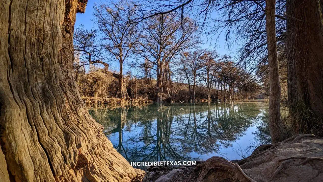
When Medina Lake boat ramps close or summer afternoons top 98 degrees Fahrenheit, the spring-fed Medina River above and below the reservoir saves the trip. Within 15 to 25 minutes of Lakehills, two reliable river parks trade dry reservoir coves for cold, clear current shaded by towering bald cypress trees.
Upstream Wading and Kayaking at Bandera City Park
Drive 14 miles northwest from Lakehills up State Highway 16 and Park Road 37 to reach 77-acre Bandera City Park at 1102 Maple Street along the Medina River. Towering cypress roots frame gentle gravel-bottomed wading pools, open picnic lawns, and an easy river takeout just blocks from Bandera’s historic Western storefronts.
Check the USGS Medina River at Bandera streamflow gauge before renting a shuttle kayak or launching your own boat. Local paddlers look for at least 80 cubic feet per second (cfs) to clear shallow limestone riffles without frequent dragging.
Always exit upstream of the Bandera City Park low-water dam rather than attempting to run the drop. Hikers extending their drive 40 miles northwest into Sabinal Canyon can pair the river with our Lost Maples State Natural Area hiking and camping guide.
Downstream Carload Day Use at Paradise Canyon in Rio Medina
Twelve miles south of Mico below the Diversion Dam, privately operated Paradise Canyon (2220 County Road 2615 in Rio Medina, 30 miles northwest of San Antonio) protects nearly a mile of calm, spring-fed Medina River frontage. Day-use admission costs $35 per carload for up to five guests, plus $3 per additional person over age two ($20 for motorcycles).
Summer gates (mid-May through August) run 9:00 AM to 7:00 PM on Saturdays, 9:00 AM to 6:00 PM on Sundays, and 10:00 AM to 6:00 PM on weekdays, shifting to reservation-only visits from December through February. Carload tent camping starts around $50 per night ($55 with electric hookups, check-in 4:00 PM to 8:00 PM).
Pack with property rules in mind: Paradise Canyon strictly bans all pets, glass containers, firearms, and portable radios or Bluetooth speakers (even inside parked vehicles), and no lifeguards are on duty.
Planning a Flexible Day Trip from San Antonio
A Medina Lake day trip from San Antonio works best when you treat the limestone hill drive, small-town dining, and river swim backups as a connected loop rather than gambling everything on an open boat ramp. Driving the 38 miles from downtown San Antonio takes 45 to 55 minutes outside weekday commuter peaks.
Driving Routes via State Highway 16 and FM 1283
Two paved corridors frame the reservoir from northwest Bexar County:
- The Western Lakehills Route (SH 16 to PR 37): Follow Bandera Road (State Highway 16) northwest past Helotes, then turn south onto Park Road 37 toward Lakehills and Bandera County Park. Choose this route for RV resorts, weekend county park picnics, or quick pivots north into Bandera.
- The Eastern Cliff Route (Loop 1604 West to FM 1283): Head west past Potranco Road or US Highway 90 toward Castroville, then wind north up Farm to Market Road 1283 through Mico. Narrow two-lane curves climb high above the eastern canyon basin, delivering dramatic bluff overlooks of the deepest water near Medina Dam before looping into Lakehills.
Pairing Mico Cliff Overlooks with Bandera and Castroville
Run through a quick pre-departure check the morning you leave San Antonio: verify the Water Data for Texas elevation, confirm Bandera County’s weekend picnic notice, pack $20 in small cash bills plus water shoes, and set your backup river stop before losing cell bars in deep creek hollows.
Start your morning driving FM 1283 past Mico for canyon photography and an early burger at Red Cove, or spread a Saturday picnic under the oaks on Park Road 37. Spend the afternoon wading the Medina River in Bandera followed by live Western music on Main Street, or loop south through Castroville for pastries at Haby’s Alsatian Bakery.
Families comparing other one-tank routes within an hour of Alamo Plaza can explore our full guide to weekend day trips from San Antonio.
Frequently Asked Questions About Medina Lake
What is the current water level at Medina Lake in 2026?
As of late October 2026, Water Data for Texas reports Medina Lake at roughly 27.2% full, holding about 71,000 acre-feet after rebounding from 3.9% capacity in May. Even after summer rainfall gains, the surface sits near 1,019 feet elevation, roughly 45 feet below the 1,064.2-foot conservation pool.
Is Bandera County Medina Lake Park open right now?
Bandera County Medina Lake Park at the end of Park Road 37 keeps all lake access, trailer parking, and boat ramps closed due to low water levels. The county opens the park strictly for dry-land picnicking on Saturdays and Sundays from 9:00 AM to 5:00 PM, weather permitting, with cash-only admission.
Can you launch a boat on Medina Lake during low water?
Public boat launching at Bandera County Park remains closed until reservoir levels rise safely onto the concrete ramp. Boaters must call private operators such as Red Cove Marina in Mico ahead of departure to verify whether shallow gravel-bank launching is open for kayaks or small trailers.
Where can you camp or park an RV near Medina Lake?
Two major resorts in Lakehills anchor overnight stays: Thousand Trails Medina Lake on Spettle Road (387 RV, tent, and cabin sites) and Lake Medina RV Resort on Leibolds Point (95 full-hookup RV pads and 6 cottages). Both properties keep swimming pools, hot tubs, and shaded Hill Country grounds open year-round even when shoreline water activities pause.
What fish can you catch in Medina Lake?
Texas Parks and Wildlife manages largemouth bass, white bass, hybrid striped bass, and channel, blue, and flathead catfish in Medina Lake under statewide harvest limits. Because the reservoir is infested with zebra mussels, anglers and boaters must legally clean, drain, and dry all livewells, bilges, and bait buckets before leaving the shore.
How far is Medina Lake from downtown San Antonio?
Medina Lake sits 38 to 40 miles northwest of downtown San Antonio across the Bandera and Medina county line, requiring a 45- to 55-minute drive. Travelers reach the Lakehills shore via State Highway 16 and Park Road 37, or take Loop 1604 West to FM 1283 for cliff views near Mico.
What are the best swimming alternatives when Medina Lake is low?
For guaranteed deep-water boating and swim beaches, drive 42 miles northeast of San Antonio to Canyon Lake, which holds around 96% capacity. Closer to Medina Lake, families wade for free under bald cypress trees at 77-acre Bandera City Park or pay $35 per carload at spring-fed Paradise Canyon in Rio Medina.