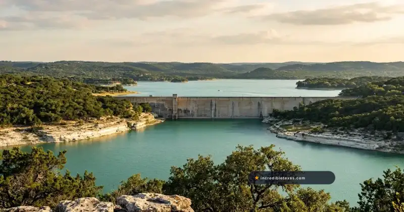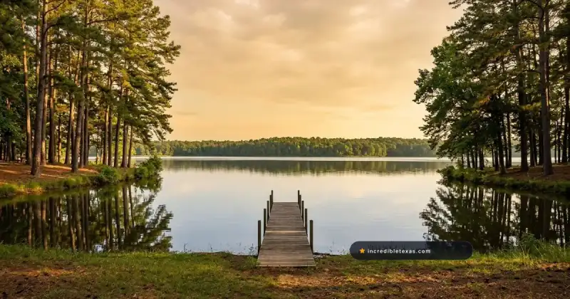
Lake Ray Hubbard sits just 17 miles east of downtown Dallas along Interstate 30, delivering more than 20,900 surface acres of powerboating, sailing, hybrid striped bass fishing, and west-facing boardwalk dining. Spanning four North Texas counties, the reservoir gives metroplex visitors open-water scale within a 25-minute drive of central city neighborhoods.
Key takeaways
- Lake Ray Hubbard is a City of Dallas water-supply reservoir impounded by Rockwall-Forney Dam across Dallas, Rockwall, Kaufman, and Collin counties at a 435.5-foot normal pool elevation.
- Four municipal parks offer free public boat launches: John Paul Jones Park in Garland, Elgin B. Robertson Park near I-30, the State Highway 66 ramp in Rockwall, and Terry Park in Heath.
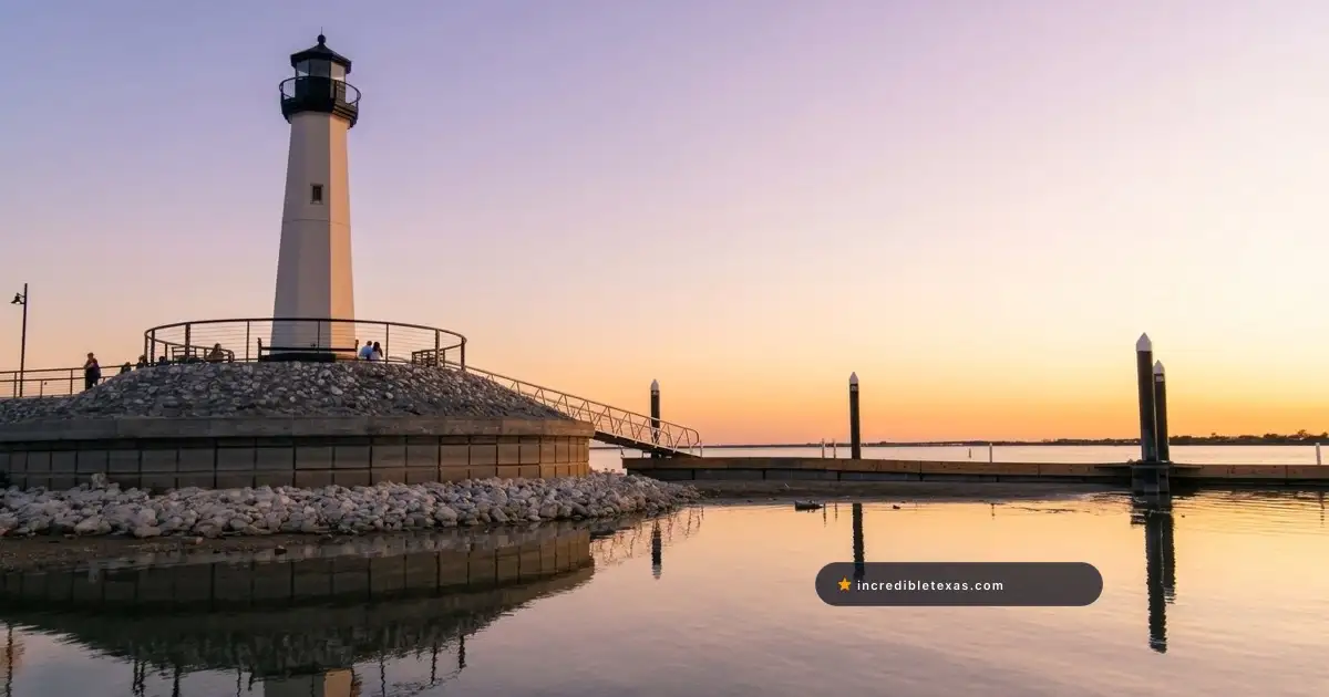
- The Harbor Rockwall at 2059 Summer Lee Drive anchors lakeside dining, sunset sailing cruises, a stone lighthouse pier, and free Thursday evening concerts from May through July.
- Texas Parks and Wildlife manages the Ray Hubbard fishery under statewide bag limits, led by stocked hybrid striped bass (18-inch minimum, 5/day), white bass (10-inch minimum, 25/day), and blue or channel catfish (25/day).
- Ray Hubbard has zero public campgrounds and prohibits swimming off municipal park banks, making Rowlett’s Paddle Point Park and local marinas the primary hubs for daytime water access.
Picking the right shoreline before leaving home saves 30 minutes of cross-causeway traffic. Compare regional options in our roundup of the best lakes in Dallas Fort Worth, then match Rockwall, Garland, Rowlett, or Heath to your gear and schedule below.
Plan your visit
Verified
- Location
- East of Dallas across Rockwall, Garland, Rowlett & Heath, TX
- Hours
- Open daily (shoreline city parks open 6:00 AM to 11:00 PM)
- Admission
- Free public boat ramps; private marina launch fees vary
- Best time to go
- April to June and Sept to Nov; mornings before wind rises
Where Is Lake Ray Hubbard and How Does the Shoreline Work?
Lake Ray Hubbard sits 17 miles east of downtown Dallas along Interstate 30 and State Highway 66, covering 20,947 conservation-pool acres across Dallas, Rockwall, Kaufman, and Collin counties. Impounded in 1968 on the East Fork of the Trinity River, the reservoir borders Garland, Rowlett, Rockwall, Heath, Sunnyvale, and Forney.
Unlike small urban park ponds, the impoundment behaves like an inland sea whenever south winds build across its eight-mile fetch. Two major highway causeways (Interstate 30 to the south and State Highway 66 to the north) split the water into sheltered upper timber arms and wide lower-basin sailing reaches.
Dallas Water Utilities Governance and Reservoir Scale
According to the Texas Water Development Board Rockwall-Forney Reservoir Survey, the City of Dallas (operating through Dallas Water Utilities) owns and manages Rockwall-Forney Dam for municipal water supply and recreation. Originally constructed with a 22,745-acre footprint, the modern conservation pool holds 20,947 surface acres and 439,559 acre-feet of storage at 435.5 feet above mean sea level.
Water depth reaches 40 feet near the southern dam before tapering into shallow flats north of State Highway 66. Because a municipal utility owns the basin up to the city take-line rather than the U.S. Army Corps of Engineers, shoreline rules differ sharply from federal reservoirs in North Texas.
Each bordering town shapes its own shoreline: Rockwall anchors boardwalk dining and yacht clubs on the east, Garland runs four-lane ramps on the west, Rowlett hosts the paddling trailhead, and Heath offers a quiet southeast launch.
Comparing Ray Hubbard, White Rock Lake, and Lake Lavon
Choosing among east-metro lakes comes down to motorboat rules, campground needs, and dining access. Visitors wanting a wake-free cycling loop inside city limits should visit White Rock Lake in East Dallas, where gas outboards are restricted and a 9.3-mile paved trail circles the water.
Campers needing shaded federal tent loops or sandy swim beaches should drive 20 minutes north to Lake Lavon instead. Use the table below to compare all three reservoirs.
| Feature | Lake Ray Hubbard | Lake Lavon | White Rock Lake |
|---|---|---|---|
| Drive from Downtown Dallas | 17 miles east via I-30 (20 to 25 min) | 32 miles northeast via TX-78 (40 min) | 5 miles northeast in East Dallas (12 min) |
| Surface Size & Max Depth | 20,947 acres (22,745 historic) / 40 ft | 21,400 acres / 38 ft | 1,015 acres / 18 ft |
| Managing Agency | Dallas Water Utilities & shoreline cities | U.S. Army Corps of Engineers (USACE) | Dallas Park and Recreation |
| Motorboats & Jet Skis | Permitted lakewide (unlimited hp) | Permitted (heavy timber north of bridges) | Prohibited (non-motorized & <10.5 hp) |
| Public Campgrounds | None (day-use & hotel lodging only) | Multiple USACE RV and tent campgrounds | None (urban day-use park) |
| Signature Strength | Waterfront dining, sailing & hybrid stripers | Federal campgrounds, beaches & crappie | 9.3-mile hike/bike loop & Arboretum |
The Harbor Rockwall: Boardwalk Dining, Lighthouse, and Parking
The Harbor Rockwall at 2059 Summer Lee Drive is the primary waterfront dining and entertainment district on Lake Ray Hubbard, pairing west-facing restaurant patios with a stone lighthouse pier, splash fountains, and summer concerts. Positioned just north of Interstate 30 Exit 67, the Mediterranean-style plaza faces directly toward Dallas for unobstructed sunset views.
Treating this Rockwall Harbor boardwalk as an early-evening stop works far better than arriving mid-afternoon in July heat. Terraced walkways step down from a Cinemark theater and retail shops to a timbered promenade along the water.
Rockwall Lighthouse Pier, Sunset Cruises, and Waterfront Restaurants
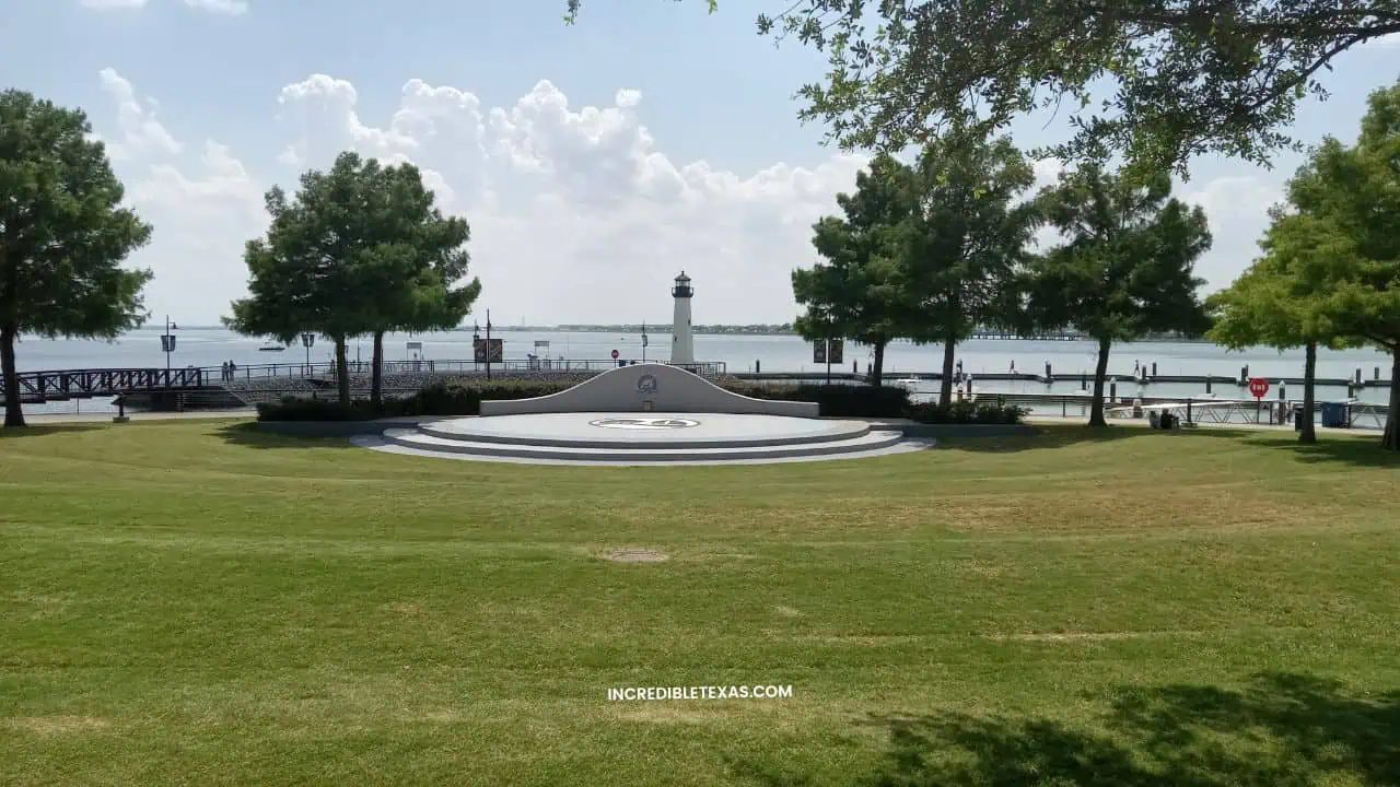
A stone Rockwall lighthouse stands at the tip of the wooden pier extending into the eastern basin. Families walk the pier free at golden hour to watch sailboats tacking north while waves hit the limestone seawall.
Waterfront restaurants along the Harbor plaza serve wood-fired steaks, Gulf seafood, Tex-Mex, and patio cocktails steps from the docks. Confirm weekend patio reservations directly before driving out from Dallas, as tenant hours vary seasonally.
Captained sunset cruises and catamaran charters board near the lighthouse docks on calm spring, summer, and autumn evenings. Pairing a 90-minute sail with dinner ranks among the best romantic Dallas date night ideas outside downtown.
Concert by the Lake and Harbor Parking Rules
From May through July, Rockwall Parks and Recreation hosts its free Concert by the Lake series every Thursday evening at the Brad Griggs Amphitheater. Live bands play as locals spread lawn chairs on the terraced grass and pontoon boats anchor offshore.
Weather updates post by 6:00 PM on Thursday show nights. Arrive by 6:15 PM to claim lawn space before lower streets fill.
Warning
Strict Retail vs. Event Parking Split: Per The Harbor Rockwall Official Location and Parking Guide, front retail and restaurant lots are reserved strictly for shopping and dining patrons, with towing enforced. Visitors heading to the boardwalk park, lighthouse docks, sailing charters, or Thursday concerts must park across the street in City of Rockwall spaces on Summer Lee Drive and Lake Front Trail or inside the free TrendHR Tower garage uphill. Grass parking is prohibited.
Boat Ramps and Marinas Across Garland, Rockwall, Rowlett, and Heath
Boaters using Lake Ray Hubbard boat ramps can launch free at four municipal parks in Garland, Dallas/Rowlett, Rockwall, and Heath, or rent wet slips and launch through four private marinas. Selecting the right shoreline before hitching up keeps you out of congested I-30 bridge lanes and full Saturday ramp queues.
Per the TPWD Ray Hubbard Public Access and Ramp Directory, shoreline access splits between no-fee city concrete ramps and commercial marinas that charge launch fees or limit gates to slip holders.
| Access Point / Marina | Shoreline City | Ramp Lanes & Parking | Launch Fee | Key Amenities & Services | Best For |
|---|---|---|---|---|---|
| John Paul Jones Park (Chaha) | Garland (4099 Zion Rd) | 4-lane ramp / ~50 spaces | Free | Picnic tables, restrooms, wide turnaround | Powerboats & central-basin anglers |
| Elgin B. Robertson Park | Dallas / Rowlett (Dalrock Rd) | 2 public ramps / large lots | Free | 250+ day-use acres, prime bank fishing | Bank anglers & tournament launches |
| State Highway 66 Ramp | Rockwall (north side SH 66) | 1 double + 2 single lanes | Free | Direct upper-basin & riprap access | Upper-arm crappie & bass boats |
| Terry Park | Heath (Terry Ln off FM 740) | 2-lane ramp / ~30 spaces | Free | Courtesy dock, restrooms, quiet cove | Southeast shore & lower-lake runs |
| Harbor Bay Marina | Rockwall (Windjammer Way) | 2-lane ramp / ~50 spaces | Paid fee | Fuel dock, wet slips, fishing barge | East-shore service & slip convenience |
| Captains Cove Marina | Garland (5965 Marina Dr) | Private ramp / marina lot | Paid fee | Wet slips, marine fuel, ship store | West-shore slip holders & fueling |
| Chandlers Landing Marina | Rockwall (501 Yacht Club Dr) | Member / slip gated access | Slip / club | Clean Texas Marina, yacht & boat club | Deep-water sailing & boat club fleet |
| Sapphire Bay Marina | Rowlett (south of I-30) | Wet-slip peninsula basin | Slip / transient | Modern floating docks, breakwater harbor | Rowlett wet-slip docking & cruising |
Free Public Boat Ramps at Paul Jones, Robertson, SH 66, and Terry Park
John Paul Jones Park (the Chaha Ramp at 4099 Zion Road in Garland) offers the fastest free launch on the west shore. Its four-lane concrete apron and 50-rig lot handle bass boats and runabouts smoothly, though summer Saturday spots fill by 8:30 AM.
Near Interstate 30 and Dalrock Road, Elgin B. Robertson Park spans over 250 day-use acres with two free public boat ramps and rocky fishing points. Check gate signage on arrival for active lanes as Dallas and Rowlett advance waterfront park updates.
On the east bank, Rockwall maintains the free State Highway 66 boat ramp north of the causeway for upper-timber runs. Farther south, Terry Park Heath provides a quiet two-lane free launch with a courtesy dock and 30 trailer spaces.
Collin County boaters wanting federal multi-lane ramps beside campgrounds can compare routes in our guide to Lake Lavon parks and boat ramps 25 minutes north.
Full-Service Marinas: Chandlers Landing, Sapphire Bay, Harbor Bay, and Captains Cove
When you need marine fuel, gated slips, boat club rentals, or deep sailboat water, commercial Lake Ray Hubbard marinas cover services city parks omit. Chandlers Landing Marina in Rockwall is a Clean Texas Marina offering deep-water slips, sailing fleets, and a Suntex Boat Club location.
South of I-30, Sapphire Bay Marina provides modern floating wet slips inside a sheltered Rowlett peninsula basin. For a paid day-launch with fuel access, call Harbor Bay Marina in Rockwall or Captain’s Cove Marina in Garland to confirm current ramp fees before towing.
Tip
Check Live Lake Levels and Drain Your Boat: Check the Water Data for Texas Lake Ray Hubbard Live Elevation Gauge against the 435.5-foot full pool mark; three-foot drops expose silt bars north of SH 66. Under Texas zebra mussel Clean, Drain, Dry law, pull drain plugs and empty livewells, bilges, and ballast tanks before leaving any ramp.
Fishing Lake Ray Hubbard: Species, Structure, and TPWD Limits
Lake Ray Hubbard fishing ranks among the strongest urban sportfisheries in North Texas, supporting abundant hybrid striped bass, white bass, blue and channel catfish, largemouth bass, and white crappie. According to the Texas Parks and Wildlife Lake Ray Hubbard Fishery Overview, all fish species in the reservoir follow standard statewide harvest rules.
One rule catches shore anglers off guard: because shoreline parks are municipal rather than Texas State Parks, the state park license-free shore exemption does not apply. Every angler aged 17 or older must carry a valid Texas freshwater fishing license on both boats and city banks.
Confirm current resident permit options in our guide to Texas fishing license fees and bag rules before rigging tackle.
| Fish Species | Minimum Length Limit | Daily Bag Limit | Prime Structure & Seasonal Zone |
|---|---|---|---|
| Hybrid Striped Bass | 18 inches | 5 fish (combined with striped bass) | Deep main-basin humps in summer; warm-water discharge in winter |
| White Bass (Sand Bass) | 10 inches | 25 fish | Wind-blown points, bridge pilings & schooling shad flats |
| Blue & Channel Catfish | No minimum length | 25 combined (max 5 >= 20 in; max 1 >= 30 in) | Windward riprap causeways, creek channels & baited humps |
| Flathead Catfish | 18 inches | 5 fish | Submerged timber north of I-30 & deep rock ledges |
| Largemouth Bass | 14 inches | 5 fish | Hydrilla edges, marina boat docks & riprap rock banks |
| White & Black Crappie | 10 inches | 25 combined | Standing timber north of SH 66 & deep bridge columns |
Hybrid Striped Bass, White Bass, and Warm-Water Discharge Tactics
Stocked consistently by TPWD biologists, hybrid striped bass produce the hardest-fighting open-water action here. From late May through September, hybrids and white bass push threadfin shad onto submerged roadbeds, ridges, and 18-to-28-foot humps south of the Interstate 30 causeway.
Scan for diving gulls or dawn boils, then drop slab spoons, swimbaits, or topwaters into feeding schools before boat wakes scatter bait. When winter fronts chill the basin, hybrids and sand bass stack near the warm-water power plant discharge on the west bank south of I-30.
Catfish, Largemouth Bass, Crappie, and Bank Fishing Spots
Blue and channel catfish populate every arm and deliver the steadiest shore bite. Brisk south winds push baitfish against the limestone riprap lining I-30 and SH 66, pulling catfish within easy casting range.
Bank fishing at Robertson Park offers rocky points, wide casting room, and free parking. Pack rod holders, fresh shad or punch bait, and sturdy shoes for angled riprap rocks.
Boaters chasing white crappie work north of State Highway 66, where flooded standing timber and bridge pilings hold schools at 10 to 20 feet in winter and spring. Largemouth bass ambush prey along marina docks, brush piles, and hydrilla edges in quiet coves.
Kayaking Paddle Point Park in Rowlett and Shoreline Parks
Paddle Point Park Rowlett on Miller Road is the official trailhead for the 6.4-mile Paddle Point Creek Paddling Trail, giving kayakers a sheltered upper-arm launch away from main-basin wakes. While ski boats dominate south of I-30, northern Rowlett and Garland coves reward quiet sunrise floats and birding.
Operated by the City of Rowlett Parks and Recreation Department, the 1.4-acre park opens daily from 6:00 AM to 11:00 PM free of charge. Amenities include a floating kayak launch in Rowlett, jon boat access, paved parking, and ADA spaces near Miller Road.
Navigating the Paddle Point Creek Paddling Trail
Mapped in the TPWD Paddle Point Creek Paddling Trail Guide, the 6.4-mile route takes two to eight hours depending on wind and loop length. Paddlers trace willow banks, flooded timber, and wooden trestle pilings where herons, egrets, and ospreys hunt shad.
Launch within 30 minutes of daybreak for glassy water and cooler air. Every paddlecraft must carry a Coast Guard-approved life jacket per person plus a whistle, and kids under 13 must wear PFDs continuously underway.
Windsurf Bay Park and Open-Water Wind Cutoffs
South at 5556 Locust Grove Road, Windsurf Bay Park Garland occupies an exposed peninsula built for the exact breeze paddlers avoid. Whenever 15-to-25 mph south winds funnel up the lower fetch, windsurfers and wing-foilers launch off the point while families picnic onshore.
Travelers exploring top outdoor things to do around Dallas can pair a dawn Rowlett float with a shaded Garland park lunch for free. Respect how fast Prairie gusts roughen open water.
Warning
12 to 15 MPH Kayak Wind Ceiling & Emergency Take-Out: Open stretches of Lake Ray Hubbard kick up steep whitecaps once sustained winds pass 12 to 15 mph. TPWD warns that strong winds make kayaking on this trail hazardous; if gusts catch your group, use the unimproved emergency take-out near the Rowlett Community Centre rather than fighting headwinds back across the bridge channel.
Swimming Rules, Camping Reality, and Easy Lake Itineraries
Planning things to do at Lake Ray Hubbard starts with two firm shoreline rules: zero public campgrounds exist around the water, and municipal ordinances prohibit swimming off city park banks and boat ramps. Knowing both rules ahead of time keeps families from hauling tents or beach chairs to day-use boat lots.
Why Ray Hubbard Has Zero Public Campgrounds or Swim Beaches
Because Dallas Water Utilities manages the basin as a drinking-water supply without federal park loops, TPWD confirms there is no public camping at Lake Ray Hubbard. Overnight visitors book rooms at the Hilton Dallas/Rockwall Lakefront beside The Harbor or reserve RV sites in Fate, Wylie, and Royse City.
Lake Ray Hubbard swimming rules separate city shorelines from open water. Municipal codes (including Rowlett park rules) ban wading or swimming off park banks, piers, and ramps due to drop-offs, riprap rock, and trailer traffic, and the reservoir has zero lifeguarded sand swim beaches.
Boaters swim at their own risk from anchored vessels inside calm coves away from bridge channels with life jackets and throwable cushions ready. For a public sand swim beach, visit Little Elm Park on Lewisville Lake or Lynn Creek Park on Joe Pool Lake instead.
Half-Day, Full-Day, and Sunset Harbor Itineraries
Focusing on a single shoreline makes the reservoir one of the easiest easy day trips from Dallas:
- Morning Paddle or Bank-Fishing Half-Day (6:30 AM to 11:30 AM): Launch kayaks at Rowlett’s Paddle Point Park at dawn or fish rocky Robertson Park points before heat and wind build.
- Full-Day Boat & Marina Split (7:30 AM to 7:30 PM): Launch before 8:00 AM at Paul Jones Park or Terry Park, rest off the water midday, and return for an evening run.
- Rockwall Harbor Sunset Evening (5:30 PM to 9:30 PM): Park in the Summer Lee Drive lot or TrendHR garage, walk to the stone lighthouse at golden hour, and dine on a west-facing patio.
Tip
Keep a Same-Shore Wind Backup: Afternoon gusts regularly top 18 mph in spring and summer. If whitecaps scrub a paddle or boat run, pivot on the same bank: swap a Rowlett kayak float for leeward bank fishing at Robertson Park, or trade an east-shore cruise for lighthouse photos and dinner at The Harbor.
Frequently Asked Questions About Lake Ray Hubbard
Can you swim in Lake Ray Hubbard?
The Ray Hubbard reservoir has no lifeguarded public sand beaches, and municipal ordinances such as Rowlett city park rules prohibit swimming directly off public park shorelines and boat ramps. Boaters may swim at their own risk from anchored vessels in calm coves away from bridge channels while keeping life jackets accessible.
Where are the free boat ramps on Ray Hubbard?
Boaters can launch on Ray Hubbard without a ramp fee at John Paul Jones Park in Garland, Elgin B. Robertson Park near Interstate 30, the State Highway 66 ramp in Rockwall, and Terry Park in Heath. Arrive before 8:00 AM on warm weekends because trailer parking spaces at Paul Jones Park (50 spots) and Terry Park (30 spots) fill rapidly.
Is there camping at Lake Ray Hubbard?
No, Texas Parks and Wildlife confirms there are zero public campgrounds or overnight tent sites around the Ray Hubbard shoreline because Dallas Water Utilities operates the impoundment strictly for municipal water supply and day use. Overnight travelers book rooms at lakefront hotels near The Harbor Rockwall or reserve RV spaces in nearby Fate, Wylie, or Cedar Hill State Park.
What fish species can you catch in Ray Hubbard?
Texas Parks and Wildlife stocks and manages the Ray Hubbard fishery for hybrid striped bass, white bass, largemouth bass, blue and channel catfish, and white crappie under statewide bag limits. Anyone aged 17 or older needs a valid Texas freshwater fishing license even when casting from municipal shoreline parks.
Where do you park at The Harbor Rockwall for concerts and cruises?
Surface parking lots directly in front of Harbor shops and restaurants are reserved strictly for retail and dining patrons, with towing enforced during peak hours. Visitors attending Thursday night Concert by the Lake shows, walking the lighthouse pier, or boarding sailing cruises should use City of Rockwall spaces along Summer Lee Drive or the free TrendHR Tower garage.
Can you kayak at Paddle Point Park in Rowlett?
Yes, kayakers and canoeists launch daily between 6:00 AM and 11:00 PM from the floating dock at Rowlett’s Paddle Point Park to explore the 6.4-mile Paddle Point Creek Paddling Trail. Check wind forecasts before launching, as sustained gusts above 12 to 15 mph turn open Ray Hubbard waters choppy and hazardous for paddlecraft.
How big is the Ray Hubbard reservoir and how far is it from Dallas?
The Ray Hubbard reservoir sits roughly 17 miles east of downtown Dallas along Interstate 30, spanning Dallas, Rockwall, Kaufman, and Collin counties. Built with an original 22,745-acre footprint, the impoundment holds 20,947 conservation-pool surface acres and reaches a maximum depth of 40 feet at its 435.5-foot normal elevation.